Maverick: GPS Navigation
Code Sector Australia
3.9 ★
30K ratings
5,000,000+
downloads
Free
In this GPS navigation app, you can use offline maps, share locations, and record tracks. Includes offline maps, waypoint management, and trip data tracking.
AppRecs review analysis
AppRecs rating 3.9. Trustworthiness 0 out of 100. Review manipulation risk 0 out of 100. Based on a review sample analyzed.
★★★☆☆
3.9
AppRecs Rating
Ratings breakdown
5 star
57%
4 star
13%
3 star
7%
2 star
8%
1 star
14%
What to know
✓
Good user ratings
71% positive sampled reviews
✓
Authentic reviews
Natural distribution, no red flags
About Maverick: GPS Navigation
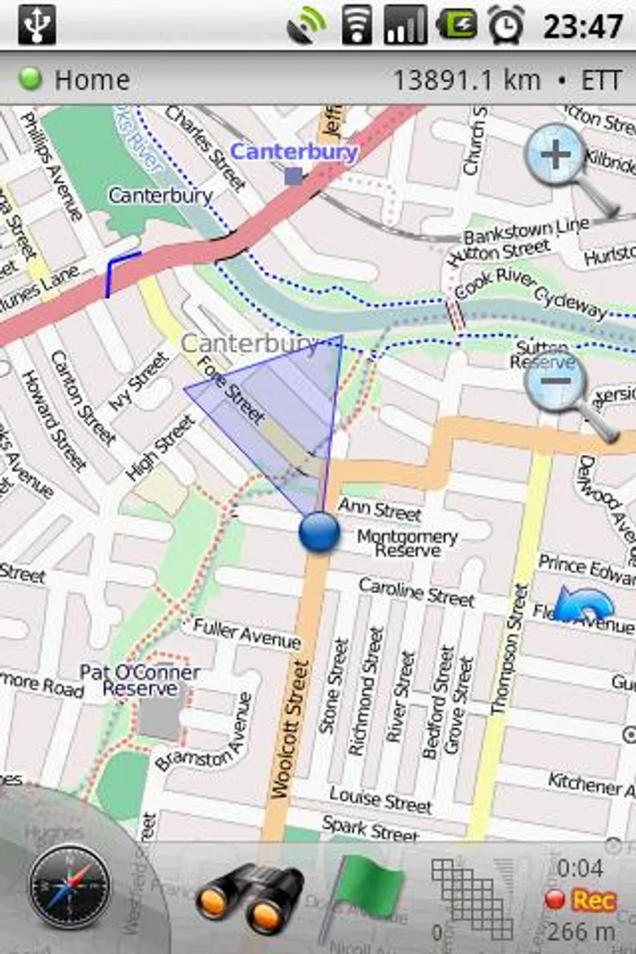
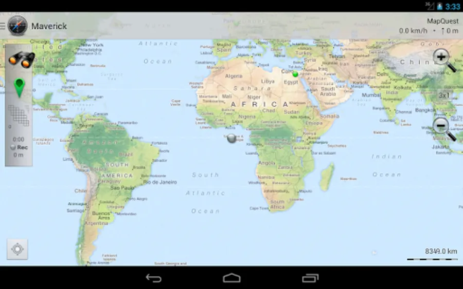
Use offline maps and GPS even without an internet connection. This app is great for hiking, boating, geocaching and other outdoor activities.
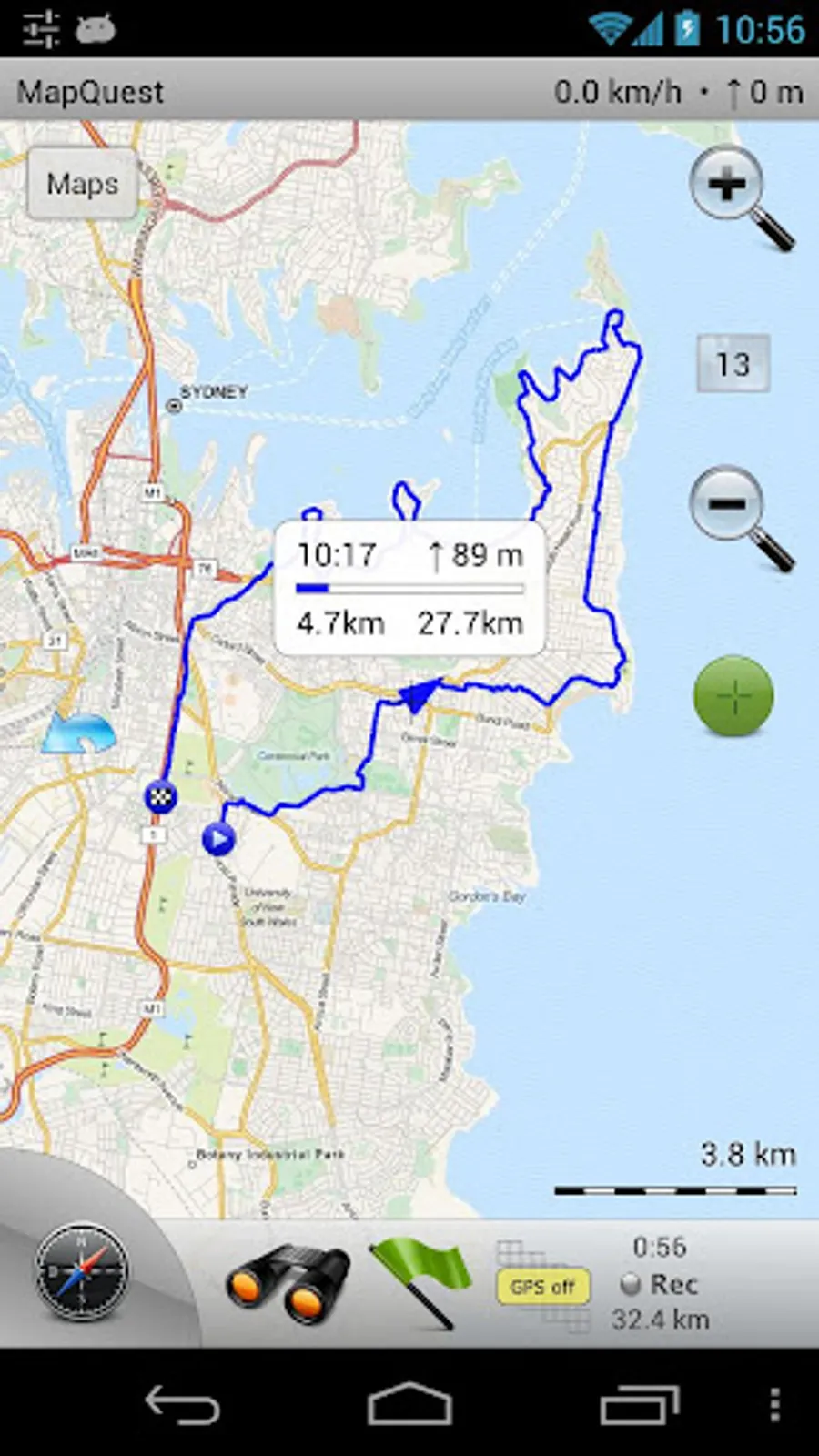
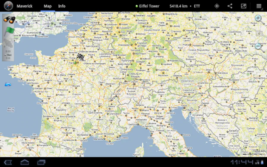
• Multiple global and regional online maps, including: Bing, Yandex, Open Street Maps, OSM Cycle, OSM Public Transport, Multimap (UK), OutdoorActive (Germany, Austria, South Tyrol), Cykloatlas, HikeBikeMap (Germany), Open Piste Map, NearMap (Australia) and many other maps.
All maps automatically cached for offline use. Use Mobile Atlas Creator to download maps or MAPC2MAPC to convert maps from other formats.
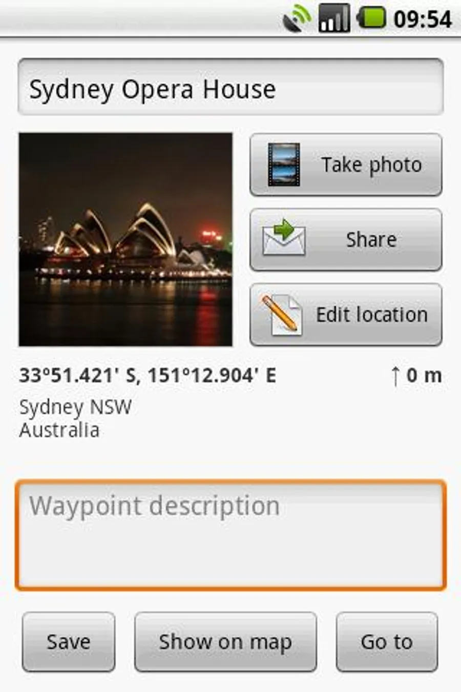
• Share your current or planned position
You can send address, GPS coordinates, link to Google Maps and even map image.
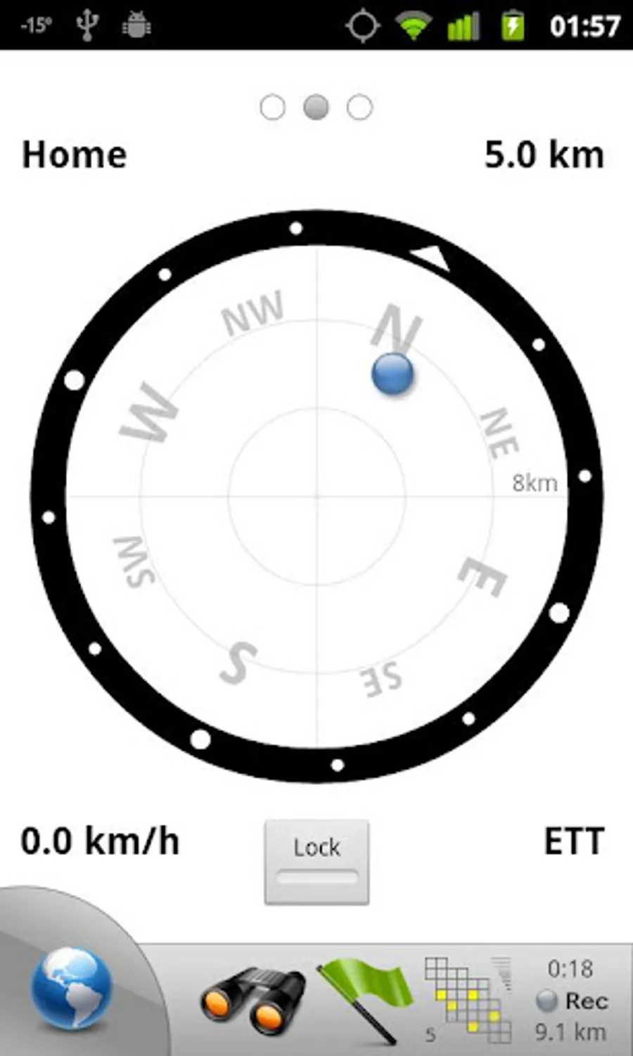
• Navigate easily
Build-in radar shows the direction, distance and estimated time to a point of interest.
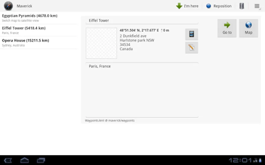
• Save places you visit
All waypoint stored in KML file and can be viewed and edited in Google Earth.
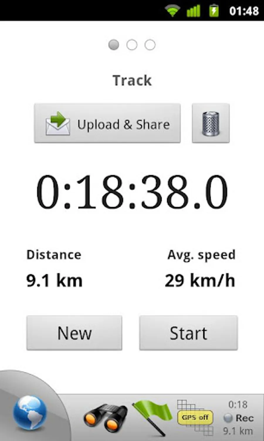
• Record tracks with single tap
Tracks are recorded in GPX format and can be viewed in Google Earth and other software.
• Upload tracks to GPSies
Free account is required for uploading.
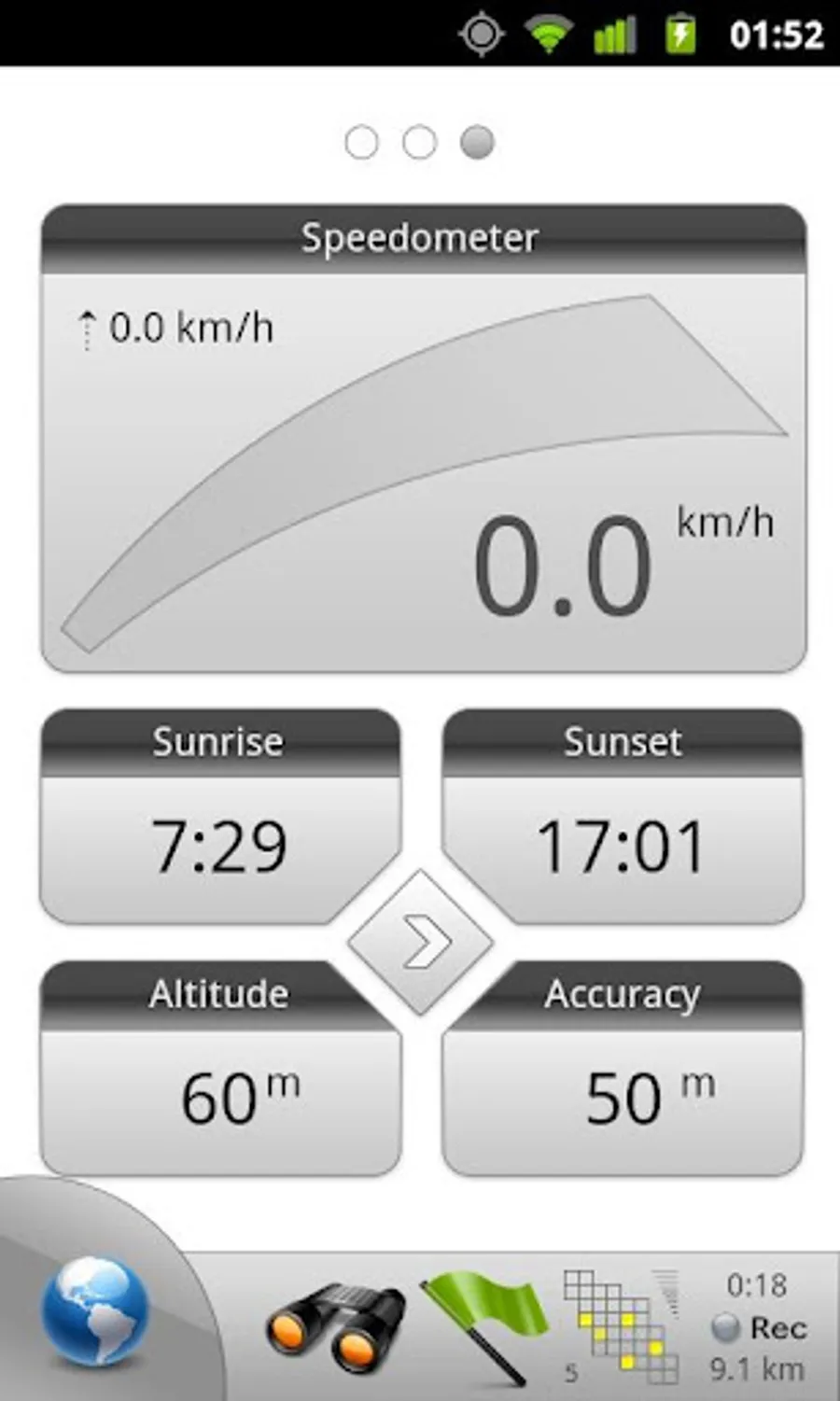
• Trip Computer
Watch speed, altitude, pitch and many other values.
Only in Pro version:
• Unlimited waypoints and tracks
�� Lock compass to bearing
• UTM and OSGB grids
• OS Explorer maps
• FourSquare support
We can implement standard Google MapView, but it's limited - no caching and terrain view. If you need it, please email us or leave a comment.
• Multiple global and regional online maps, including: Bing, Yandex, Open Street Maps, OSM Cycle, OSM Public Transport, Multimap (UK), OutdoorActive (Germany, Austria, South Tyrol), Cykloatlas, HikeBikeMap (Germany), Open Piste Map, NearMap (Australia) and many other maps.
All maps automatically cached for offline use. Use Mobile Atlas Creator to download maps or MAPC2MAPC to convert maps from other formats.
• Share your current or planned position
You can send address, GPS coordinates, link to Google Maps and even map image.
• Navigate easily
Build-in radar shows the direction, distance and estimated time to a point of interest.
• Save places you visit
All waypoint stored in KML file and can be viewed and edited in Google Earth.
• Record tracks with single tap
Tracks are recorded in GPX format and can be viewed in Google Earth and other software.
• Upload tracks to GPSies
Free account is required for uploading.
• Trip Computer
Watch speed, altitude, pitch and many other values.
Only in Pro version:
• Unlimited waypoints and tracks
�� Lock compass to bearing
• UTM and OSGB grids
• OS Explorer maps
• FourSquare support
We can implement standard Google MapView, but it's limited - no caching and terrain view. If you need it, please email us or leave a comment.
Maverick: GPS Navigation Screenshots
Tap to Rate: