In this aviation app, pilots can plan, file, fly, and log flights using a range of tools and real-time weather data. Includes route planning, weather briefing resources, navigation capabilities, and an integrated electronic logbook.
AppRecs review analysis
AppRecs rating 2.4. Trustworthiness 85 out of 100. Review manipulation risk 18 out of 100. Based on a review sample analyzed.
★★☆☆☆
2.4
AppRecs Rating
Ratings breakdown
5 star
25%
4 star
8%
3 star
12%
2 star
21%
1 star
34%
What to know
⚠
Ad complaints
Many low ratings mention excessive ads
⚠
Pricing complaints
Many low ratings mention paywalls or pricing
⚠
Mixed user feedback
Average 2.7★ rating suggests room for improvement
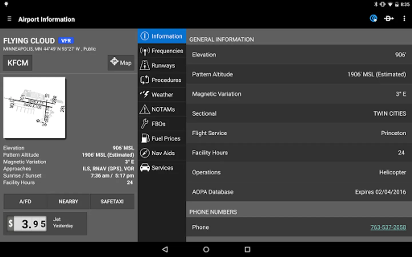
About Garmin Pilot
Garmin Pilot is a comprehensive aviation application that allows pilots to plan, file, fly and log with ease.
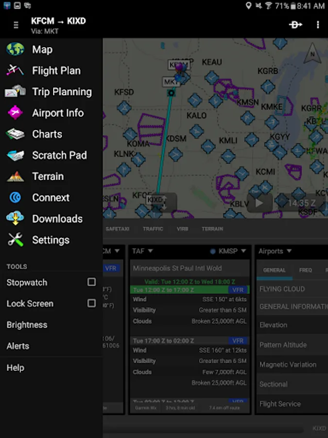
Garmin Pilot is the most comprehensive suite of tools for Android designed specifically for general aviation and corporate pilots. Flight planning, filing, charts, interactive maps, weather briefing resources and navigation capabilities; it’s all included. The app’s intuitive interface mirrors those on the newest Garmin touchscreen avionics so you can go seamlessly from preflight to inflight. Plan, file, fly with Garmin Pilot.
Plan
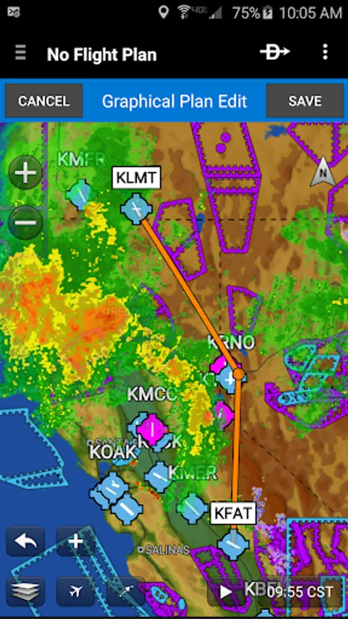
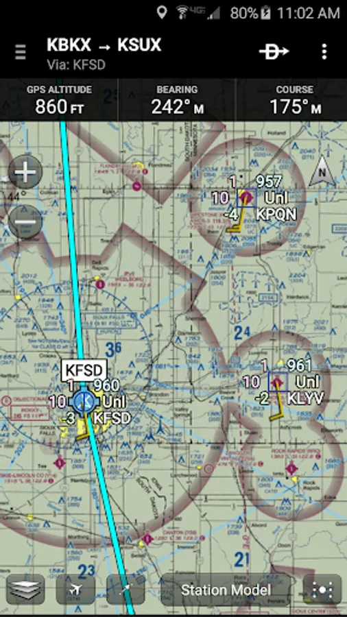
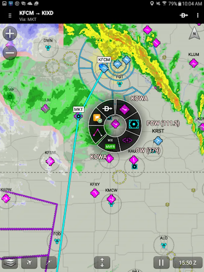
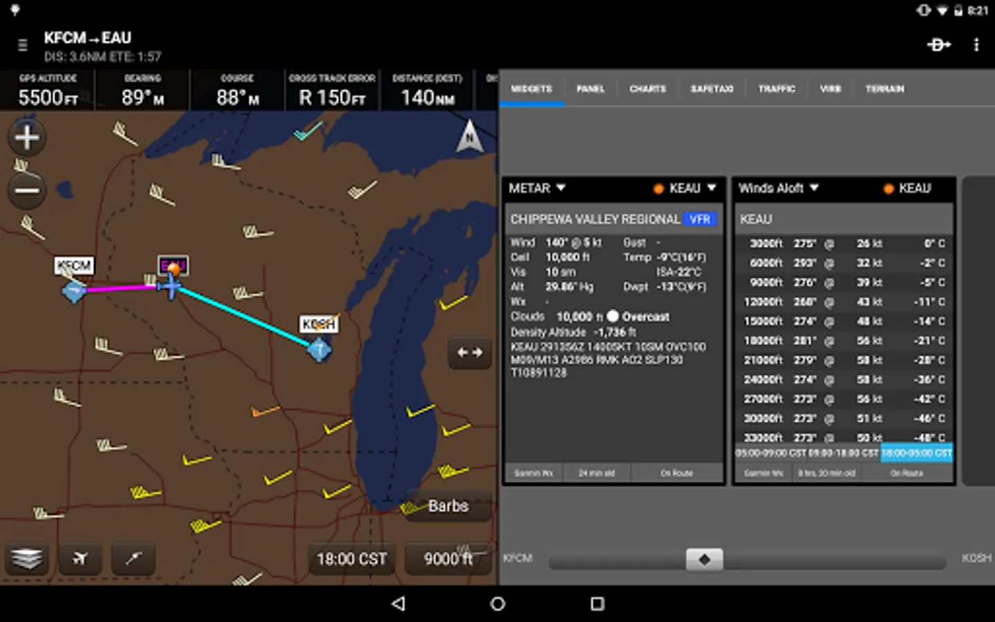
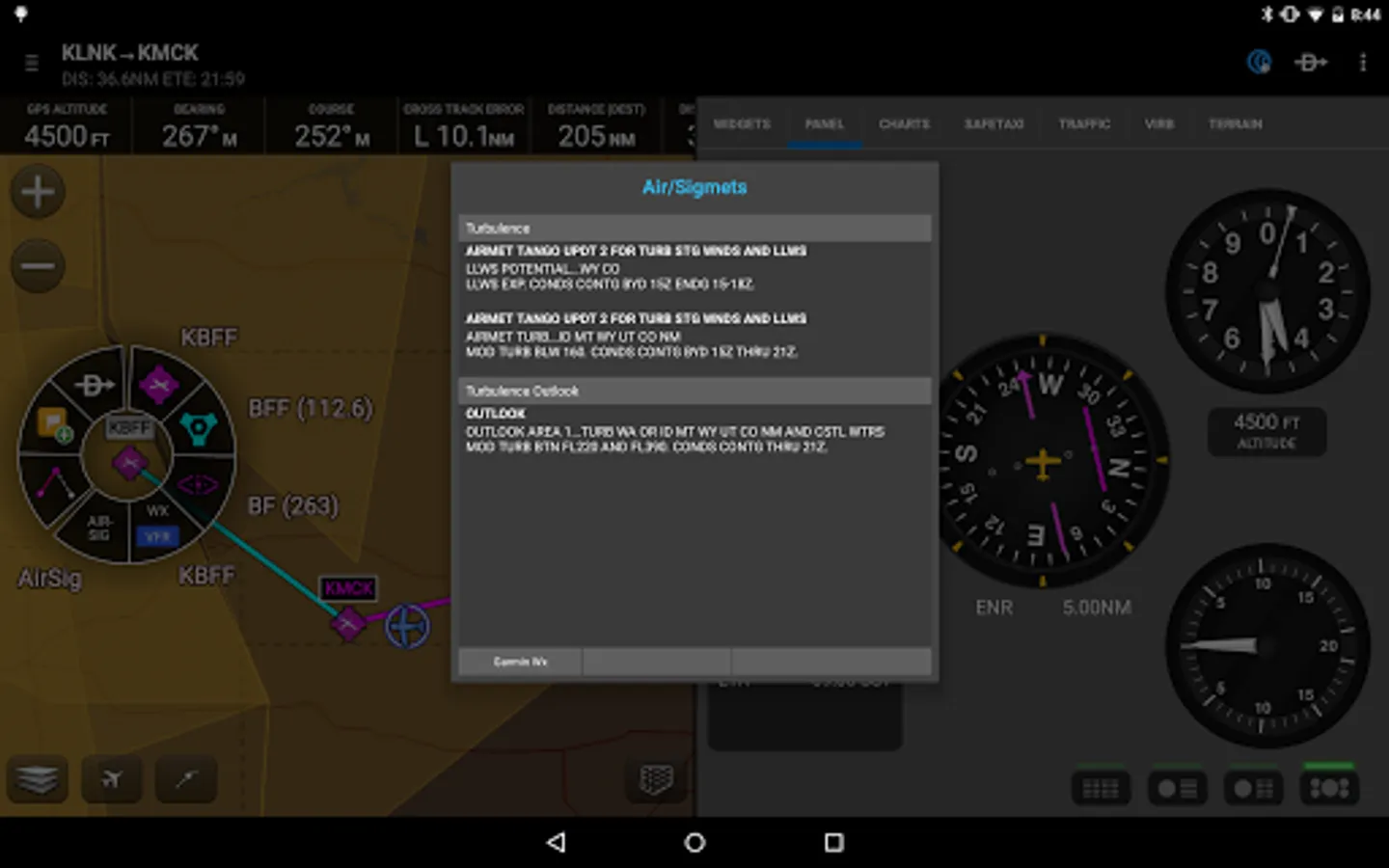
Garmin Pilot’s powerful capabilities start with pre-flight planning, providing pilots with the most comprehensive aviation weather information to make better-informed flight decisions. Pilots can check NEXRAD radar, visible and infrared cloud imagery, METARs, TAFs, AIRMETs, SIGMETs, PIREPs, NOTAMs, winds and temperature aloft, PIREPs, TFRs and lightning data. With Garmin Pilot, data can be displayed over a VFR sectional or an IFR low or high en-route chart to visualize the weather for your route. Add text-based weather widgets and use the exclusive NavTrack feature to view weather along the planned route.
File
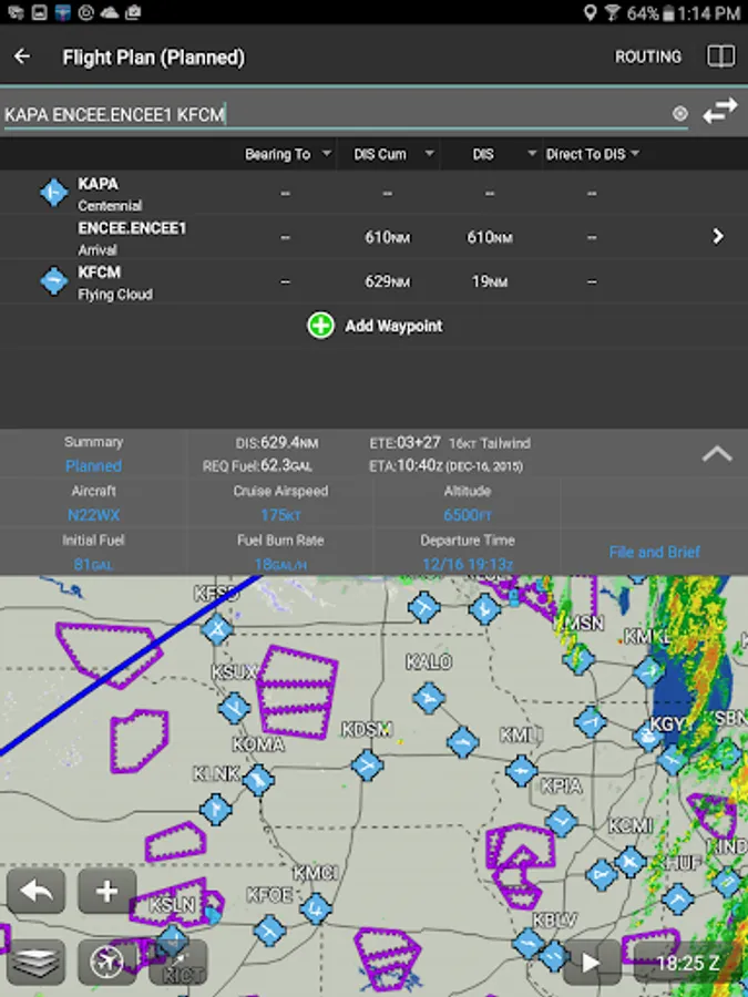
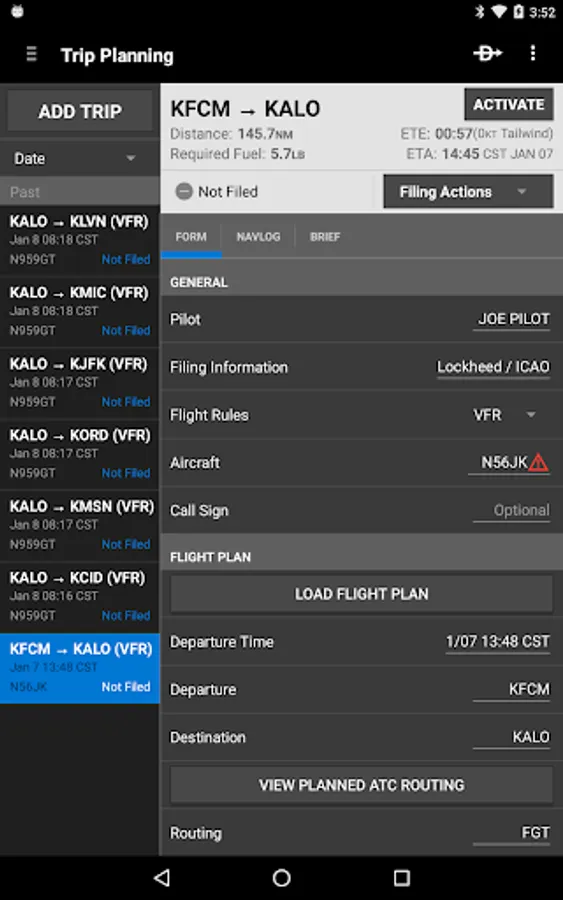
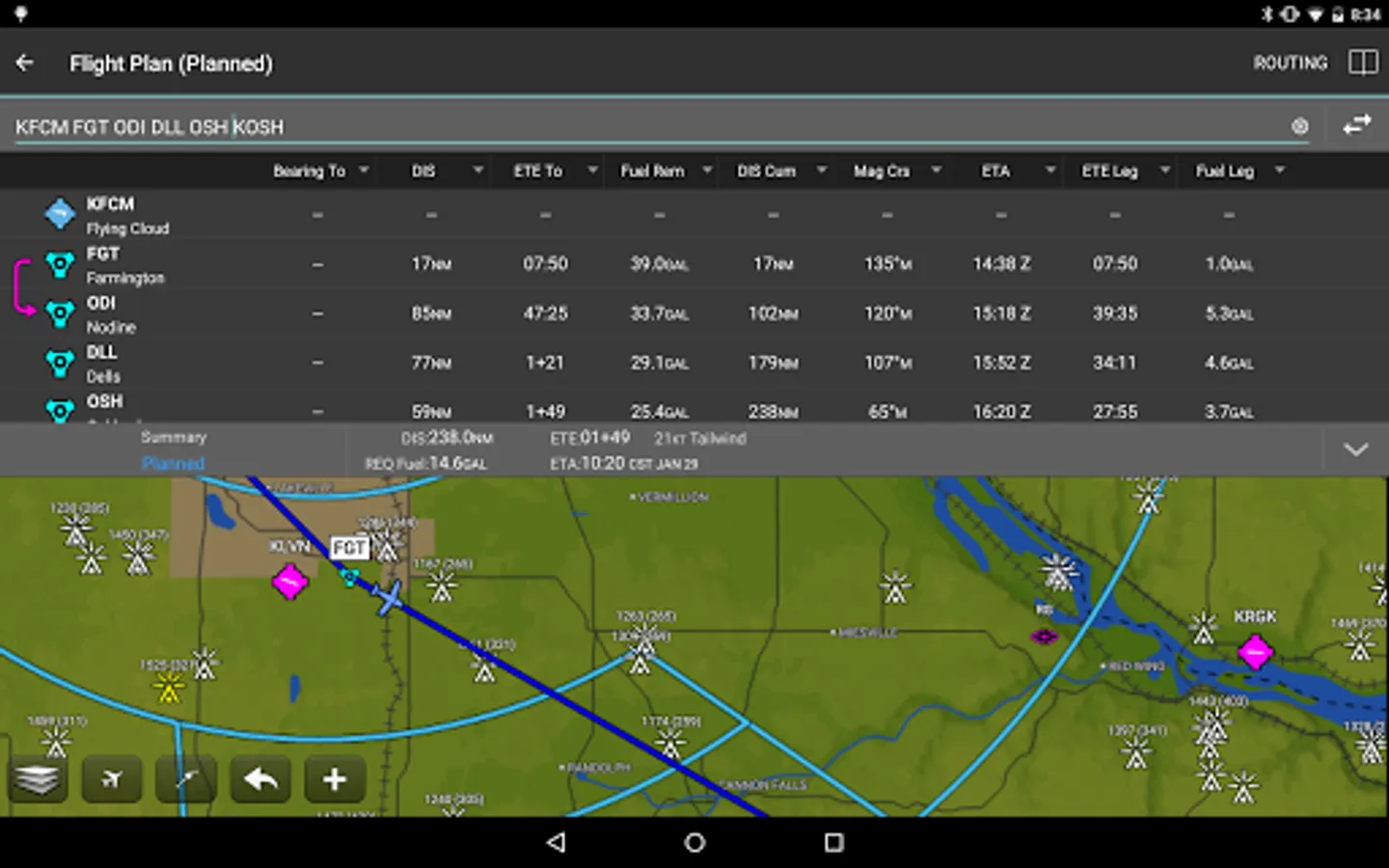
With Garmin Pilot, users can easily enter a flight plan. Pre-loaded forms make it quick to save and reuse data for frequently flown routes. And when the flight plan is ready, Garmin Pilot makes it simple to file, cancel or close the flight plan.
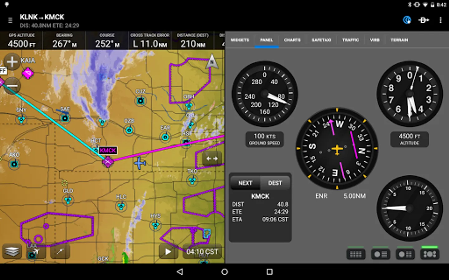
Fly
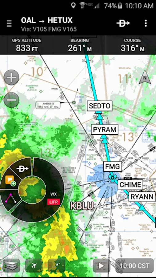
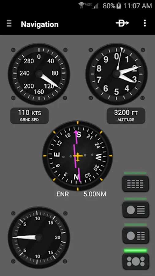
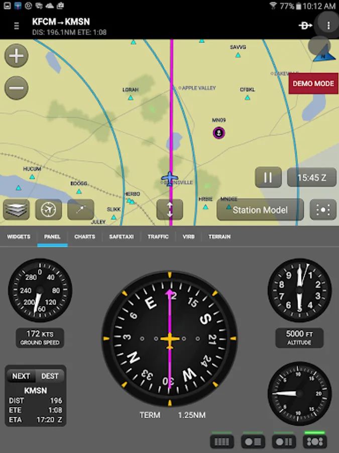
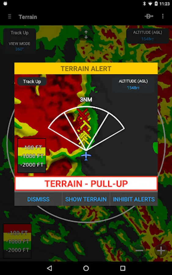
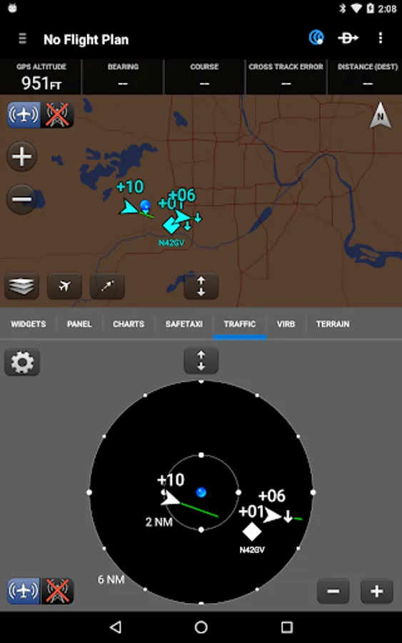
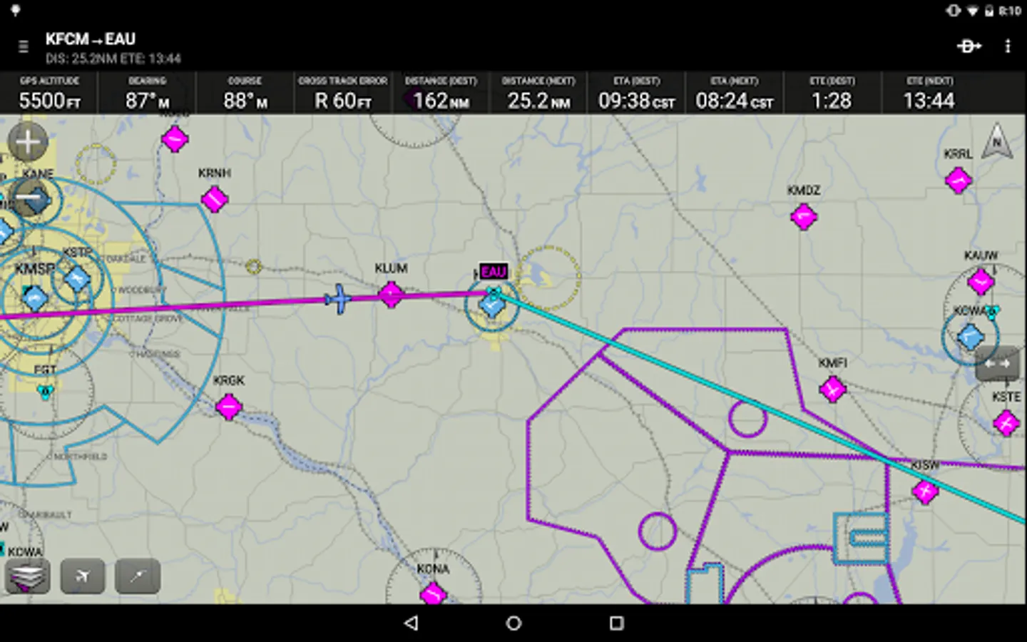
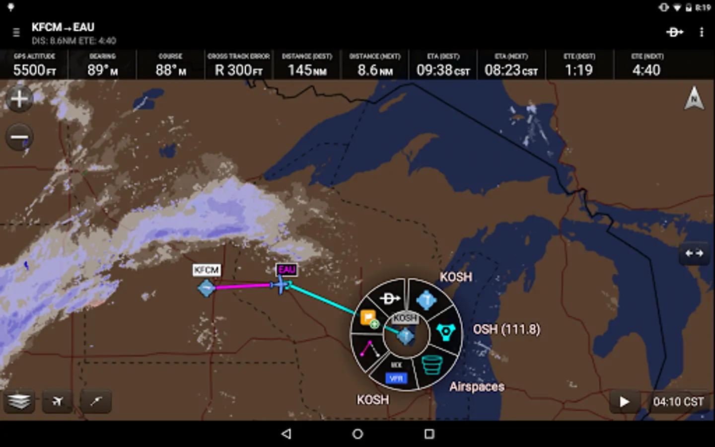
Garmin Pilot provides full en-route navigation capability on its moving map, while showing ETE, ETA, cross track error, distance to waypoint and current position.
Log
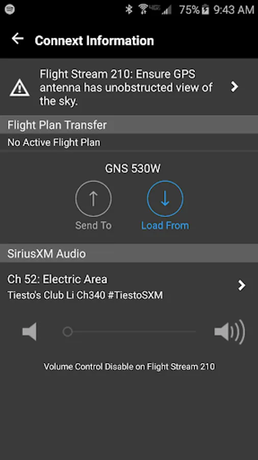
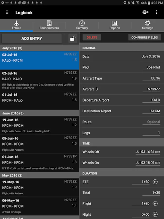
Garmin Pilot includes a comprehensive electronic logbook that syncs with flyGarmin. The logbook automatically generates entries based upon GPS data collected during the flight, tracks currency, supports manual entries, endorsements and creates reports.
Garmin Pilot. It’s the app aviators have been waiting for.
Features include:
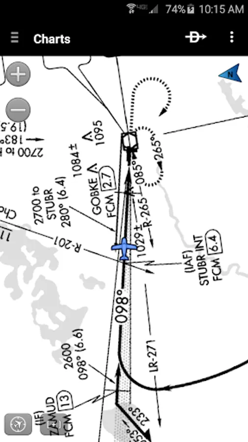
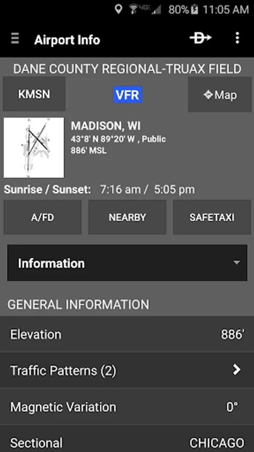
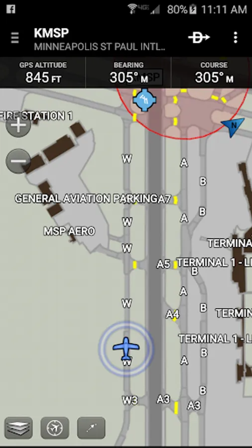
- Charts: VFR Sectionals, low and high IFR en-route, airport diagrams and approach procedures
- Optional geo-reference Garmin FliteCharts® and Garmin SafeTaxi® show aircraft position on approach charts and taxiways
- Weather Maps: Animated radar, AIRMETs/SIGMETs, Lightning, PIREPs, METARs/TAFs, Winds Aloft, TFRs, Infrared and Visible Satellite
- Extensive text products: METARs, TAFs, Winds Aloft, PIREPs, AIRMETs, SIGMETs, Area Forecasts and NOTAMs
- Dynamic weather overlays with your route displayed on map
- AOPA Airport Directory
- Flight plan filing via Lockheed Martin and DUATS
- Comprehensive weather data direct from the National Weather Service and Environment Canada
Garmin Pilot Screenshots

Tap to Rate:
Reviews for Garmin Pilot
Max Fedorov
3/1/2026
not recommended. go with 4 flight I used app since 2018 but every ear the android app quality is degrading. now it wil not open on Android tablets, it is clanky and slow on android phones. ios version of this app is way better. I can not believe that garmin dont have resources to make this app better for Android users.
Grant Alexander
2/25/2026
Great for what I need. The only reason for not giving 5 Stars is the lack of Statux support on Android. Seeing that Garmin owns FltPlan Go (which supports Statux), seems reasonable to add to Pilot. However I'm not a mobile app developer.