Satellite Check: GPS Tools
Disciple Skies Software
4.6 ★
7K ratings
1,000,000+
downloads
Free
+ in-app
In this GPS tool app, you can view satellite positions, measure distances, and improve location accuracy. Includes satellite statistics, maps, compass, and waypoint logging features.
AppRecs review analysis
AppRecs rating 4.2. Trustworthiness 74 out of 100. Review manipulation risk 29 out of 100. Based on a review sample analyzed.
★★★★☆
4.2
AppRecs Rating
Ratings breakdown
5 star
76%
4 star
13%
3 star
6%
2 star
2%
1 star
3%
What to know
✓
Low review manipulation risk
29% review manipulation risk
✓
Credible reviews
74% trustworthiness score from analyzed reviews
⚠
Ad complaints
Many low ratings mention excessive ads
About Satellite Check: GPS Tools
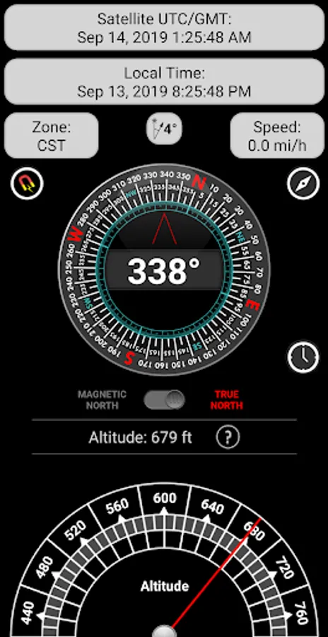
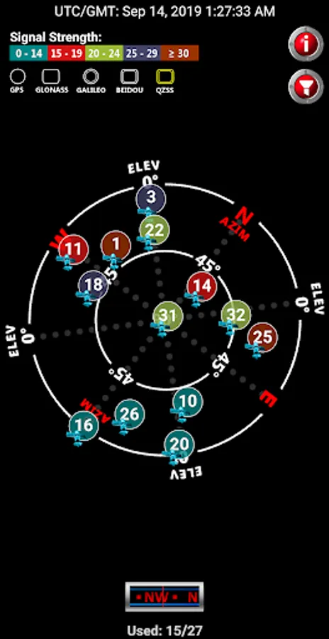
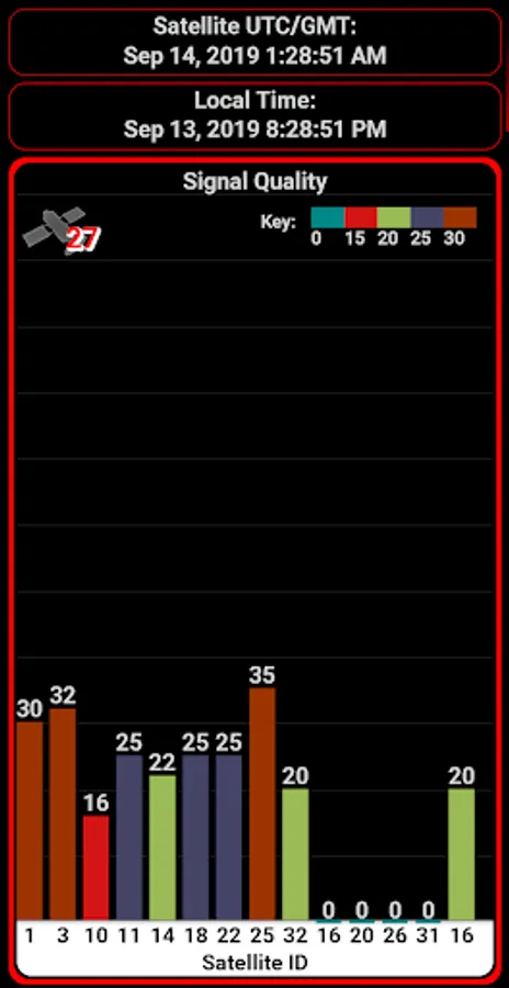
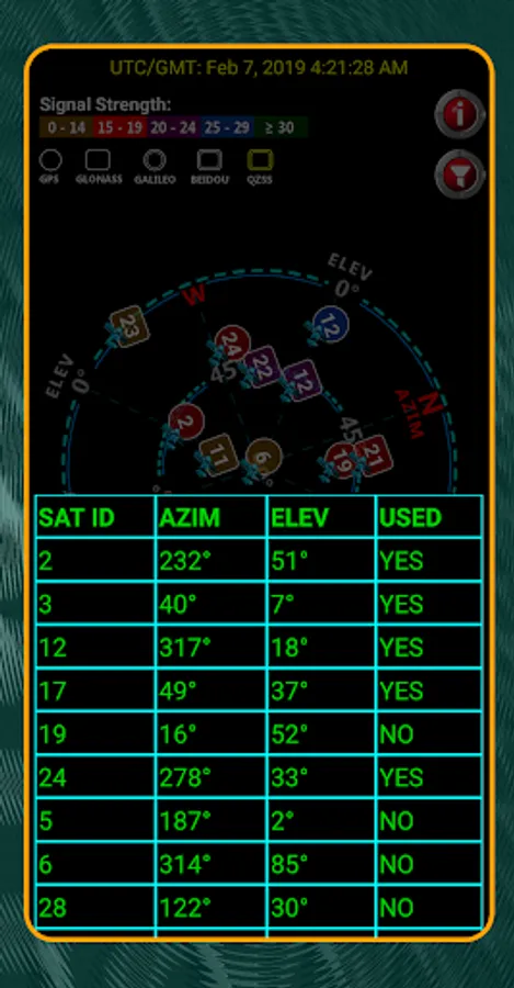
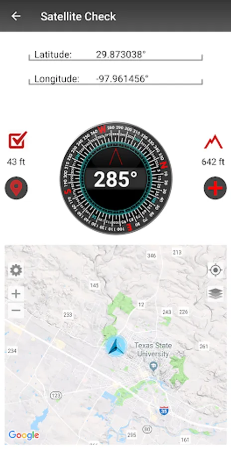
Use Satellite Check to navigate with the 6 navigation satellite constellations.
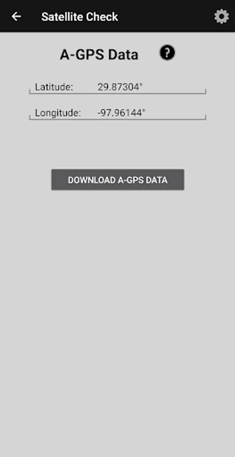
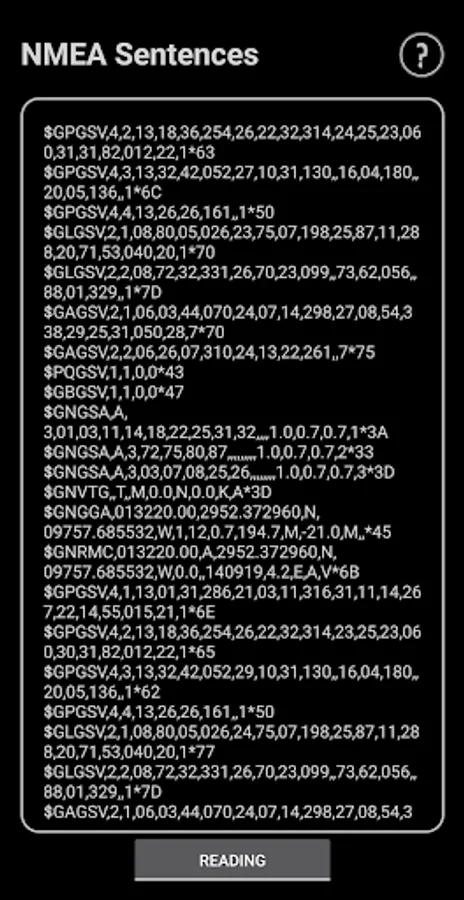
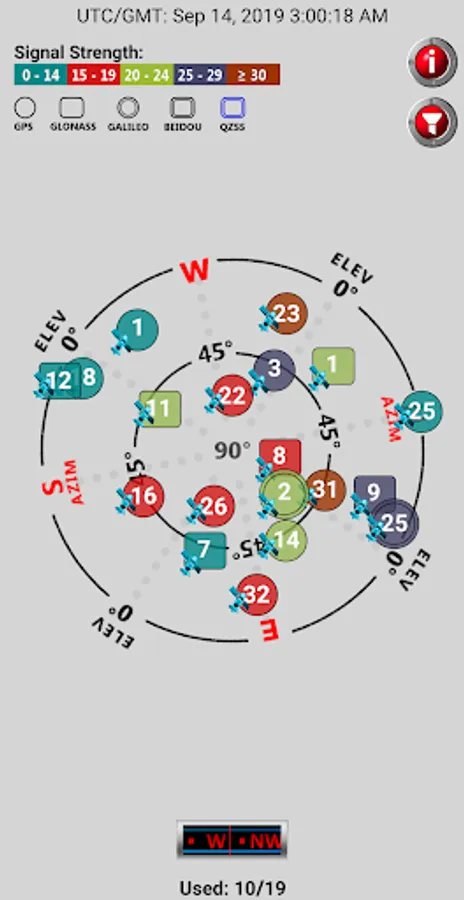
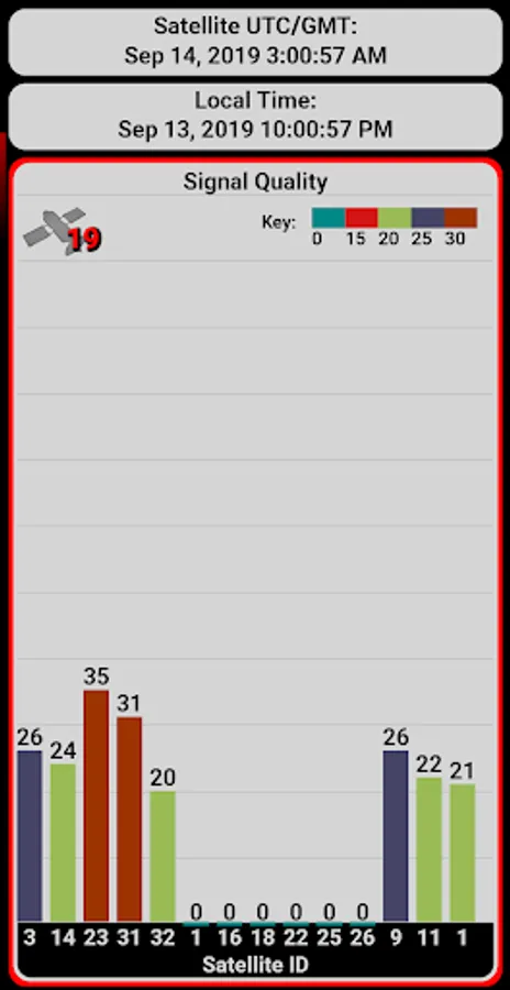
Navigate online and offline, view coordinates, number of available satellites, atomic satellite time, satellite signal quality, satellite positions and other satellite statistics.
Use the app's satellite reports to understand the quality of the location information provided by your Android device. If the quality is poor, the app provides a utility to improve both the time to an initial fix and the accuracy of your location reports.
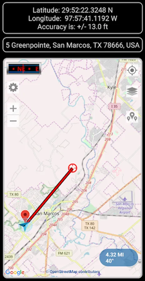
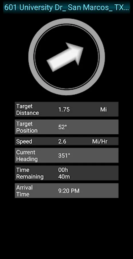
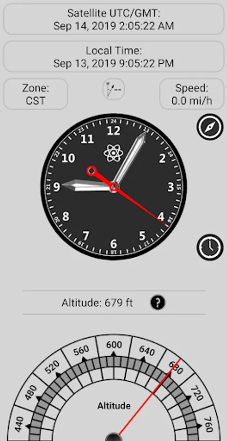
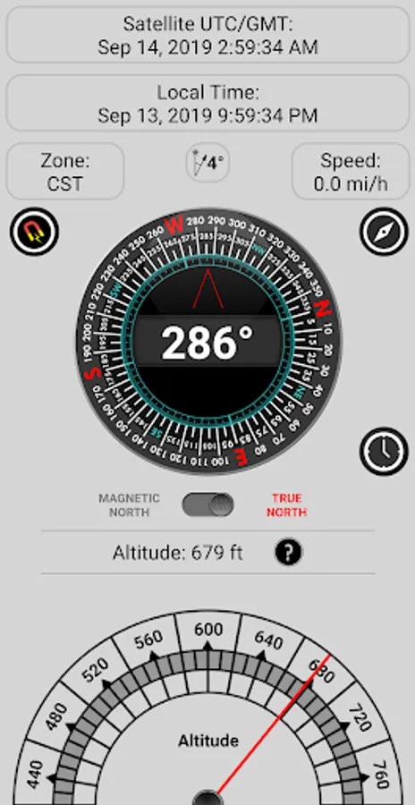
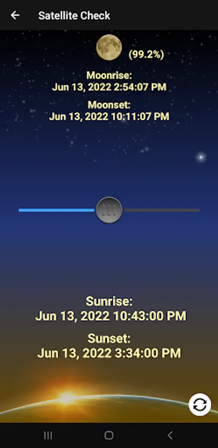
In addition to location and satellite reporting, the app will calculate all kinds of interesting figures such as your altitude, distance to points of interest, physical addresses, sunrise, sunset, moon phases and much more. Your position and the date are used to calculate the magnetic declination for your location allowing magnetic compasses in the application to report deviation from true north instead of magnetic north. The true-north-reporting compasses work very nicely with the maps which can be oriented along the true north-south axis or rotated to your heading, depending on your preference.
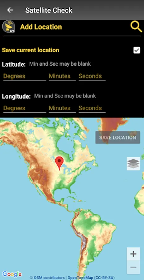
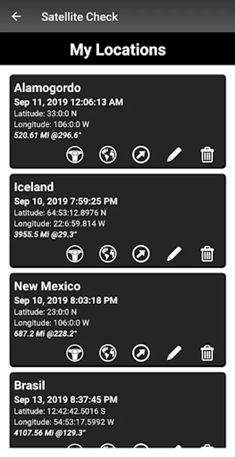
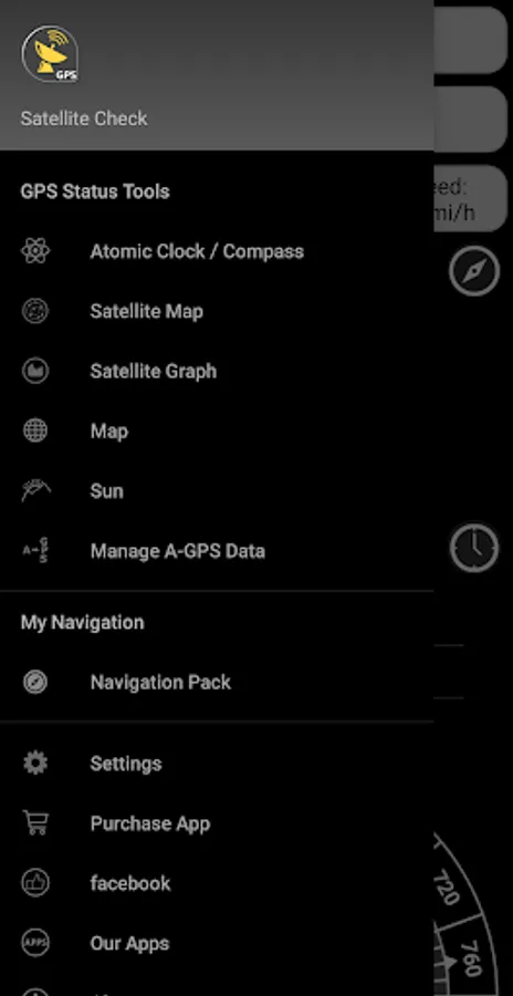
The app's navigation package includes a waypoint logger and works with many different map types, compasses, and measuring tools. This app will help keep you oriented even in the strangest of places.
A handy app for any GPS aficionado.
New:
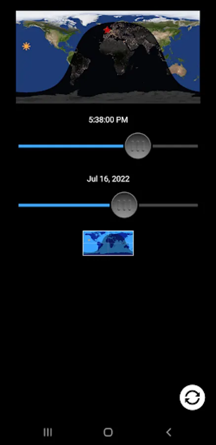
- Day and night map with sliding day-night terminator showing where it is day and where it is night.
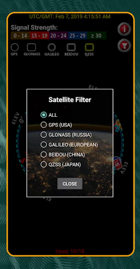
- Satellite filter:
Identify navigation satellites by
country or countries of origin:
● GPS Satellites (USA)
● Glonass Satellites (Russia)
● Galileo Satellites (European Space Agency)
● Beidou (China)
● QZSS (Japan)
● IRNSS (India)
* Galileo, Beidou, IRNSS and QZSS satellites may be visible on some devices manufactured after 2017 and must be running Android 7.0 or later.
Navigate online and offline, view coordinates, number of available satellites, atomic satellite time, satellite signal quality, satellite positions and other satellite statistics.
Use the app's satellite reports to understand the quality of the location information provided by your Android device. If the quality is poor, the app provides a utility to improve both the time to an initial fix and the accuracy of your location reports.
In addition to location and satellite reporting, the app will calculate all kinds of interesting figures such as your altitude, distance to points of interest, physical addresses, sunrise, sunset, moon phases and much more. Your position and the date are used to calculate the magnetic declination for your location allowing magnetic compasses in the application to report deviation from true north instead of magnetic north. The true-north-reporting compasses work very nicely with the maps which can be oriented along the true north-south axis or rotated to your heading, depending on your preference.
The app's navigation package includes a waypoint logger and works with many different map types, compasses, and measuring tools. This app will help keep you oriented even in the strangest of places.
A handy app for any GPS aficionado.
New:
- Day and night map with sliding day-night terminator showing where it is day and where it is night.
- Satellite filter:
Identify navigation satellites by
country or countries of origin:
● GPS Satellites (USA)
● Glonass Satellites (Russia)
● Galileo Satellites (European Space Agency)
● Beidou (China)
● QZSS (Japan)
● IRNSS (India)
* Galileo, Beidou, IRNSS and QZSS satellites may be visible on some devices manufactured after 2017 and must be running Android 7.0 or later.
Satellite Check: GPS Tools Screenshots


Tap to Rate:
Reviews for Satellite Check: GPS Tools
Udayangani Alahakoon
12/13/2025
easy to use including more information
Haider Z
9/22/2025
best in regards to simplicity and knowledge