AppRecs review analysis
AppRecs rating 4.7. Trustworthiness 78 out of 100. Review manipulation risk 23 out of 100. Based on a review sample analyzed.
★★★★☆
4.7
AppRecs Rating
Ratings breakdown
5 star
95%
4 star
0%
3 star
5%
2 star
0%
1 star
0%
What to know
✓
Low review manipulation risk
23% review manipulation risk
✓
Credible reviews
78% trustworthiness score from analyzed reviews
✓
High user satisfaction
95% of sampled ratings are 5 stars
About Ecobot Collector
Ecobot Collector is the mobile app for field data collection within the Ecobot platform. Built for environmental consultants, wetland delineators, stream assessors, and natural resources professionals, Collector streamlines how you capture environmental field data, map geospatial features, organize photos, and complete required forms in the field. Collector reduces repetitive data entry so you can stay focused on the scientific expertise your clients rely on.
Ecobot Collector works with Ecobot Manager, the web-based part of the platform, to create a connected field-to-office workflow. Together, they keep your data consistent, organized, and ready for reporting across environmental consulting projects.
WHY ENVIRONMENTAL SCIENTISTS USE ECOBOT
Accurate environmental field data
Standardized data entry, photo organization, calculations, and built-in references support clear, defensible wetland, stream, and natural resources documentation.
Built for real field conditions
Collect data online or offline. Collector saves entries locally and syncs when back online. Unsynced data alerts help ensure nothing is missed in the field.
Faster environmental workflows
Smart defaults, automated calculations, improved survey views, and updated navigation reduce time spent on paperwork and rework.
Consistent team data
Unified mobile and web workflows help environmental consulting teams reduce variation and deliver reliable results. Project Merge and Project Transfer support team changes and large project management.
Connected to Ecobot Manager
Review, manage, QA/QC, and export data from the web with enhanced photo tools, mapped features, and standardized environmental forms. Two-factor authentication and role-based permissions provide stronger team controls.
KEY FEATURES
Environmental field data collection
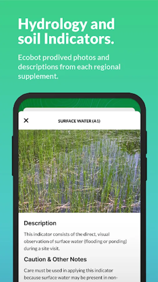
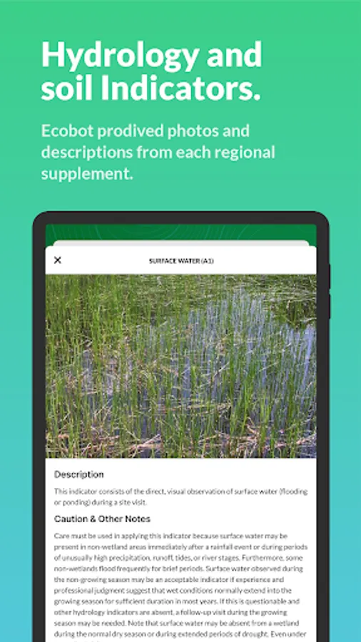
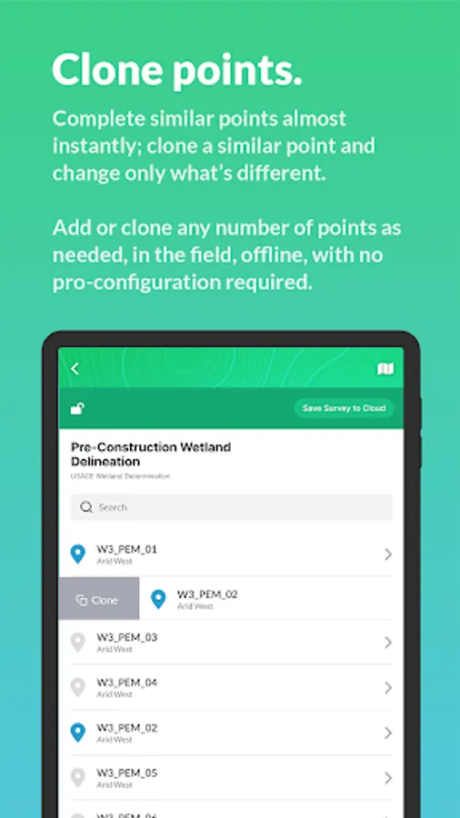
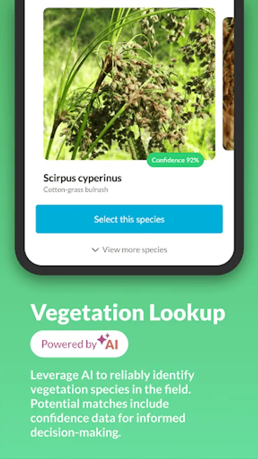
Capture vegetation, soils, hydrology indicators, OHWM observations, and more. Add geotagged photos, build automated photo logs, and work offline during wetland delineations, stream assessments, and natural resources surveys.
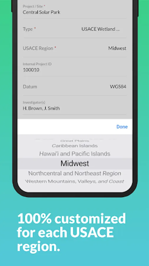
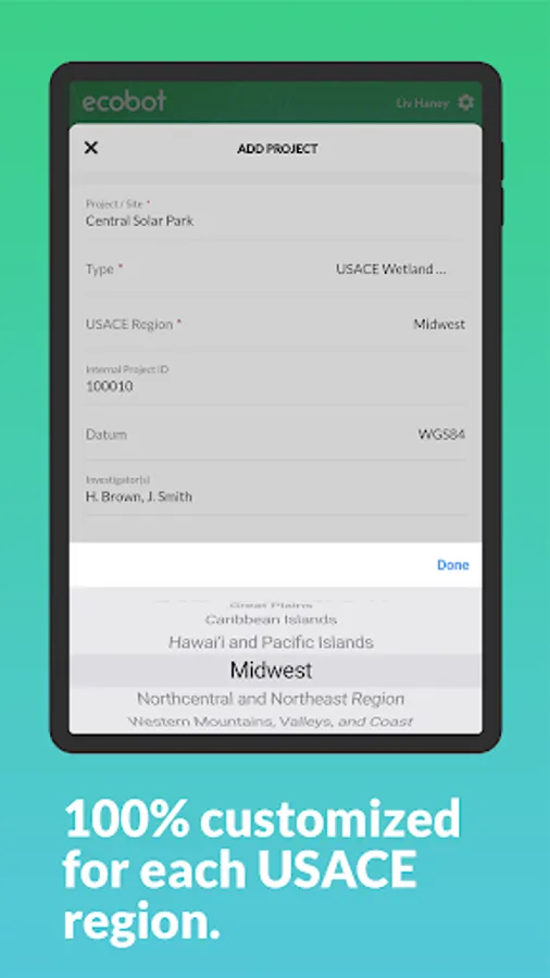
Standardized wetland, stream, and environmental forms
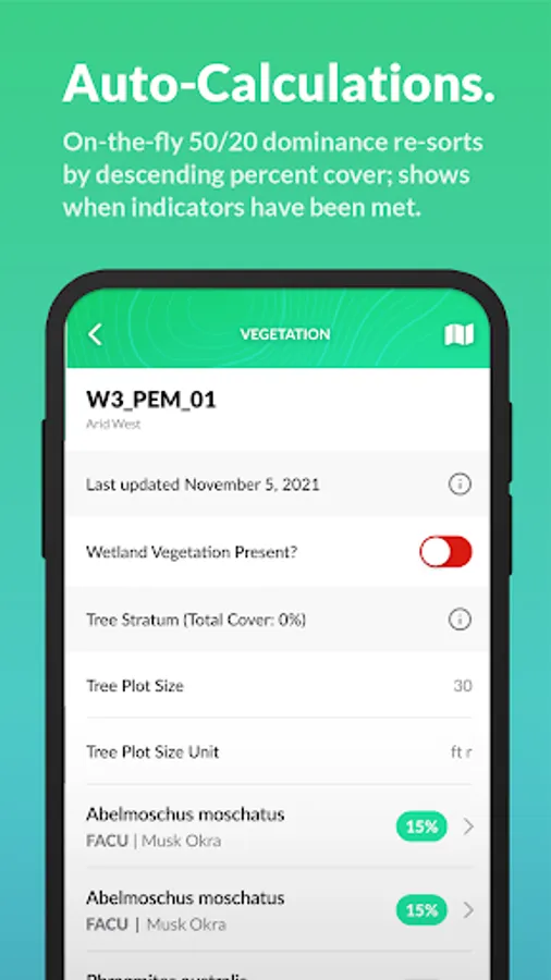
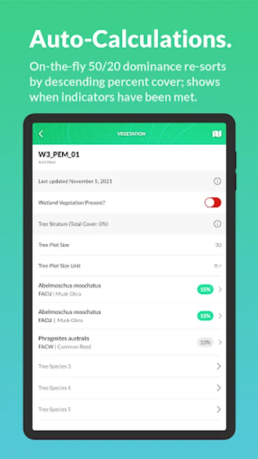
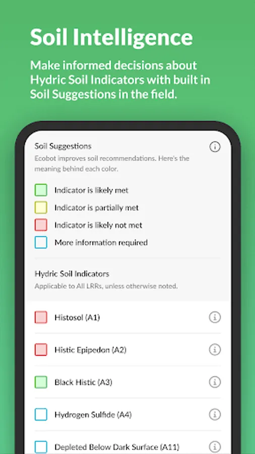
Use USACE Regional Wetland Determination Data Sheets, USACE Rapid OHWM, and NC DWQ Stream Identification forms. Collector automates dominance ratios, prevalence indices, hydric soil indicators, and required calculations.
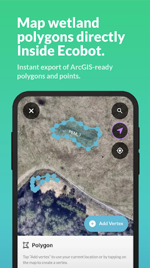
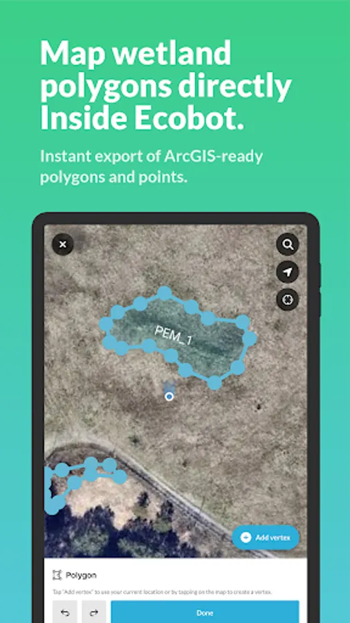
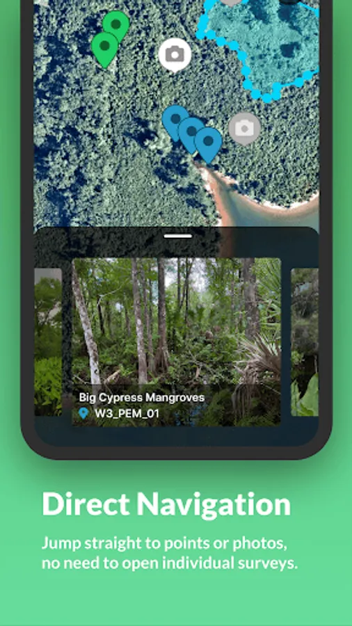
Integrated geospatial mapping
Map points, lines, and polygons. Navigate to features. View geolocated photos. Use mobile GPS or GNSS receivers. Jump directly to features and photos from the home screen.
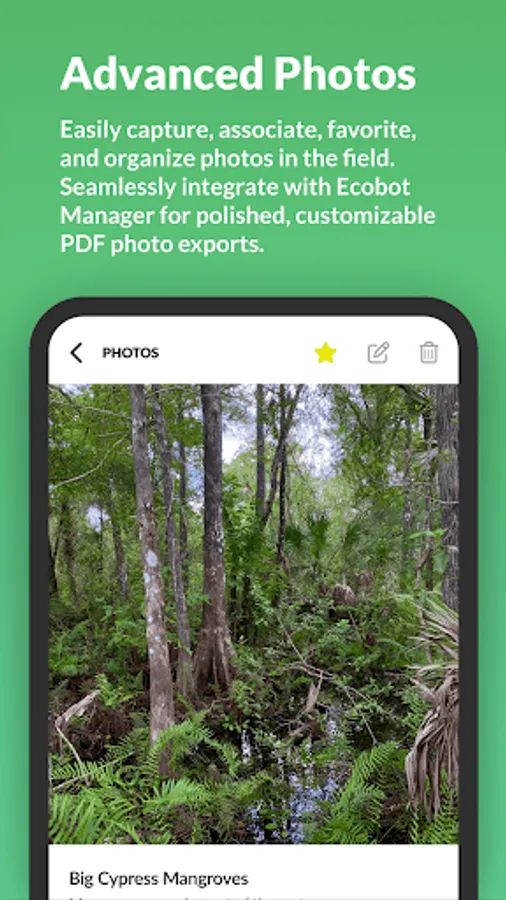
Advanced environmental photo tools
Capture, organize, favorite, and rotate field photos. Use incremental loading for faster viewing. Review and QA photos in Ecobot Manager.
Survey and workflow enhancements
Distraction-free survey views, color-coded statuses, improved feature navigation, and new survey management tools.
Team and security features
Project Merge, Project Transfer, device naming, unsynced data alerts, two-factor authentication, and role-based permissions.
Secure data storage
Ecobot uses AWS-backed infrastructure so your environmental project data is safely stored, backed up, and accessible.
Ecobot is built by environmental consultants and used by leading AEC firms. With connected mobile and web workflows, Ecobot helps teams collect accurate environmental data, reduce rework, and deliver consistent, defensible results for wetlands, streams, and natural resources projects.
ECOBOT® is a trademark of Ecobot, Inc. Patent pending.
Ecobot Collector works with Ecobot Manager, the web-based part of the platform, to create a connected field-to-office workflow. Together, they keep your data consistent, organized, and ready for reporting across environmental consulting projects.
WHY ENVIRONMENTAL SCIENTISTS USE ECOBOT
Accurate environmental field data
Standardized data entry, photo organization, calculations, and built-in references support clear, defensible wetland, stream, and natural resources documentation.
Built for real field conditions
Collect data online or offline. Collector saves entries locally and syncs when back online. Unsynced data alerts help ensure nothing is missed in the field.
Faster environmental workflows
Smart defaults, automated calculations, improved survey views, and updated navigation reduce time spent on paperwork and rework.
Consistent team data
Unified mobile and web workflows help environmental consulting teams reduce variation and deliver reliable results. Project Merge and Project Transfer support team changes and large project management.
Connected to Ecobot Manager
Review, manage, QA/QC, and export data from the web with enhanced photo tools, mapped features, and standardized environmental forms. Two-factor authentication and role-based permissions provide stronger team controls.
KEY FEATURES
Environmental field data collection
Capture vegetation, soils, hydrology indicators, OHWM observations, and more. Add geotagged photos, build automated photo logs, and work offline during wetland delineations, stream assessments, and natural resources surveys.
Standardized wetland, stream, and environmental forms
Use USACE Regional Wetland Determination Data Sheets, USACE Rapid OHWM, and NC DWQ Stream Identification forms. Collector automates dominance ratios, prevalence indices, hydric soil indicators, and required calculations.
Integrated geospatial mapping
Map points, lines, and polygons. Navigate to features. View geolocated photos. Use mobile GPS or GNSS receivers. Jump directly to features and photos from the home screen.
Advanced environmental photo tools
Capture, organize, favorite, and rotate field photos. Use incremental loading for faster viewing. Review and QA photos in Ecobot Manager.
Survey and workflow enhancements
Distraction-free survey views, color-coded statuses, improved feature navigation, and new survey management tools.
Team and security features
Project Merge, Project Transfer, device naming, unsynced data alerts, two-factor authentication, and role-based permissions.
Secure data storage
Ecobot uses AWS-backed infrastructure so your environmental project data is safely stored, backed up, and accessible.
Ecobot is built by environmental consultants and used by leading AEC firms. With connected mobile and web workflows, Ecobot helps teams collect accurate environmental data, reduce rework, and deliver consistent, defensible results for wetlands, streams, and natural resources projects.
ECOBOT® is a trademark of Ecobot, Inc. Patent pending.