Altimeter GPS Offline Altitude
Foxpoi
2.5 ★
93 ratings
10,000+
downloads
Free
With this GPS app, you can measure and record altitude, location, and direction during outdoor activities. Includes real-time altitude display, location querying, and photo sharing features.
AppRecs review analysis
AppRecs rating 2.5. Trustworthiness 80 out of 100. Review manipulation risk 21 out of 100. Based on a review sample analyzed.
★★☆☆☆
2.5
AppRecs Rating
Ratings breakdown
5 star
34%
4 star
0%
3 star
0%
2 star
16%
1 star
50%
What to know
✓
Low review manipulation risk
21% review manipulation risk
⚠
Mixed user feedback
Average 2.5★ rating suggests room for improvement
⚠
High negative review ratio
66% of sampled ratings are 1–2 stars
About Altimeter GPS Offline Altitude
The Altimeter GPS Offline Altitude is a necessary app for outdoor people, including information such as geographical location, GPS, altitude, oxygen content, atmospheric pressure, and direction; It can be used when measuring and recording geographic information during travel and work, and it can also take photos with information such as height, longitude, and latitude.
[Function]
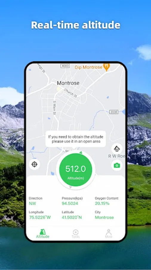
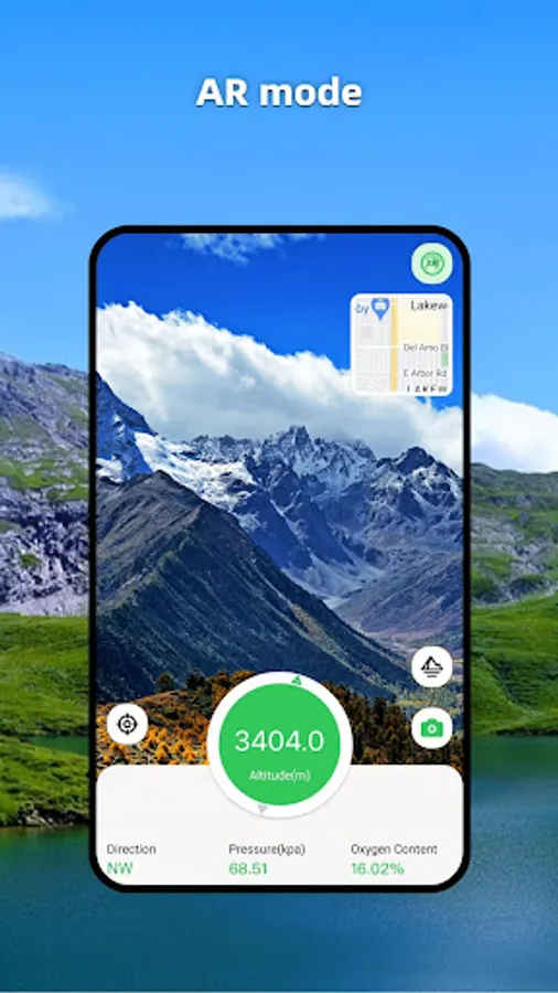
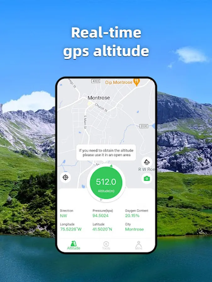
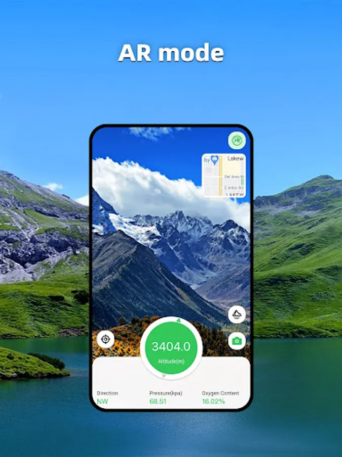
1. Altitude: Display the current altitude information accurately and in real time.
2. Query altitude: View other locations to measure altitude.
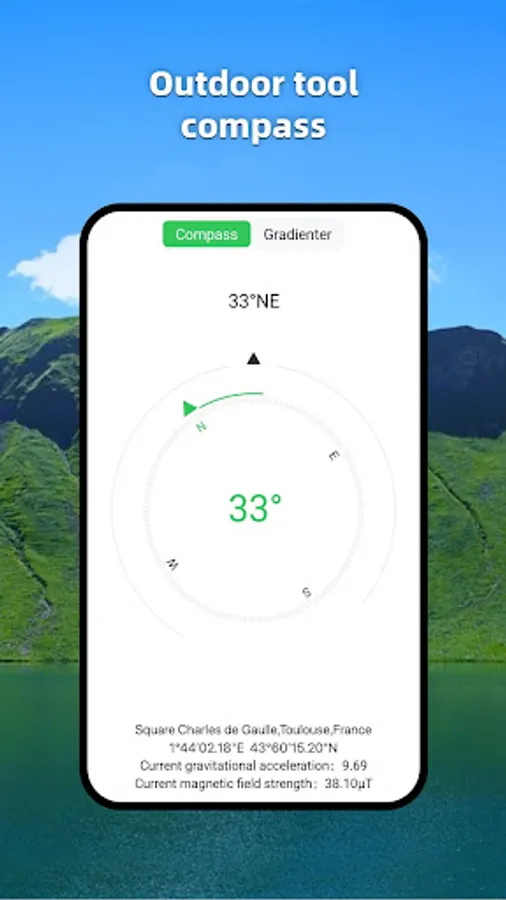
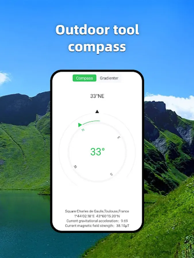
3. Compass and level: Accurate and real-time display of current direction.
Locator: Displays the current longitude, latitude, and address information, and displays it on the map.
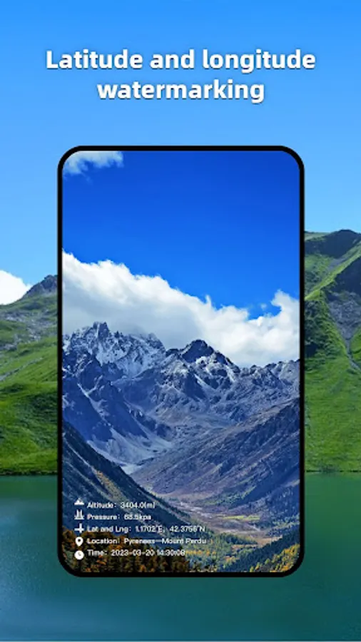
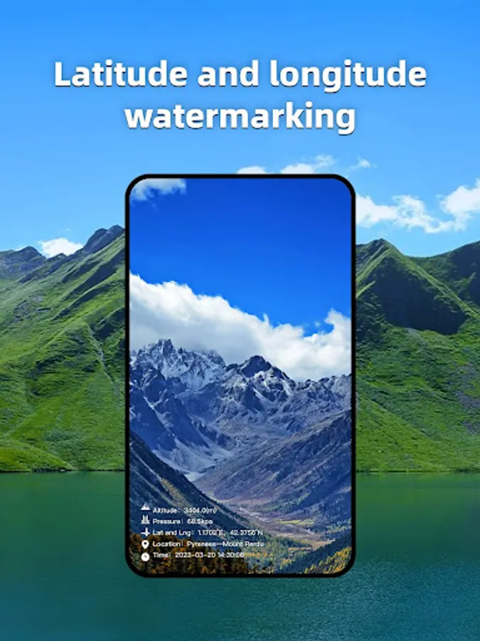
5. Social sharing: You can take photos with height, longitude, latitude, and other information to share.
The format of longitude and latitude is as follows:
-DMS degrees, minutes, seconds hex
-DD Decimal
The height format is as follows:
-Meters
-Feet
The air pressure format is as follows:
- kpa
- mbar
- atm
- mmHg
-GPS does not work well indoors.
-GPS accuracy depends on the receiver in your device.
-Air pressure data depends on the presence or absence of air pressure sensors in your device.
[Function]
1. Altitude: Display the current altitude information accurately and in real time.
2. Query altitude: View other locations to measure altitude.
3. Compass and level: Accurate and real-time display of current direction.
Locator: Displays the current longitude, latitude, and address information, and displays it on the map.
5. Social sharing: You can take photos with height, longitude, latitude, and other information to share.
The format of longitude and latitude is as follows:
-DMS degrees, minutes, seconds hex
-DD Decimal
The height format is as follows:
-Meters
-Feet
The air pressure format is as follows:
- kpa
- mbar
- atm
- mmHg
-GPS does not work well indoors.
-GPS accuracy depends on the receiver in your device.
-Air pressure data depends on the presence or absence of air pressure sensors in your device.
Altimeter GPS Offline Altitude Screenshots


Tap to Rate:
Reviews for Altimeter GPS Offline Altitude
karunakaran kumar
10/11/2025
Not much user friendly
Asep Yuliantara
9/29/2025
Good idea.. Great..