Metar-Taf - Visual decoder
Studio Eveline
4.9 ★
962 ratings
10,000+
downloads
$5.99
In this app, you can view and interpret visualized METAR and TAF weather data for airports worldwide. Includes weather symbols, crosswind calculations, and customizable units for aviation weather information.
AppRecs review analysis
AppRecs rating 4.5. Trustworthiness 73 out of 100. Review manipulation risk 25 out of 100. Based on a review sample analyzed.
★★★★☆
4.5
AppRecs Rating
Ratings breakdown
5 star
94%
4 star
3%
3 star
2%
2 star
2%
1 star
0%
What to know
✓
Low review manipulation risk
25% review manipulation risk
✓
Credible reviews
73% trustworthiness score from analyzed reviews
✓
High user satisfaction
94% of sampled ratings are 5 stars
About Metar-Taf - Visual decoder
Visualized METAR and TAF weather information for all airports in the world. Concise summary of everything you need to know about today's aviation weather.
METAR features:
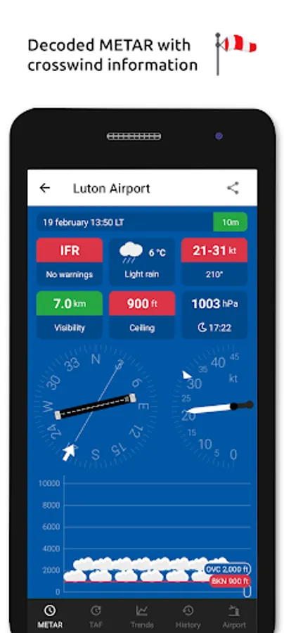
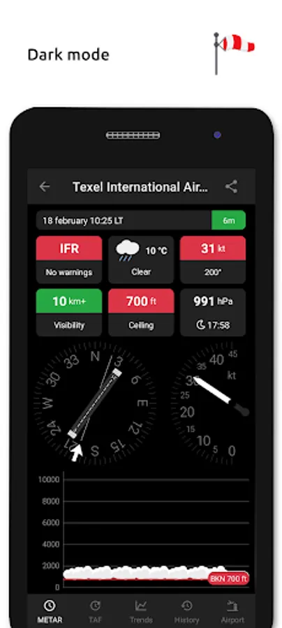
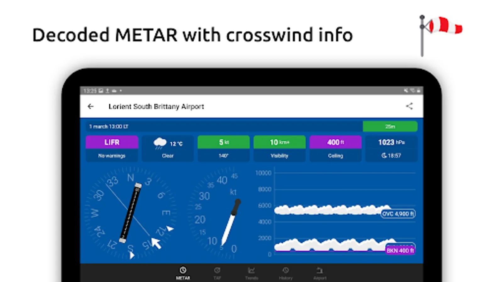
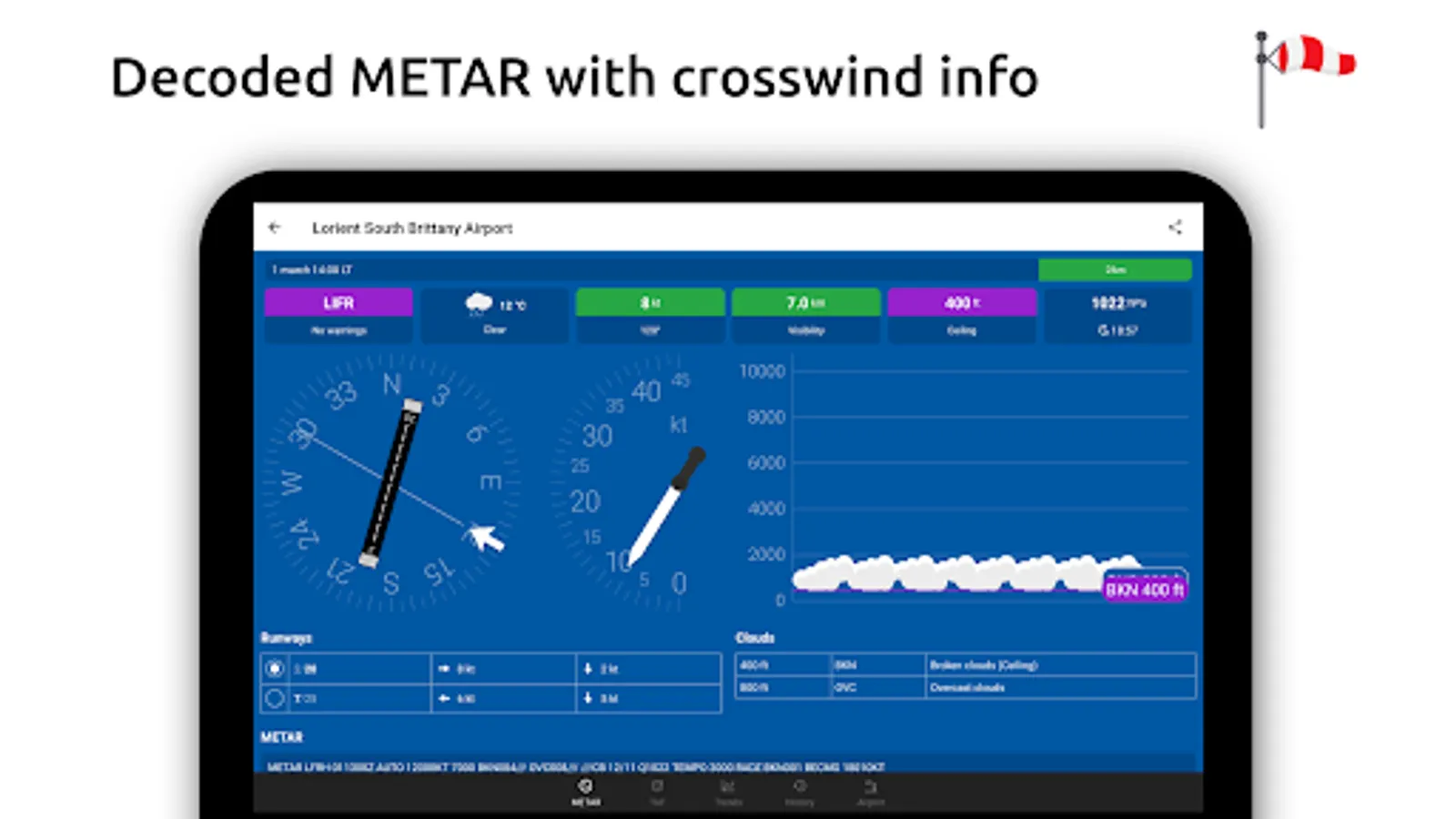
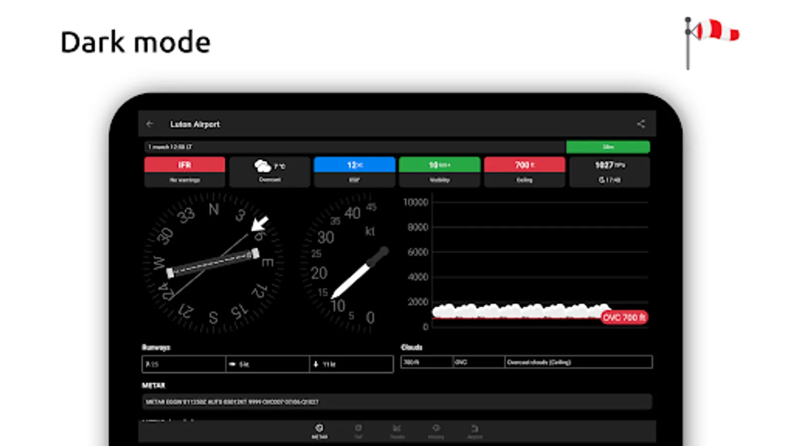
- Visualized in easy to understand and colourful metrics
- Weather symbols for significant weather and clouds, like in a non-aviation weather report
- Crosswind calculations, by combining METAR and runway information
- Flight rules category: VFR, MVFR, IFR, LIFR
- Read out by text-to-speech available, listen to a decoded METAR while doing other things
TAF features:
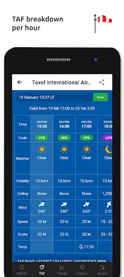
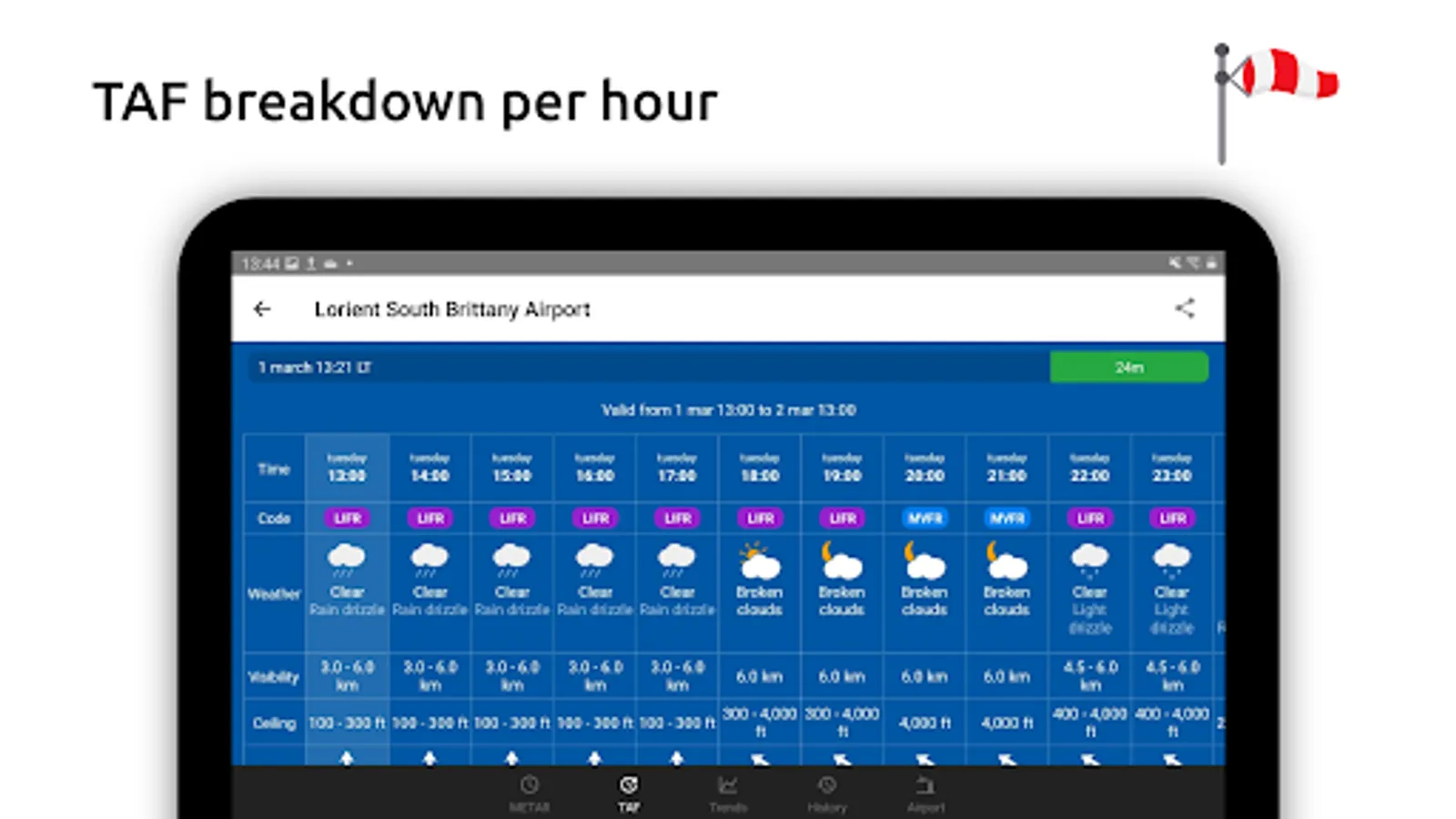
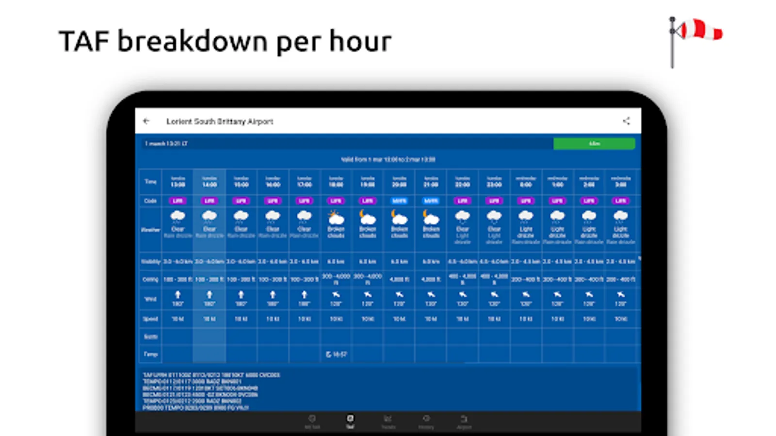
- TAF broken down and displayed per hour in a table
- Show sunrise/sunset, minimum and maximum temperature
Keeping track:
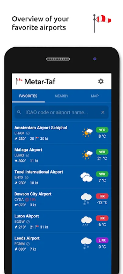
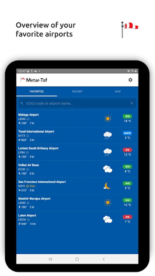
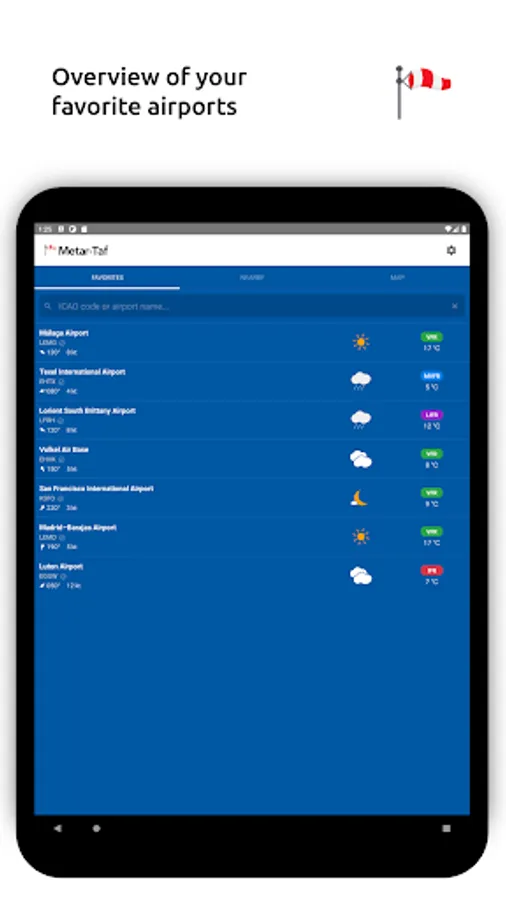
- Add your favorite stations to the list, see their weather at a glance
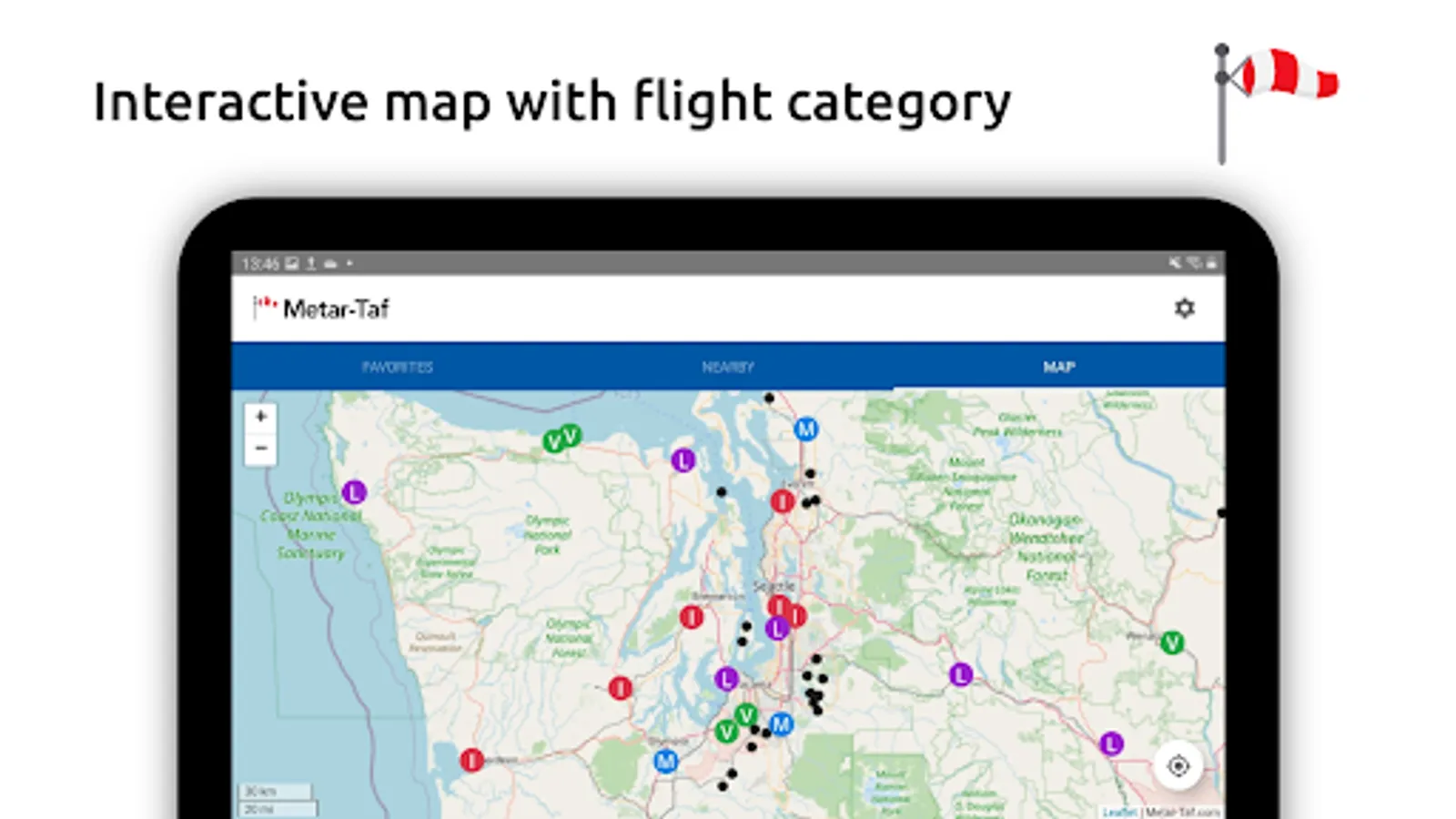
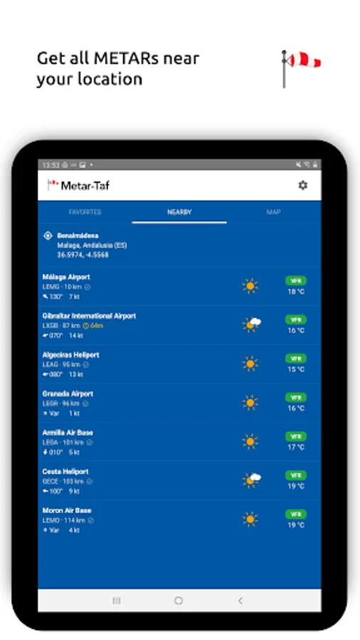
- Get observations near your location
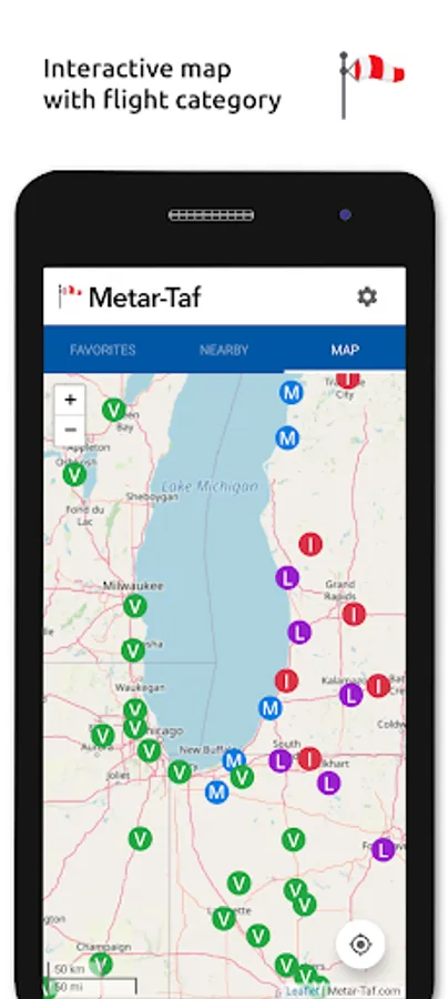
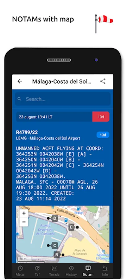
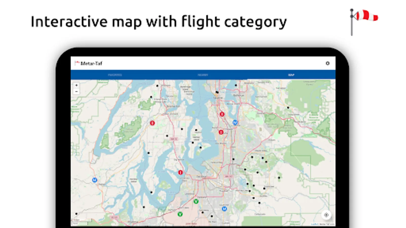
- Find stations in the interactive map with weather codes
- Search airports by ICAO code or name
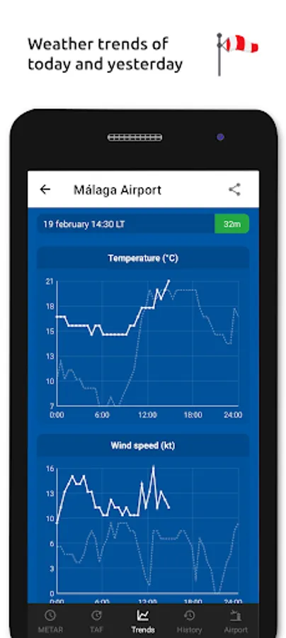
History:
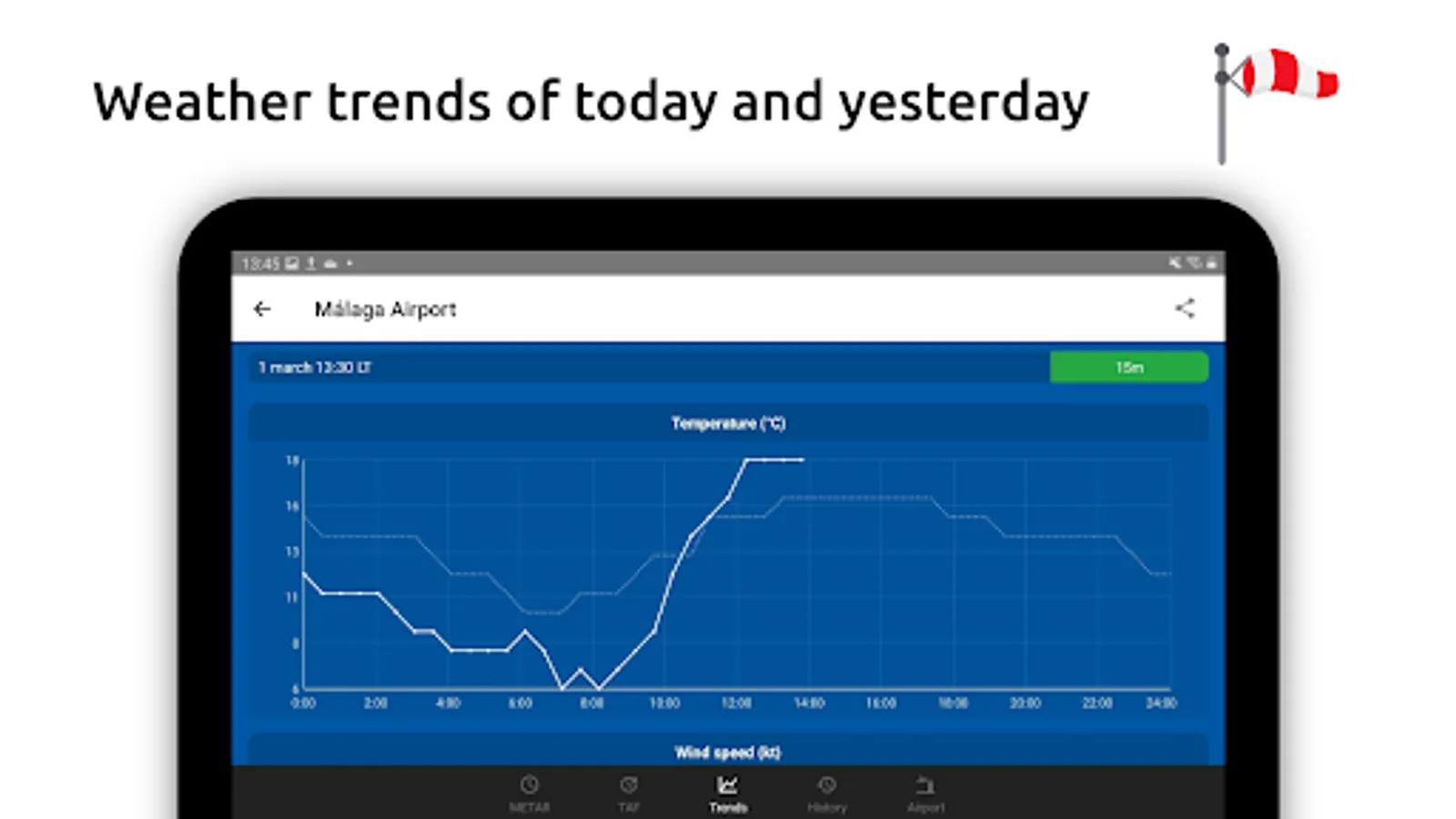
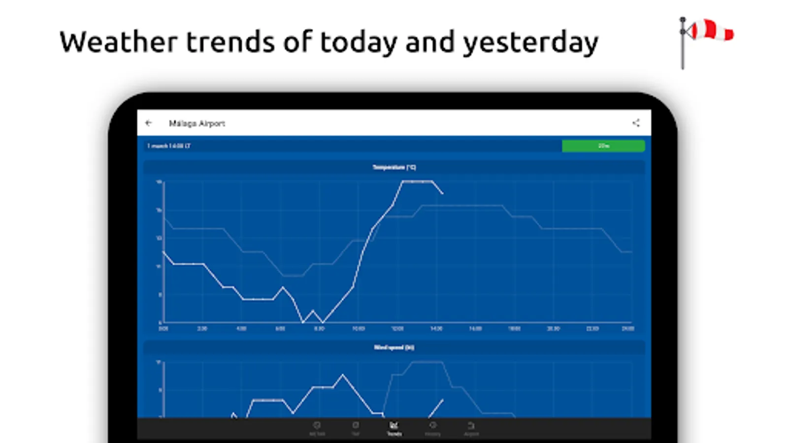
- Graphs with weather trends today and yesterday: temperature, visibility, wind speed, QNH
- METAR history for the last hours and link to more on the website
Airport information:
- See information about the airports, like runway directions, elevation, location
- If the airport doesn't report a METAR, the nearest station used for calculations
Calculations:
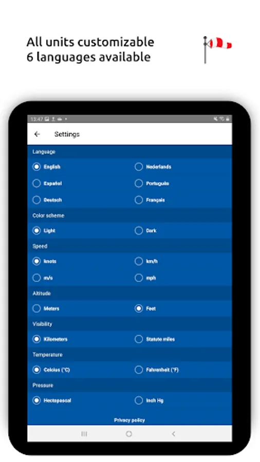
- All units are customizable units: speed (knots, km/h, m/s, mph), altitude (meters/feet), visibility (kilometers/miles), temperature (Celcius/Fahrenheit) and air pressure (Hectopascal, Inch Hg)
- Times are converted to the local time for each airport
- Sunrise and sunset are calculated based on the airports latitude/longitude
General:
- METAR, TAF and airport data are automatically saved for offline use
- Available in 6 languages: English, Dutch, Spanish, Portuguese, German and French
METAR features:
- Visualized in easy to understand and colourful metrics
- Weather symbols for significant weather and clouds, like in a non-aviation weather report
- Crosswind calculations, by combining METAR and runway information
- Flight rules category: VFR, MVFR, IFR, LIFR
- Read out by text-to-speech available, listen to a decoded METAR while doing other things
TAF features:
- TAF broken down and displayed per hour in a table
- Show sunrise/sunset, minimum and maximum temperature
Keeping track:
- Add your favorite stations to the list, see their weather at a glance
- Get observations near your location
- Find stations in the interactive map with weather codes
- Search airports by ICAO code or name
History:
- Graphs with weather trends today and yesterday: temperature, visibility, wind speed, QNH
- METAR history for the last hours and link to more on the website
Airport information:
- See information about the airports, like runway directions, elevation, location
- If the airport doesn't report a METAR, the nearest station used for calculations
Calculations:
- All units are customizable units: speed (knots, km/h, m/s, mph), altitude (meters/feet), visibility (kilometers/miles), temperature (Celcius/Fahrenheit) and air pressure (Hectopascal, Inch Hg)
- Times are converted to the local time for each airport
- Sunrise and sunset are calculated based on the airports latitude/longitude
General:
- METAR, TAF and airport data are automatically saved for offline use
- Available in 6 languages: English, Dutch, Spanish, Portuguese, German and French
Metar-Taf - Visual decoder Screenshots


Tap to Rate:
Reviews for Metar-Taf - Visual decoder
Gabriel Hershberger
12/28/2025
Love it. Makes TAFs visible. The instrument gauges are cool too.
Edwin Sanabia
11/28/2025
Favorite new aviation weather app!