About MapX – DXF Map & GPS Viewer
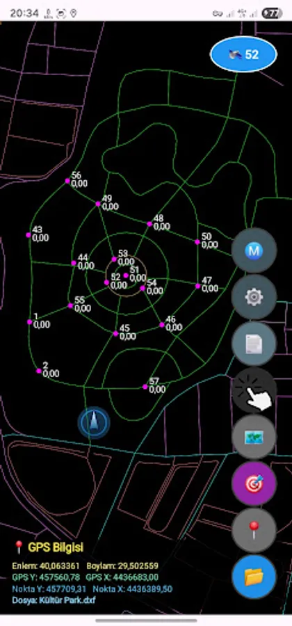
MapX allows you to visualize your DXF project files based on the UTM 3 ITRF coordinate system with real-time GPS support in the field.
Designed for surveyors, construction technicians, and field teams, MapX lets you track your project coordinates live, manage points, and view them directly on the map. DXF, UTM, GPS, coordinate, mapping, survey, CAD, ITRF, map viewer, point manager, topography, engineering, field data, mapping tool, coordinate system, AutoCAD DXF
Features:
View DXF files (UTM 3 ITRF based)
Display your device’s GPS position on the DXF map in real time
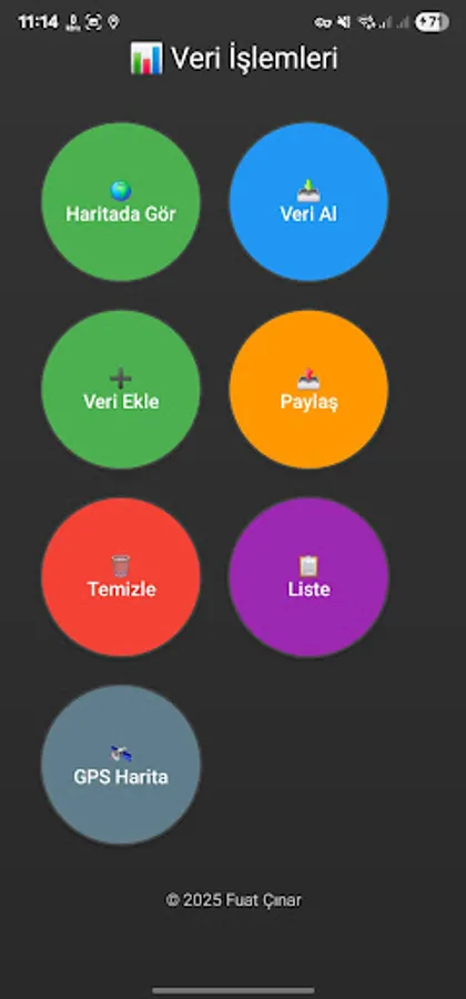
Import TXT (UTM 3) point files
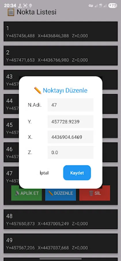
Add, delete, and batch-edit points
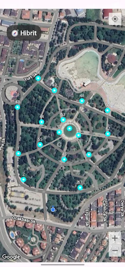
Display points on Google Maps
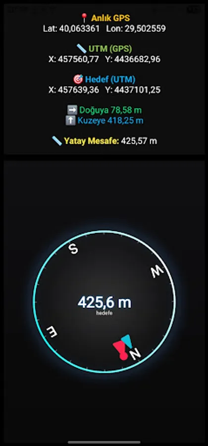
Get navigation and route directions to selected points
Performance Tips:
Keep your DXF file size below 10 MB for better performance.
Exploding “Block Insert” entities improves rendering speed.
Convert DWG files to DXF using professional CAD software (AutoCAD, ZWCAD, etc.).
Note:
MapX supports DXF files only.
Projects not created in the UTM 3 ITRF 96 system may show incorrect positions.
Designed for surveyors, construction technicians, and field teams, MapX lets you track your project coordinates live, manage points, and view them directly on the map. DXF, UTM, GPS, coordinate, mapping, survey, CAD, ITRF, map viewer, point manager, topography, engineering, field data, mapping tool, coordinate system, AutoCAD DXF
Features:
View DXF files (UTM 3 ITRF based)
Display your device’s GPS position on the DXF map in real time
Import TXT (UTM 3) point files
Add, delete, and batch-edit points
Display points on Google Maps
Get navigation and route directions to selected points
Performance Tips:
Keep your DXF file size below 10 MB for better performance.
Exploding “Block Insert” entities improves rendering speed.
Convert DWG files to DXF using professional CAD software (AutoCAD, ZWCAD, etc.).
Note:
MapX supports DXF files only.
Projects not created in the UTM 3 ITRF 96 system may show incorrect positions.