NOAA Buoy Reports & Ship Data
Juggernaut Technology, Inc.
4.4 ★
230 ratings
10,000+
downloads
Free
+ in-app
In this app, you can view real-time buoy and ship data with an intuitive map interface and customizable favorites. Includes buoy conditions, ship observations, storm locations, and interactive graphs.
AppRecs review analysis
AppRecs rating 4.3. Trustworthiness 0 out of 100. Review manipulation risk 0 out of 100. Based on a review sample analyzed.
★★★★☆
4.3
AppRecs Rating
Ratings breakdown
5 star
72%
4 star
13%
3 star
7%
2 star
4%
1 star
4%
What to know
✓
High user satisfaction
85% of sampled ratings are 4+ stars (4.4★ average)
✓
Authentic reviews
Natural distribution, no red flags
About NOAA Buoy Reports & Ship Data
This is the no-nonsense app to get all the buoy information you need — without the clutter of tide or weather forecasts.
NOAA Buoy Reports includes:
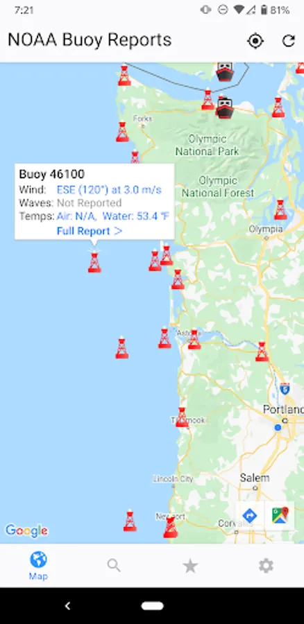
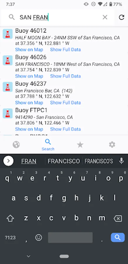
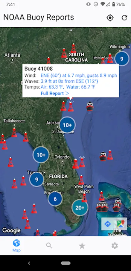
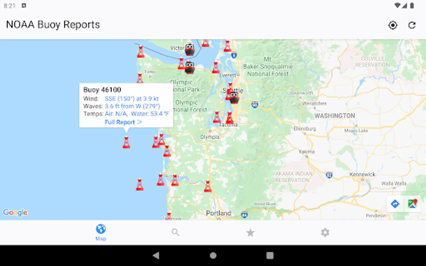
• Intuitive map interface
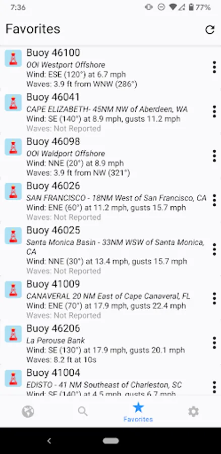
• Quick-view Favorites
• Locations of Tropical Storms, Hurricanes, and Cyclones from the NHC
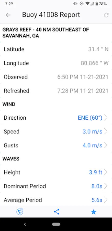
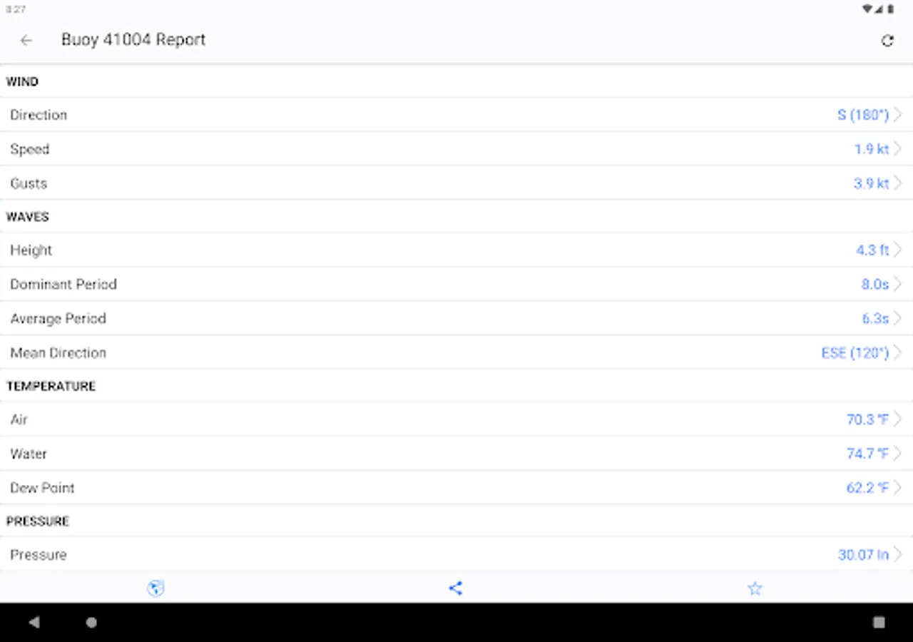
• Full buoy current conditions (always free)
• Ship observations (free preview)
• Buoy Cams (free preview)
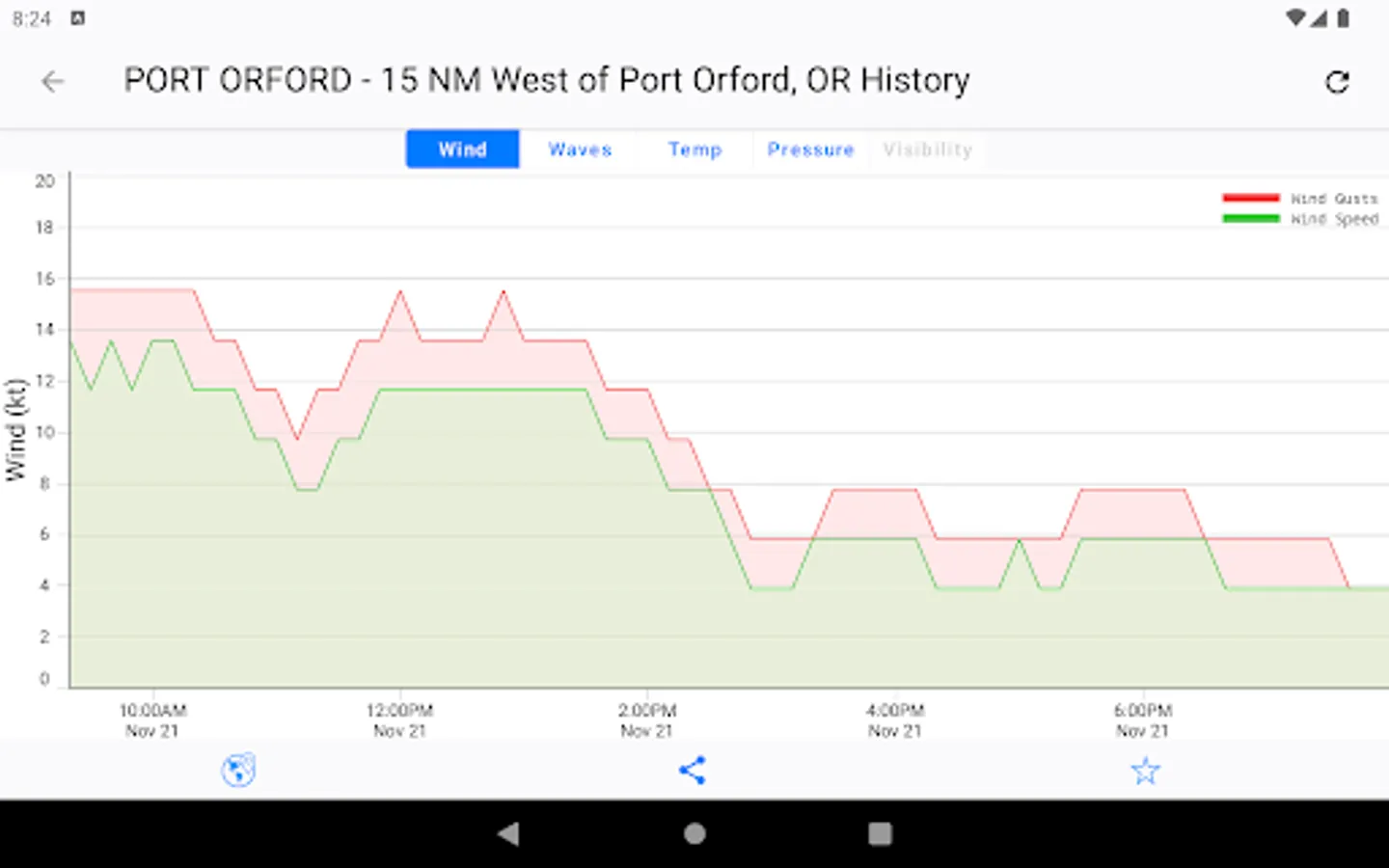
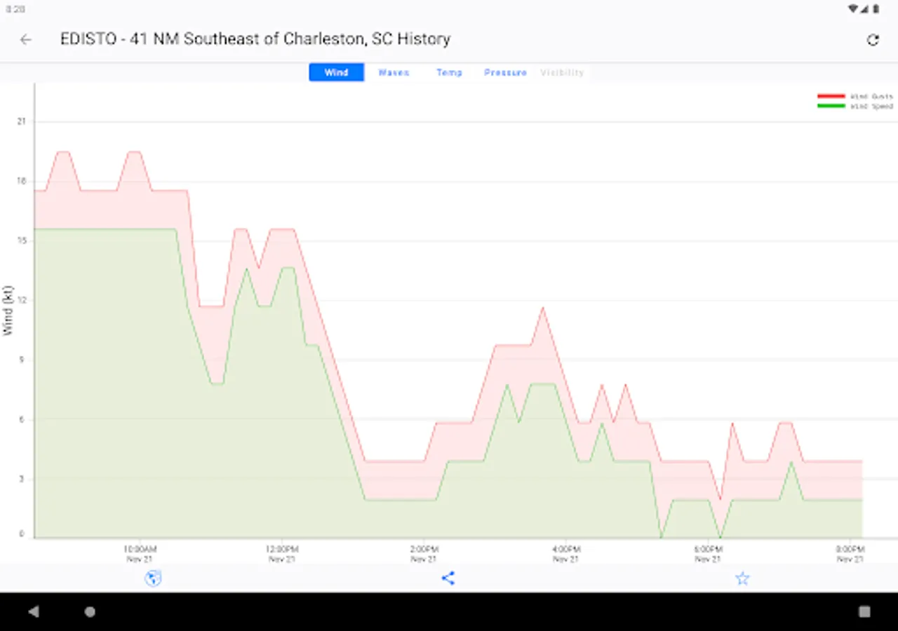
• Past buoy data up to 45 days (Premium feature)
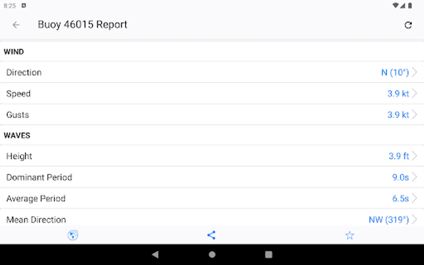
• Wave heights and directions (when available)
• Wind, gusts, and directions (when available)
• Air and Water temperatures (when available)
• Atmospheric pressure (when available)
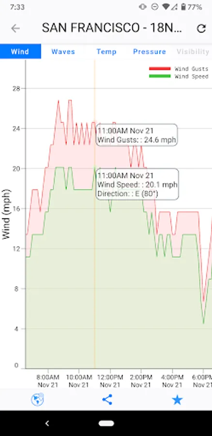
• Interactive graphs
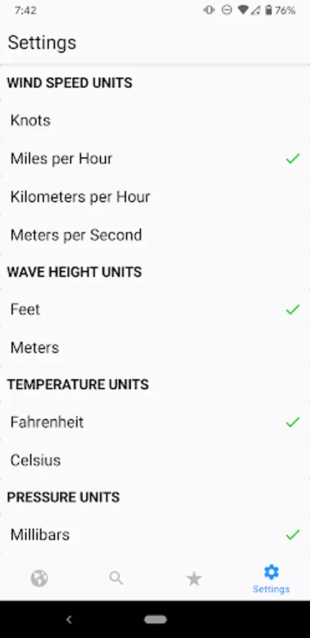
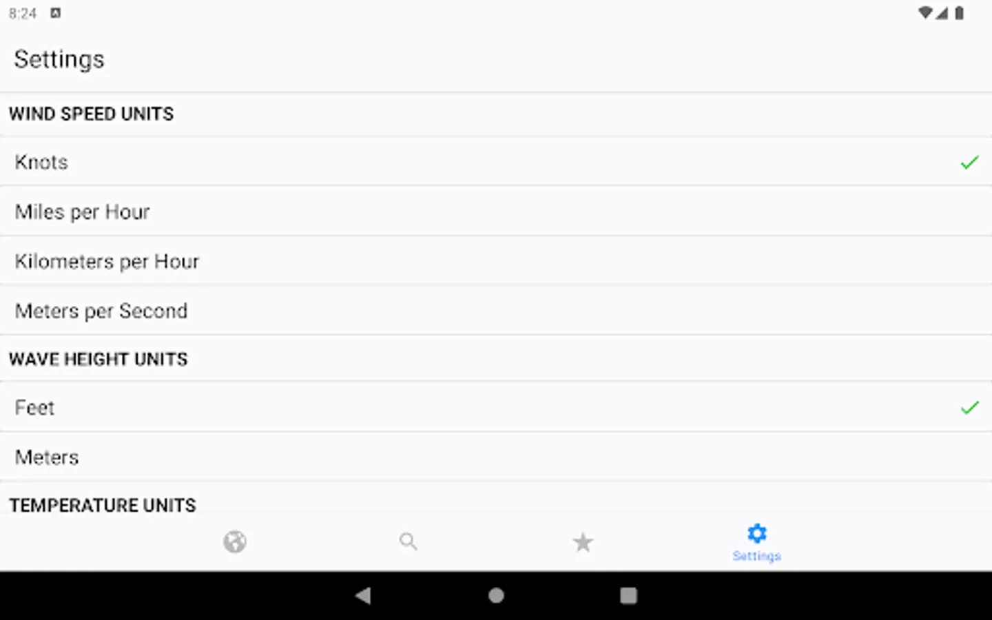
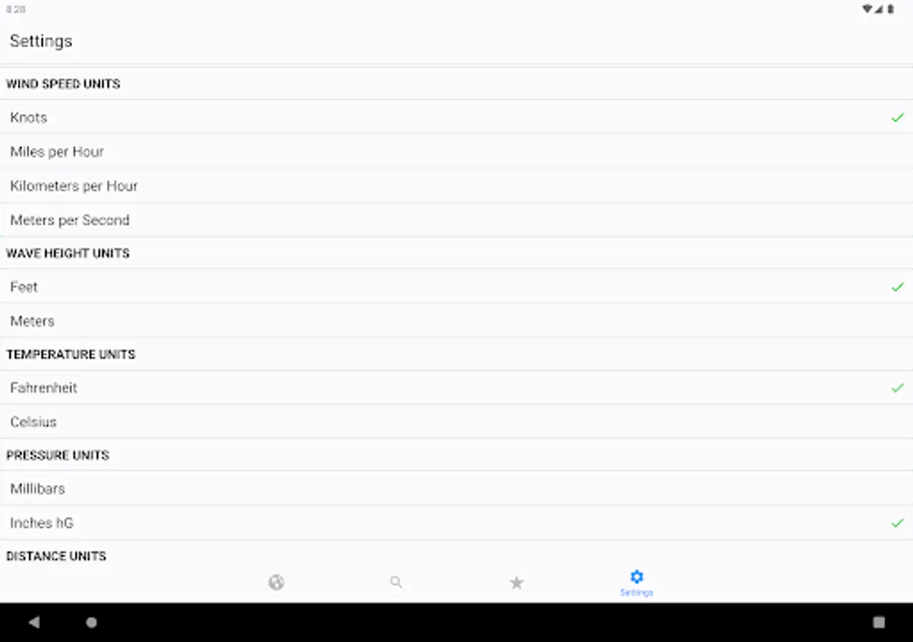
• Units in Metric or English
• Readings in your local time
• Share data via Text, Email, Facebook, etc.
• Dark Theme support
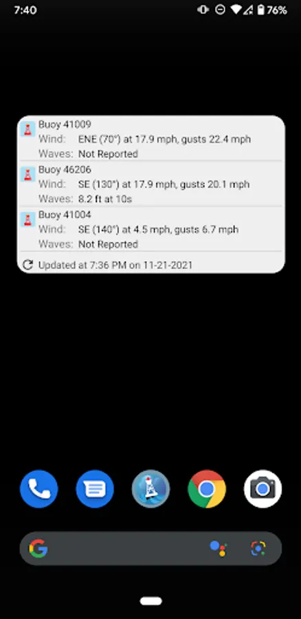
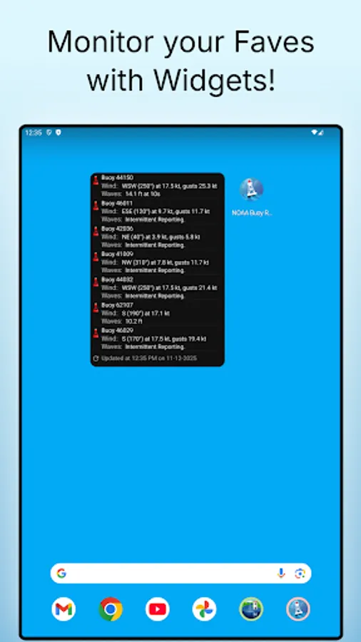
• Home Screen Widget to monitor your favorite locations at any time.
Coverage includes more than 1000 buoys and 200 ships worldwide, spanning the Atlantic and Pacific Oceans near the U.S. and Canada, the Great Lakes, the Caribbean, and waters around Ireland and Great Britain.
Simply tap any buoy or ship on the map to view its latest reported conditions. Tap again for a full summary or an interactive graph of recent trends, so you can see not only what’s happening now, but how conditions have changed over time.
Add favorites to quickly view the locations that matter most to you, and monitor them anytime with the included widgets.
This app DOES NOT provide tide data, or maritime or other weather forecasts. There are dedicated apps for these from other publishers that do an excellent job. This app specializes exclusively in buoy and ship observation data.
Please note that not all buoys have all types of data available, and buoys do experience intermittent outages — a life at sea can be harsh!
Additionally, note that some buoys may be seasonal, and may be physically removed from the water during winter months, such as in the Great Lakes.
Source data is from NOAA, National Data Buoy Center (NDBC), and the National Hurricane Center (NHC).
Juggernaut Technology, Inc. is not associated with NOAA, NDBC, NHC, or any other government organization.
Juggernaut Technology, Inc. is not liable for any errors or omissions in the information and shall not be liable for any loss, injury, or damage of any kind caused by its use.
NOAA Buoy Reports includes:
• Intuitive map interface
• Quick-view Favorites
• Locations of Tropical Storms, Hurricanes, and Cyclones from the NHC
• Full buoy current conditions (always free)
• Ship observations (free preview)
• Buoy Cams (free preview)
• Past buoy data up to 45 days (Premium feature)
• Wave heights and directions (when available)
• Wind, gusts, and directions (when available)
• Air and Water temperatures (when available)
• Atmospheric pressure (when available)
• Interactive graphs
• Units in Metric or English
• Readings in your local time
• Share data via Text, Email, Facebook, etc.
• Dark Theme support
• Home Screen Widget to monitor your favorite locations at any time.
Coverage includes more than 1000 buoys and 200 ships worldwide, spanning the Atlantic and Pacific Oceans near the U.S. and Canada, the Great Lakes, the Caribbean, and waters around Ireland and Great Britain.
Simply tap any buoy or ship on the map to view its latest reported conditions. Tap again for a full summary or an interactive graph of recent trends, so you can see not only what’s happening now, but how conditions have changed over time.
Add favorites to quickly view the locations that matter most to you, and monitor them anytime with the included widgets.
This app DOES NOT provide tide data, or maritime or other weather forecasts. There are dedicated apps for these from other publishers that do an excellent job. This app specializes exclusively in buoy and ship observation data.
Please note that not all buoys have all types of data available, and buoys do experience intermittent outages — a life at sea can be harsh!
Additionally, note that some buoys may be seasonal, and may be physically removed from the water during winter months, such as in the Great Lakes.
Source data is from NOAA, National Data Buoy Center (NDBC), and the National Hurricane Center (NHC).
Juggernaut Technology, Inc. is not associated with NOAA, NDBC, NHC, or any other government organization.
Juggernaut Technology, Inc. is not liable for any errors or omissions in the information and shall not be liable for any loss, injury, or damage of any kind caused by its use.
NOAA Buoy Reports & Ship Data Screenshots
Tap to Rate:
Reviews for NOAA Buoy Reports & Ship Data
Steven Garbus
2/14/2026
Very prompt, friendly and helpful tech support from the Dev. Thanks!
j
1/17/2026
Great way to help locate temperature fluctuations for better fishing.