Regrid Property App
Regrid
4.7 ★
5K ratings
500,000+
downloads
Free
+ in-app
In this map-based app, you can view detailed land and property information by tapping on parcels and exploring boundaries. Includes property data, owner info, sale history, and mapping tools.
AppRecs review analysis
AppRecs rating 4.4. Trustworthiness 72 out of 100. Review manipulation risk 36 out of 100. Based on a review sample analyzed.
★★★★☆
4.4
AppRecs Rating
Ratings breakdown
5 star
82%
4 star
12%
3 star
2%
2 star
2%
1 star
2%
What to know
✓
Credible reviews
72% trustworthiness score from analyzed reviews
✓
High user satisfaction
82% of sampled ratings are 5 stars
⚠
Pricing complaints
Many low ratings mention paywalls or pricing
About Regrid Property App
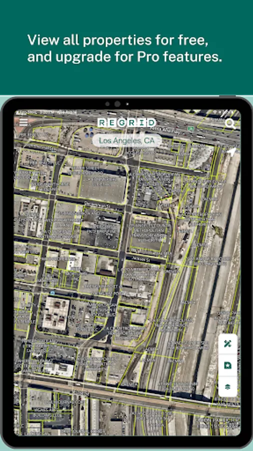
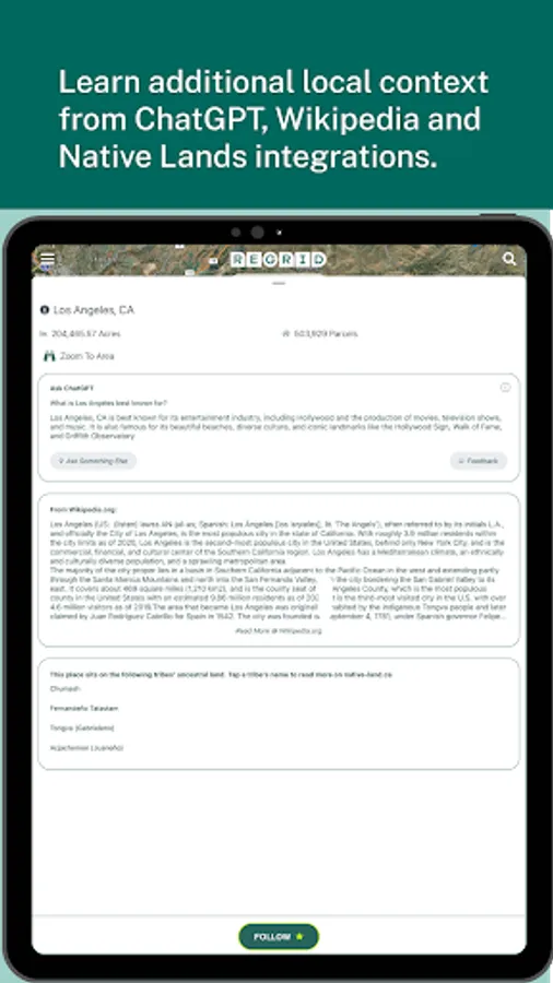
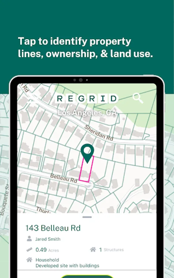
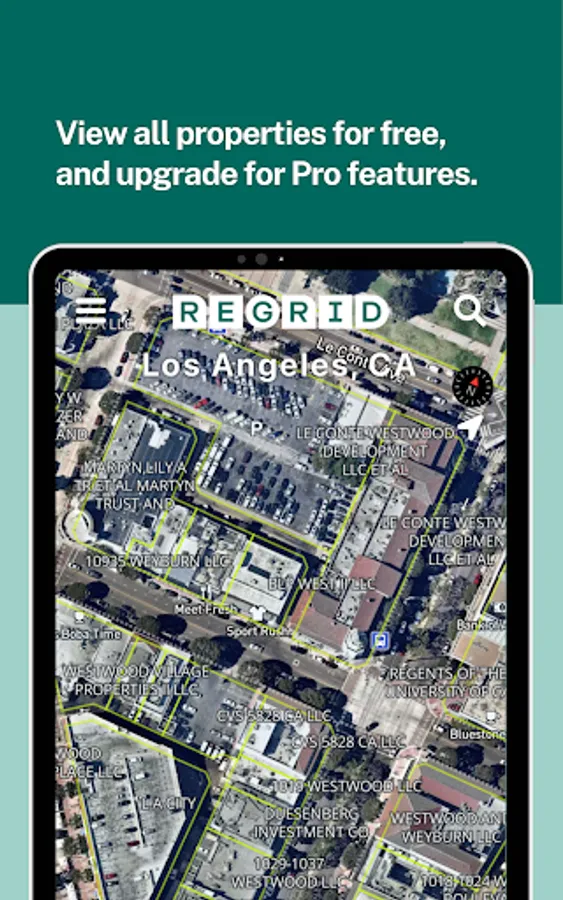
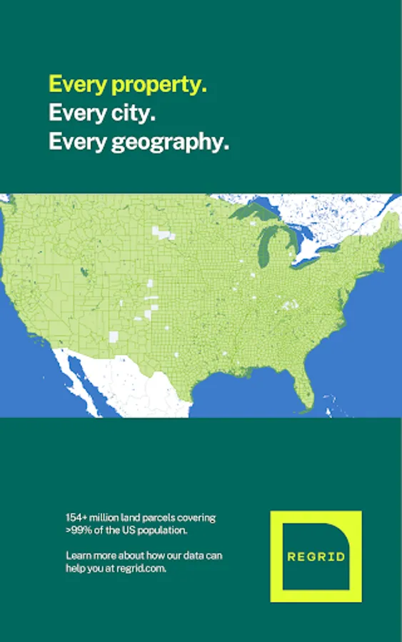
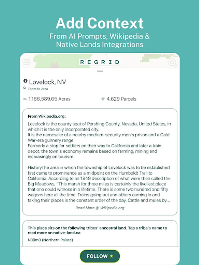
Loved by millions, the Regrid Property App is a map-based solution that unlocks the world of land and property information to anyone with a smart phone. Tap a property to easily view property data and parcel boundaries for 157+ million parcels covering over 99% of the US population.
Easy access to all of the following info (and more!):
- Lot lines / boundaries
- APN/Parcel ID/Regrid UUID
- Property Address
- Property Owner
- Number of acres and square footage of properties
- Sale price and date
- Mailing Address
- Property Value
- Land Use
- Standardized Zoning data
- Vacancy Indicator
For free, you get:
- Access extensive public record property boundaries and details nationwide (no caps or time limit) with just an email address
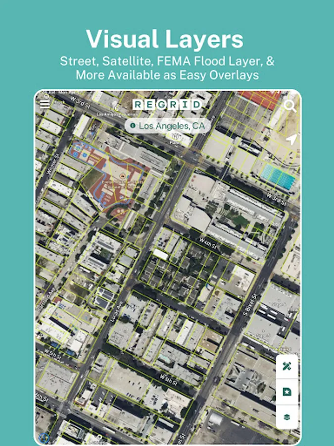
- Street and satellite basemap toggle
- Search by address or place
- Easy-to-use property map interface
- Ability to share a link to properties of interest
- Ideal for use as a property finder, real estate tool, and as a hunting app to find who owns land.
If you sign up for our $10/month Pro plan, you also get:
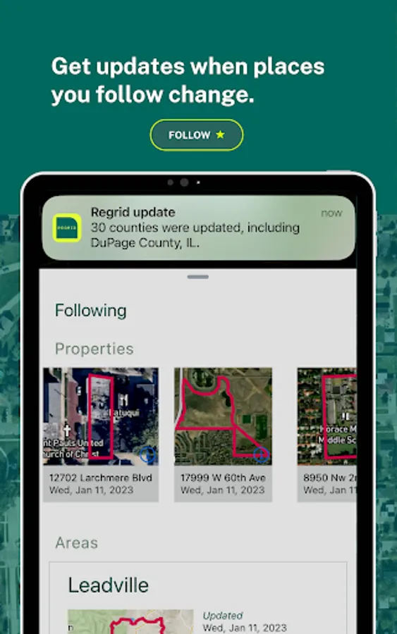
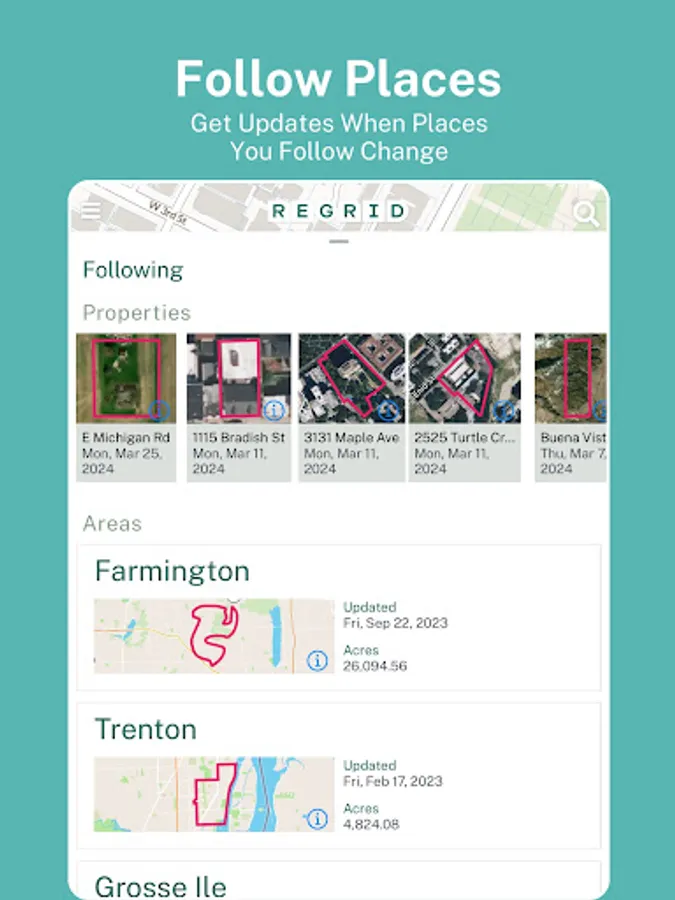
- Follow feature: create a list of properties you care about, and get automated updates when things change.
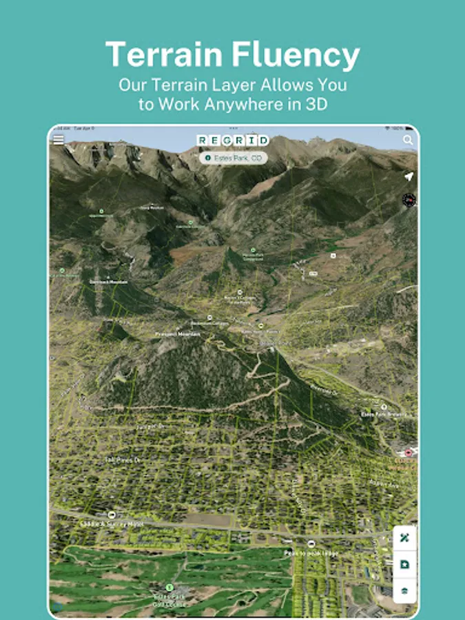
- Additional basemap layers: building footprints, elevation (topo) contours overlaid on property boundaries.
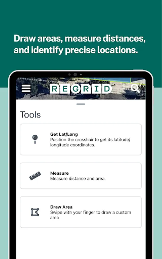
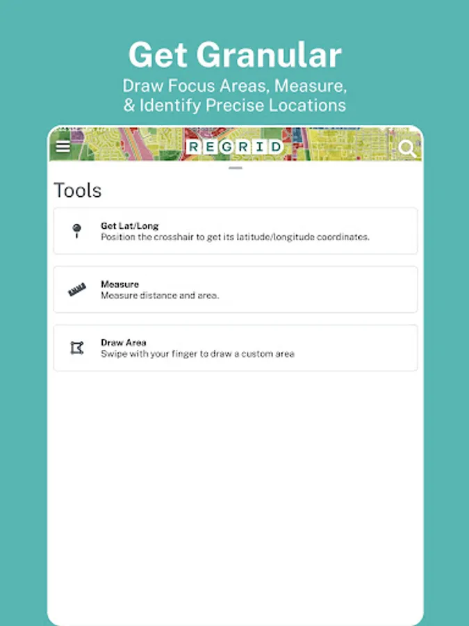
- Measure tool to calculate linear feet, acreage, and square footage of a drawn area
- Overlay owner names and parcel ID on the map
Plus, Pro gets you access to our premium data fields:
- Vacancy
- Land use
- Building footprint data
- Residential & Vacancy indicator
PLUS: Full access to a host of additional mapping tools on our website, [regrid.com](http://regrid.com). Signing up for a Pro account gets you access to both with the same login.
Easy access to all of the following info (and more!):
- Lot lines / boundaries
- APN/Parcel ID/Regrid UUID
- Property Address
- Property Owner
- Number of acres and square footage of properties
- Sale price and date
- Mailing Address
- Property Value
- Land Use
- Standardized Zoning data
- Vacancy Indicator
For free, you get:
- Access extensive public record property boundaries and details nationwide (no caps or time limit) with just an email address
- Street and satellite basemap toggle
- Search by address or place
- Easy-to-use property map interface
- Ability to share a link to properties of interest
- Ideal for use as a property finder, real estate tool, and as a hunting app to find who owns land.
If you sign up for our $10/month Pro plan, you also get:
- Follow feature: create a list of properties you care about, and get automated updates when things change.
- Additional basemap layers: building footprints, elevation (topo) contours overlaid on property boundaries.
- Measure tool to calculate linear feet, acreage, and square footage of a drawn area
- Overlay owner names and parcel ID on the map
Plus, Pro gets you access to our premium data fields:
- Vacancy
- Land use
- Building footprint data
- Residential & Vacancy indicator
PLUS: Full access to a host of additional mapping tools on our website, [regrid.com](http://regrid.com). Signing up for a Pro account gets you access to both with the same login.
Regrid Property App Screenshots


Tap to Rate:
Reviews for Regrid Property App
Gabriel Lopez
12/30/2025
It helps when in doubt
Todd Perkins
12/30/2025
it works and the free stuff is really free