Water Map Plus
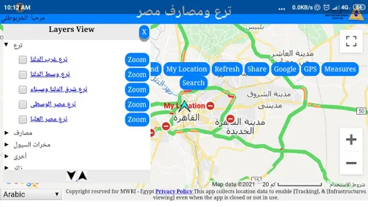
Egypt Agriculture Canals Network
Copyright reserved for Ministry of Water Resources & Irrigation "MWRI" EGYPT
This application propose are
•help users to find nearest irrigation water source and display its administrative information.
•Show waterway data where the user is standing.
•Determine the kilometric location on the waterway for any specific point
•Display geographical coordinates where the user is standing.
•Displaying on the background of satellite images or the background of Google Map methods of its services.
•Share coordinates via WhatsApp
In general, this application helps users by showing their locations around areas of water networks, canals and water sources in order to help them reach the nearest source of water and drainage for them to save each drop of water and to avoid lost way, accidents and damage to themselves
"This app collects location data to enable [Tracking], & [Infrastructures viewing] even when the app is closed or not in use.”
Show More