With this 3D scanner app, you can capture images to create detailed 3D models and maps, then upload or export data for processing. Includes options for data upload, export to desktop software, and measurement tools.
AppRecs review analysis
AppRecs rating 3.4. Trustworthiness 86 out of 100. Review manipulation risk 20 out of 100. Based on a review sample analyzed.
★★★☆☆
3.4
AppRecs Rating
Ratings breakdown
5 star
50%
4 star
14%
3 star
5%
2 star
10%
1 star
22%
What to know
✓
Low review manipulation risk
20% review manipulation risk
⚠
Pricing complaints
Many low ratings mention paywalls or pricing
⚠
High negative review ratio
31% of sampled ratings are 1–2 stars
About PIX4Dcatch: 3D scanner
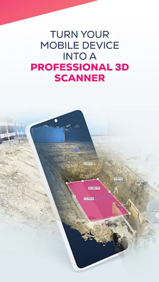
PIX4Dcatch lets you create 3D models and maps with your mobile device.
Just point and shoot to gather data, ready for accurate 3D model generation. Use it to recreate reality and measure the world around you.
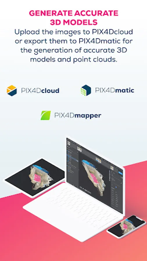
To generate georeferenced 3D models, the collected images can be uploaded to PIX4Dcloud or exported to PIX4Dmatic. Both offer a 15-day trial to get started. Projects can also be freely exported, processed, and visualized in third-party photogrammetry software.
Workflow
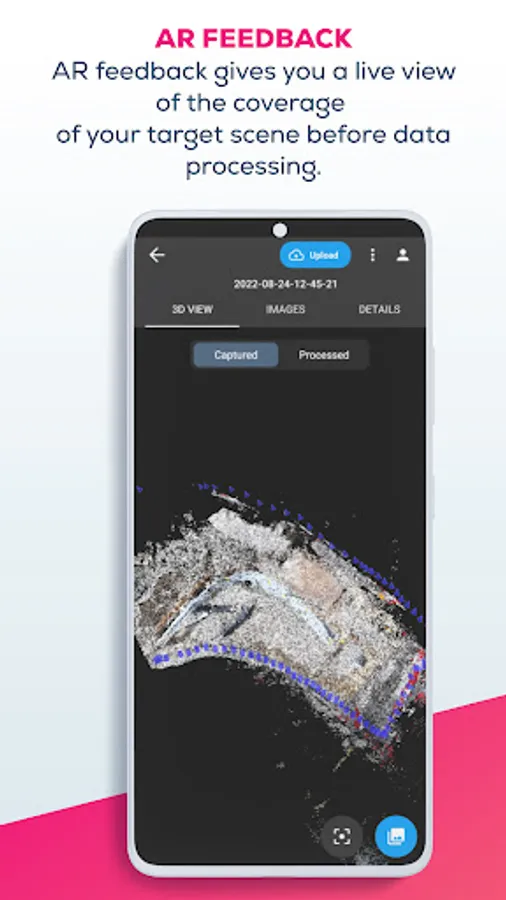
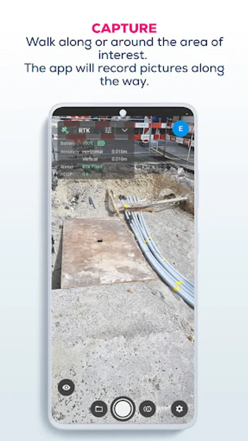
1- Scan: walk around your site. The app automatically gathers data and gives you live feedback to make sure you capture every detail.
2- Upload or export: upload your data to PIX4Dcloud, or export to desktop software PIx4Dmatic, and process the data. Get high-quality, accurate 2D and 3D outputs.
3- Analyze and share: share your results, measure the space, and enjoy all the benefits of a detailed 3D model of your surroundings.
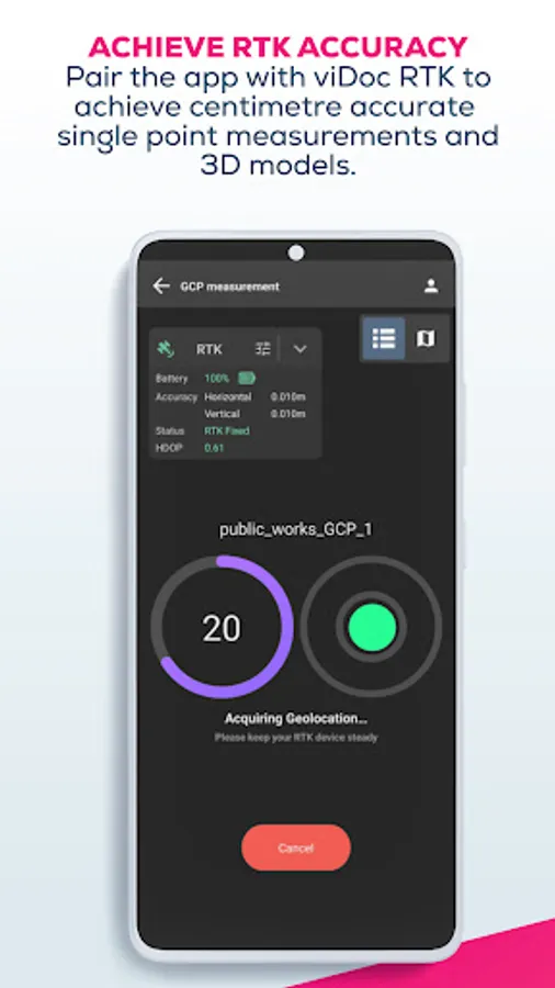
This workflow can be used for tracking stockpiles on construction sites, measuring volumes, or keeping permanent records of underground piping or work. Measure single points with confidence and enhance your accuracy with viDoc. Digitize reality with your mobile device.
Device compatibility:
- All ARCore-enabled devices
Google Play Services for AR needs to be installed in order to use the app.
Usage information guidance:
Ensure the app is up to date.
Pix4D accepts no liability for damage, injuries, or legalities from the misuse of this app. Use only in safe environments.
Just point and shoot to gather data, ready for accurate 3D model generation. Use it to recreate reality and measure the world around you.
To generate georeferenced 3D models, the collected images can be uploaded to PIX4Dcloud or exported to PIX4Dmatic. Both offer a 15-day trial to get started. Projects can also be freely exported, processed, and visualized in third-party photogrammetry software.
Workflow
1- Scan: walk around your site. The app automatically gathers data and gives you live feedback to make sure you capture every detail.
2- Upload or export: upload your data to PIX4Dcloud, or export to desktop software PIx4Dmatic, and process the data. Get high-quality, accurate 2D and 3D outputs.
3- Analyze and share: share your results, measure the space, and enjoy all the benefits of a detailed 3D model of your surroundings.
This workflow can be used for tracking stockpiles on construction sites, measuring volumes, or keeping permanent records of underground piping or work. Measure single points with confidence and enhance your accuracy with viDoc. Digitize reality with your mobile device.
Device compatibility:
- All ARCore-enabled devices
Google Play Services for AR needs to be installed in order to use the app.
Usage information guidance:
Ensure the app is up to date.
Pix4D accepts no liability for damage, injuries, or legalities from the misuse of this app. Use only in safe environments.
PIX4Dcatch: 3D scanner Screenshots


Tap to Rate:
Reviews for PIX4Dcatch: 3D scanner
YongJun Chong
7/20/2025
Amazing
Ronnie fawell
7/1/2025
very cool