GPS Monitor: satellite data
Alexander Kozyukov
4.4 ★
242 ratings
10,000+
downloads
Free
With this GPS monitoring app, you can view satellite data, check device location, and analyze satellite signals. Includes satellite details, navigation status, and location maps.
AppRecs review analysis
AppRecs rating 4.4. Trustworthiness 61 out of 100. Review manipulation risk 47 out of 100. Based on a review sample analyzed.
★★★★☆
4.4
AppRecs Rating
Ratings breakdown
5 star
58%
4 star
32%
3 star
5%
2 star
0%
1 star
5%
What to know
✓
Authentic reviews
Natural distribution, no red flags
⚠
Questionable review patterns
47% review manipulation risk - some review patterns appear unusual
⚠
Limited rating diversity
90% high ratings in sampled reviews
About GPS Monitor: satellite data
GPS Monitor helps you to check navigation satellites explored by your device and location information they provide. The application displays the objects of the following global navigation satellite systems (GNSS): GPS, GLONASS, Beidou, Galileo and other systems (QZSS, IRNSS). In addition, you can get your current latitude, longitude, altitude, heading and speed data. The application does not require an Internet connection, so you can determine the location even in airplane mode.
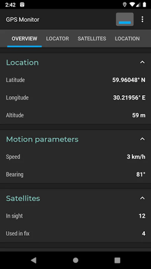
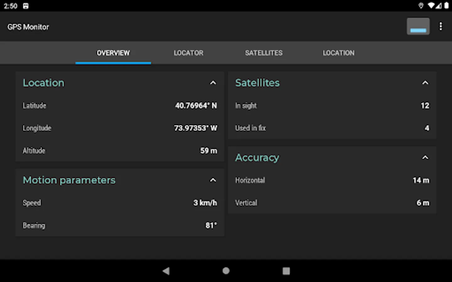
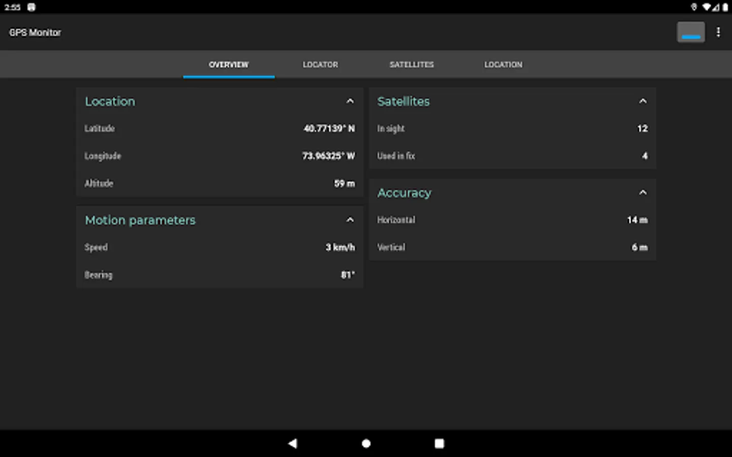
The "Overview" tab contains basic information about the state of the navigation system: longitude, latitude, altitude, heading and speed of your device. The tab shows the total amount of navigation satellites in the field of view and the number of satellites used for positioning.
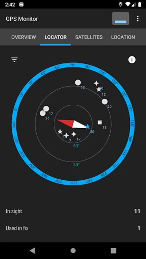
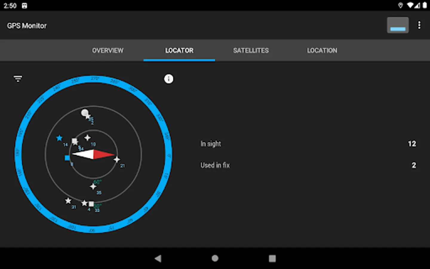
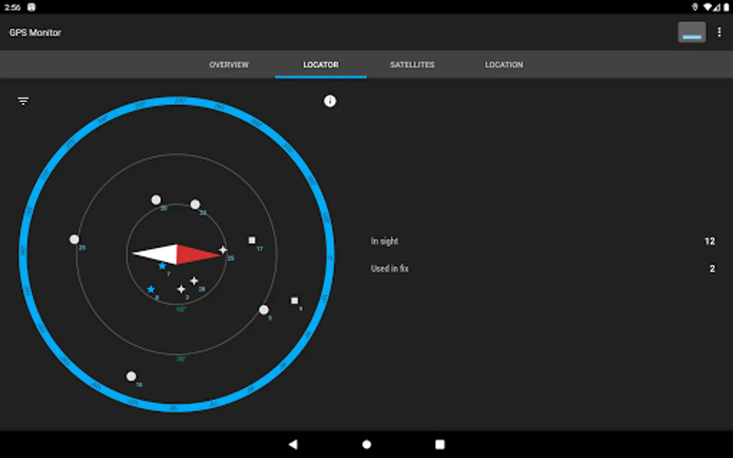
The "Locator" tab displays a map of visible navigation satellites. Satellites whose data is used by the device are highlighted in blue. Objects can be filtered by its type and state.
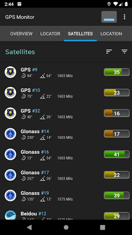
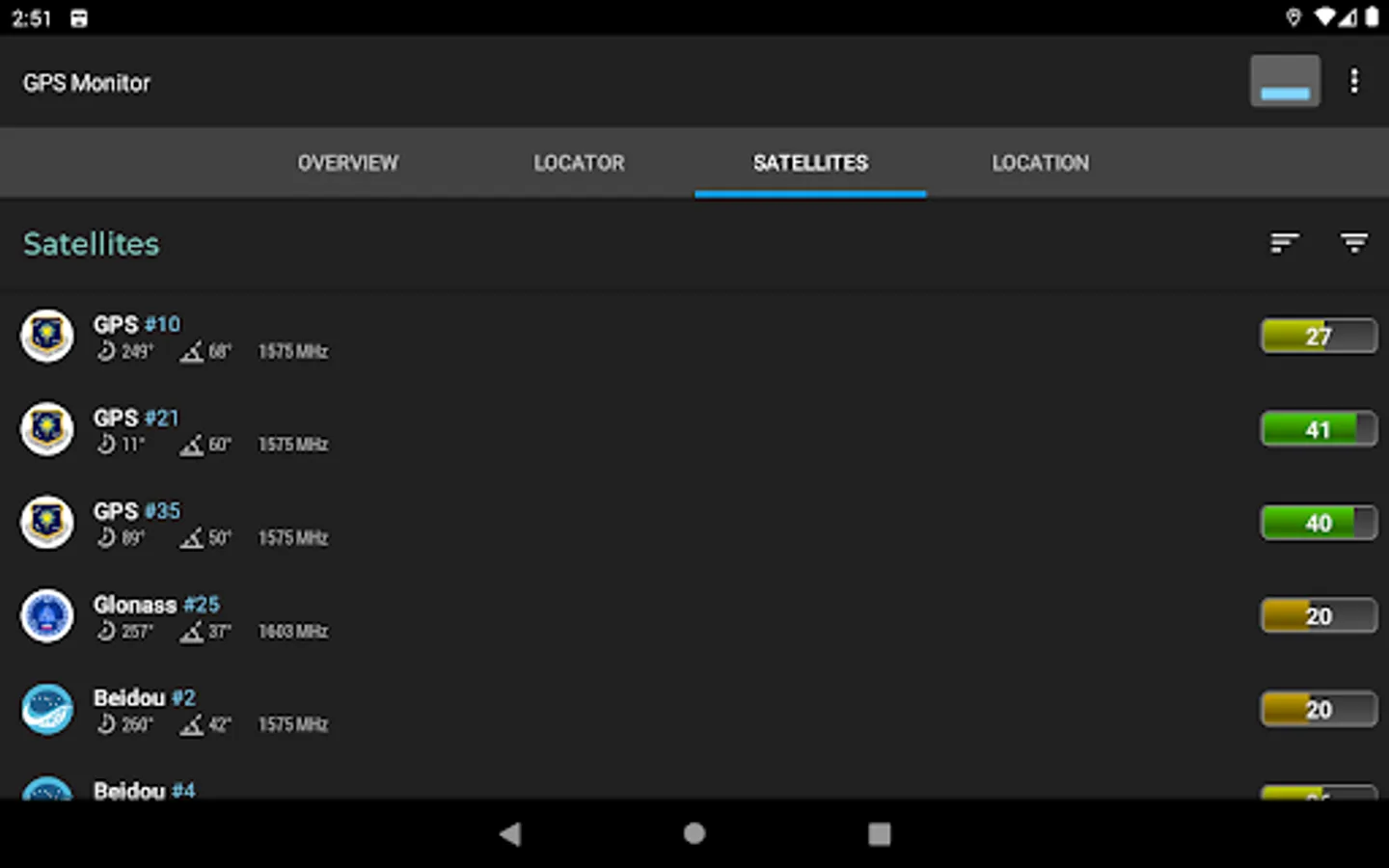
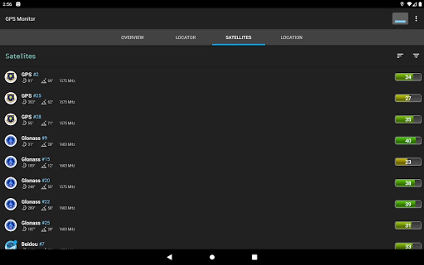
The "Satellites" tab contains a list of objects whose signal is registered by the device. Displayed parameters: type of navigation system (GNSS), identification number, azimuth, elevation, frequency, signal-to-noise ratio and others. The list can be filtered and sorted by several parameters.
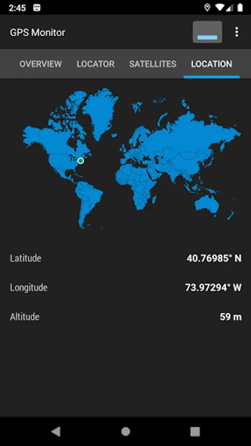
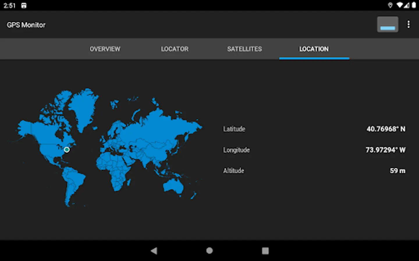
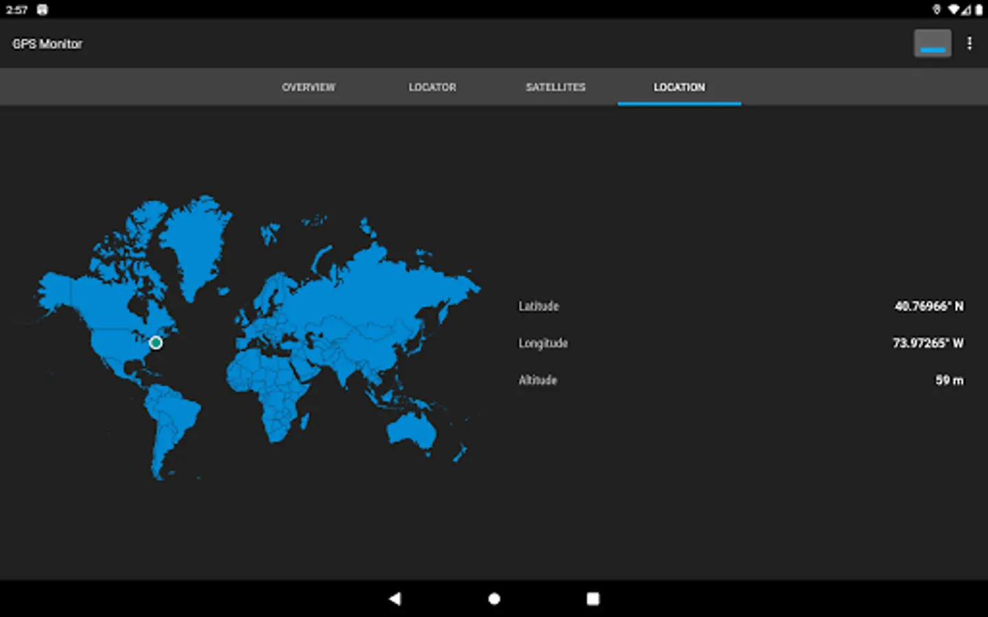
The "Position" tab includes a world map with a label for the current position, current longitude and latitude coordinates, and altitude.
The "Overview" tab contains basic information about the state of the navigation system: longitude, latitude, altitude, heading and speed of your device. The tab shows the total amount of navigation satellites in the field of view and the number of satellites used for positioning.
The "Locator" tab displays a map of visible navigation satellites. Satellites whose data is used by the device are highlighted in blue. Objects can be filtered by its type and state.
The "Satellites" tab contains a list of objects whose signal is registered by the device. Displayed parameters: type of navigation system (GNSS), identification number, azimuth, elevation, frequency, signal-to-noise ratio and others. The list can be filtered and sorted by several parameters.
The "Position" tab includes a world map with a label for the current position, current longitude and latitude coordinates, and altitude.
GPS Monitor: satellite data Screenshots
Tap to Rate:
Reviews for GPS Monitor: satellite data
Bill Simmons
11/17/2025
great tool!
Kenneth Gerecke
8/7/2024
Reliable