About Gorbeia 1.25 000
GORBEIA
MAPAS PIRENAICOS (1/25000)
CARDS Pyrénéennes (1/25000)
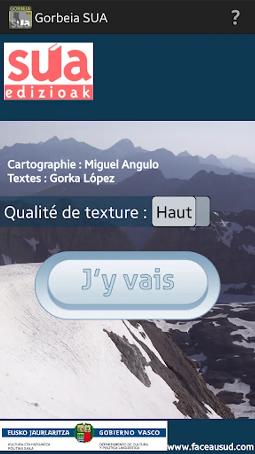
Miguel Angulo / Lopez Gorca
Guides in Castellano and Basque
Menus in French, Castellano, Basque and English
3D map Izarra sector - Murgia - Gogepi
Aramotz Mendikatea - Dima - igore - Zubialde
Hiking, climbing
1 - Cueva de Mairuelegorreta
2 - Fuentes del río Baias
3 - Arraba desde Larreder
4 - Robledal Zarate
5 - Fresno Lexarreta there Tejo Aginalde desde Iondegorta
6 - Oketa (1.031 m) desde las canteras Murua
7 - Paseo forestal has Burbona (934 m) desde Altube
8 - Berretin (1.221 m) desde Zaldibartxo
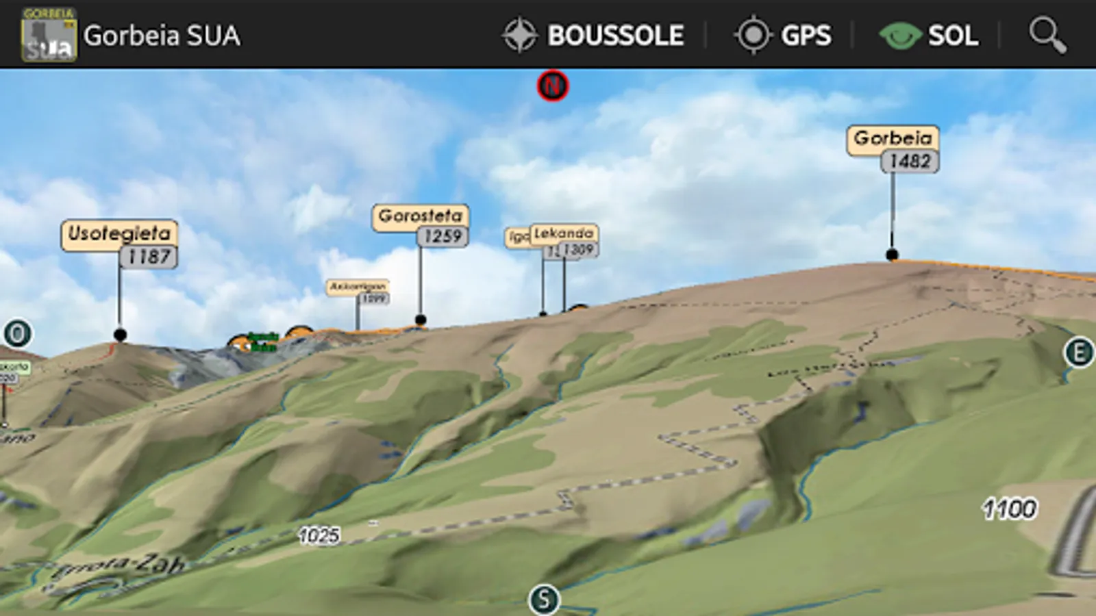
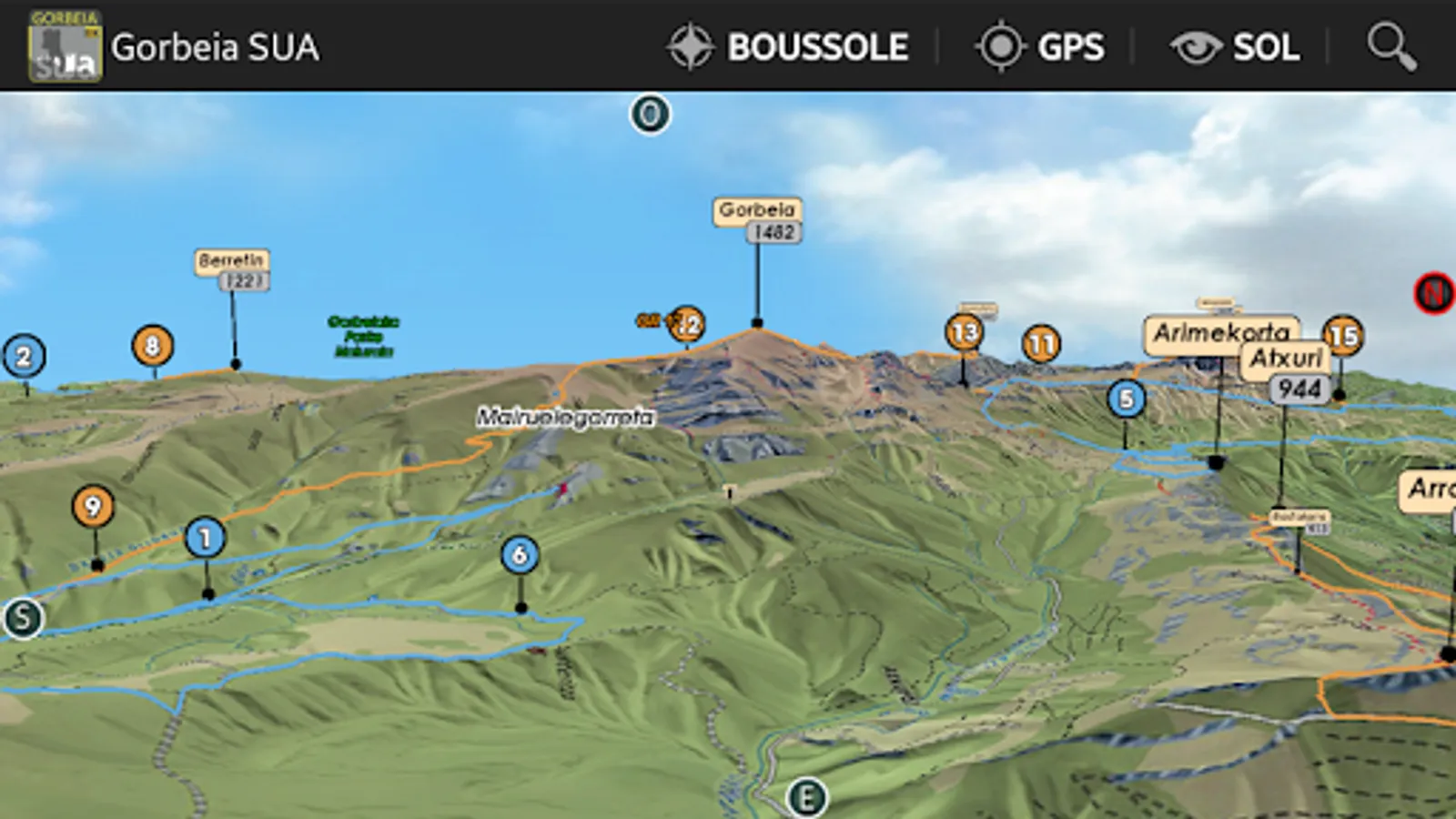
9 - Gorbeia (1.482 m) desde las canteras Murua
10 - Urtutxe (1.082 m) y Axkorrigan (1.099 m) desde Urigoiti
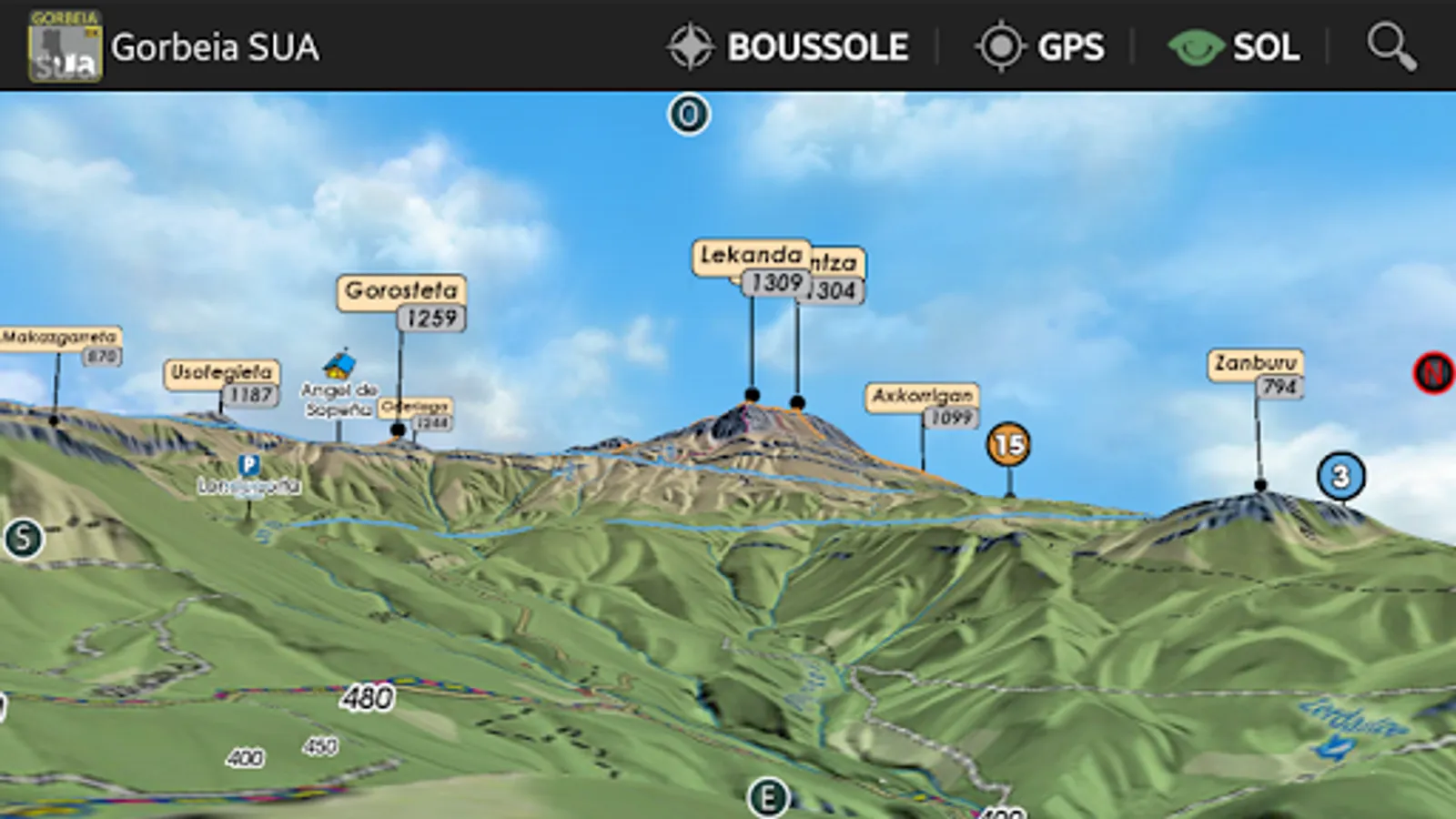
11 - Gorosteta (1.259 m) e Ipergorta (1.235 m) desde Urigoiti
12 - Oderiaga (1.244 m) desde Garrastatxu
13 - Gorbeia (1.482 m) desde Pagomakurre
14 - Atxuri (942 m) there Arralde (945 m) desde Saldropo
15 - Lekanda (1.309 m) e Igalirrintza (1.304 m) desde Pagomakurre
marked trails (GR, PR, SL, biking, PN)
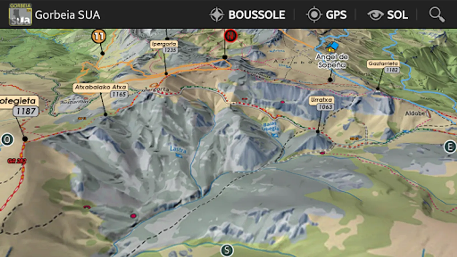
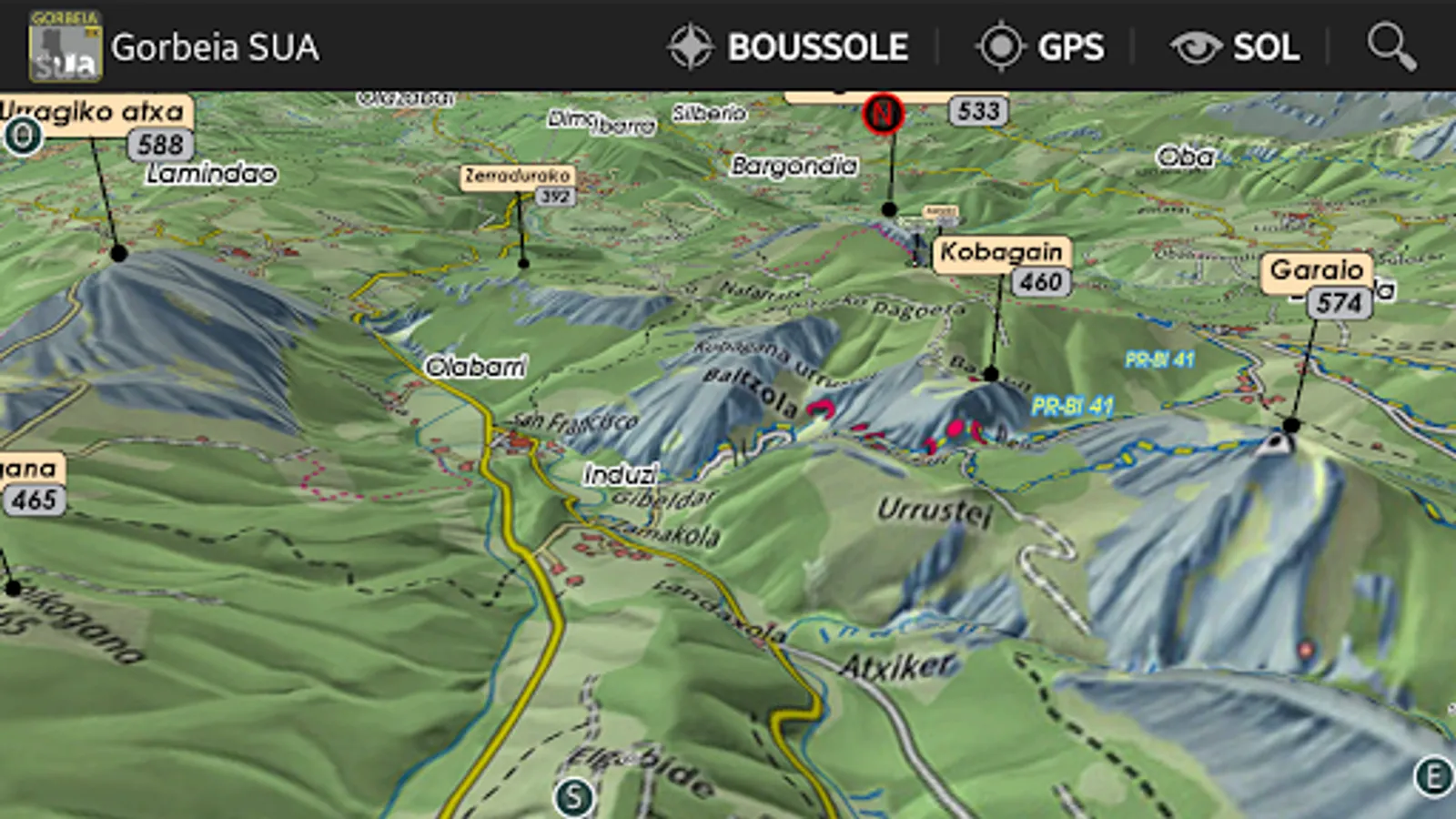
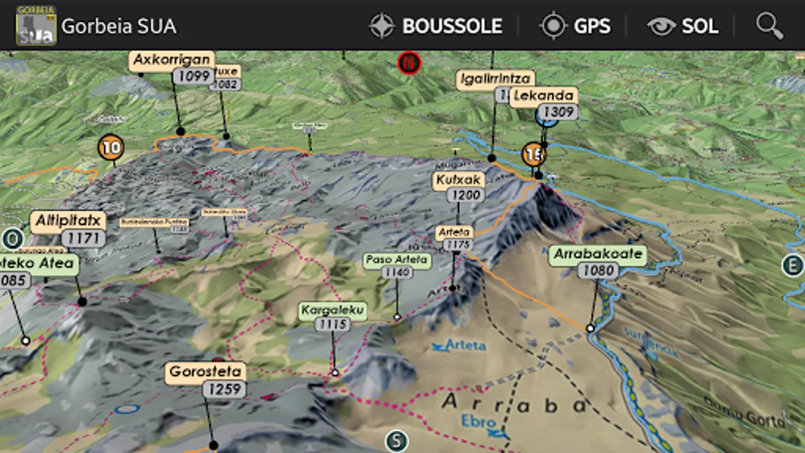
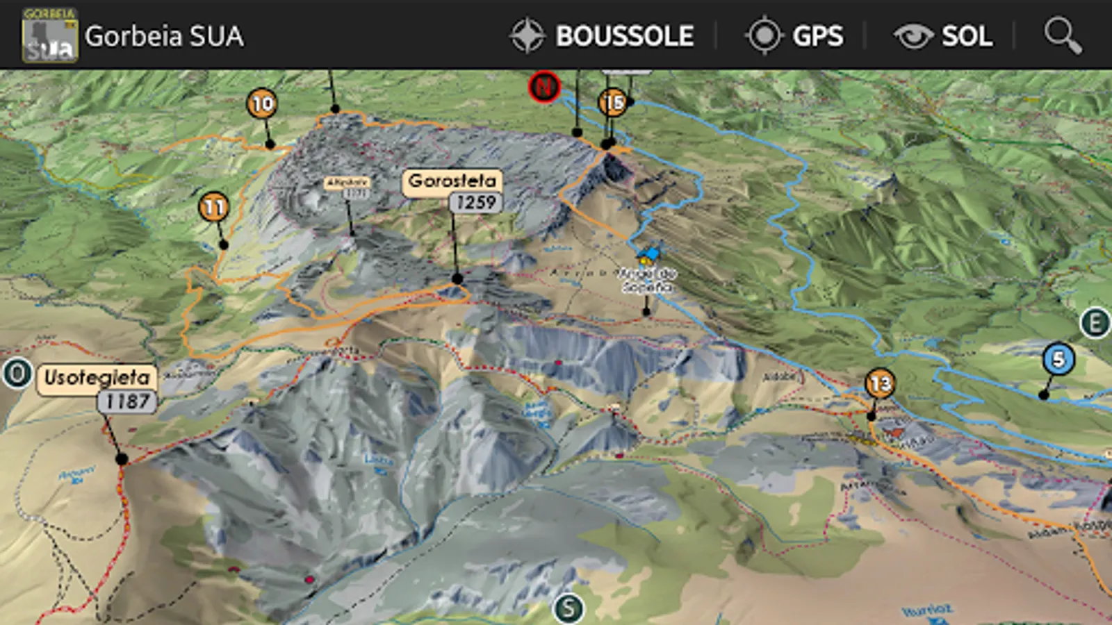
3D Hiking Guide
interactive and immersive application.
Take full advantage of this embedded hiking guide and map realistic.
The description of the routes is detailed in dynamic 3D illustration.
All features are easy to use and accessible OFFLINE mountain forces.
Good hiking at all.
IMMERSIVE 3D FEATURES
○ intuitive and precise controls ... fingertips.
○ Aerial View, overview
○ View and taxiing
○ Compass
○ Geolocation
& DESIGN GUIDE
○ precise descriptions, text and visuals
○ Steps
○ Live View in 3D
GPS
The GPS of your phone is used for geolocation on the map area, it is particularly useful to see its position in the relief, especially in poor visibility on the ground.
COMPASS
The compass mode is integrated in 3D, the cardinal points are oriented according to the manual movements or map automatically orients the north by activating the compass mode directly from 3D.
RELIEF IN SIGHT & 3D SOL
The aerial view and floor to illustrate the general view raised to a level of accuracy optimized, it is displayed on the screen depending on the definition of the relief and texture chosen to launch the application automatically loaded or select depending on the device capabilities used.
The displacement of the ground camera allows to appreciate the details of the route to follow and total immersion in the terrain.
TRACKS
Besides hiking described, variations and alternative routes.
Rando3D - Facing the South TOPOMAP3D ® ®
www.sua.eus
www.faceausud.com
Brand and patented models 486299 08082013 - 12 3953606 ©
All rights reserved, reproduction prohibited
MAPAS PIRENAICOS (1/25000)
CARDS Pyrénéennes (1/25000)
Miguel Angulo / Lopez Gorca
Guides in Castellano and Basque
Menus in French, Castellano, Basque and English
3D map Izarra sector - Murgia - Gogepi
Aramotz Mendikatea - Dima - igore - Zubialde
Hiking, climbing
1 - Cueva de Mairuelegorreta
2 - Fuentes del río Baias
3 - Arraba desde Larreder
4 - Robledal Zarate
5 - Fresno Lexarreta there Tejo Aginalde desde Iondegorta
6 - Oketa (1.031 m) desde las canteras Murua
7 - Paseo forestal has Burbona (934 m) desde Altube
8 - Berretin (1.221 m) desde Zaldibartxo
9 - Gorbeia (1.482 m) desde las canteras Murua
10 - Urtutxe (1.082 m) y Axkorrigan (1.099 m) desde Urigoiti
11 - Gorosteta (1.259 m) e Ipergorta (1.235 m) desde Urigoiti
12 - Oderiaga (1.244 m) desde Garrastatxu
13 - Gorbeia (1.482 m) desde Pagomakurre
14 - Atxuri (942 m) there Arralde (945 m) desde Saldropo
15 - Lekanda (1.309 m) e Igalirrintza (1.304 m) desde Pagomakurre
marked trails (GR, PR, SL, biking, PN)
3D Hiking Guide
interactive and immersive application.
Take full advantage of this embedded hiking guide and map realistic.
The description of the routes is detailed in dynamic 3D illustration.
All features are easy to use and accessible OFFLINE mountain forces.
Good hiking at all.
IMMERSIVE 3D FEATURES
○ intuitive and precise controls ... fingertips.
○ Aerial View, overview
○ View and taxiing
○ Compass
○ Geolocation
& DESIGN GUIDE
○ precise descriptions, text and visuals
○ Steps
○ Live View in 3D
GPS
The GPS of your phone is used for geolocation on the map area, it is particularly useful to see its position in the relief, especially in poor visibility on the ground.
COMPASS
The compass mode is integrated in 3D, the cardinal points are oriented according to the manual movements or map automatically orients the north by activating the compass mode directly from 3D.
RELIEF IN SIGHT & 3D SOL
The aerial view and floor to illustrate the general view raised to a level of accuracy optimized, it is displayed on the screen depending on the definition of the relief and texture chosen to launch the application automatically loaded or select depending on the device capabilities used.
The displacement of the ground camera allows to appreciate the details of the route to follow and total immersion in the terrain.
TRACKS
Besides hiking described, variations and alternative routes.
Rando3D - Facing the South TOPOMAP3D ® ®
www.sua.eus
www.faceausud.com
Brand and patented models 486299 08082013 - 12 3953606 ©
All rights reserved, reproduction prohibited