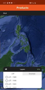
The GUHeat mobile app was created to enable users to access weather information, calculate heat index, share/gather data and information on thermal comfort, and view map layers representing land surface temperature (LST) and urban heat islands (UHIs). It also provides access to other UHI-related information.
GUHeat users are encouraged to share their "thermal comfort" whenever they are outdoors, anywhere and anytime. This citizen science on the thermal environment is expected to provide very useful information for our researchers, planners, policy and decision makers. It is also a collective clamor for better living environments.
The GUHeat mobile app is a product of Project GUHeat, which was implemented by the UP Training Center for Applied Geodesy and Photogrammetry (TCAGP), the R&D arm of the UP Department of Geodetic Engineering and one of the contituent centers of the UP National Engineering Center (NEC). Project GUHeat was funded by the DOST Philippine Council for Industry, Energy, and Emerging Technology Research and Development (PCIEERD).
Show More