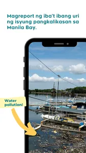
MASDAN is a mobile application developed by Project MapABLE of the IM4ManilaBay Program. This tool was designed to be used in crowdsourcing information on various environmental issues that need prompt response from government agencies and Local Government Units. MASDAN, as a system, aims to promote citizen science and collaborative monitoring and management of the environment.
Project MapABLE is implemented by UP Training Center for Applied Geodesy and Photogrammetry (TCAGP) through the support of the Department of Science and Technology (DOST) and the Philippine Council for Industry, Energy, and Emerging Technology Research and Development (PCIEERD).
Project MapABLE is implemented by UP Training Center for Applied Geodesy and Photogrammetry (TCAGP) through the support of the Department of Science and Technology (DOST) and the Philippine Council for Industry, Energy, and Emerging Technology Research and Development (PCIEERD).
Show More