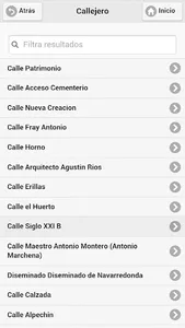
In this El Saucejo tourist guide it will be very useful to move around its streets, locate each bar, restaurant, accommodation, each corner, each balcony to enjoy its views or each place of tourist or cultural interest. You will also be able to find out where its main festivals are held, or discover incredible paths between oaks and olive trees and enjoy the views and the fresh air of the beautiful Sierra Sur Sevilla. Located at 527 meters high, El Saucejo has unique places where you can enjoy priceless views, and the natural wealth that surrounds it with the unique views of the Peñón de Algámitas or La Gomera.
El Saucejo, was named for the willows that used to grow in its streams and riverside areas. El Saucejo, a town formerly located in the confluence area of the kingdoms of Granada and Seville, between Moors and Christians. Proof of this is the legacy of this town where there are from architectural pieces of Muslim origin to the current Christian parishes and hermitages. A town that is characterized by the great kindness and hospitality of its inhabitants.
El Saucejo acts as the main nucleus, since it is home to two villages: the village of Navarredonda, with its hermitage of San José and its particular pillar or fountain of the four spouts, and the village of Mezquitilla, with its hermitage of the Immaculate and its old Moorish Fountain.
El Saucejo has a strategic geographical position 114 km from Seville, 112 km from Córdoba, 95 km from Málaga, 150 km from Granada and 163 km from Cádiz. You can visit more than half of the provincial capitals of Andalusia in less than two hours of the trip. Without forgetting the proximity to Ronda or El Chorro and its Caminito del Rey.
The Privacy and Data Protection Policy can be found at the following URL: https://www.juntadeandalucia.es/protecciondedatos.html
Show More


