Altimeter
PixelProse SARL
4.7 ★
22K ratings
1,000,000+
downloads
Free
+ in-app
In this navigation app, you can measure the true altitude above sea level using GPS or barometric data. Includes offline functionality, location search, and coordinate system support.
AppRecs review analysis
AppRecs rating 4.7. Trustworthiness 72 out of 100. Review manipulation risk 38 out of 100. Based on a review sample analyzed.
★★★★☆
4.7
AppRecs Rating
Ratings breakdown
5 star
81%
4 star
13%
3 star
1%
2 star
1%
1 star
4%
What to know
✓
Credible reviews
72% trustworthiness score from analyzed reviews
✓
High user satisfaction
81% of sampled ratings are 5 stars
✓
Authentic reviews
Natural distribution, no red flags
About Altimeter
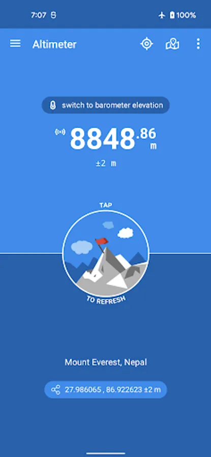
Altimeter is an handy Android application allowing you to get the true altitude above sea level (MSL) at your current location or any location on earth. It requires access to your device location to get raw altitude from the GPS signal and do not require a network connection to work. True altitude above mean sea level is determined using EGM96 Earth Gravitational Model. Main features are :
• Offline true altitude above sea level
• No network required (works offline and in flight mode)
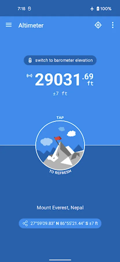
• True altitude above sea level (AMSL using EGM96)
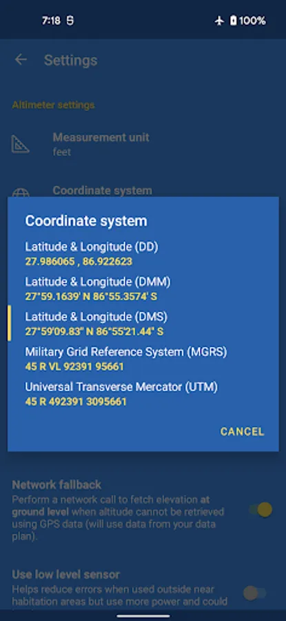
• Ordnance Survey National Grid reference system (OSGB36)
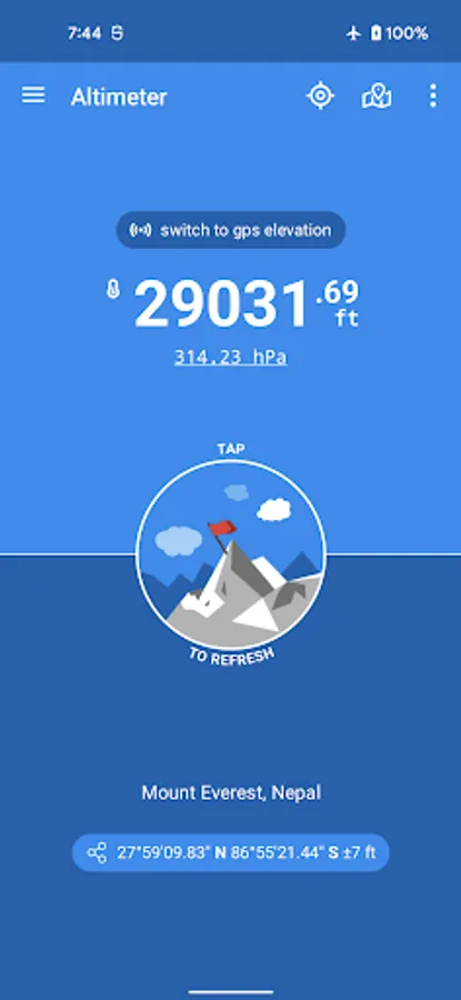
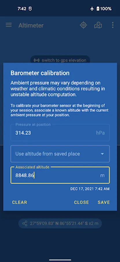
• Use Barometer or GPS Satellite
• Address at current location
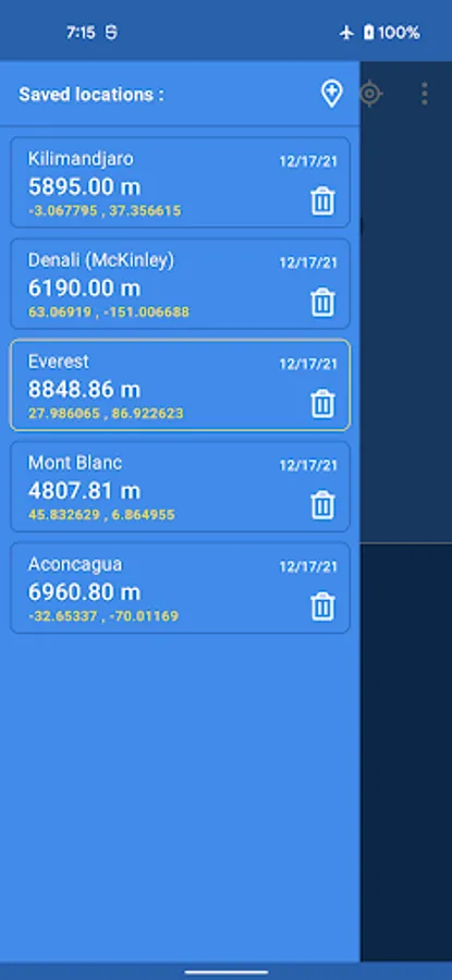
• Save altitude at location
• Altitude accuracy estimation
• Horizontal accuracy estimation
• Altitude at any location
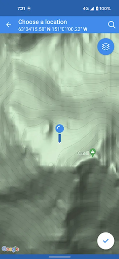
• Pick location on a Map
• Open photo geotags to display associated altitude
• Search for a location by name or address
• Universal Transverse Mercator coordinates (UTM)
• Military Grid Reference System coordinates (MGRS)
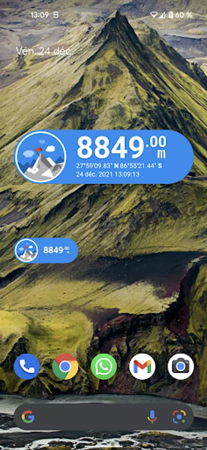
• Home screen widget to display altitude at current position
Network access is required to get the altitude of a location picked from the map.
Height above mean sea level (AMSL) is the elevation (on the ground) or altitude (in the air) of an object, relative to the average sea level datum. Normal GPS elevation considers the entire Earth as an ellispoid and differences up to 100 metres (328 feet) can exist between this ellipsoid height and true mean tidal height. The alternative, which is what we use in this application, is a geoid-based vertical datum such as the global EGM96 model.
Altitude vertical accuracy is defined at 68% confidence. Specifically, as 1-side of the 2-sided range above and below the estimated altitude reported, within which there is a 68% probability of finding the true altitude.
Enjoy!
• Offline true altitude above sea level
• No network required (works offline and in flight mode)
• True altitude above sea level (AMSL using EGM96)
• Ordnance Survey National Grid reference system (OSGB36)
• Use Barometer or GPS Satellite
• Address at current location
• Save altitude at location
• Altitude accuracy estimation
• Horizontal accuracy estimation
• Altitude at any location
• Pick location on a Map
• Open photo geotags to display associated altitude
• Search for a location by name or address
• Universal Transverse Mercator coordinates (UTM)
• Military Grid Reference System coordinates (MGRS)
• Home screen widget to display altitude at current position
Network access is required to get the altitude of a location picked from the map.
Height above mean sea level (AMSL) is the elevation (on the ground) or altitude (in the air) of an object, relative to the average sea level datum. Normal GPS elevation considers the entire Earth as an ellispoid and differences up to 100 metres (328 feet) can exist between this ellipsoid height and true mean tidal height. The alternative, which is what we use in this application, is a geoid-based vertical datum such as the global EGM96 model.
Altitude vertical accuracy is defined at 68% confidence. Specifically, as 1-side of the 2-sided range above and below the estimated altitude reported, within which there is a 68% probability of finding the true altitude.
Enjoy!
Altimeter Screenshots
Tap to Rate:
Reviews for Altimeter
Stacy Lynch
12/29/2025
Love to use this app when out on the trails.
Thomas Soddemann
12/24/2025
I don't see why a simple app like this requires to gather that extensive amount of personal information. It's a business model, I get it - but without me.