GPS Field Measure - GLandGo
4Digsoft
4.1 ★
6K ratings
500,000+
downloads
Free
+ in-app
In this land surveying app, users measure land area, distance, and perimeter with GPS accuracy and organize data efficiently. Includes collaboration tools, import/export options, and cloud backups for project management.
AppRecs review analysis
AppRecs rating 4.1. Trustworthiness 73 out of 100. Review manipulation risk 37 out of 100. Based on a review sample analyzed.
★★★★☆
4.1
AppRecs Rating
Ratings breakdown
5 star
66%
4 star
12%
3 star
4%
2 star
2%
1 star
16%
What to know
✓
Credible reviews
73% trustworthiness score from analyzed reviews
✓
High user satisfaction
78% of sampled ratings are 4+ stars (4.1★ average)
✓
Authentic reviews
Natural distribution, no red flags
About GPS Field Measure - GLandGo
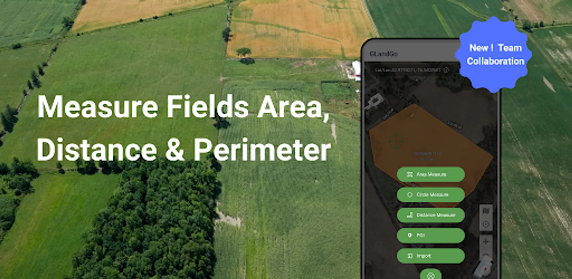
Measure land area, distance, and perimeter with precision using your device's GPS.
GLandGo is the smart, reliable, and professional GPS Area Measurement app designed for accurate land surveying. Whether you’re measuring fields, tracking distances, or managing land data, GLandGo gives you full control — right from your mobile device.
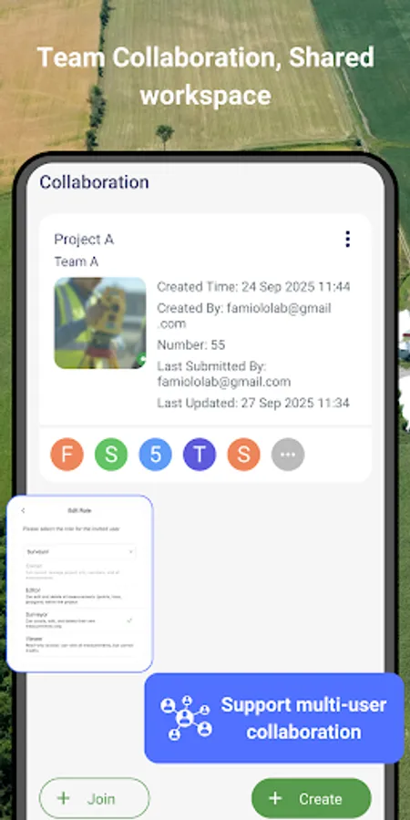
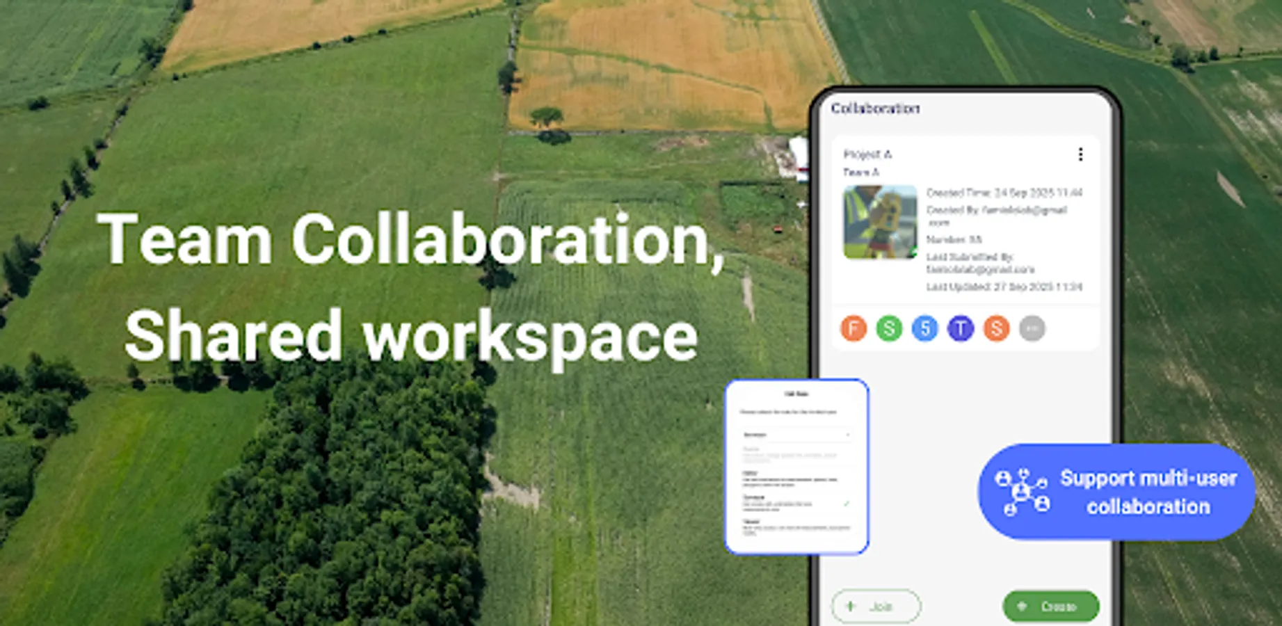
✅Major Update: Collaboration Mode Now you can create projects, add multiple accounts, and work together with your team. All members’ measurement records are synced in real time, and different project roles come with different permissions – making teamwork smooth and efficient.
🌍 Key Features:
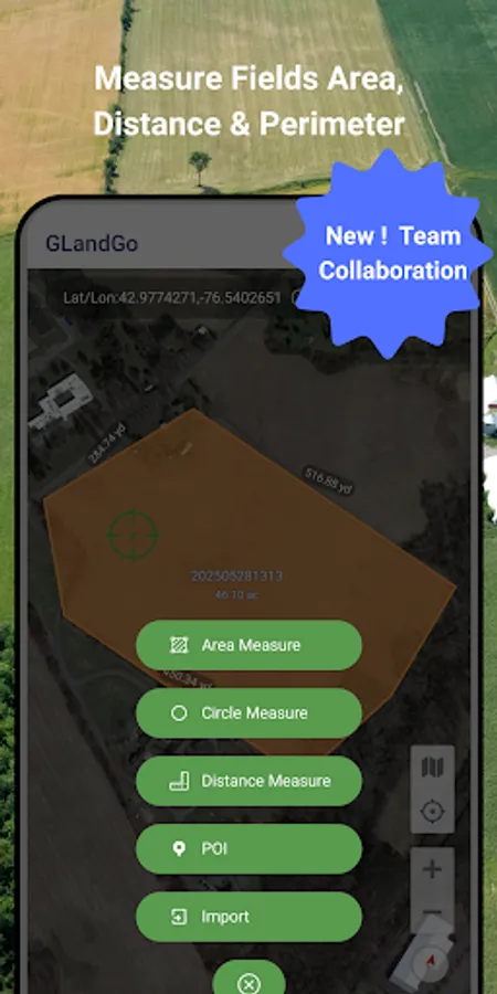
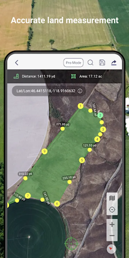
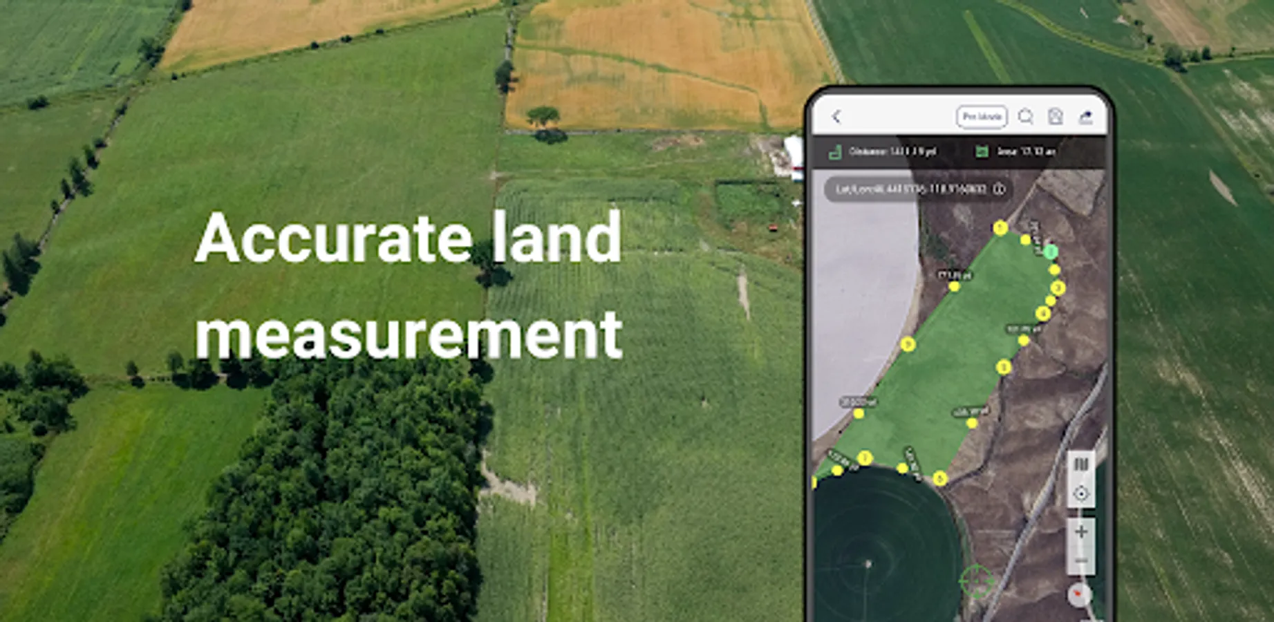
1. GPS Area Measurement
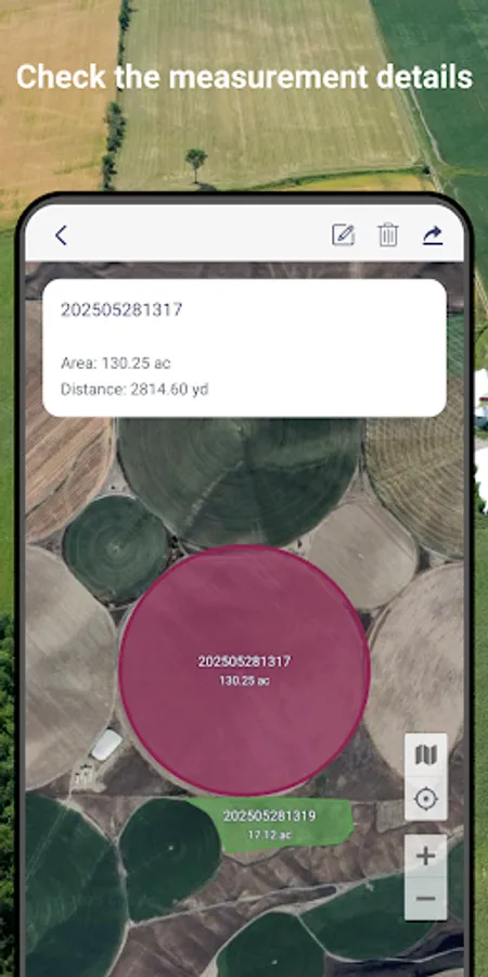
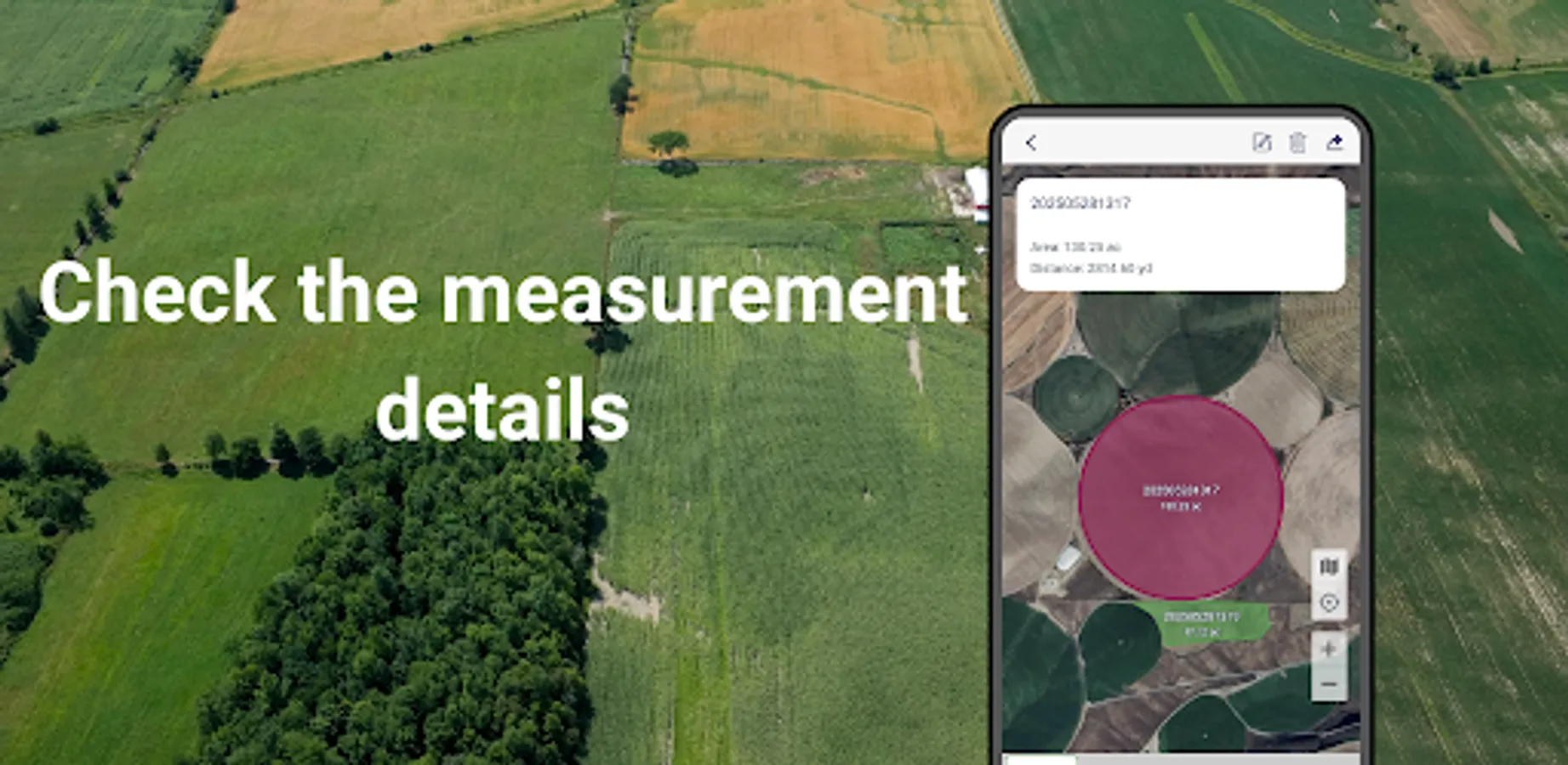
Measure land by walking the perimeter or placing points manually on the map.
Save results with names, notes, photos, and categories.
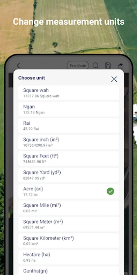
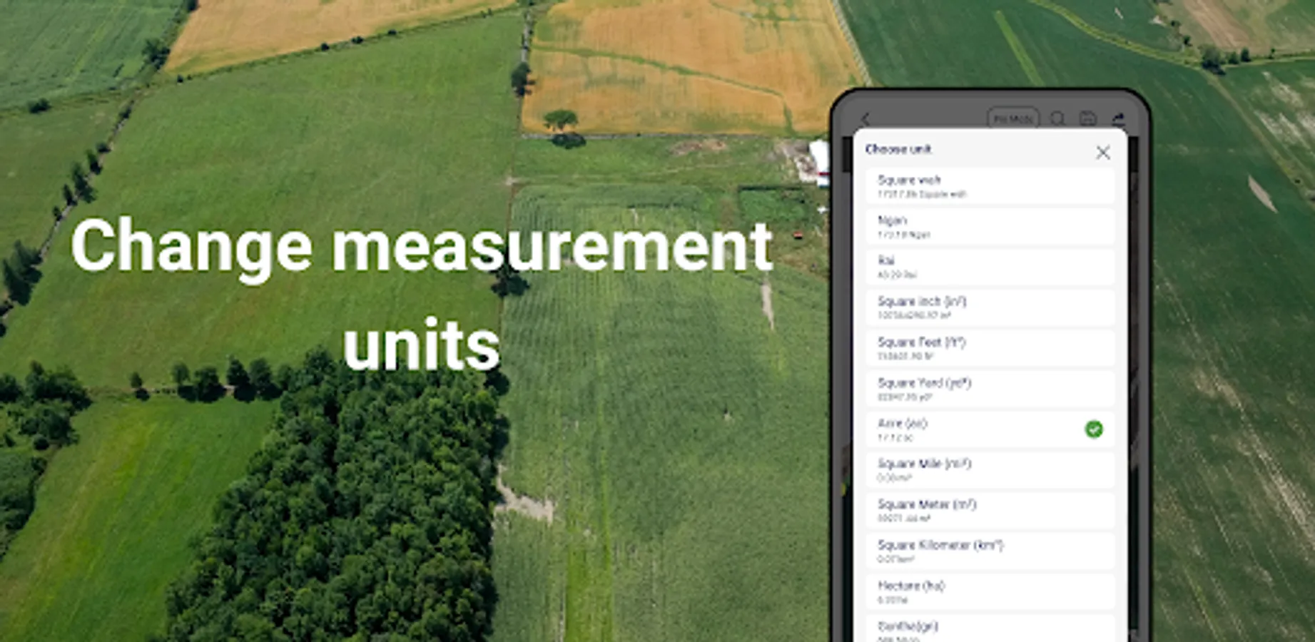
Multiple units supported: hectares, acres, square meters, etc.
2. Distance Measurement
Track path lengths and calculate straight-line or multi-point distances.
Supports GPS tracking and manual distance input.
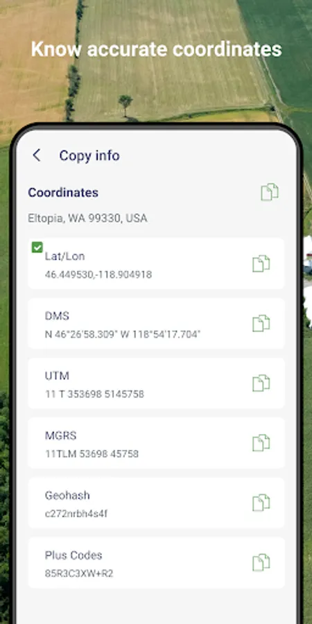
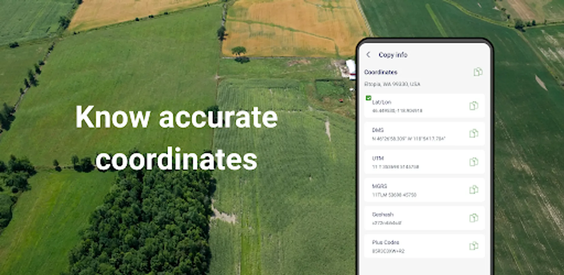
3. Manual Coordinate Input
NEW: Precisely add points by entering latitude and longitude.
Useful for remote mapping and GPS data referencing.
4. Location Marking & Organization
Save and categorize important locations for future reference.
5. GPS Tools & Navigation
Built-in compass for field alignment.
Real-time GPS tracking, direction, and satellite positioning.
6. Import & Export Support
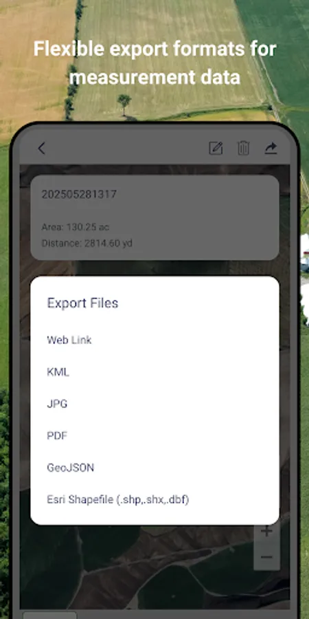
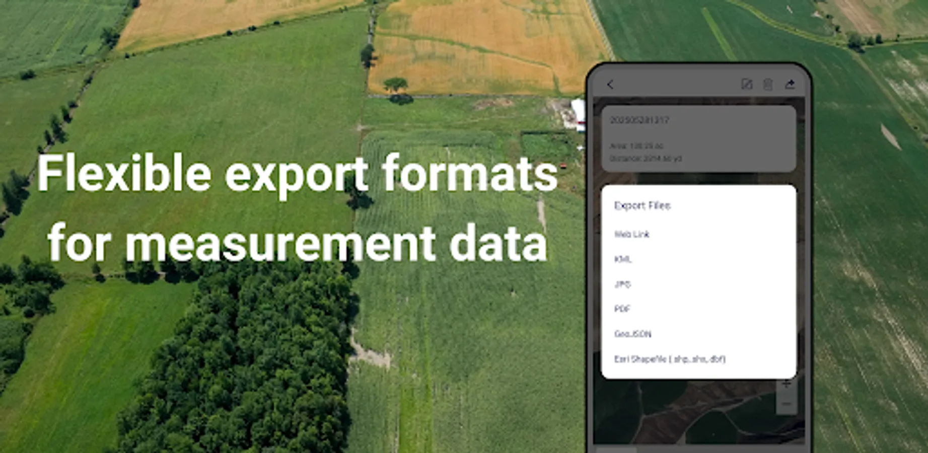
Import: SHP, GeoJSON, KML, KMZ
Export: SHP, KML, JPG, PDF, GeoJSON, CSV
Share measurement results via custom web links.
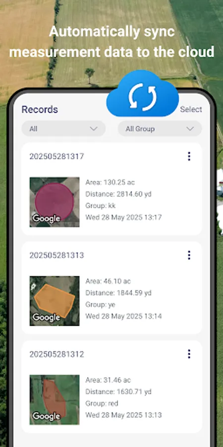
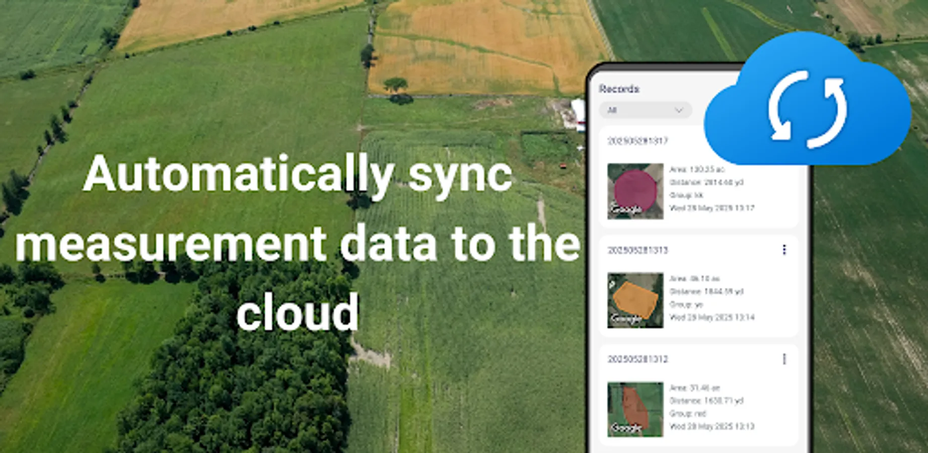
7. GLandGo Cloud
Protect your data with built-in cloud/local backup options.
8. Professional Mapping Support:
Coordinate formats: DMS, UTM, MGRS, Plus Code, Geohash
Map history tracking
Customizable map types and themes
9. Collaboration – add multiple users to projects, assign roles, and collaborate with real-time data sync
10. Cross-Platform Sync - Log in with your account and seamlessly access your data across both Android and iOS devices. Whether you switch phones or use multiple platforms, your data stays synchronized in the cloud.
11. Circle Area Measurement – Quickly measure circular plots of land by setting the center and radius.
12. Manual Coordinate Entry – Add precise location points by entering coordinates manually.
13.Added support for WMS map layers.
New ! Add Image Layers for Smarter Field Mapping
Enhance your GPS Area Measure and Field Area Measure experience with the new Image Layer feature. Now you can import and overlay images directly on the map — perfect for comparing drone photos, survey maps, or satellite shots.
This update makes area measurement and distance measure more visual and accurate, helping you manage land, farms, or projects with ease.
Whether you use it for Measure Map Pro, land planning, or professional area app tasks, you’ll enjoy a smarter, clearer gps measure and area measure workflow.
👥 Perfect For:
Farmers & Agronomists
Land Surveyors
Real Estate Professionals
Engineers & Architects
Environmental Planners
Outdoor Enthusiasts & Hikers
GIS Survery
GLandGo is your GPS Fields Area Measure Map, Map Area Calculator, Field Area Measure, and GPS Land Measurement & Survey solution – smart, simple, and accurate.
Download GLandGo – GPS Area Measurement today and experience the easiest and most powerful way to measure land and distances anywhere.
GLandGo is the smart, reliable, and professional GPS Area Measurement app designed for accurate land surveying. Whether you’re measuring fields, tracking distances, or managing land data, GLandGo gives you full control — right from your mobile device.
✅Major Update: Collaboration Mode Now you can create projects, add multiple accounts, and work together with your team. All members’ measurement records are synced in real time, and different project roles come with different permissions – making teamwork smooth and efficient.
🌍 Key Features:
1. GPS Area Measurement
Measure land by walking the perimeter or placing points manually on the map.
Save results with names, notes, photos, and categories.
Multiple units supported: hectares, acres, square meters, etc.
2. Distance Measurement
Track path lengths and calculate straight-line or multi-point distances.
Supports GPS tracking and manual distance input.
3. Manual Coordinate Input
NEW: Precisely add points by entering latitude and longitude.
Useful for remote mapping and GPS data referencing.
4. Location Marking & Organization
Save and categorize important locations for future reference.
5. GPS Tools & Navigation
Built-in compass for field alignment.
Real-time GPS tracking, direction, and satellite positioning.
6. Import & Export Support
Import: SHP, GeoJSON, KML, KMZ
Export: SHP, KML, JPG, PDF, GeoJSON, CSV
Share measurement results via custom web links.
7. GLandGo Cloud
Protect your data with built-in cloud/local backup options.
8. Professional Mapping Support:
Coordinate formats: DMS, UTM, MGRS, Plus Code, Geohash
Map history tracking
Customizable map types and themes
9. Collaboration – add multiple users to projects, assign roles, and collaborate with real-time data sync
10. Cross-Platform Sync - Log in with your account and seamlessly access your data across both Android and iOS devices. Whether you switch phones or use multiple platforms, your data stays synchronized in the cloud.
11. Circle Area Measurement – Quickly measure circular plots of land by setting the center and radius.
12. Manual Coordinate Entry – Add precise location points by entering coordinates manually.
13.Added support for WMS map layers.
New ! Add Image Layers for Smarter Field Mapping
Enhance your GPS Area Measure and Field Area Measure experience with the new Image Layer feature. Now you can import and overlay images directly on the map — perfect for comparing drone photos, survey maps, or satellite shots.
This update makes area measurement and distance measure more visual and accurate, helping you manage land, farms, or projects with ease.
Whether you use it for Measure Map Pro, land planning, or professional area app tasks, you’ll enjoy a smarter, clearer gps measure and area measure workflow.
👥 Perfect For:
Farmers & Agronomists
Land Surveyors
Real Estate Professionals
Engineers & Architects
Environmental Planners
Outdoor Enthusiasts & Hikers
GIS Survery
GLandGo is your GPS Fields Area Measure Map, Map Area Calculator, Field Area Measure, and GPS Land Measurement & Survey solution – smart, simple, and accurate.
Download GLandGo – GPS Area Measurement today and experience the easiest and most powerful way to measure land and distances anywhere.
GPS Field Measure - GLandGo Screenshots
Tap to Rate:
Reviews for GPS Field Measure - GLandGo
Abdur Razzak
12/28/2025
nice
pawan kesharwani
12/25/2025
GLandGO I love you..... very very nice and full working app