Mobile Topographer Pro
applicality
3.2 ★
374 ratings
10,000+
downloads
$21.99
In this surveying app, users can collect terrain data, create 3D models, and export GIS files. Includes route tracking, map editing, group point management, and offline functionality.
AppRecs review analysis
AppRecs rating 3.1. Trustworthiness 57 out of 100. Review manipulation risk 34 out of 100. Based on a review sample analyzed.
★★★☆☆
3.1
AppRecs Rating
Ratings breakdown
5 star
44%
4 star
11%
3 star
0%
2 star
11%
1 star
33%
What to know
✓
Authentic reviews
Natural distribution, no red flags
⚠
High negative review ratio
44% of sampled ratings are 1–2 stars
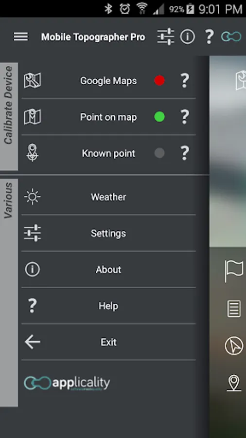
About Mobile Topographer Pro
Your Mobile Topographer goes... Pro!
The leading tool for the professional surveyor or anyone who wants to mark his property, offering the best accuracy and extensive functionality that no other app can!
Only in Pro:
*** Export data in the standard of GIS Shape files (.shp)
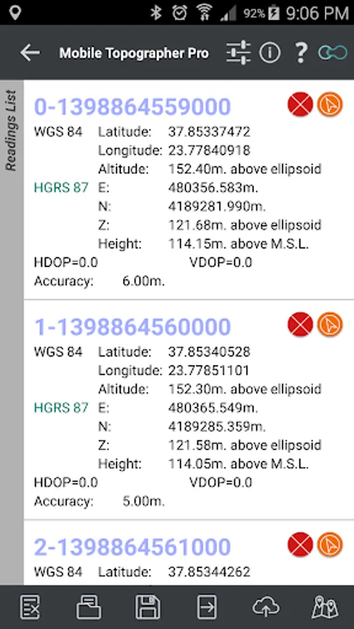
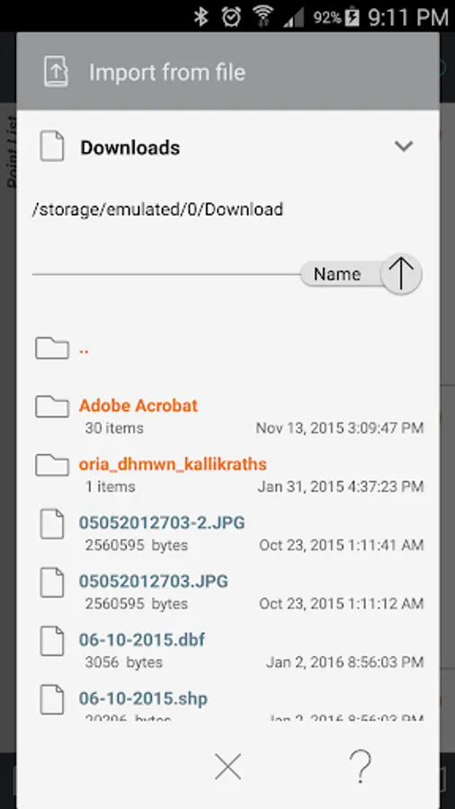
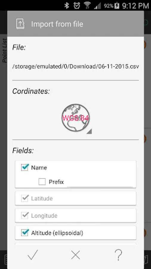
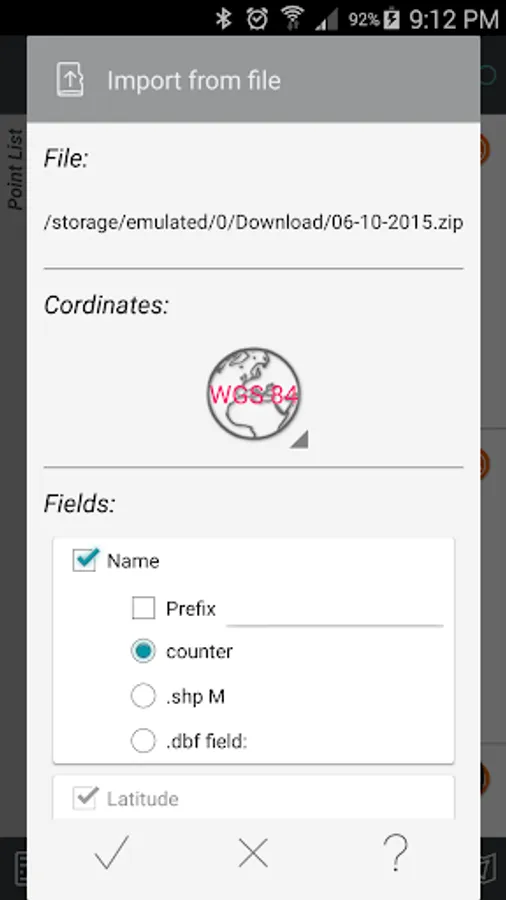
*** Import file
- Import points from file in WGS84 format or CRS of your choice
- Import points from text files (.txt, .csv) or Shape files (.shp)
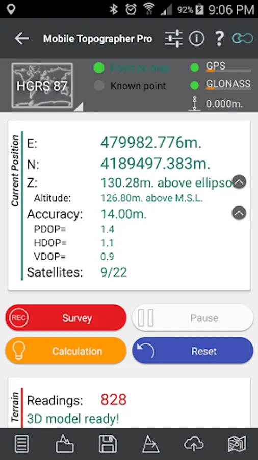
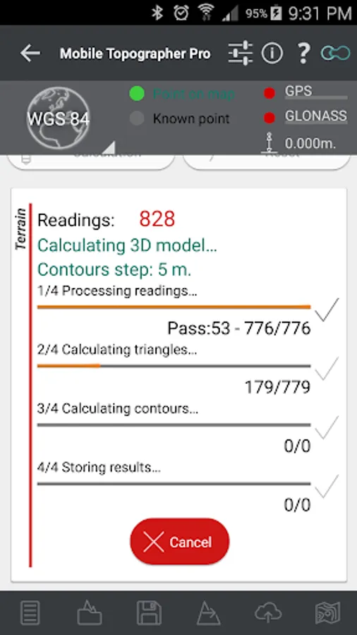
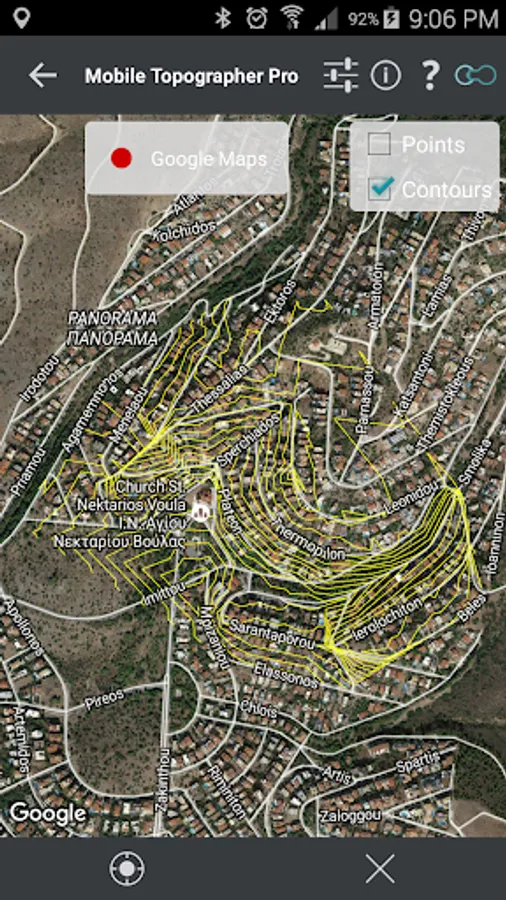
*** 3D Terrain modeling & contours
- Collect terrain data
- Create a 3D terrain model
- Create contours
- Show on map
- Load, save, export 3D terrain model and contours
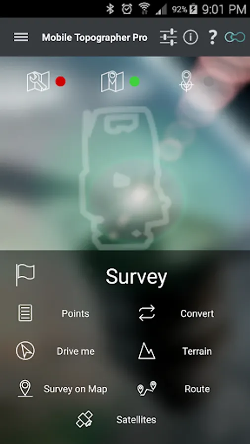
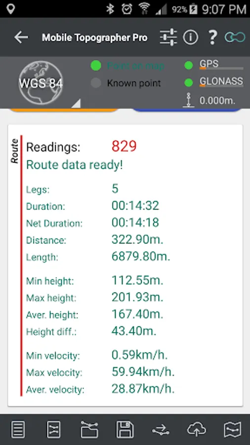
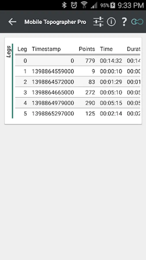
*** Route tracking
- Track your route
- Process route
- Get statistics
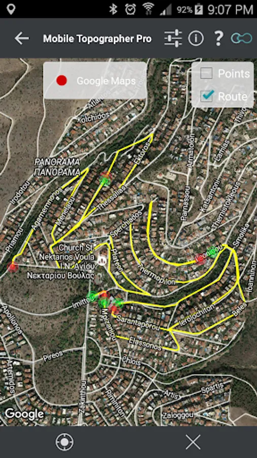
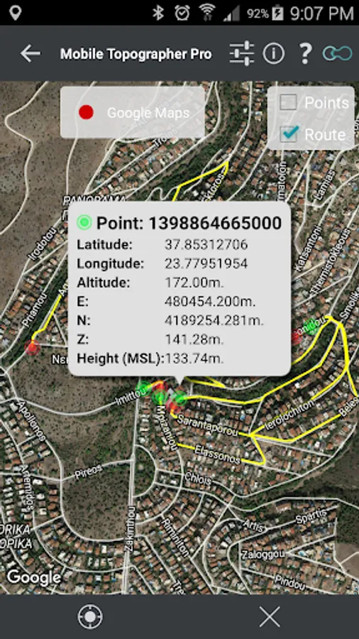
- Show on map
- Load, save, export route
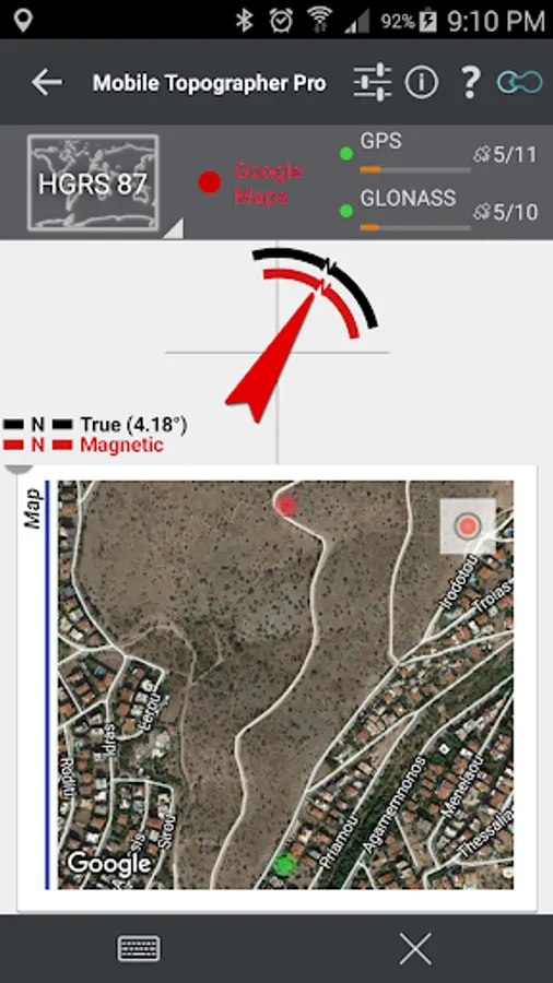
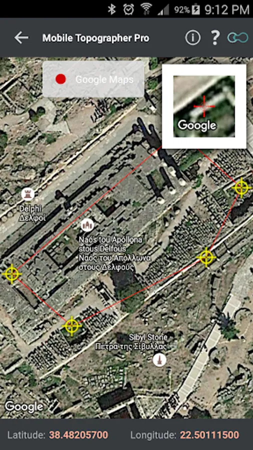
*** Real time map projection while surveying
*** Survey on map.
- Complete a survey without even going to the field
- Insert, modify or delete points directly on the map
- Correct or make additions to an existing survey
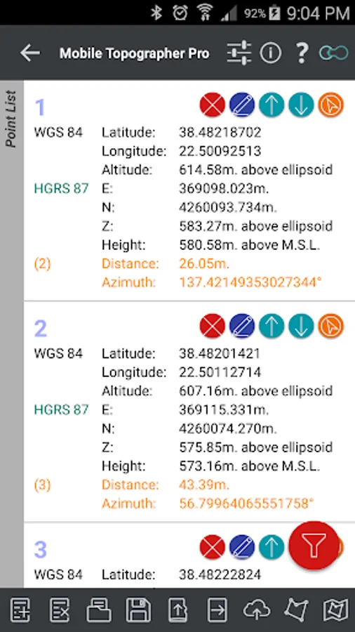
*** Group points
- Divide your list of points in groups
- Filter list of points view, by naming groups
- Export list of points with group division or filtering
- Select the contents of the exported lists of points
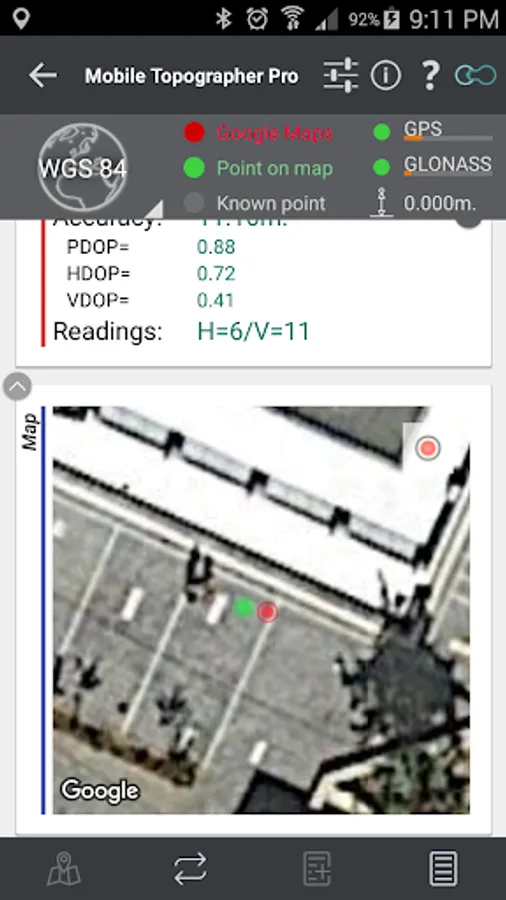
*** Device Elevation
*** Auto survey mode
*** Area, Perimeter, Number of vertices of polygon
*** Manually edit coordinates of a point
- Key in the new coordinates
- Reposition a point using drag & drop or edit mode
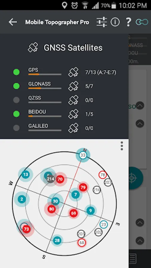
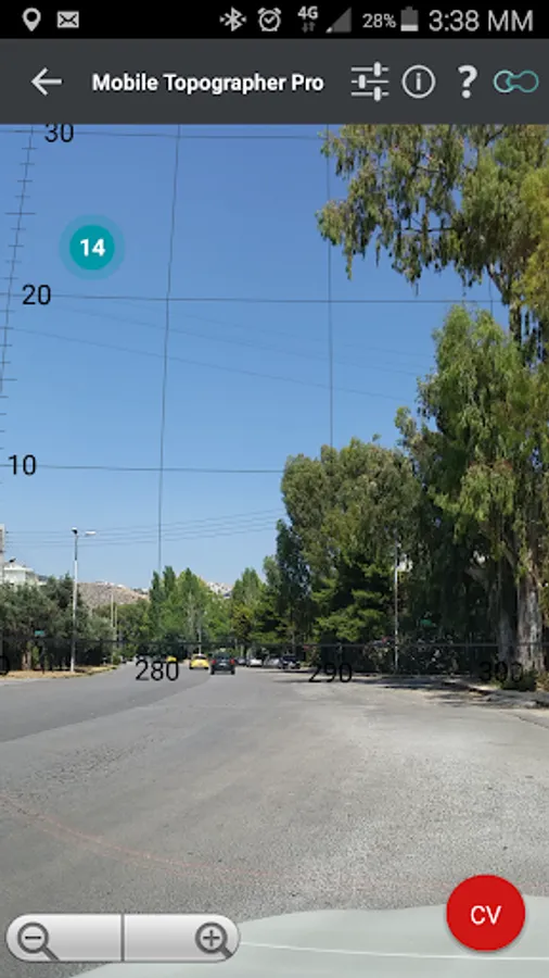
*** Swipe from left to view satellites while surveying
*** View GNSS satellites in Augmented Reality
*** Full functionality even without internet connection
*** Maps v2
*** Weather
*** Increased accuracy(For even better accuracy, you can link your device to an external GPS receiver)
Plus the well known features of Mobile Topographer Free:
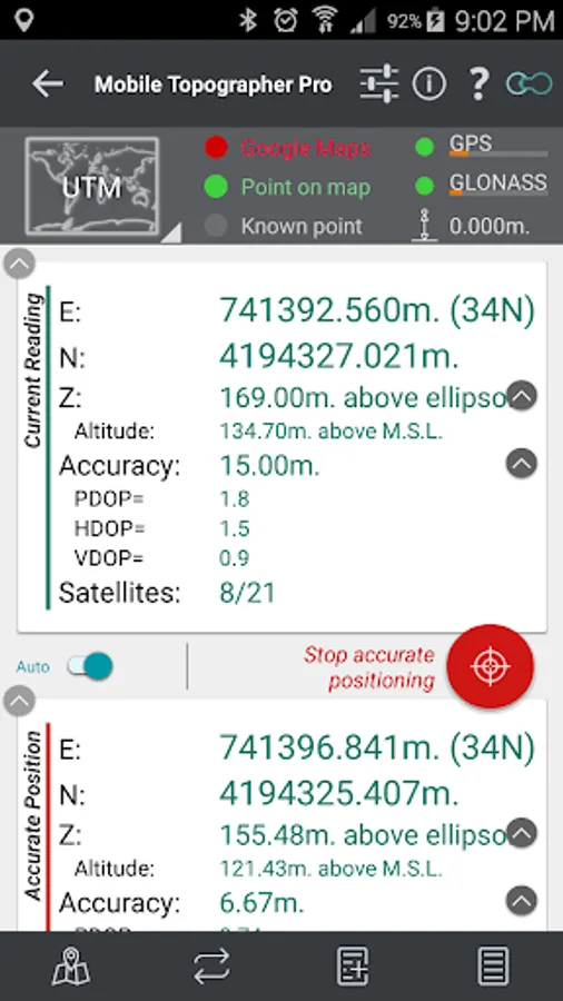
*** Increase GPS accuracy using:
- Weighted averaging (on every axis)
- Map calibration
- Device calibration on map, or on a know point
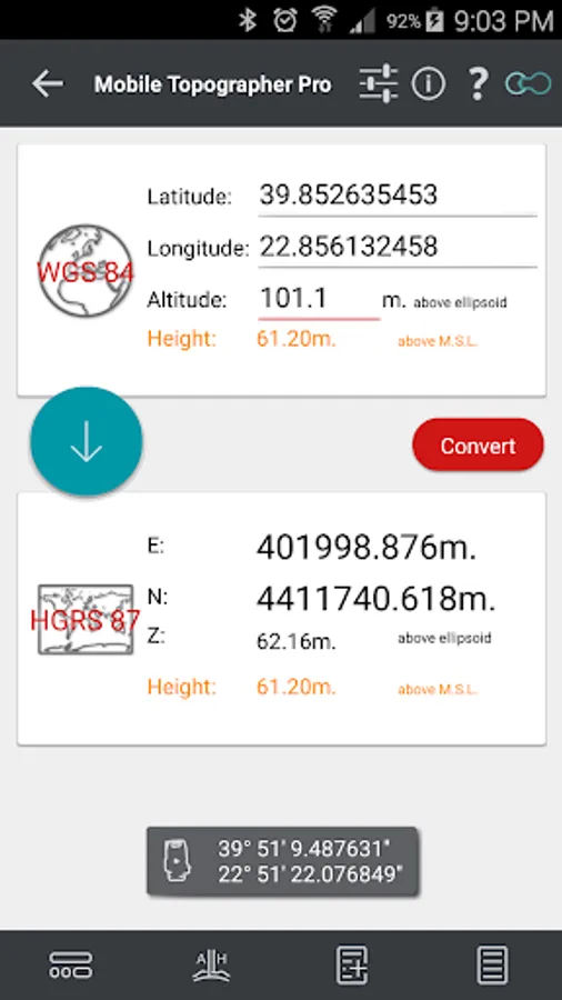
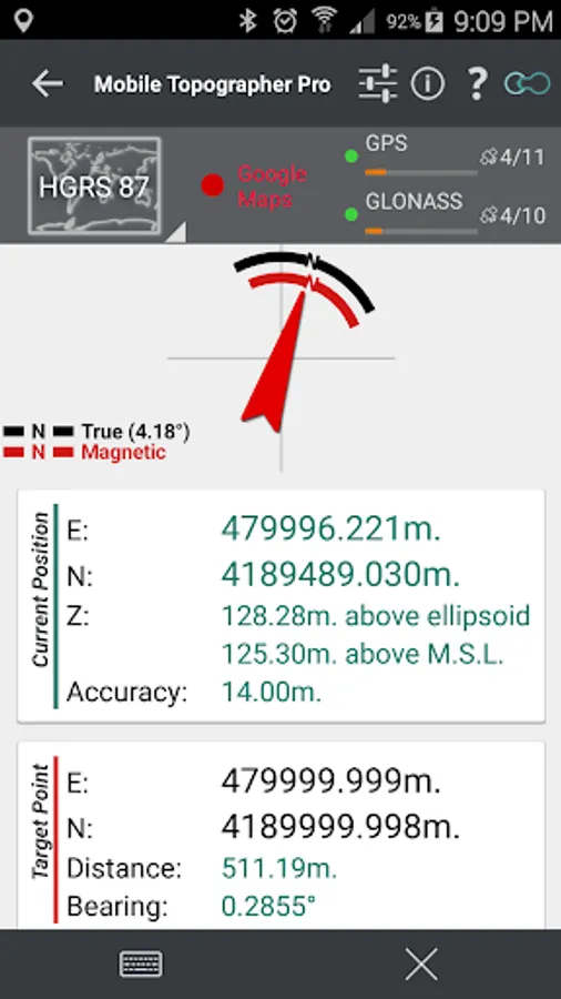
*** Display and convert GPS geodetic to cartesian EN coordinates and back:
- UTM
- Europe ETRS89/UTMZ28-38
- Hellas HGRS 87 (GGRS87 - EGSA 87 - ΕΓΣΑ 87)
- Hellas HGRS 87 (HEPOS)
- Hellas HTRS07/TM07
- Morocco Merchich CS
- SPCS83 (124 zones) USA
- Brazil & Central and South America SIRGAS 2000
- Brazil SAD69/UTM Z18-25 & SAD69(96)/UTM Z18-25
- Australia MGA94 & AMG66 National, A.C.T., Northern Territory, NSW & Victoria, Tasmania & AMG84 (AGD84)
- Italy Monte Mario West Zn 1 Peninsular, West Zn 1 Sardinia, East Zn 2 Peninsular, East Zn 2 Sicily
- Spain ED50/UTMZ29-30 NW, ED50/UTMZ29-31 ML, ED50/UTMZ31 BA.
- Uk's OSTN02/OSGM02
- Turkey ED 50/Gauss-Kruger 3° Z9-15 & ITRF96 & ED50/UTMZ35-38
- Argentina POSGAR 94 & POSGAR 2007
- India Kalianpur 1975 ZI - ZIV
- Central and South American SIRGAS 2000
- France RGF93/CC42-50 Auto & manual
- Canada CSRS (19 systems)
- Carthage of Tunisia
and many more... (http://applicality.com/supported-coordinates-reference-systems/)
*** Multiple units support:
- Meters
- International feet
- US survey feet
*** Height calculation:
- Ellipsoidal height
- EGM96 orthometric height
*** Convert from geodetic to cartesian coordinates and back:
- Support for device measured points, or
- Manually input of geodetic or cartesian coords
*** Drive me:
- Key in coordinates of a target point in either geodetic or cartesian format, or select a point from the list and follow the pointer.
- Compass indicating both magnetic and true North
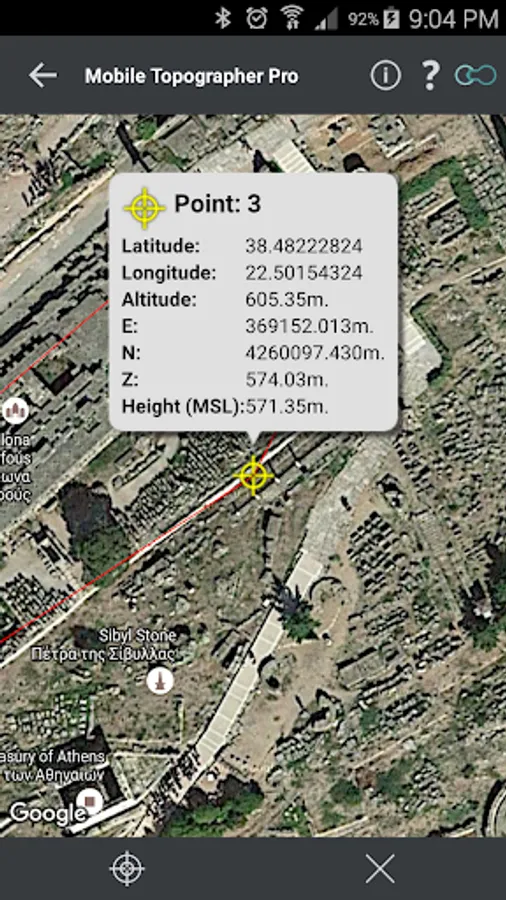
*** Project on Map:
- Project individual points on any map application
- Project list of points, and the defined polygon, on embedded Google maps
*** Save multiple point lists.
*** Calculate area.
*** Export point lists to:
- .txt (text file)
- .csv (point file - comma separated)
- .kml (google earth file)
- .gpx (GPS Exchange format)
- .dxf (drawing file)
- .shp (shape files)
*** Send file via e-mail, or upload it to cloud
*** Satellites sky view
*** Signal strength and number of satellites indication for each GNSS constellation
*** Support of all GNSS constellations:
- GPS
- GLONASS
- QZSS
- BEIDOU
- GALILEO
*** Complete help text support
The leading tool for the professional surveyor or anyone who wants to mark his property, offering the best accuracy and extensive functionality that no other app can!
Only in Pro:
*** Export data in the standard of GIS Shape files (.shp)
*** Import file
- Import points from file in WGS84 format or CRS of your choice
- Import points from text files (.txt, .csv) or Shape files (.shp)
*** 3D Terrain modeling & contours
- Collect terrain data
- Create a 3D terrain model
- Create contours
- Show on map
- Load, save, export 3D terrain model and contours
*** Route tracking
- Track your route
- Process route
- Get statistics
- Show on map
- Load, save, export route
*** Real time map projection while surveying
*** Survey on map.
- Complete a survey without even going to the field
- Insert, modify or delete points directly on the map
- Correct or make additions to an existing survey
*** Group points
- Divide your list of points in groups
- Filter list of points view, by naming groups
- Export list of points with group division or filtering
- Select the contents of the exported lists of points
*** Device Elevation
*** Auto survey mode
*** Area, Perimeter, Number of vertices of polygon
*** Manually edit coordinates of a point
- Key in the new coordinates
- Reposition a point using drag & drop or edit mode
*** Swipe from left to view satellites while surveying
*** View GNSS satellites in Augmented Reality
*** Full functionality even without internet connection
*** Maps v2
*** Weather
*** Increased accuracy(For even better accuracy, you can link your device to an external GPS receiver)
Plus the well known features of Mobile Topographer Free:
*** Increase GPS accuracy using:
- Weighted averaging (on every axis)
- Map calibration
- Device calibration on map, or on a know point
*** Display and convert GPS geodetic to cartesian EN coordinates and back:
- UTM
- Europe ETRS89/UTMZ28-38
- Hellas HGRS 87 (GGRS87 - EGSA 87 - ΕΓΣΑ 87)
- Hellas HGRS 87 (HEPOS)
- Hellas HTRS07/TM07
- Morocco Merchich CS
- SPCS83 (124 zones) USA
- Brazil & Central and South America SIRGAS 2000
- Brazil SAD69/UTM Z18-25 & SAD69(96)/UTM Z18-25
- Australia MGA94 & AMG66 National, A.C.T., Northern Territory, NSW & Victoria, Tasmania & AMG84 (AGD84)
- Italy Monte Mario West Zn 1 Peninsular, West Zn 1 Sardinia, East Zn 2 Peninsular, East Zn 2 Sicily
- Spain ED50/UTMZ29-30 NW, ED50/UTMZ29-31 ML, ED50/UTMZ31 BA.
- Uk's OSTN02/OSGM02
- Turkey ED 50/Gauss-Kruger 3° Z9-15 & ITRF96 & ED50/UTMZ35-38
- Argentina POSGAR 94 & POSGAR 2007
- India Kalianpur 1975 ZI - ZIV
- Central and South American SIRGAS 2000
- France RGF93/CC42-50 Auto & manual
- Canada CSRS (19 systems)
- Carthage of Tunisia
and many more... (http://applicality.com/supported-coordinates-reference-systems/)
*** Multiple units support:
- Meters
- International feet
- US survey feet
*** Height calculation:
- Ellipsoidal height
- EGM96 orthometric height
*** Convert from geodetic to cartesian coordinates and back:
- Support for device measured points, or
- Manually input of geodetic or cartesian coords
*** Drive me:
- Key in coordinates of a target point in either geodetic or cartesian format, or select a point from the list and follow the pointer.
- Compass indicating both magnetic and true North
*** Project on Map:
- Project individual points on any map application
- Project list of points, and the defined polygon, on embedded Google maps
*** Save multiple point lists.
*** Calculate area.
*** Export point lists to:
- .txt (text file)
- .csv (point file - comma separated)
- .kml (google earth file)
- .gpx (GPS Exchange format)
- .dxf (drawing file)
- .shp (shape files)
*** Send file via e-mail, or upload it to cloud
*** Satellites sky view
*** Signal strength and number of satellites indication for each GNSS constellation
*** Support of all GNSS constellations:
- GPS
- GLONASS
- QZSS
- BEIDOU
- GALILEO
*** Complete help text support
Mobile Topographer Pro Screenshots
Tap to Rate:
Reviews for Mobile Topographer Pro
Amazing Grace
2/14/2026
Good and reliable
MeDeR
2/1/2026
need to use map to collect the coordinate and export it to dxf