Public transport map Istanbul
Sklr
2.3 ★
159 ratings
50,000+
downloads
Free
+ in-app
In this public transport map app, you can browse and search Istanbul’s metro, tram, and bus routes, view transfer stations, and save preferred routes. Includes station search, route planning, and location tracking features.
AppRecs review analysis
AppRecs rating 2.3. Trustworthiness 78 out of 100. Review manipulation risk 16 out of 100. Based on a review sample analyzed.
★★☆☆☆
2.3
AppRecs Rating
Ratings breakdown
5 star
17%
4 star
17%
3 star
0%
2 star
17%
1 star
50%
What to know
✓
Low review manipulation risk
16% review manipulation risk
⚠
Mixed user feedback
Average 2.3★ rating suggests room for improvement
⚠
High negative review ratio
67% of sampled ratings are 1–2 stars
About Public transport map Istanbul
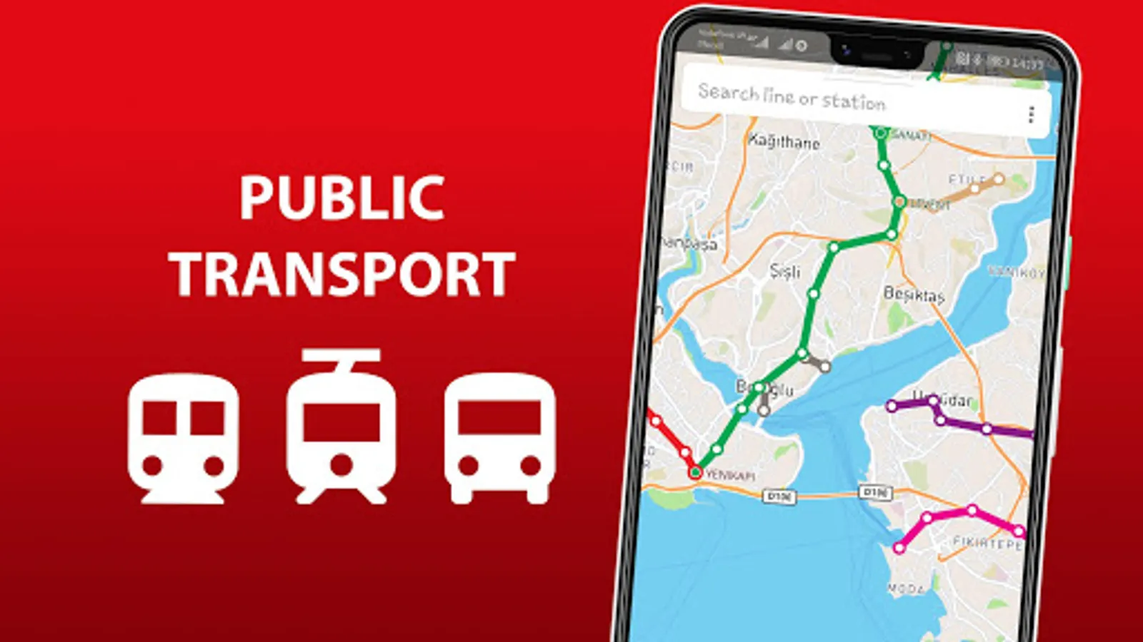
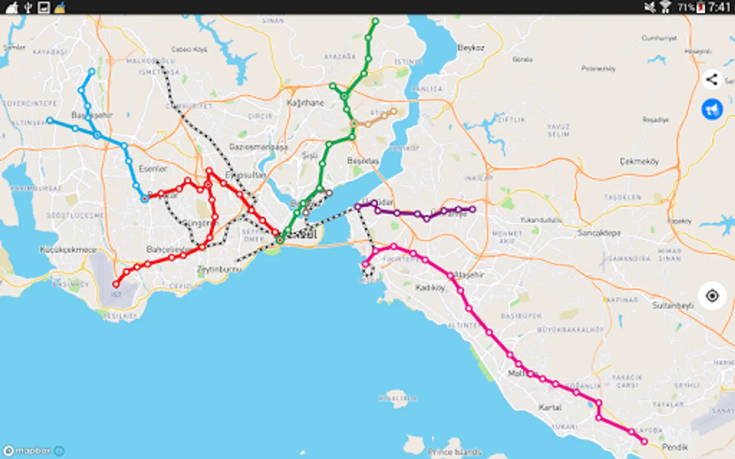
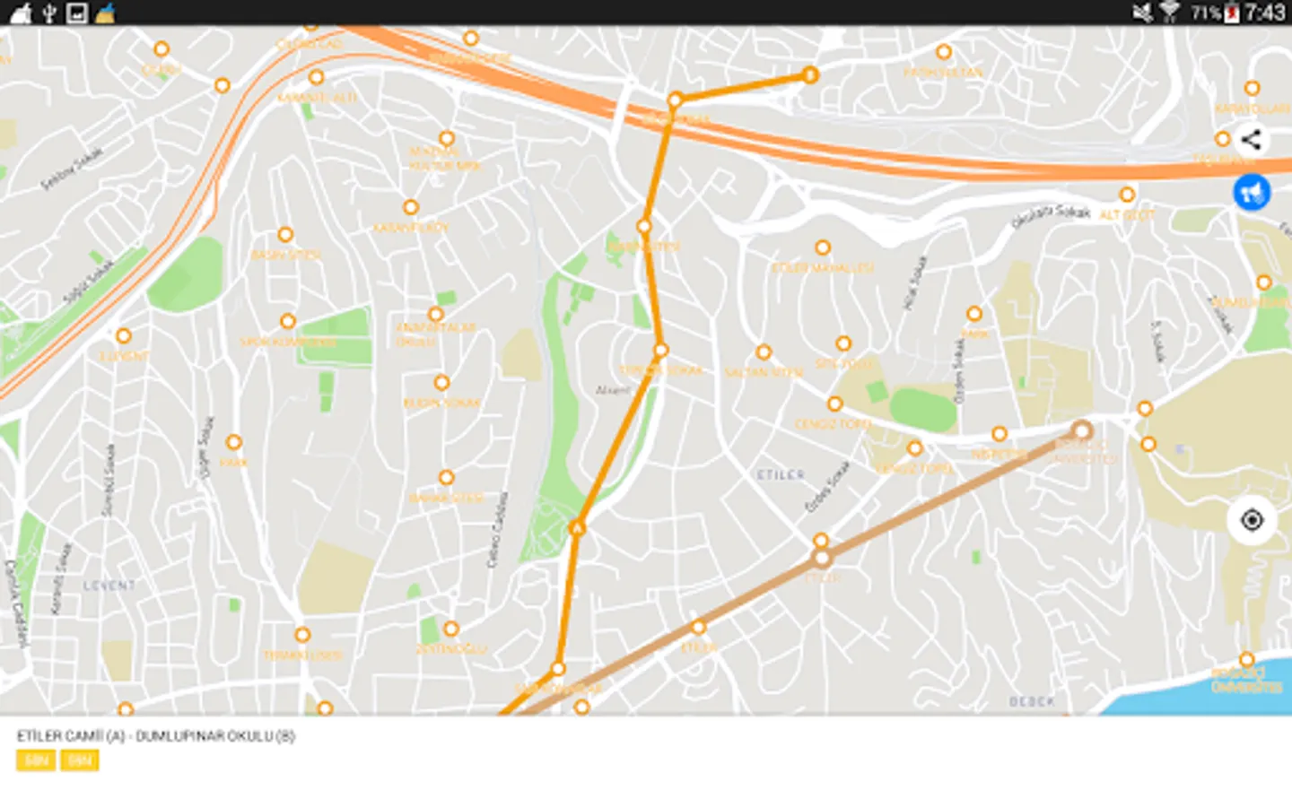
The entire Istanbul's transport infrastructure of in one app. Metro lines, trams and buses routes, transfer stations - all of those you will find inside.
Search by station name or route number, saving chosen routes and geo-positioning are available in the basic version.
Why do this app is should be tried?
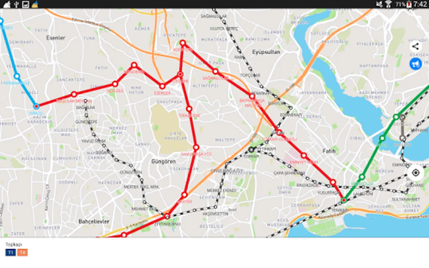
1) On the screen of your device you will see the whole Istanbul's public transport scheme, and the more scale is choosen the more details are given.
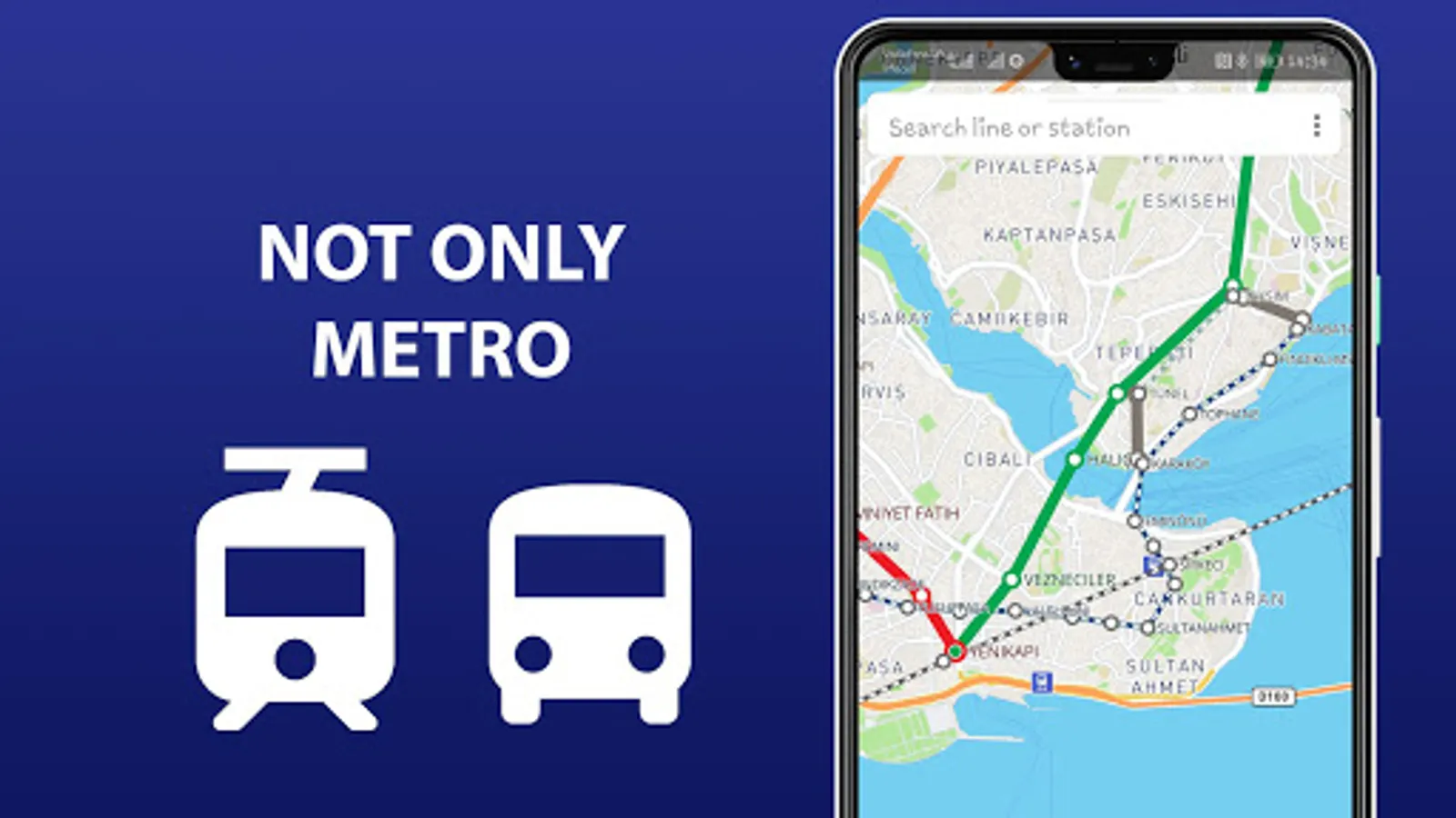
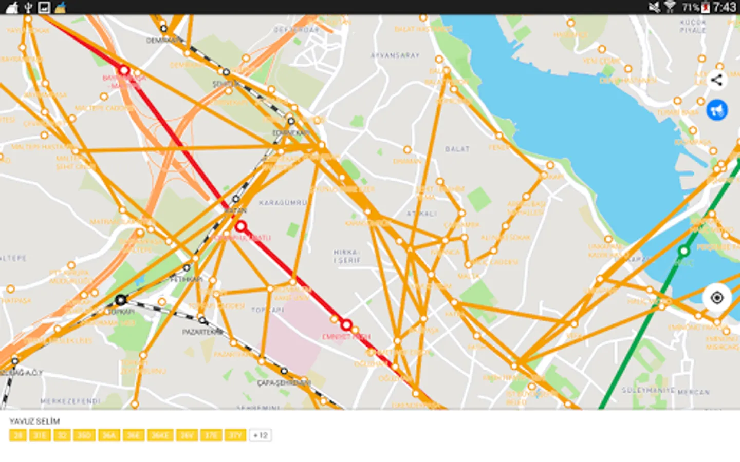
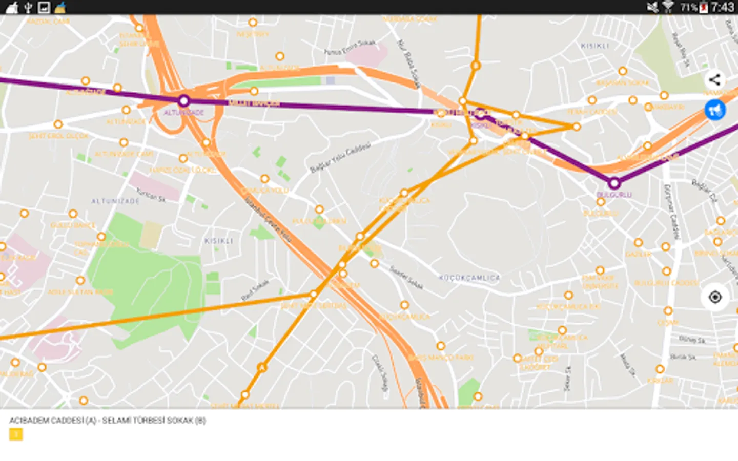
2) The map of Istanbul shows not only metro lines, but tram and bus routes as well. Stations of possible metro-tram-bus transfers are grouped.
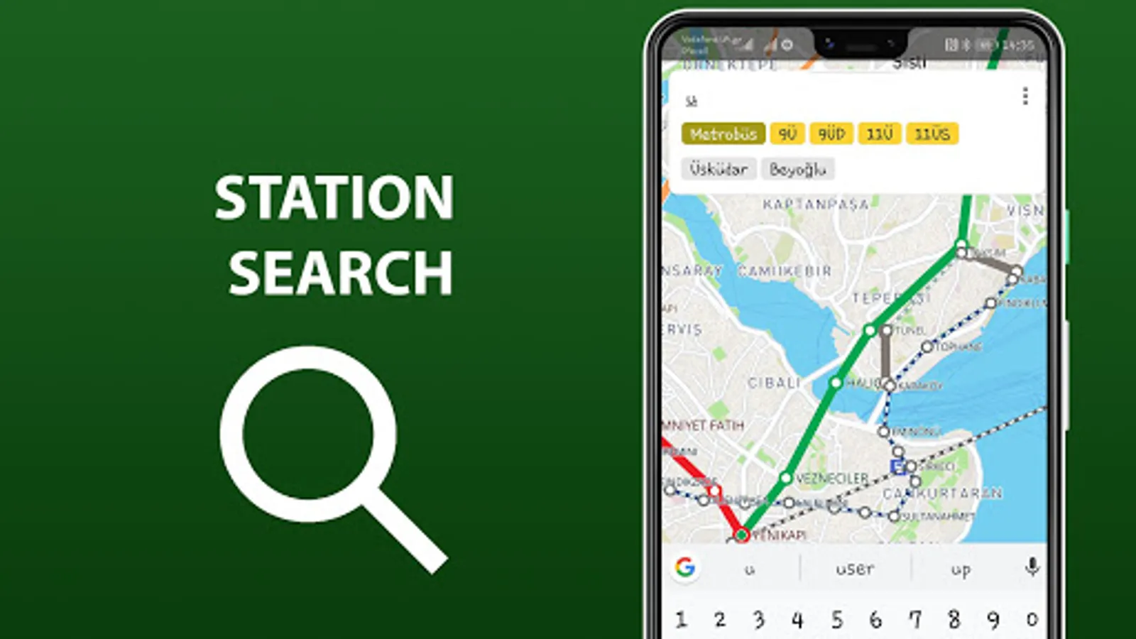
3) The search by station name will help you to find it on the map and select the proper transport. Search by route number allows you to quickly determine whether it suitable or not.
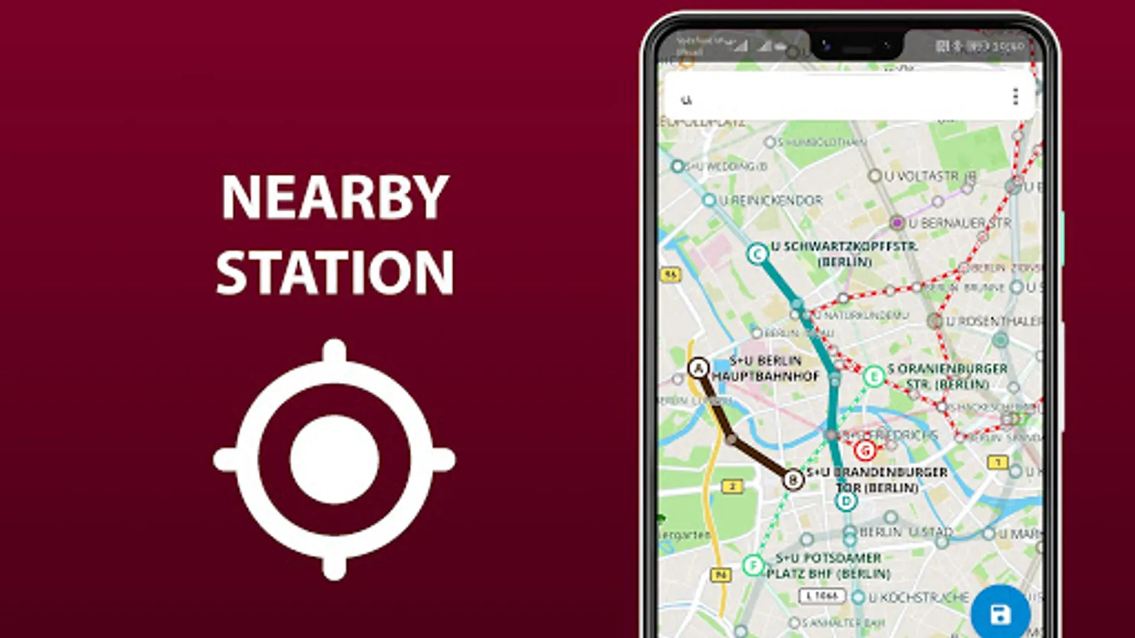
4) By allowing the application to access the location and mark it on the map, you will see stations nearby. So you won't ever get lost and without any help you will be able to get anywhere in the city.
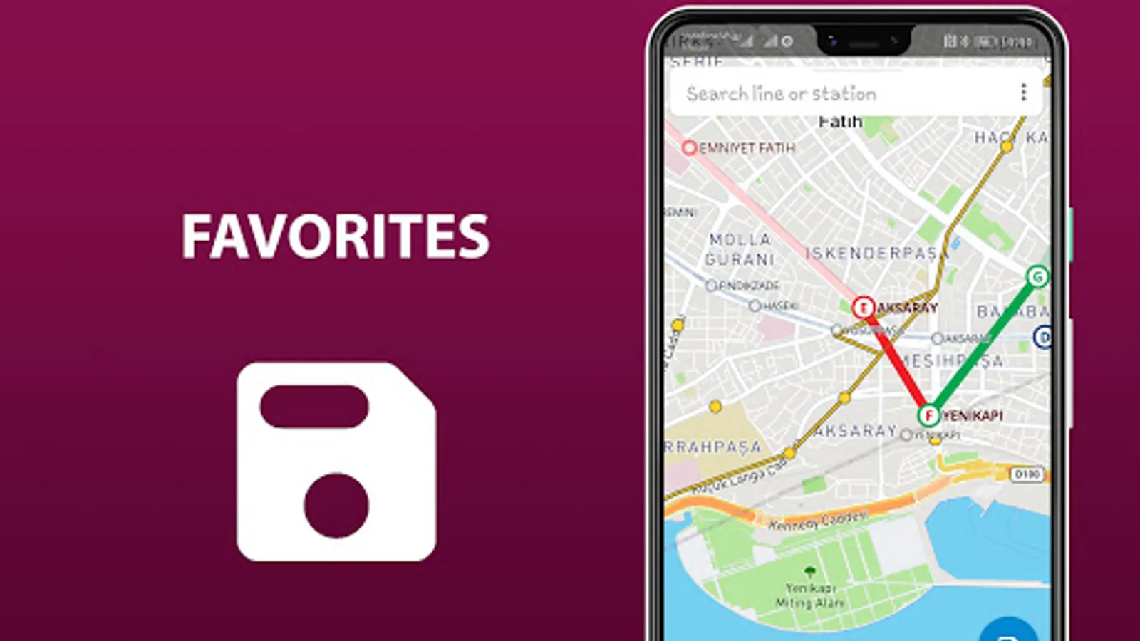
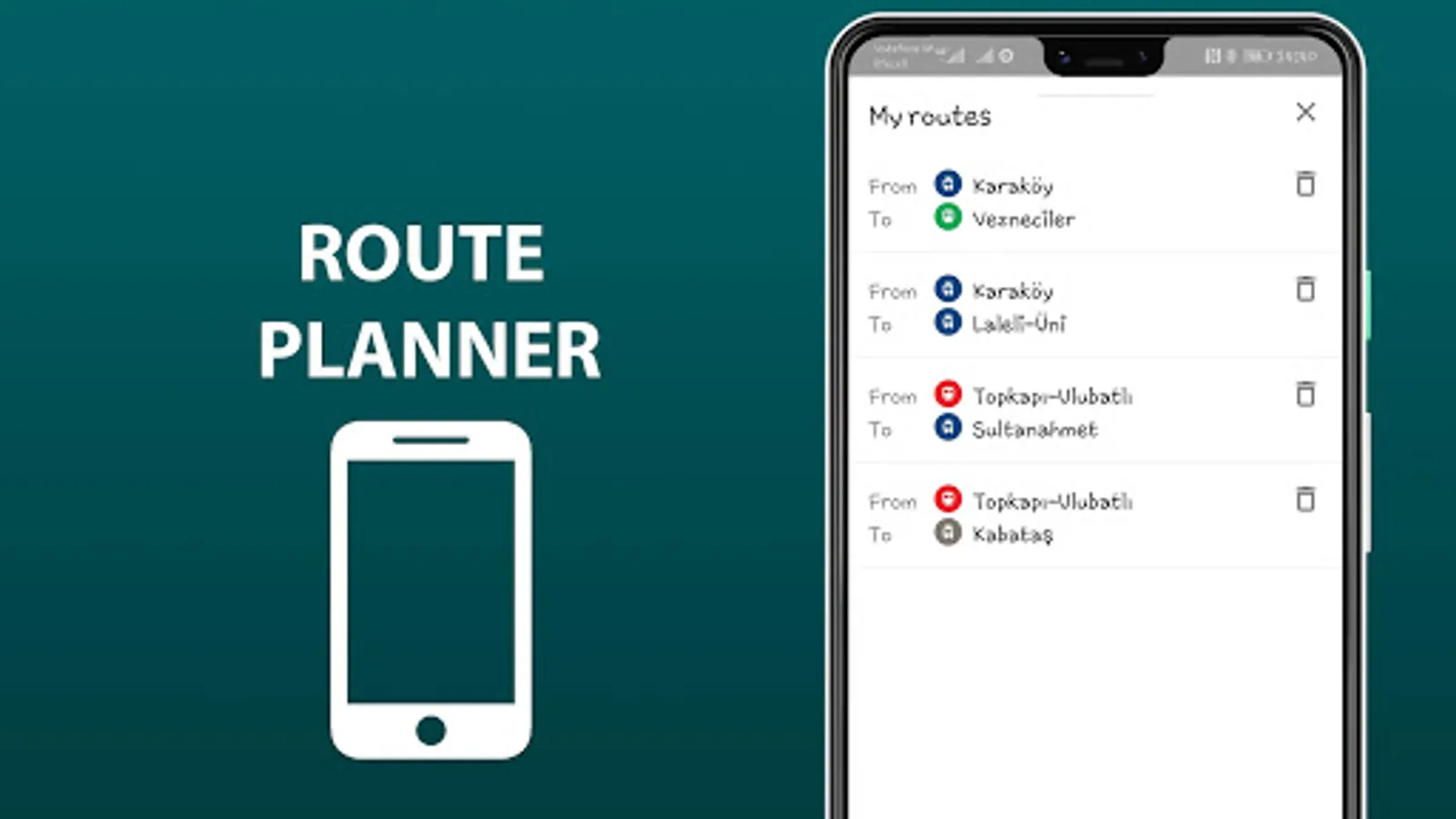
5) The routes you planned in advance, can be saved in the list and you may use them again at any time.
In an extended version, the app allow you:
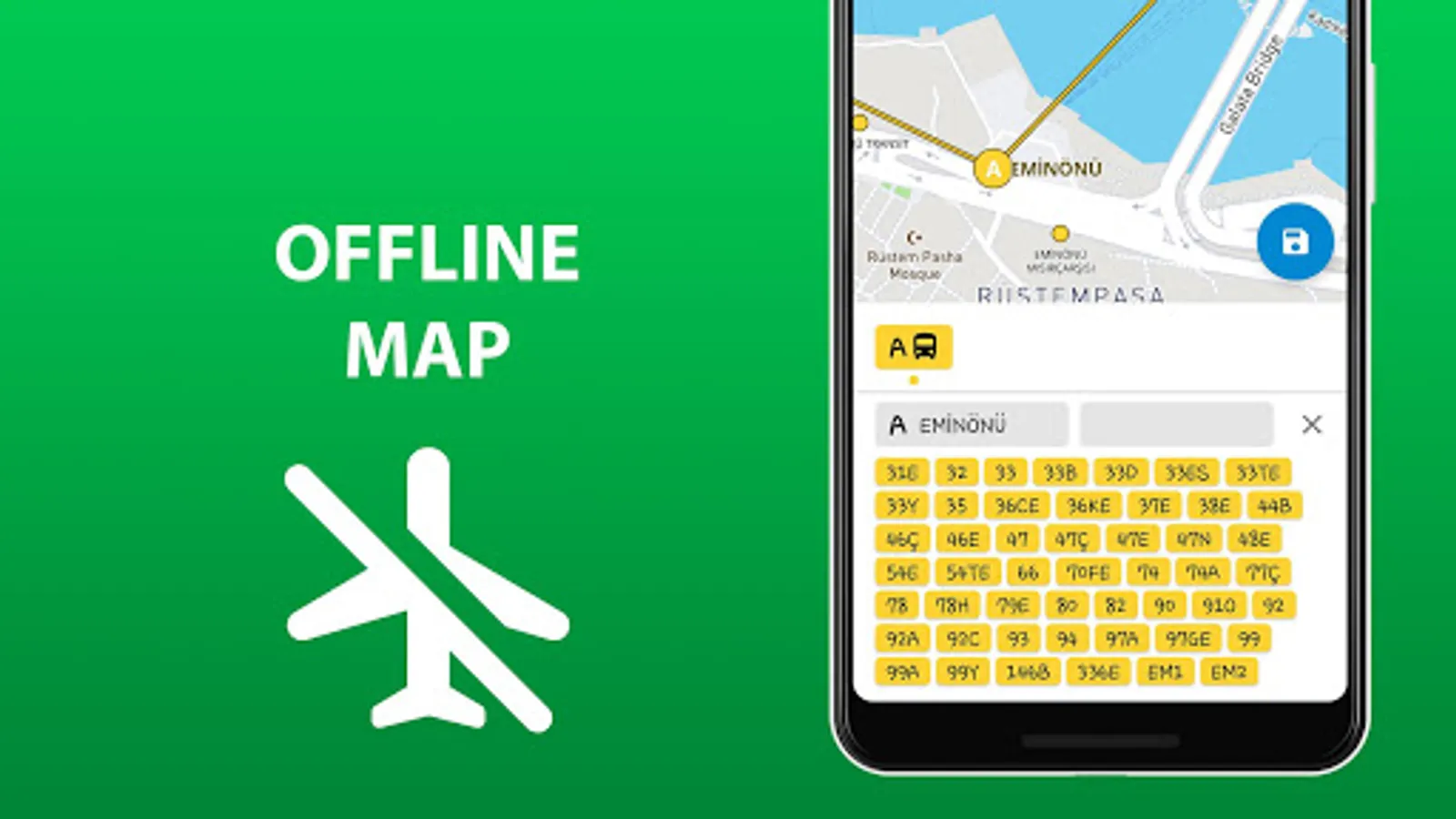
6) To use all of the above in offline mode without wasting time searching for the wifi reception.
7) To check a short schedule of public transport routes if it is needed.
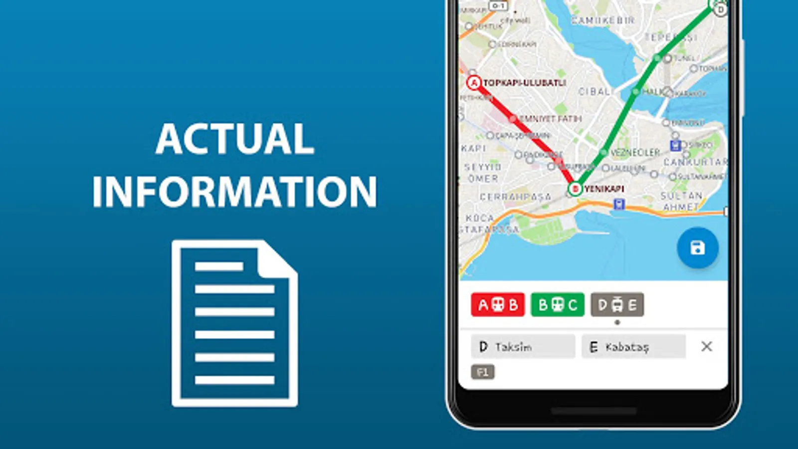
8) To know not just where the station is, but where the stops of all routes passing through are located as well.
Confident use of all types of public transport is the key to the most comfortable visiting Istanbul.
Search by station name or route number, saving chosen routes and geo-positioning are available in the basic version.
Why do this app is should be tried?
1) On the screen of your device you will see the whole Istanbul's public transport scheme, and the more scale is choosen the more details are given.
2) The map of Istanbul shows not only metro lines, but tram and bus routes as well. Stations of possible metro-tram-bus transfers are grouped.
3) The search by station name will help you to find it on the map and select the proper transport. Search by route number allows you to quickly determine whether it suitable or not.
4) By allowing the application to access the location and mark it on the map, you will see stations nearby. So you won't ever get lost and without any help you will be able to get anywhere in the city.
5) The routes you planned in advance, can be saved in the list and you may use them again at any time.
In an extended version, the app allow you:
6) To use all of the above in offline mode without wasting time searching for the wifi reception.
7) To check a short schedule of public transport routes if it is needed.
8) To know not just where the station is, but where the stops of all routes passing through are located as well.
Confident use of all types of public transport is the key to the most comfortable visiting Istanbul.
Public transport map Istanbul Screenshots
Tap to Rate:
Reviews for Public transport map Istanbul
Shota Chachukashvili
6/17/2025
Useless
Nora Szponar
5/23/2025
not updated since 2023 but still taking money for premium version! I downloaded the update but the map has not changed.