In this earthquake monitoring app, you can receive real-time alerts, view earthquake data on maps, and filter events by location or magnitude. Includes notifications, multiple data sources, event details, tsunami bulletins, and data sharing options.
AppRecs review analysis
AppRecs rating 3.5. Trustworthiness 72 out of 100. Review manipulation risk 44 out of 100. Based on a review sample analyzed.
★★★☆☆
3.5
AppRecs Rating
Ratings breakdown
5 star
82%
4 star
12%
3 star
3%
2 star
1%
1 star
2%
What to know
⚠
Pricing complaints
Many low ratings mention paywalls or pricing
⚠
Questionable review patterns
44% review manipulation risk - some review patterns appear unusual
⚠
Rating authenticity concerns
High rating concentration (82% 5-star) in sampled ratings
About Earthquake
Access the latest global data from multiple sources, receive push notification alerts, and experience the trusted app that millions of iOS users have relied on for over a decade, now available on Android.
Main features:
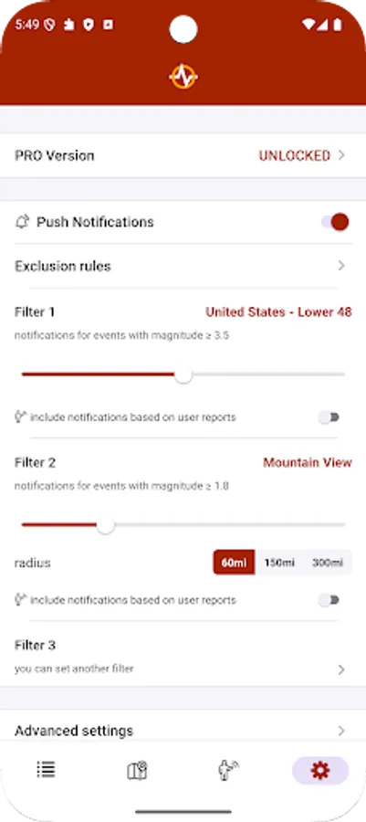
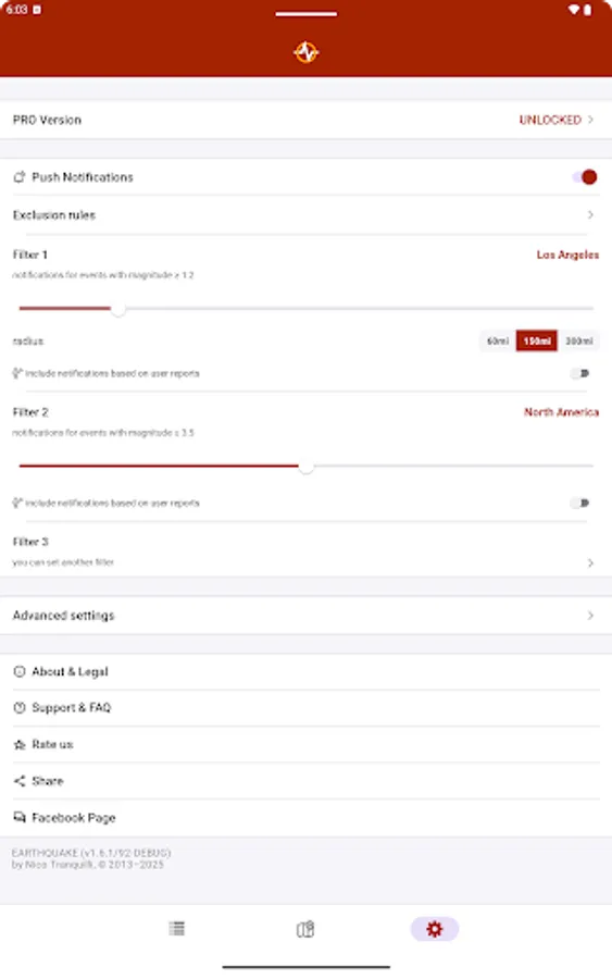
• notifications on your phone as soon as the event data is available from an official source (you can set up to 4 alerts based on location and/or magnitude threshold)
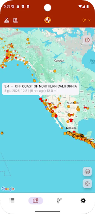
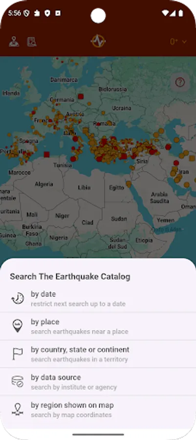
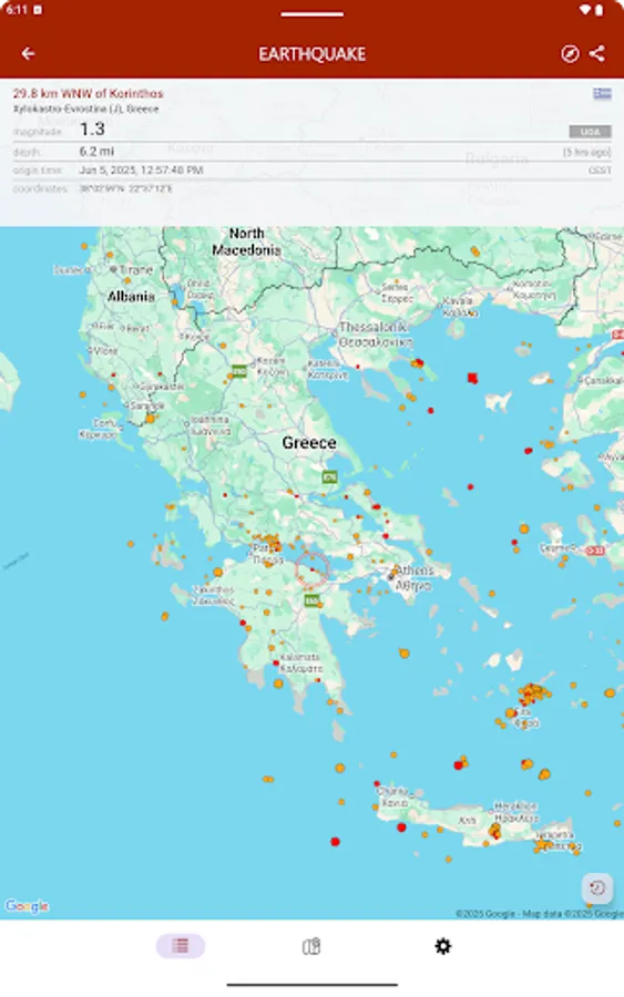
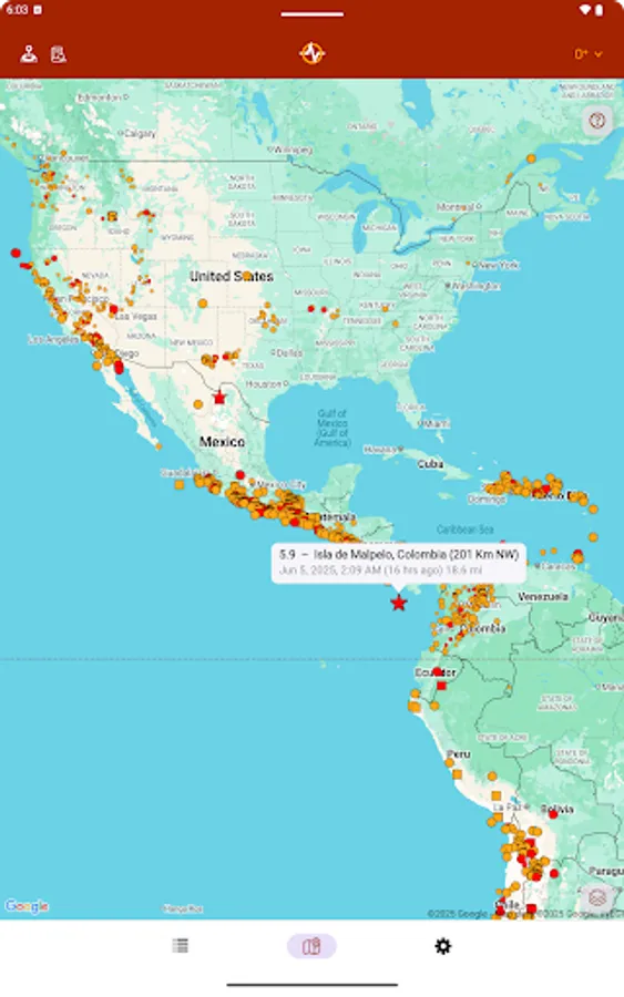
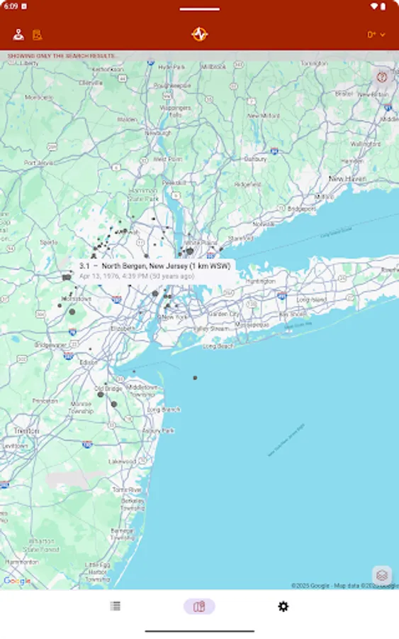
• map with different sized and colored circles to represent event magnitude and age
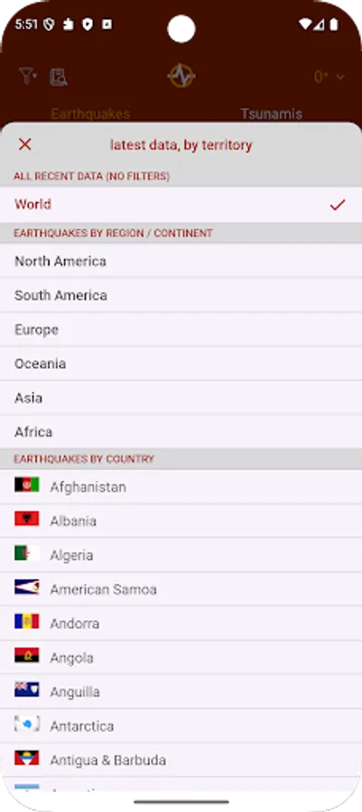
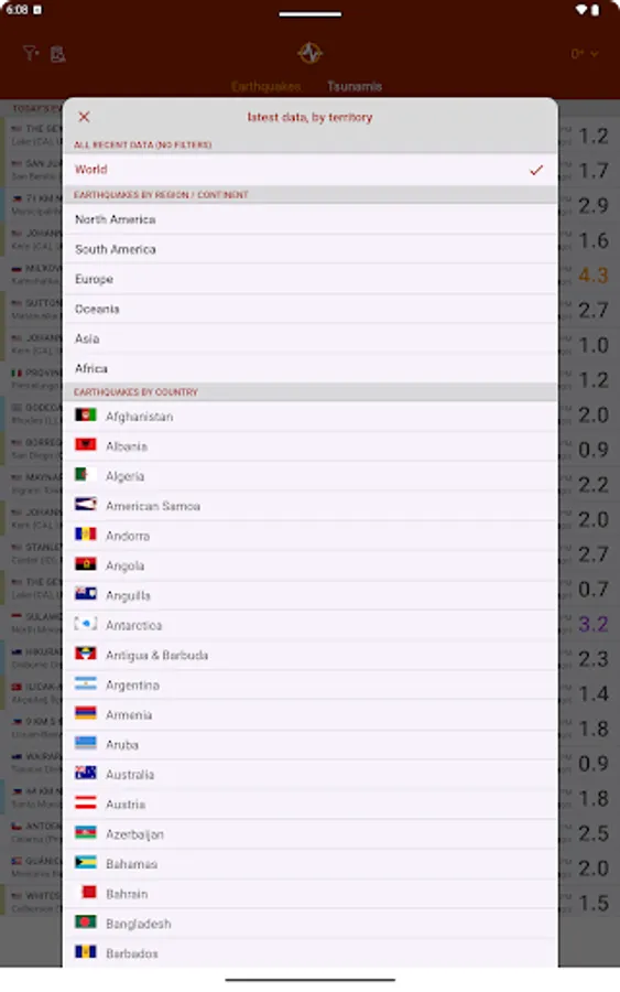
• filter events by area (country, continent) or magnitude
• multiple sources, including U.S. Geological Survey (USGS), European-Mediterranean Seismological Centre (EMSC), GeoScience Australia, GNS Science (GeoNet), Instituto Geográfico Nacional, Servicio Sismológico Nacional, British Geological Survey, GFZ GEOFON, Natural Resources Canada, NOAA
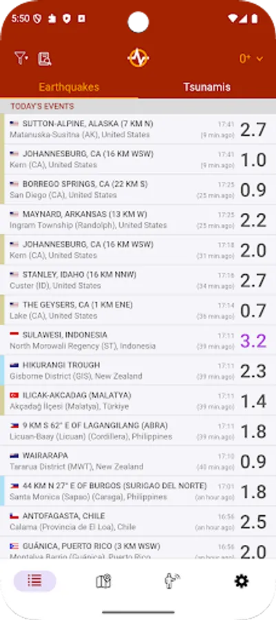
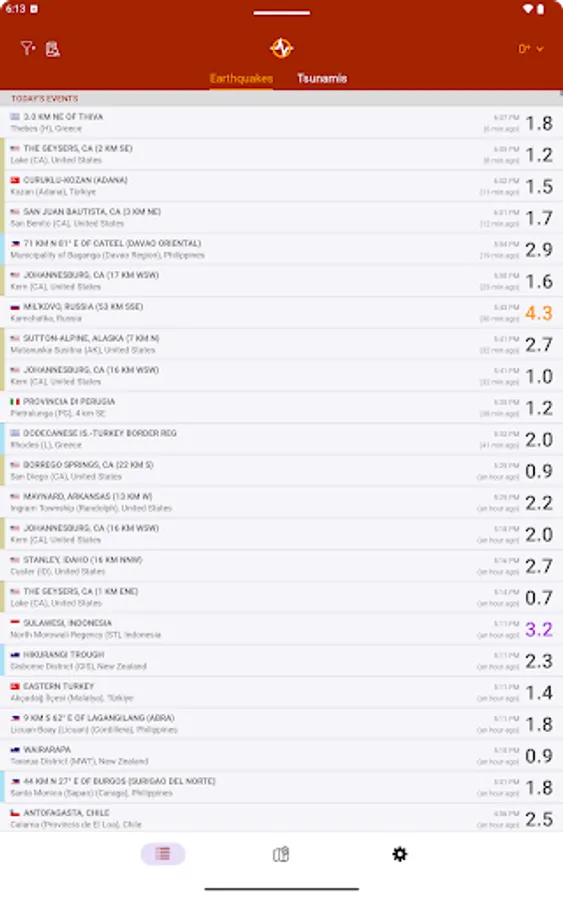
• event timeline (today, yesterday, previous days)
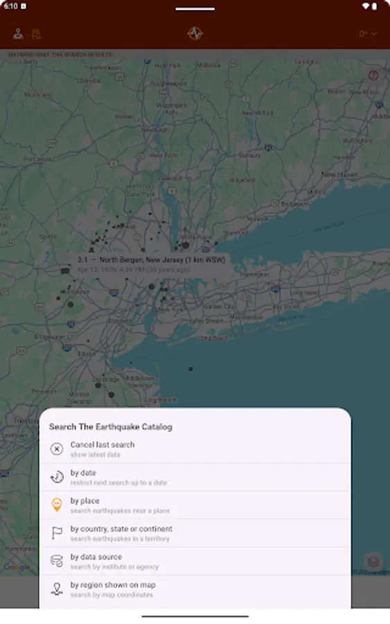
• earthquakes catalog (all world regions covered, back to 1970), search by date, territory, city or reporting agency
• data sharing: export earthquake data and map it to third-party apps
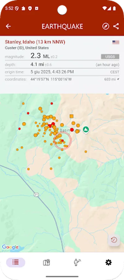
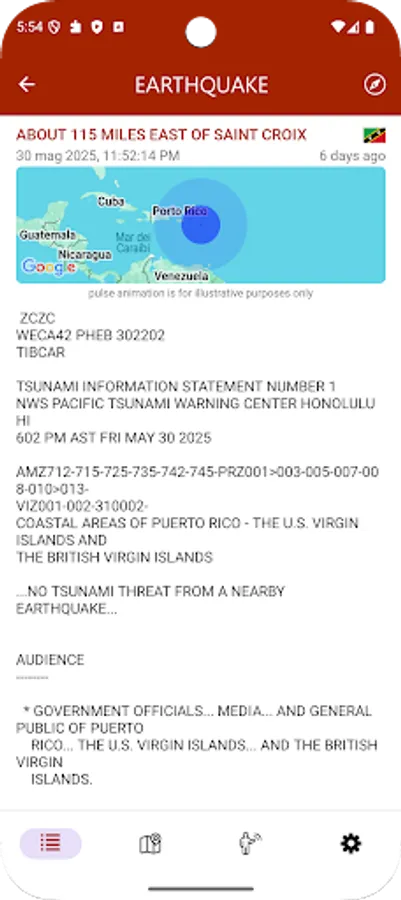
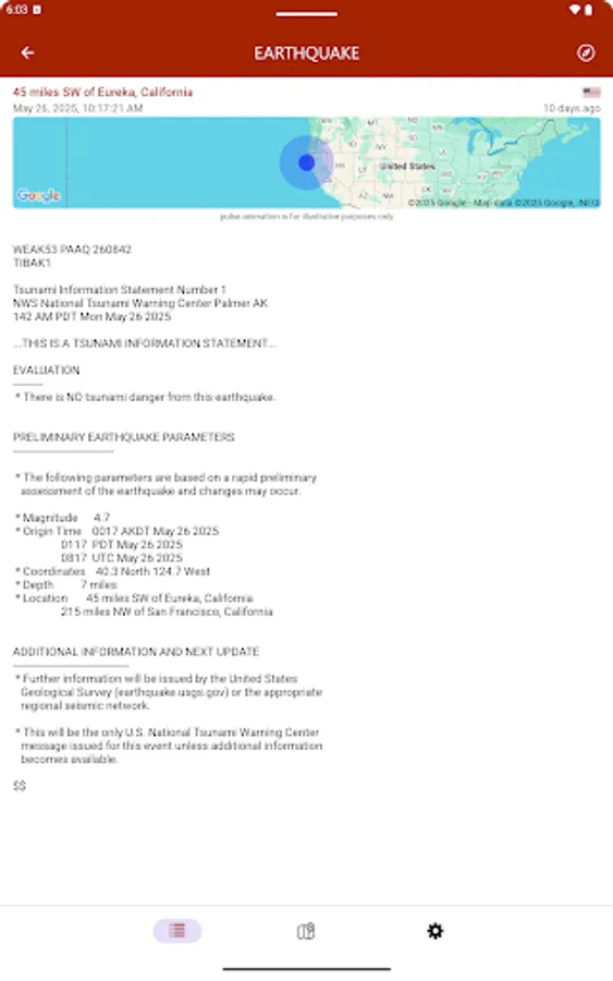
• detail view for each event, reachable from map and timeline views
• tsunami bulletins (NOAA data)
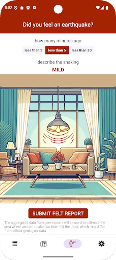
• following a potential seismic event, the app analyzes user reports and app usage data to provide an estimated location within 60-120 seconds, pending official confirmation.
• option to report a recently felt seismic event
• no ads
Main features:
• notifications on your phone as soon as the event data is available from an official source (you can set up to 4 alerts based on location and/or magnitude threshold)
• map with different sized and colored circles to represent event magnitude and age
• filter events by area (country, continent) or magnitude
• multiple sources, including U.S. Geological Survey (USGS), European-Mediterranean Seismological Centre (EMSC), GeoScience Australia, GNS Science (GeoNet), Instituto Geográfico Nacional, Servicio Sismológico Nacional, British Geological Survey, GFZ GEOFON, Natural Resources Canada, NOAA
• event timeline (today, yesterday, previous days)
• earthquakes catalog (all world regions covered, back to 1970), search by date, territory, city or reporting agency
• data sharing: export earthquake data and map it to third-party apps
• detail view for each event, reachable from map and timeline views
• tsunami bulletins (NOAA data)
• following a potential seismic event, the app analyzes user reports and app usage data to provide an estimated location within 60-120 seconds, pending official confirmation.
• option to report a recently felt seismic event
• no ads