In this earthquake monitoring app, you can view real-time seismic data, receive push alerts, and explore event details on a map. Includes event filters, social sharing, map layers, and multi-language support.
AppRecs review analysis
AppRecs rating 2.8. Trustworthiness 55 out of 100. Review manipulation risk 44 out of 100. Based on a review sample analyzed.
★★☆☆☆
2.8
AppRecs Rating
Ratings breakdown
5 star
60%
4 star
0%
3 star
20%
2 star
0%
1 star
20%
What to know
✓
Authentic reviews
Natural distribution, no red flags
⚠
Questionable review patterns
44% review manipulation risk - some review patterns appear unusual
About Terremoto
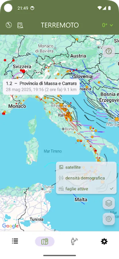
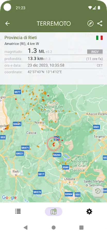
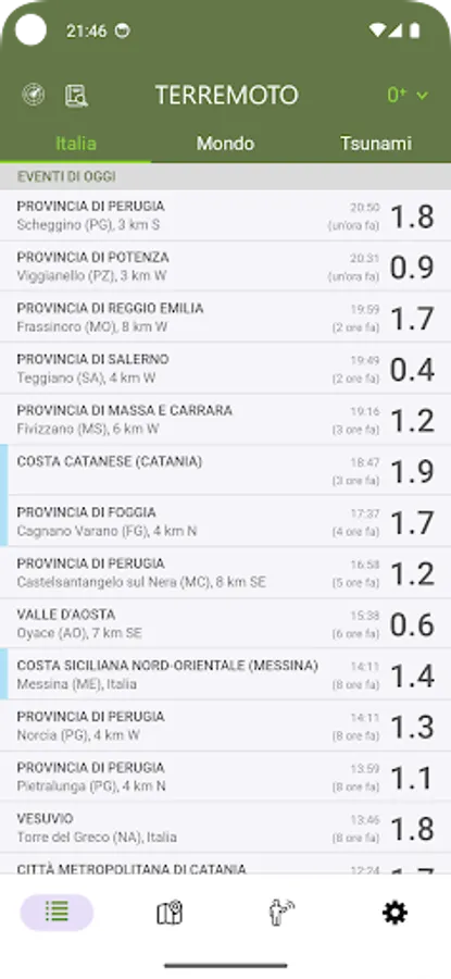
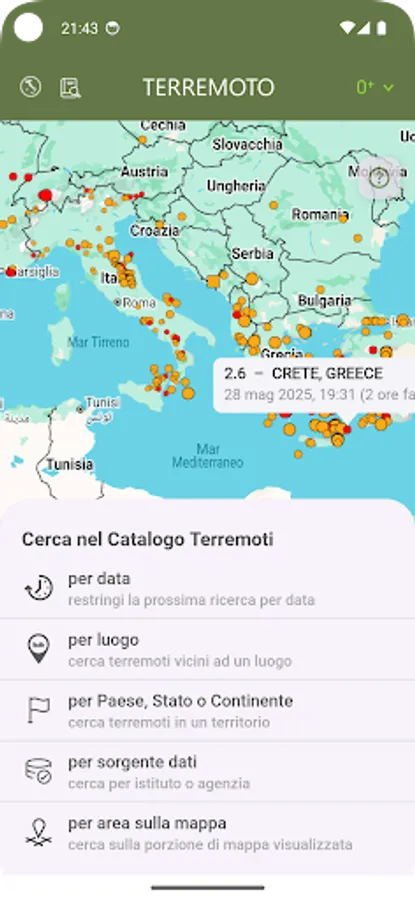
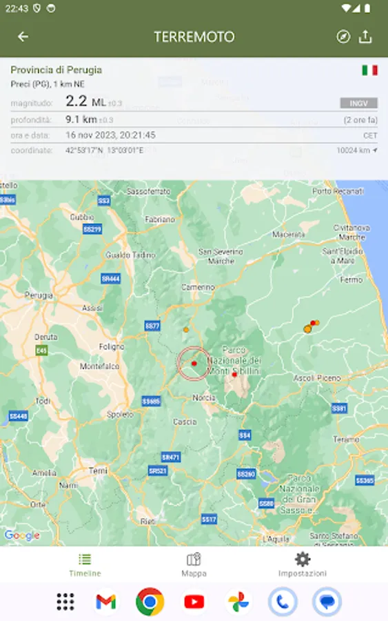
Terremoto shows the latest earthquake data for the Italian peninsula, as reported by INGV (National Institute of Geophysics and Volcanology). Includes free push notification alerts.
Main features:
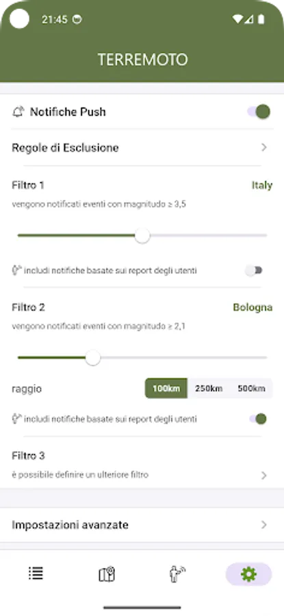
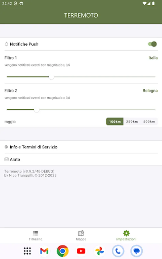
• push notifications on your phone as soon as the event data is available from an official source (you can set alerts based on location and/or magnitude threshold)
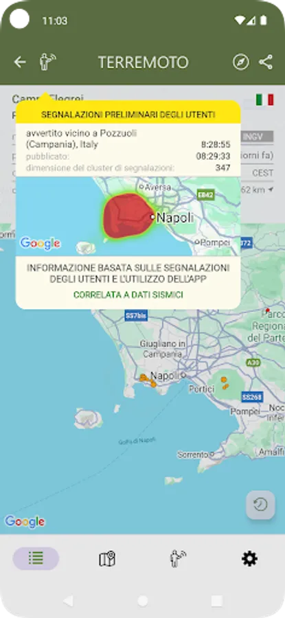
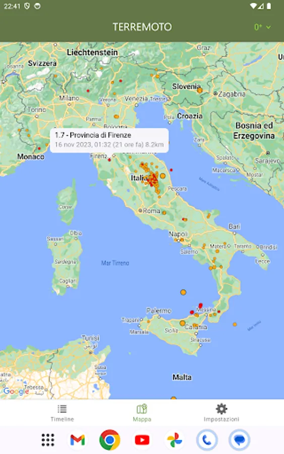
• map with different sized and colored circles to represent event magnitude and age
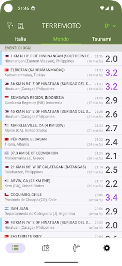
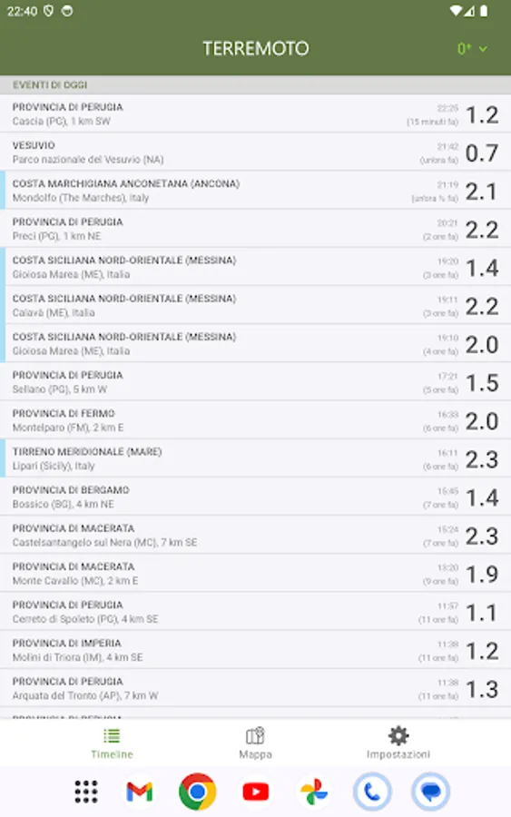
• event timeline (today, yesterday, previous days)
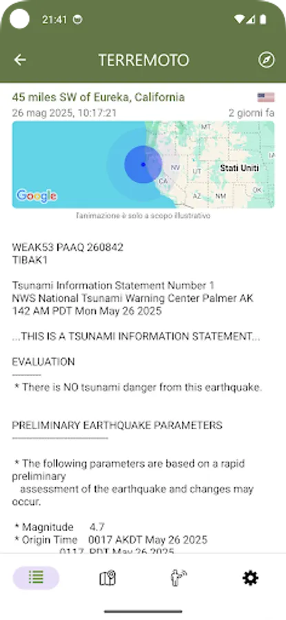
• detail view for each event, reachable from map and timeline views
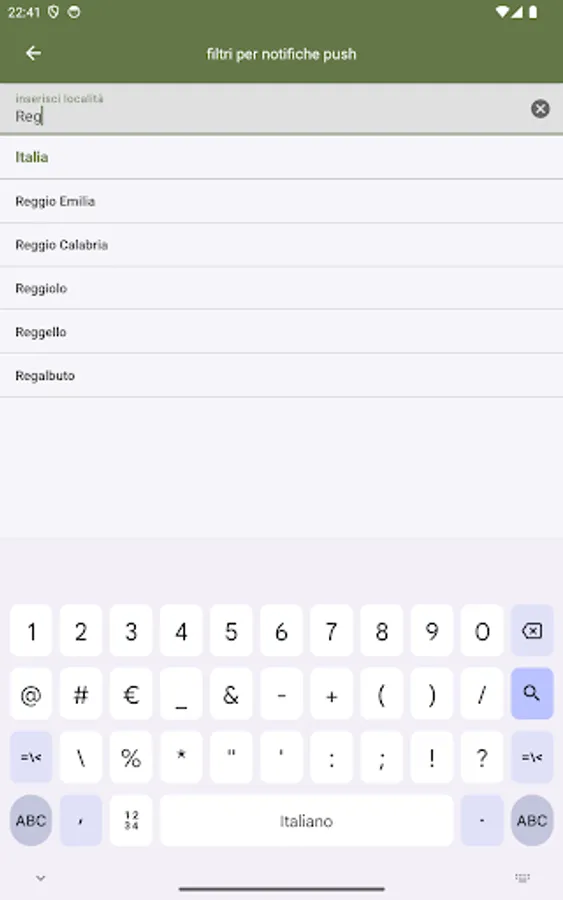
• magnitude and nearby event filters
• social sharing: share event map and data to social networks
• multiple languages: the app is localized in English, Spanish, French, German, Italian
• seismic events nearby from the seismic bulletin (data from 1970 to present)
• map layers: active faults, population density
• following a potential seismic event, the app analyzes user reports and app usage data to provide an estimated location within 60-120 seconds, pending official confirmation.
• option to report a recently felt seismic event
• no ads
Data source: © ISIDe Working Group (INGV, 2010), Italian Seismological Instrumental and parametric database.
This is an independent app and is not affiliated with or endorsed by INGV.
Main features:
• push notifications on your phone as soon as the event data is available from an official source (you can set alerts based on location and/or magnitude threshold)
• map with different sized and colored circles to represent event magnitude and age
• event timeline (today, yesterday, previous days)
• detail view for each event, reachable from map and timeline views
• magnitude and nearby event filters
• social sharing: share event map and data to social networks
• multiple languages: the app is localized in English, Spanish, French, German, Italian
• seismic events nearby from the seismic bulletin (data from 1970 to present)
• map layers: active faults, population density
• following a potential seismic event, the app analyzes user reports and app usage data to provide an estimated location within 60-120 seconds, pending official confirmation.
• option to report a recently felt seismic event
• no ads
Data source: © ISIDe Working Group (INGV, 2010), Italian Seismological Instrumental and parametric database.
This is an independent app and is not affiliated with or endorsed by INGV.