Use this mapping app to explore locations with high-definition satellite imagery and measure distances. Includes map tiles, historical street views, compass, and terrain details.
AppRecs review analysis
AppRecs rating 3.7. Trustworthiness 68 out of 100. Review manipulation risk 34 out of 100. Based on a review sample analyzed.
★★★☆☆
3.7
AppRecs Rating
Ratings breakdown
5 star
91%
4 star
5%
3 star
1%
2 star
1%
1 star
2%
What to know
⚠
Ad complaints
Many low ratings mention excessive ads
⚠
Pricing complaints
Many low ratings mention paywalls or pricing
⚠
Review quality concerns
51% of sampled 5-star reviews are very short
About Earth Maps
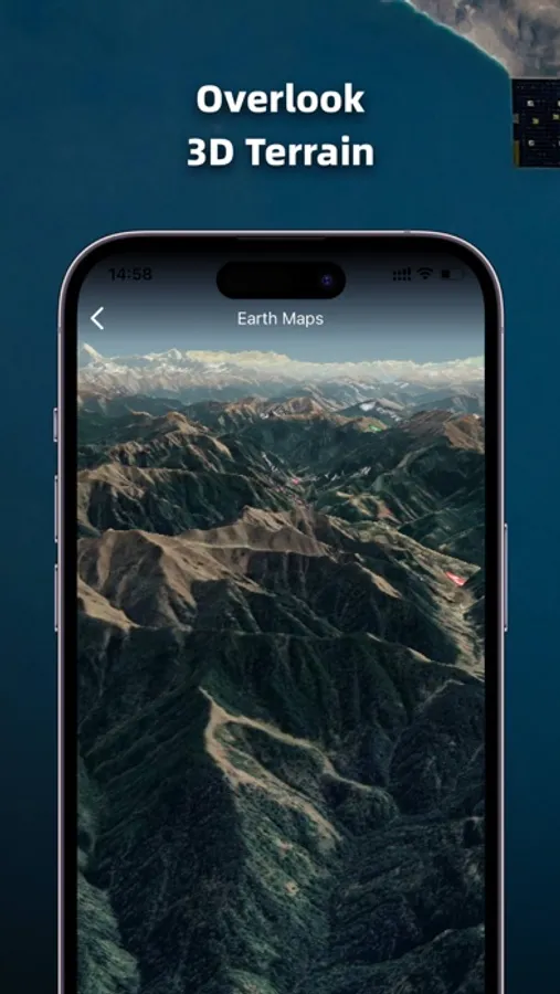
1. High-definition 3D globe
2. Load map tile data
3. Oriental compass function
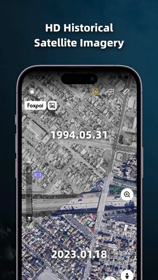
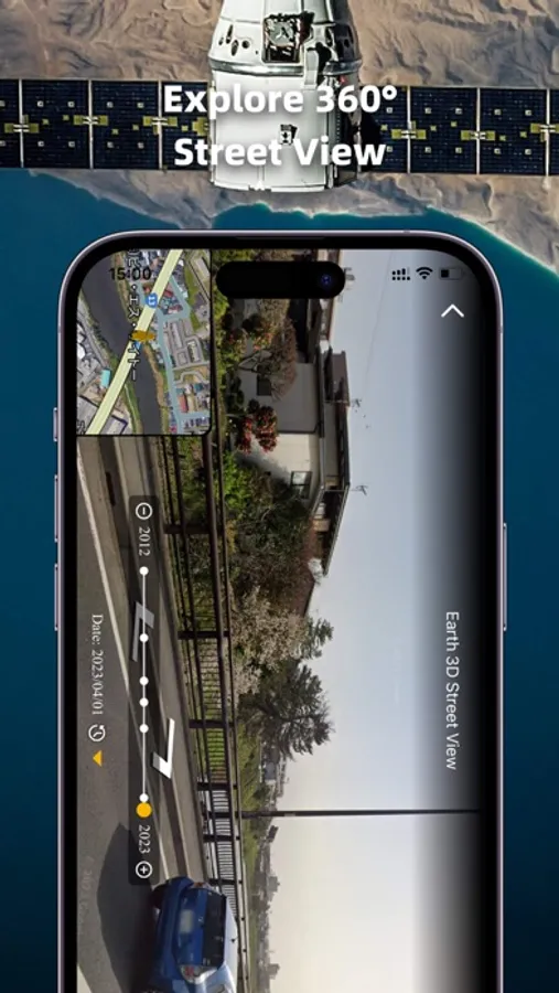
4.historical street view
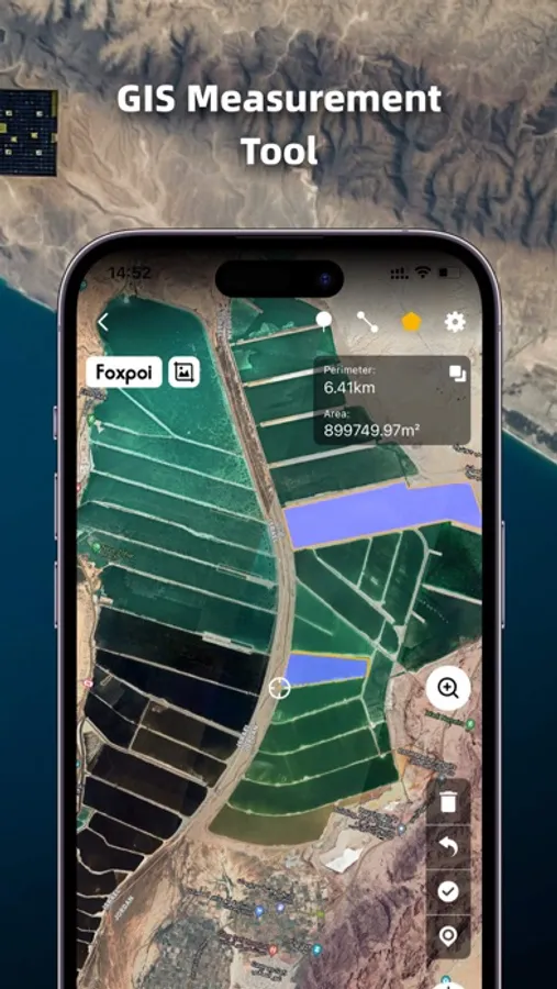
5.Measuring area distance
6.latest satellite imagery
World Satellite Map allows you to view any place on Earth using photos taken from satellites. The advantage of the world satellite map over other maps is that the satellite map allows you to consider the surface terrain, forests, rivers, lakes, buildings, roads in sufficient detail with a high degree of detail. With satellite maps, you can travel the world online without leaving your phone.
From world satellite map.
2. Load map tile data
3. Oriental compass function
4.historical street view
5.Measuring area distance
6.latest satellite imagery
World Satellite Map allows you to view any place on Earth using photos taken from satellites. The advantage of the world satellite map over other maps is that the satellite map allows you to consider the surface terrain, forests, rivers, lakes, buildings, roads in sufficient detail with a high degree of detail. With satellite maps, you can travel the world online without leaving your phone.
From world satellite map.
Earth Maps Screenshots
Tap to Rate:
Reviews for Earth Maps
h1r2
Bueno
10
Red69!!
Ty
Ty