Sight reduction
Navigational Algorithms
3.8 ★
124 ratings
10,000+
downloads
Free
In this celestial navigation app, users input observed altitudes and celestial data to calculate lines of position and create running fixes. Includes features such as plotting multiple lines of position on Google maps, a logbook function, and GPS-based location detection.
AppRecs review analysis
AppRecs rating 3.8. Trustworthiness 58 out of 100. Review manipulation risk 38 out of 100. Based on a review sample analyzed.
★★★☆☆
3.8
AppRecs Rating
Ratings breakdown
5 star
50%
4 star
25%
3 star
0%
2 star
0%
1 star
25%
What to know
✓
Good user ratings
75% positive sampled reviews
✓
Authentic reviews
Natural distribution, no red flags
About Sight reduction
Celestial navigation - Astronavigation
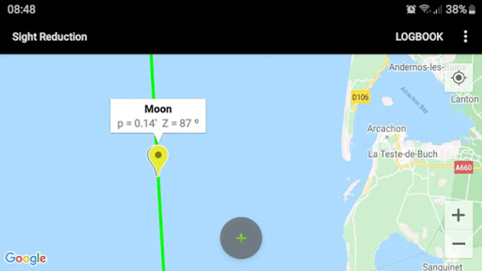
Sight reduction:
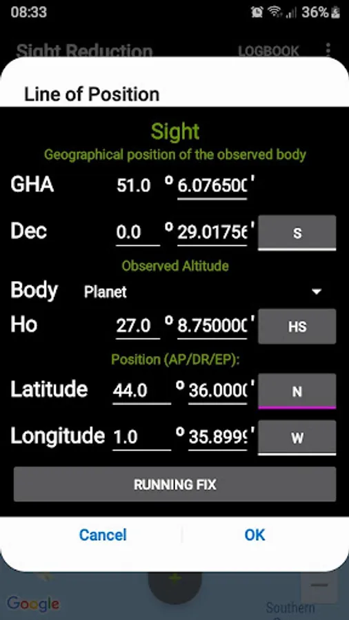
- Marcq Saint Hilaire Line of Position, intercept method (p=Ho-Hc, Zn)
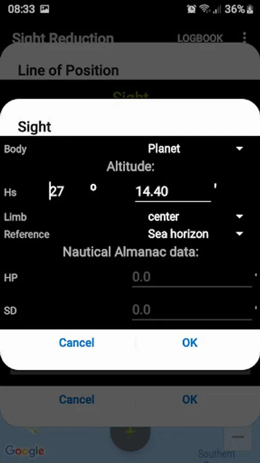
- Input for observed altitude Ho or instrumental Hs (Nautical Almanac data needed for the Sun and the Moon)
- Calculator for Intercept method (p=Ho-Hc, Zn) altitude Hc and azimuth Zn
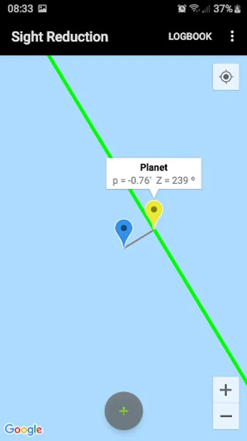
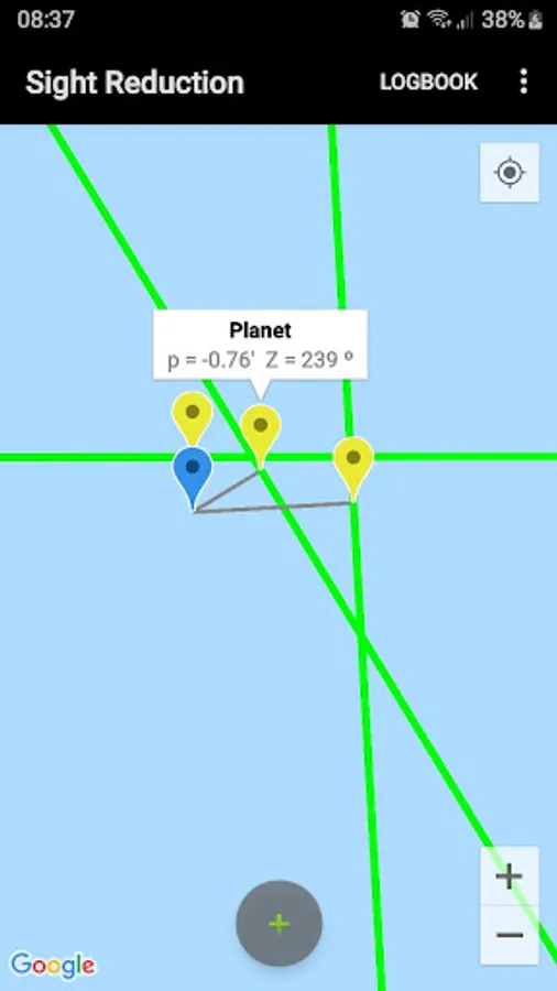
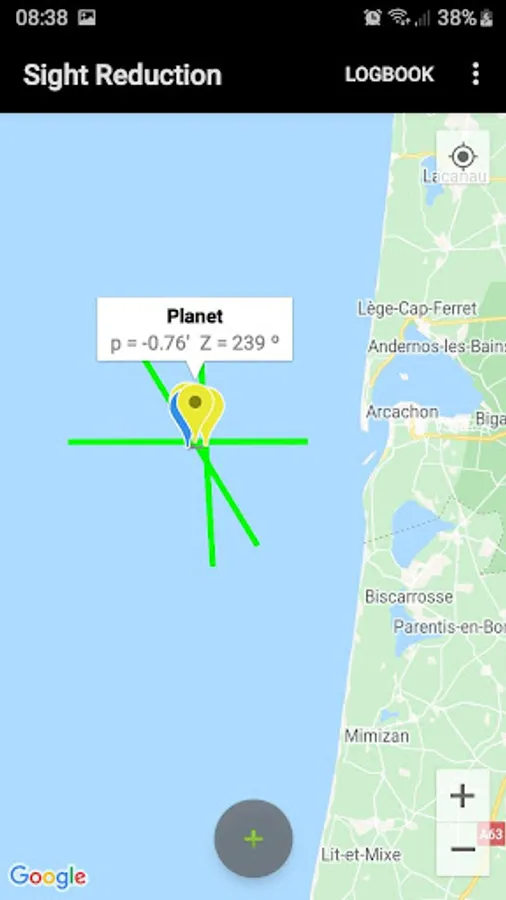
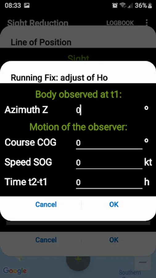
- Running fix
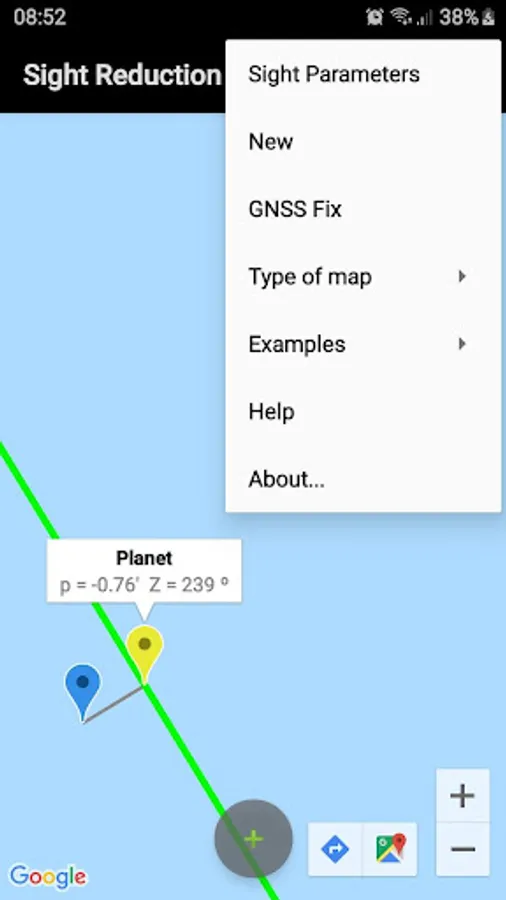
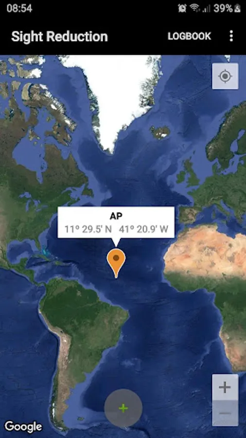
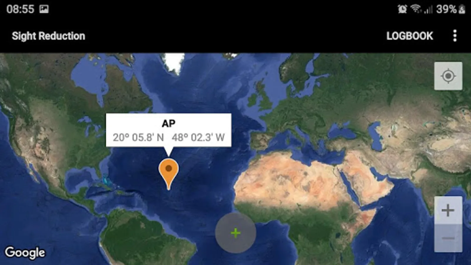
- Plots up to 3 Marcq Saint Hilaire Lines of Position on Google maps
- Local hour angle (LHA)
- List of navigational stars
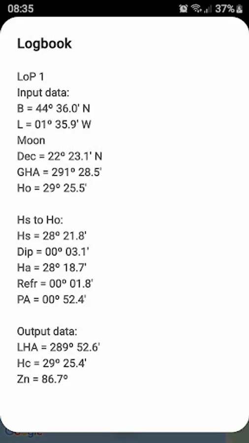
- Logbook (output is copied to clipboard)
- New optimized user interface
- GNSS fix to check the solution
Sight reduction is the process of deriving from a sight the information needed for establishing a line of position.
This app is a calculator to get the intercept from the assumed position of the observer AP(latitude, longitude), the geographical position of the celestial body observed, GP(Dec, GHA), and its corrected altitude Ho.
Manual and examples in the developer's website.
Ref: https://en.wikipedia.org/wiki/Sight_reduction
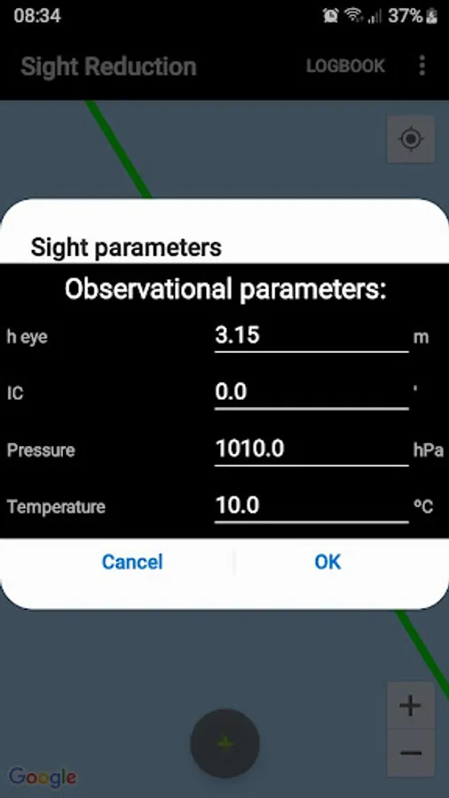
User interface:
- Zoom buttons +/-
- Map types: standard, terrain, and satellite
- GPS location. ("Location" App permission must be allowed. Switch on you GPS, and then automatic location detection is possible)
Sight reduction:
- Marcq Saint Hilaire Line of Position, intercept method (p=Ho-Hc, Zn)
- Input for observed altitude Ho or instrumental Hs (Nautical Almanac data needed for the Sun and the Moon)
- Calculator for Intercept method (p=Ho-Hc, Zn) altitude Hc and azimuth Zn
- Running fix
- Plots up to 3 Marcq Saint Hilaire Lines of Position on Google maps
- Local hour angle (LHA)
- List of navigational stars
- Logbook (output is copied to clipboard)
- New optimized user interface
- GNSS fix to check the solution
Sight reduction is the process of deriving from a sight the information needed for establishing a line of position.
This app is a calculator to get the intercept from the assumed position of the observer AP(latitude, longitude), the geographical position of the celestial body observed, GP(Dec, GHA), and its corrected altitude Ho.
Manual and examples in the developer's website.
Ref: https://en.wikipedia.org/wiki/Sight_reduction
User interface:
- Zoom buttons +/-
- Map types: standard, terrain, and satellite
- GPS location. ("Location" App permission must be allowed. Switch on you GPS, and then automatic location detection is possible)