AppRecs review analysis
AppRecs rating . Trustworthiness 38 out of 100. Review manipulation risk 47 out of 100. Based on a review sample analyzed.
★
AppRecs Rating
Ratings breakdown
5 star
100%
4 star
0%
3 star
0%
2 star
0%
1 star
0%
What to know
⚠
Questionable review patterns
47% review manipulation risk - some review patterns appear unusual
⚠
Questionable review trustworthiness
38% trustworthiness - reviews show concerning patterns
⚠
Unusually uniform ratings
100% of sampled ratings are 5 stars with very little variation
About Vector solution 2 CoP
Celestial navigation.
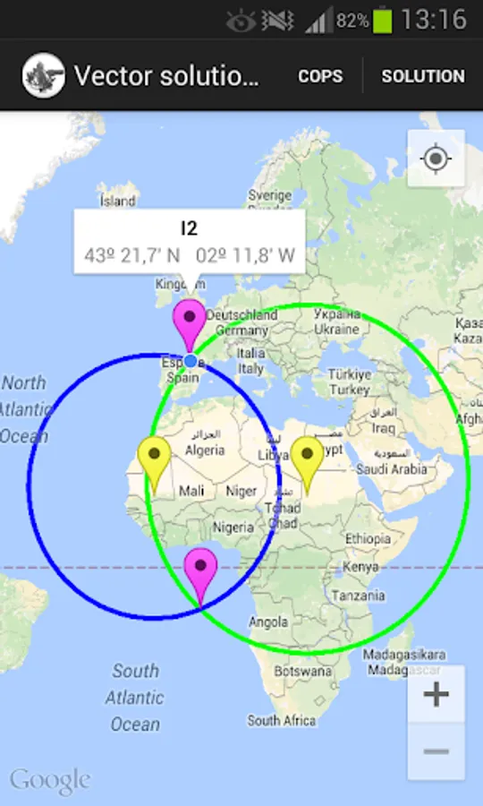
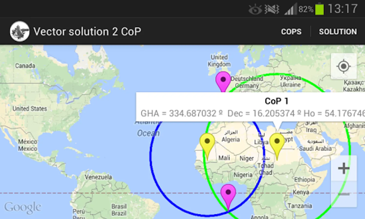
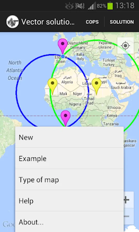
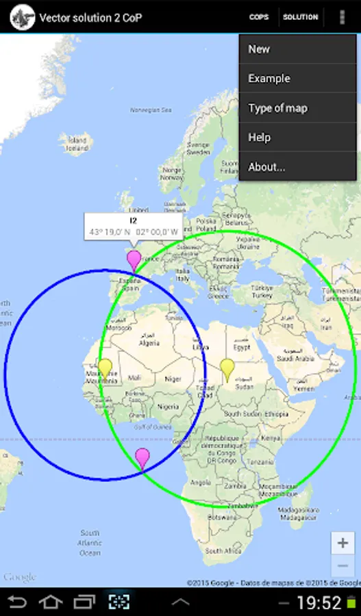
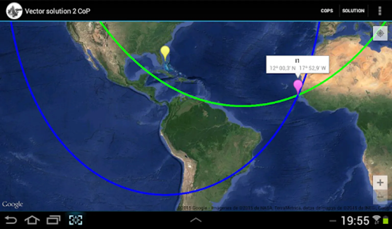
Fix by two circles of position: vector solution.
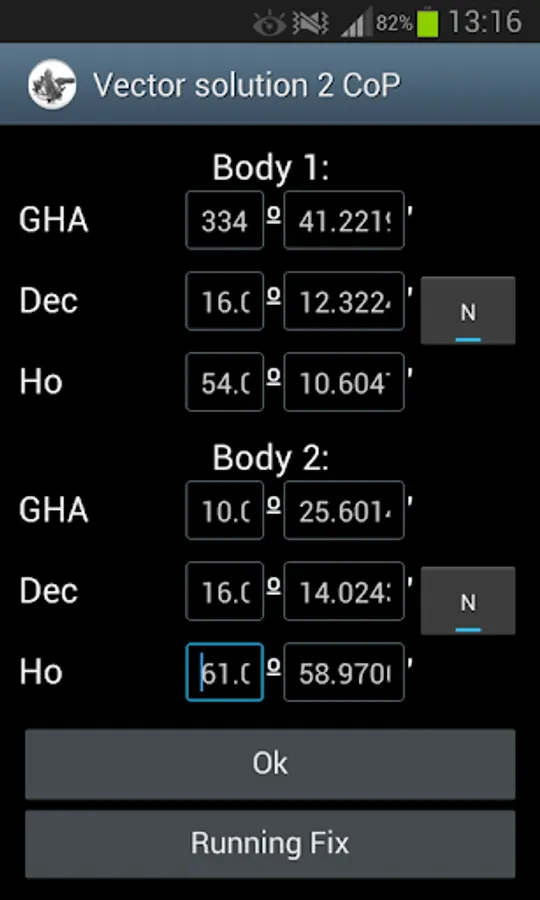
With a sextant take two altitudes, correct them and obtain the observed altitudes: Ho.
Take the Nautical Almanac and find the coordinates of the celestial bodies: GHA, declination.
Use this app to calculate the two solutions, and to plot the circles of position, or circumferences of equal altitude on Google maps.
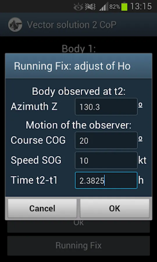
Running fix:
- The app moves the first sight to the time of the second, taking into account the motion of the observer.
Method explained in the papers:
- Vector Solution for the intersection of two Circles of Equal Altitude. (Andrés Ruiz González. Journal of Navigation 2008, 61:355-365. The Royal Institute of Navigation).
- Use of rotation matrices to plot a circle of equal altitude. (Andrés Ruiz. JOURNAL OF MARITIME RESEARCH, Vol 8, Nº3, 2011)
Available on the author's website.
- Output is copied to clipboard
User interface:
- Zoom buttons +/-
- Map types: normal and satellite
- GPS location. ("Location" App permission must be allowed. Switch on you GPS, and then automatic location detection is possible)
Fix by two circles of position: vector solution.
With a sextant take two altitudes, correct them and obtain the observed altitudes: Ho.
Take the Nautical Almanac and find the coordinates of the celestial bodies: GHA, declination.
Use this app to calculate the two solutions, and to plot the circles of position, or circumferences of equal altitude on Google maps.
Running fix:
- The app moves the first sight to the time of the second, taking into account the motion of the observer.
Method explained in the papers:
- Vector Solution for the intersection of two Circles of Equal Altitude. (Andrés Ruiz González. Journal of Navigation 2008, 61:355-365. The Royal Institute of Navigation).
- Use of rotation matrices to plot a circle of equal altitude. (Andrés Ruiz. JOURNAL OF MARITIME RESEARCH, Vol 8, Nº3, 2011)
Available on the author's website.
- Output is copied to clipboard
User interface:
- Zoom buttons +/-
- Map types: normal and satellite
- GPS location. ("Location" App permission must be allowed. Switch on you GPS, and then automatic location detection is possible)