ATAK Plugin: GeoCam
TAK Product Center
4.6 ★
23 ratings
10,000+
downloads
Free
With this ATAK plugin, you can capture geotagged images with metadata including location, altitude, and direction. Includes data annotation, image storage, and integration with existing ATAK preferences.
AppRecs review analysis
AppRecs rating 4.6. Trustworthiness 61 out of 100. Review manipulation risk 26 out of 100. Based on a review sample analyzed.
★★★★☆
4.6
AppRecs Rating
Ratings breakdown
5 star
59%
4 star
41%
3 star
0%
2 star
0%
1 star
0%
What to know
✓
Low review manipulation risk
26% review manipulation risk
✓
High user satisfaction
100% of sampled ratings are 4+ stars (4.6★ average)
About ATAK Plugin: GeoCam
ATTENTION: This is an ATAK Plugin. To use this extended capability, the ATAK baseline must be installed. Download the ATAK baseline here: https://play.google.com/store/apps/details?id=com.atakmap.app.civ
Many of the preferences within Tak GeoCam depend on the matching ATAK preference such as Coordinate Display, Altitude Display, Altitude Units, North Reference, etc.
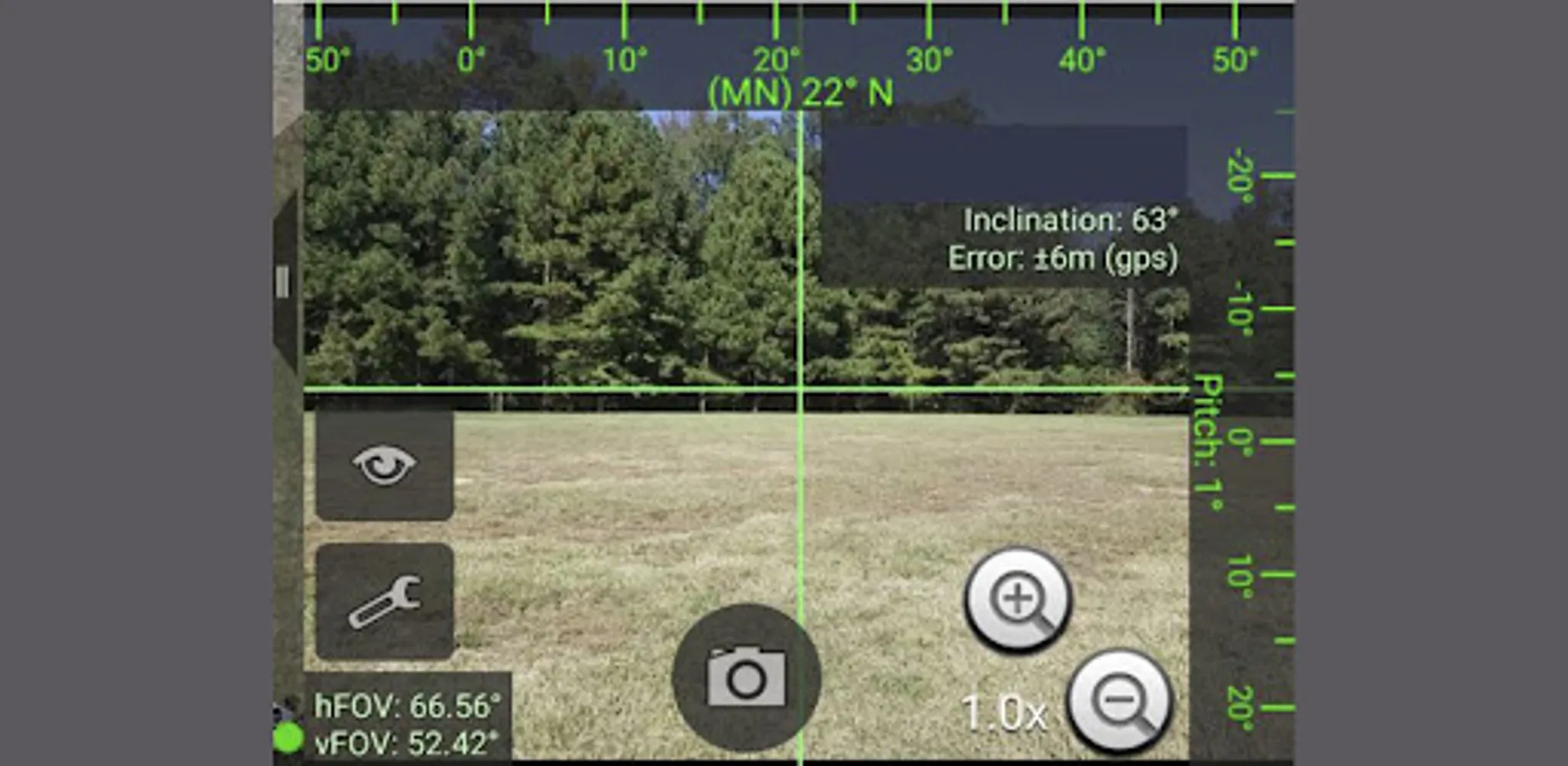
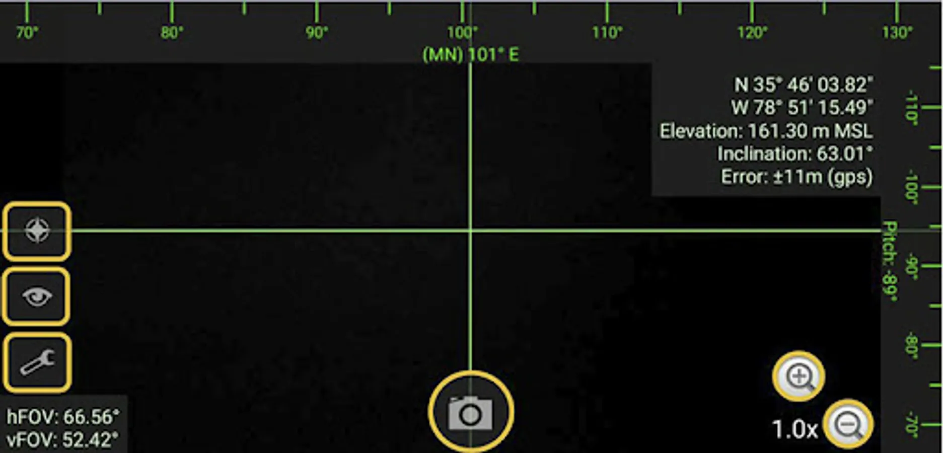
Captured images are stored with the following metadata (when possible):
• Location + Altitude
• Image direction/Azimuth
• GPS track, speed, accuracy, timestamp, and datestamp
• Image pitch and roll
• Inclination
• Horizontal and vertical FOV
• Street address based on location
Many of the preferences within Tak GeoCam depend on the matching ATAK preference such as Coordinate Display, Altitude Display, Altitude Units, North Reference, etc.
Captured images are stored with the following metadata (when possible):
• Location + Altitude
• Image direction/Azimuth
• GPS track, speed, accuracy, timestamp, and datestamp
• Image pitch and roll
• Inclination
• Horizontal and vertical FOV
• Street address based on location
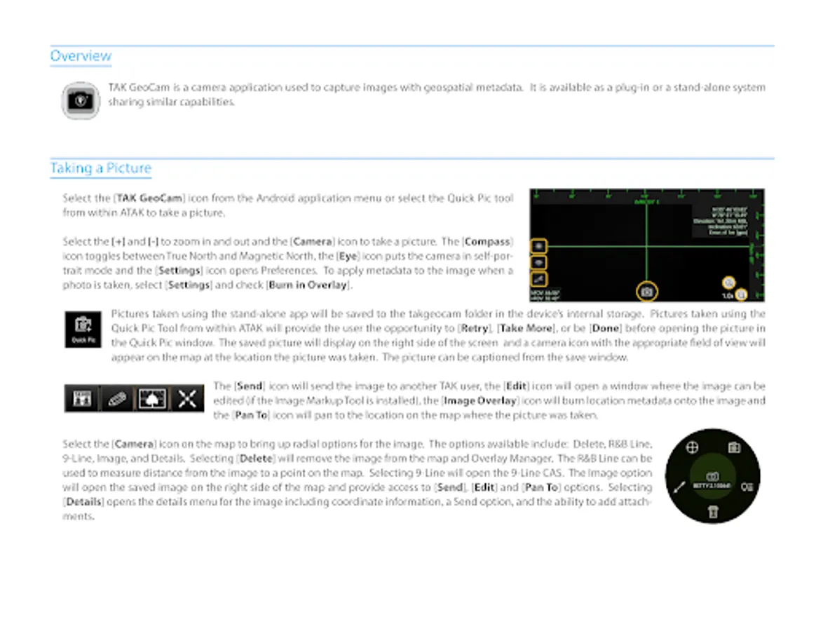
ATAK Plugin: GeoCam Screenshots
Tap to Rate:
Reviews for ATAK Plugin: GeoCam
Remedios Godez
11/19/2024
I hope this is really good
eric scuderi
3/31/2023
I love it! But it needs to have a MILS option too put into the settings for mortars and FA