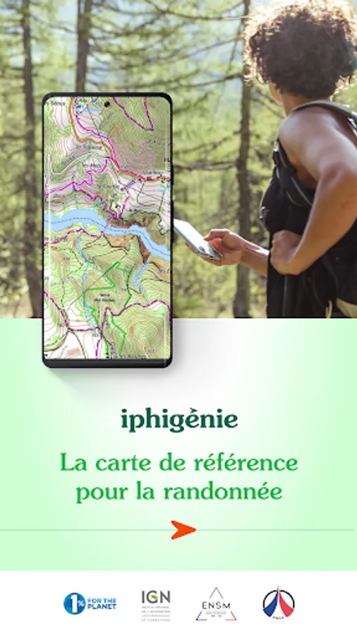
Iphigénie - offline maps
Iphigénie
3.2 ★
8K ratings
1,000,000+
downloads
Free
+ in-app
In this offline maps app, users can download and access detailed topographic maps, create and record routes, and geolocate in real time. Includes map downloads, track management, and GPS tracking features.
AppRecs review analysis
AppRecs rating 3.0. Trustworthiness 66 out of 100. Review manipulation risk 28 out of 100. Based on a review sample analyzed.
★★★☆☆
3.0
AppRecs Rating
Ratings breakdown
5 star
38%
4 star
19%
3 star
4%
2 star
4%
1 star
35%
What to know
✓
Low review manipulation risk
28% review manipulation risk
⚠
Pricing complaints
Many low ratings mention paywalls or pricing
⚠
High negative review ratio
38% of sampled ratings are 1–2 stars
About Iphigénie - offline maps
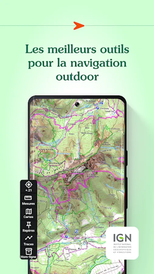
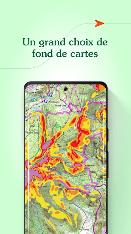
Find more than 40 detailed topographic basemaps (including IGN maps, SwissTopo, IGN Spain, OpenTopo, OpenSnow, land registry, slope inclination), even while offline.
BEFORE YOUR OUTING
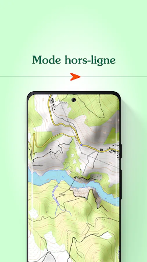
- Prepare your outing by downloading maps to access them offline
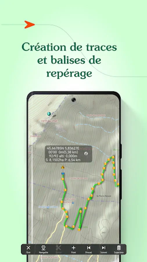
- Create, edit and import tracks
- Create and import markers (e.g. mushroom spots, departure points of routes, etc.)
- Print sections of the map if you need to
- Search for a specific location by name or by GPS details
- Access routes or landmarks from IGNRando or Data-Avalanche
- Access a 3D view and slope inclinations
DURING YOUR OUTING
- Geolocate yourself on the basemap of your choice
- Follow routes using GPS, without worrying about network availability
- Record your track
- Access real-time information such as distance traveled, elevation (±), average speed, current speed, estimated time of arrival, etc.
- Activate the beacon function to allow your loved ones to follow your progress in real-time
- Create specific voice alerts to guide you, even with your iPhone in your pocket
AFTER YOUR OUTING
- Create groups of tracks/landmarks
- Store and backup all your data in the Cloud
- Export your GPS tracks and landmarks in GPX format
- Share your outings and landmarks with all your friends
Download the free basic app
Download the basic application for free on your smartphone. This version allows you to be geolocated on one of the 25 free base maps such as Open Topo Map, Open Cycle Map, Open Snow map. The world is within reach!
You will also have access to real-time information such as your position/course/altitude/speed.
Use the complete app with the “Iphigénie Carto” subscription
The Iphigénie Carto subscription is €24.99 per year. It gives you access to 40 base maps including those of IGN. These maps can be downloaded on your device (iPhone, iPad, iPod, Watch) so that you can access them even without a network.
You also have access to the full potential of Iphigénie by finding all the features mentioned above.
Good to know: you have 7 days to test the complete app for free.
Use the high quality Italian map with the ‘Maps of the Italian Alps’ subscription
You can buy Fraternali's 1:25,000 Italian topographic maps for €24.99 a year. This subscription gives you access to accurate, information-packed digital maps covering the western Italian Alps.
List of available maps:
- IGN France
- SwissTopo
- Fraternali
- IGN Spain
- IGN Belgium
- BKG Germany
- Kartverket Norway
- Cartographic Institute of Catalunya
- OpenTopo
- OpenCycle
- OpenSnow
- ICAO
- ESRI
- Satellite view
- Cadastre
- Slope inclination
- Restricted areas for drones
- Historical maps of France
- Geological and mining maps (France)
- National Forestry Office
We donate 1% of our turnover to 1% for the Planet to help preserve the environment.
MADE IN FRANCE
Iphigénie - offline maps Screenshots
Tap to Rate:
Reviews for Iphigénie - offline maps
0q3i
12/6/2025
nice just don't make me pay
Clément DUPRÉ
11/18/2025
Pas dingue, les niveaux de zoom ne sont pas du tout adaptés à la vue mobile. Il faut imaginer qu'on regade une carte papier avec une fenêtre de la taille d'un écran... inutilisable pour a peu près tous les usages qu'on imagine en randonnée. Frustrant car par contre il y a bien tous les détails comme sur les cartes papier scan25, mais le moindre dézoom vous enverra sur une carte basique où tout détail disparaît rendant la planification et l'utilisation sur le terrain complètement inefficace.