With this survey app, you can input measurements, draw cave walls, and automate centerline creation. Includes graphical editing tools, data management options, and export formats.
AppRecs review analysis
AppRecs rating 4.4. Trustworthiness 0 out of 100. Review manipulation risk 0 out of 100. Based on a review sample analyzed.
★★★★☆
4.4
AppRecs Rating
Ratings breakdown
5 star
75%
4 star
13%
3 star
0%
2 star
0%
1 star
13%
What to know
✓
High user satisfaction
88% of sampled ratings are 4+ stars (4.4★ average)
✓
Authentic reviews
No red flags detected
About Abris
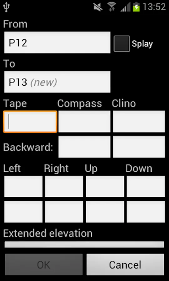
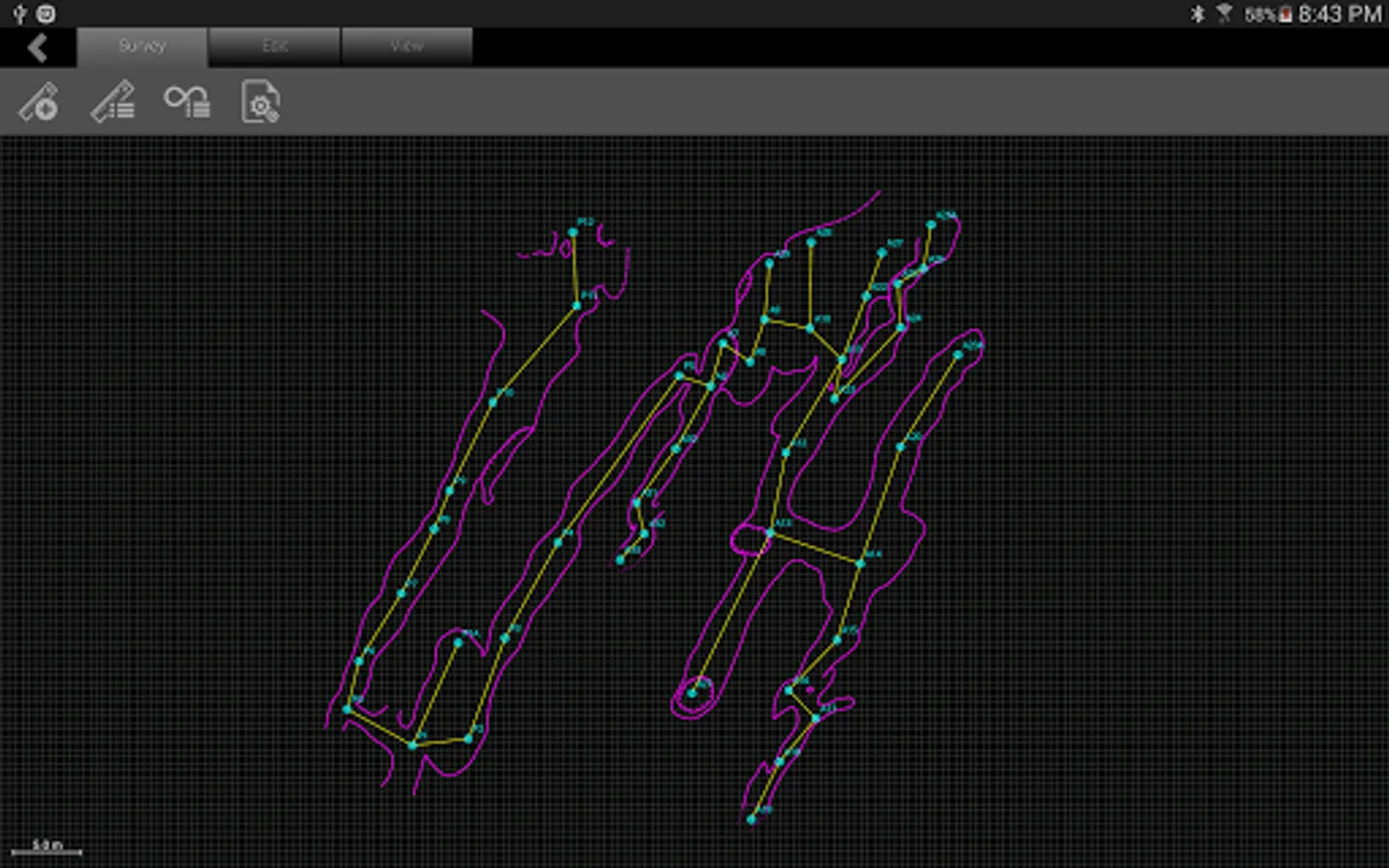
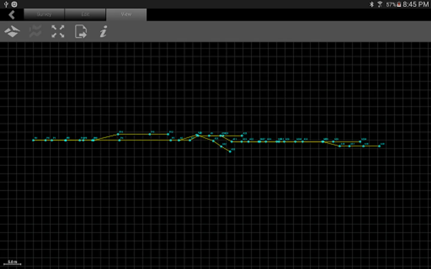
Abris is aimed to make process of surveying faster and easier. Graphical editor was implemented in the app to make the drawing and editing of complex cave walls simple. The centerline is drawn automatically after each shot is added.
User interface was designed having in mind specifics of the work in caves. It demands minimum actions to add measurement and is easy on eyes.
Abris features:
- Drawing of centerline
- Graphical editor for drawing of lines and cave elements
- Entering of forward and backward shots
- Entering of information about survey
- Auto-hints of station names
- Closure error calculations and loop defining
- Statistical data
- Export/import of survey for transfer between devices
- Export of survey to vector (.svg), raster (.png) and csv formats
We continue development of the app. Following is the list of some planned features:
- Export to popular desktop applications for cave mapping
- DistoX support
- Walls guidelines based on LRUD data
- Cross-sections support
- Map symbols and labels
- Additional line types
- Attaching photos
Abris Screenshots


Tap to Rate: