AppRecs review analysis
AppRecs rating 2.4. Trustworthiness 76 out of 100. Review manipulation risk 32 out of 100. Based on a review sample analyzed.
★★☆☆☆
2.4
AppRecs Rating
Ratings breakdown
5 star
22%
4 star
0%
3 star
33%
2 star
0%
1 star
44%
What to know
✓
Credible reviews
76% trustworthiness score from analyzed reviews
⚠
Mixed user feedback
Average 2.6★ rating suggests room for improvement
About Ontario Roads
***Please note: This app doesn’t represent a government entity.***
Live traffic reports and cameras for Ontario including Toronto and Ottowa.
- 362 traffic cameras covering Ontario.
- 191 traffic cameras covering Toronto.
- Reports of traffic incidents affecting travel (accidents, construction, maintenance etc.)
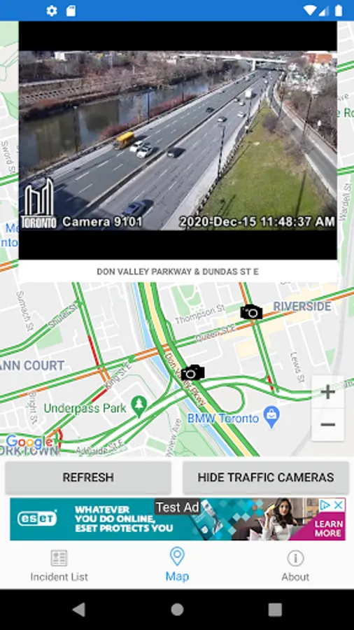
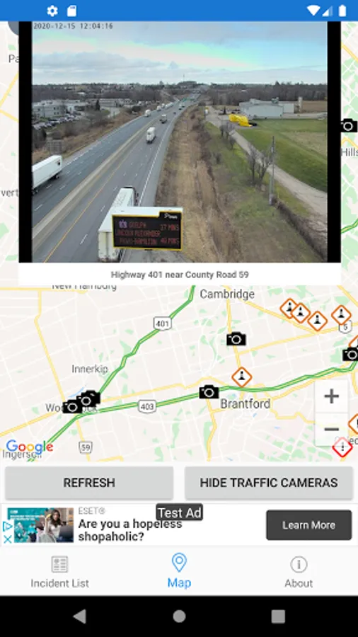
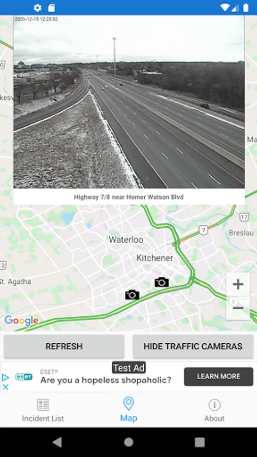
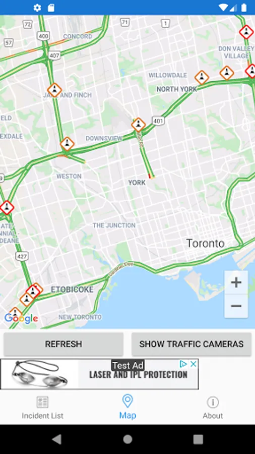
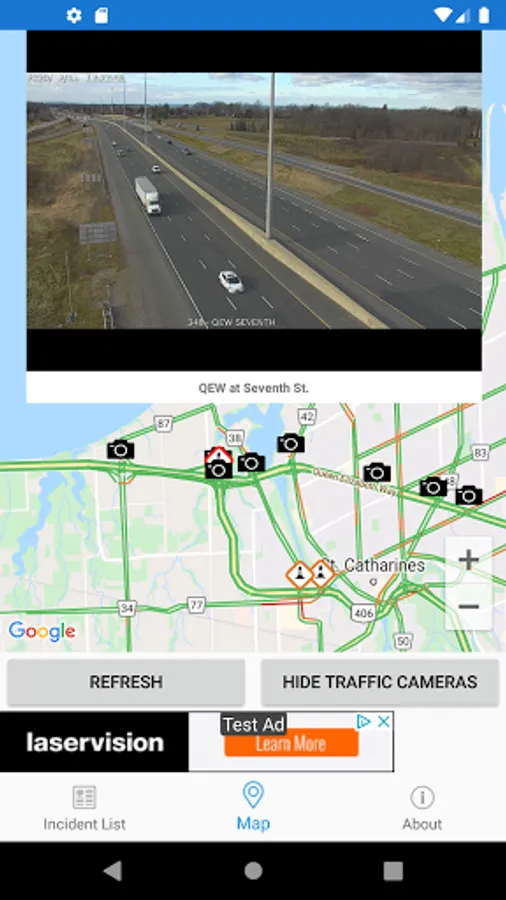
MAP VIEW
- Shows current incidents and traffic cams
- Each incident is color coded as well as being represented by an icon showing the incident type.
- Clicking on an incident displays more detail right there on the map.
- The map view can also show current traffic camera images.
- Toggle show/hide the cameras on the map.
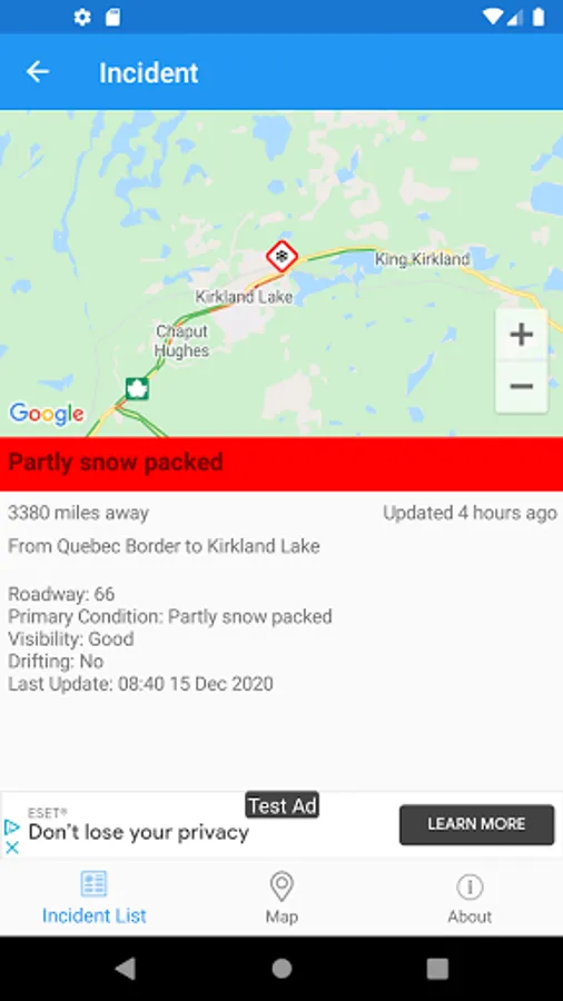
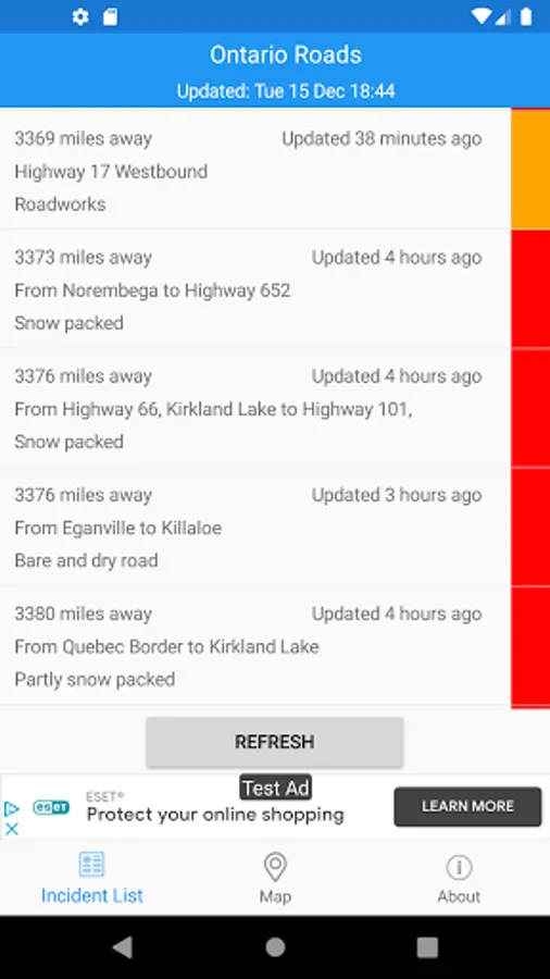
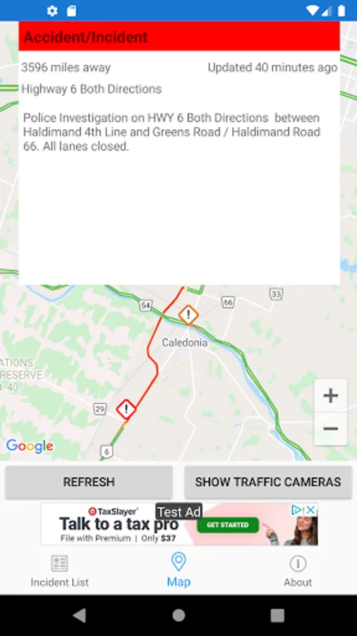
LIST VIEW
- Shows current incidents in order of distance from your current location (closest incidents are shown first).
- Each incident is color-coded to indicate the severity of the delay.
- You can quickly see the distance the incident is from you, the road name and the type of incident.
- The detail view shows the description together with a map showing the location.
IMPORTANT NOTICE
Disclaimer: This app is not affiliated with The Ontario Ministry of Transportation.
It is NOT an official Ontario Ministry of Transportation app.
Live traffic reports and cameras for Ontario including Toronto and Ottowa.
- 362 traffic cameras covering Ontario.
- 191 traffic cameras covering Toronto.
- Reports of traffic incidents affecting travel (accidents, construction, maintenance etc.)
MAP VIEW
- Shows current incidents and traffic cams
- Each incident is color coded as well as being represented by an icon showing the incident type.
- Clicking on an incident displays more detail right there on the map.
- The map view can also show current traffic camera images.
- Toggle show/hide the cameras on the map.
LIST VIEW
- Shows current incidents in order of distance from your current location (closest incidents are shown first).
- Each incident is color-coded to indicate the severity of the delay.
- You can quickly see the distance the incident is from you, the road name and the type of incident.
- The detail view shows the description together with a map showing the location.
IMPORTANT NOTICE
Disclaimer: This app is not affiliated with The Ontario Ministry of Transportation.
It is NOT an official Ontario Ministry of Transportation app.