Pennsylvania Traffic & Cameras
Coderun Technologies Ltd
3.3 ★
store rating
1,000+
downloads
Free
In this traffic app, you can view real-time incident reports and access live camera images across Pennsylvania. Includes live traffic data, camera feeds, and incident details.
AppRecs review analysis
AppRecs rating 3.3. Trustworthiness 65 out of 100. Review manipulation risk 18 out of 100. Based on a review sample analyzed.
★★★☆☆
3.3
AppRecs Rating
Ratings breakdown
5 star
33%
4 star
25%
3 star
0%
2 star
25%
1 star
17%
What to know
✓
Low review manipulation risk
18% review manipulation risk
About Pennsylvania Traffic & Cameras
Please note: This app doesn’t represent a government entity.
Live traffic reports and cameras for Pennsylvania State:
- Real time data from Pennsylvania State Department of Transportation (PennDOT).
- 770+ Traffic cameras covering Pennsylvania State.
- Reports of traffic incidents affecting travel (accidents, roadworks, maintenance, weather conditions, snow etc.)
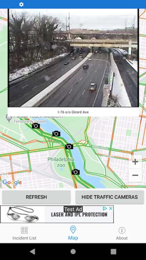
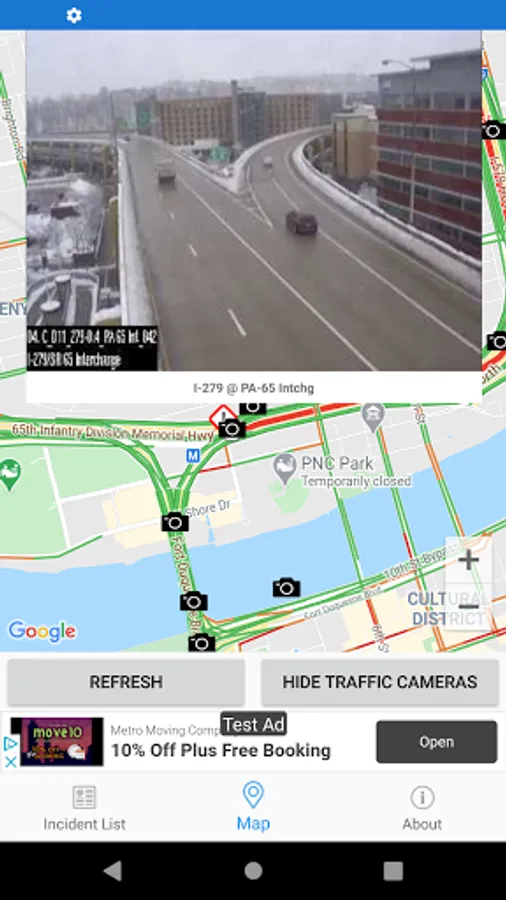
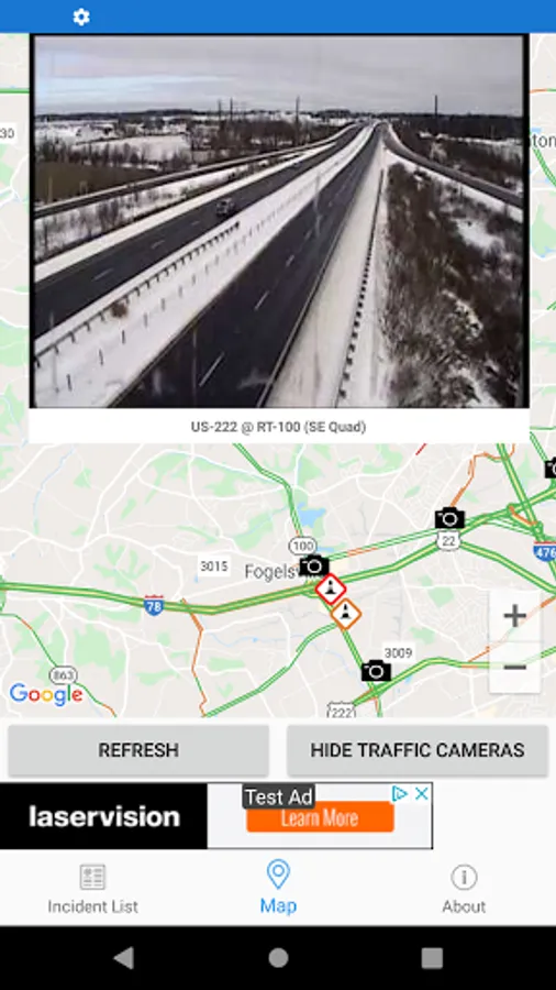
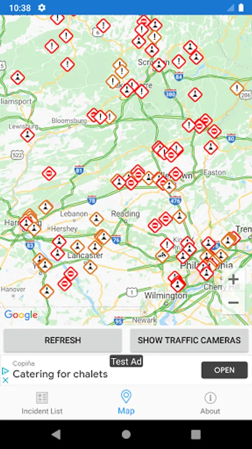
MAP VIEW
- Shows current incidents and traffic cams.
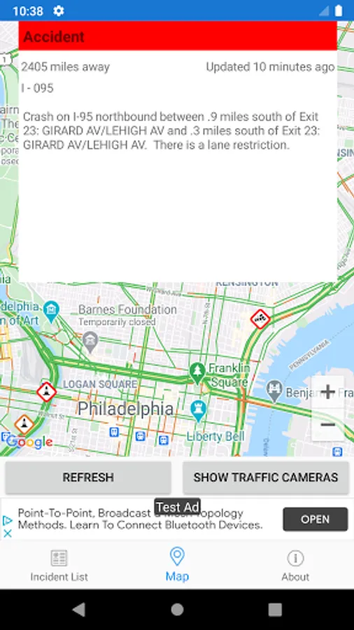
- Each incident is color coded as well as being represented by an icon showing the incident type.
- Clicking on an incident displays more detail right there on the map.
- The map view can also show Texas traffic camera images.
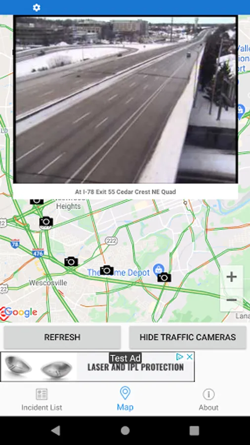
TRAFFIC CAMS
- Touch a camera icon on the map to view the most recent camera image.
- Toggle show/hide the cameras on the map.
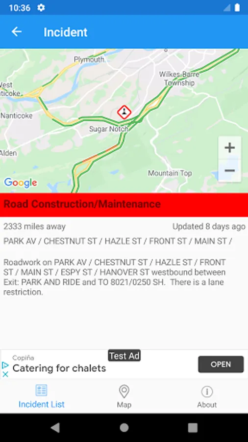
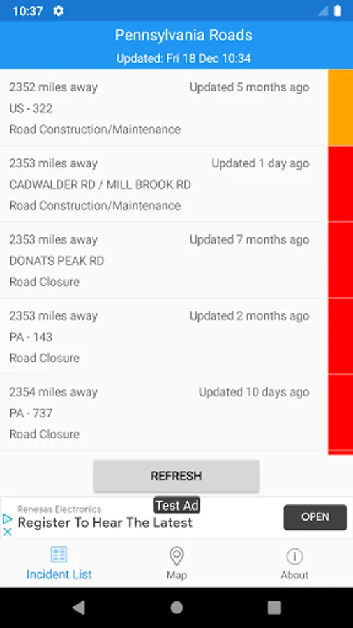
LIST VIEW
- Shows current incidents in order of distance from your current location (closest incidents are shown first).
- Each incident is color-coded to indicate the severity of the delay.
- You can quickly see the distance the incident is from you, the road name and the type of incident.
- The detail view shows the description together with a map showing the location.
Pennsylvania Traffic Data and Pennsylvania Traffic Cameras courtesy of the Pennsylvania Department of Transportation (PennDOT) PA511 system.
IMPORTANT NOTICE
Disclaimer: This app is NOT affiliated with the Pennsylvania Department of Transportation.
It is not an official Pennsylvania DOT app.
Live traffic reports and cameras for Pennsylvania State:
- Real time data from Pennsylvania State Department of Transportation (PennDOT).
- 770+ Traffic cameras covering Pennsylvania State.
- Reports of traffic incidents affecting travel (accidents, roadworks, maintenance, weather conditions, snow etc.)
MAP VIEW
- Shows current incidents and traffic cams.
- Each incident is color coded as well as being represented by an icon showing the incident type.
- Clicking on an incident displays more detail right there on the map.
- The map view can also show Texas traffic camera images.
TRAFFIC CAMS
- Touch a camera icon on the map to view the most recent camera image.
- Toggle show/hide the cameras on the map.
LIST VIEW
- Shows current incidents in order of distance from your current location (closest incidents are shown first).
- Each incident is color-coded to indicate the severity of the delay.
- You can quickly see the distance the incident is from you, the road name and the type of incident.
- The detail view shows the description together with a map showing the location.
Pennsylvania Traffic Data and Pennsylvania Traffic Cameras courtesy of the Pennsylvania Department of Transportation (PennDOT) PA511 system.
IMPORTANT NOTICE
Disclaimer: This app is NOT affiliated with the Pennsylvania Department of Transportation.
It is not an official Pennsylvania DOT app.