With this fleet management app, you can monitor vehicle locations, send remote commands, and view detailed reports. Includes real-time unit control, track visualization, and geofence management features.
AppRecs review analysis
AppRecs rating 4.5. Trustworthiness 51 out of 100. Review manipulation risk 42 out of 100. Based on a review sample analyzed.
★★★★☆
4.5
AppRecs Rating
Ratings breakdown
5 star
90%
4 star
7%
3 star
4%
2 star
0%
1 star
0%
What to know
✓
Authentic reviews
No red flags detected
⚠
Questionable review patterns
42% review manipulation risk - some review patterns appear unusual
⚠
Rating authenticity concerns
High rating concentration (90% 5-star) in sampled ratings
About Wialon Local
With the Wialon app, you can maintain access to the Wialon fleet management platform anytime and anywhere. The core features include:
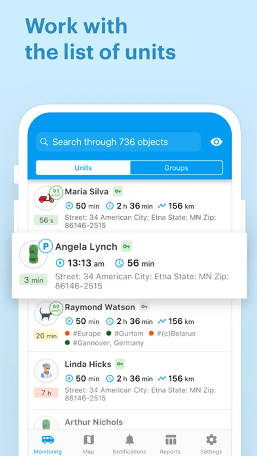
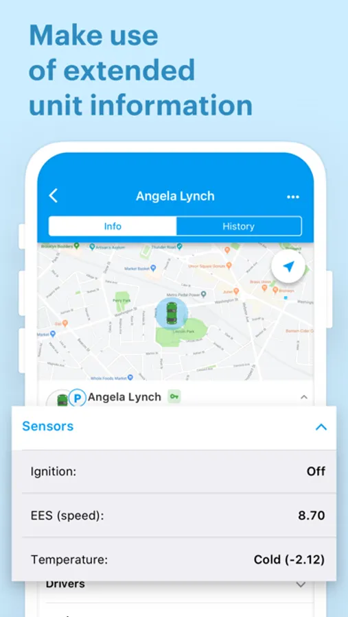
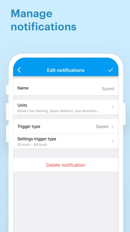
- Unit list control. Monitor movement and ignition state, unit location, and other fleet data in real time.
- Commands. Send commands, such as messages, routes, configuration and photo requests for remote unit control.
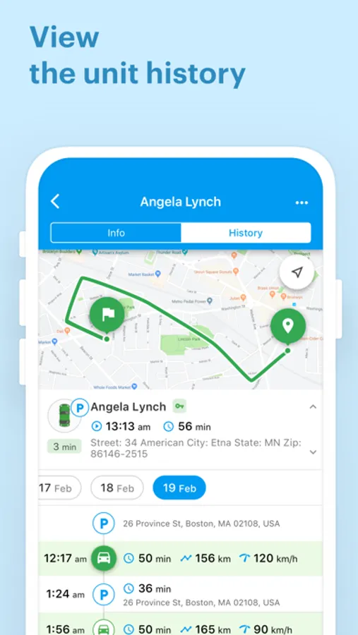
- Tracks. Build tracks of vehicle movements, displaying speed, fuel fillings, drains, and other data over a specified period, visualized on the map.
- Geofences. Switch on/off the display of the unit location inside a geofence instead of address information.
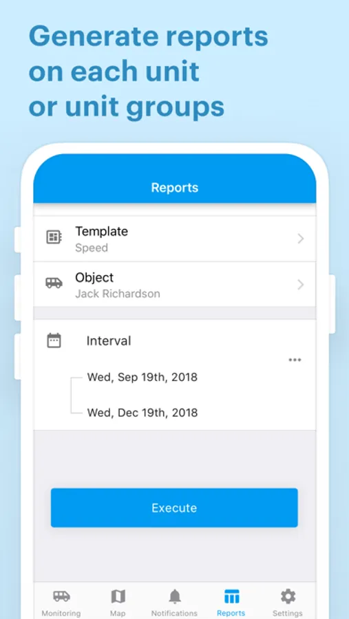
- Informative reports. Use detailed data on trips, stops, fuel drains and fillings for instant decision-making.
- History. Control unit events (movement, stops, fuel fillings, fuel drains) in chronological order and display them on the map.
- Map mode. Access units, geofences, tracks, and event markers on the map, with the option to detect your own location.
The multilingual mobile application, available for smartphones and tablets, allows users to experience the power of Wialon on the go.
- Unit list control. Monitor movement and ignition state, unit location, and other fleet data in real time.
- Commands. Send commands, such as messages, routes, configuration and photo requests for remote unit control.
- Tracks. Build tracks of vehicle movements, displaying speed, fuel fillings, drains, and other data over a specified period, visualized on the map.
- Geofences. Switch on/off the display of the unit location inside a geofence instead of address information.
- Informative reports. Use detailed data on trips, stops, fuel drains and fillings for instant decision-making.
- History. Control unit events (movement, stops, fuel fillings, fuel drains) in chronological order and display them on the map.
- Map mode. Access units, geofences, tracks, and event markers on the map, with the option to detect your own location.
The multilingual mobile application, available for smartphones and tablets, allows users to experience the power of Wialon on the go.
Wialon Local Screenshots
Tap to Rate:
Reviews for Wialon Local
Asvinji
A
Can you guys make the motion of the cars moving not slow or make it clear
14883228
123
Пойдет