AppRecs review analysis
AppRecs rating 4.8. Trustworthiness 0 out of 100. Review manipulation risk 0 out of 100. Based on a review sample analyzed.
★★★★☆
4.8
AppRecs Rating
Ratings breakdown
5 star
91%
4 star
2%
3 star
2%
2 star
2%
1 star
2%
What to know
✓
High user satisfaction
91% of sampled ratings are 5 stars
About Peakbagger
* Search the huge database of mountains and trip reports from Peakbagger.com and ListsOfJohn.com
* Keep track of your climbs, even when offline
* Measure your progress against hundreds of peak lists
* Get route information and directions from SummitPost and ListsofJohn.com
* Find peaks near your current location, or near other peaks
* Filter peaks by prominence, or climbed vs. unclimbed, or inclusion on a peak list
* See what other peaks are often climbed together with your target peak
* Create custom peak lists and order them by your personal priorities
* See weather forecasts for all U.S. peaks from the National Weather Service, and for 11,000+ major peaks worldwide from mountain-forecast.com
* See topographic maps for anywhere in the world (+/- 60 degrees latitude)
* See protected land area coverage in North America, Europe, Japan, and Australia and New Zealand
* US Forest Service maps
* Save a peak to your device for offline use, including topographic maps
* Download topographic maps along a route for offline use
* Import and display GPS tracks and waypoints instantly
* On-screen compass keeps you oriented along your track
* Long click on the map to get Street View, elevation, and driving directions
* Record your starting elevation, distance, and information about the gear and route you used
* Leaderboards show the top climbers for each peak list
* See peaks your Peakbagger buddies have climbed recently
* Update your buddy list from right in the app
* Automatically upload your ascents to ListsOfJohn (U.S. peaks)
* Show daily satellite imagery for any location on any day since 2011
* Display elevation profile for a GPS track, and show your current location along the profile
* See sunrise and sunset times at a peak, even when offline
* Daily forest fire coverage, and historical coverage for the last 20 years (U.S.)
* Constantly updated weather radar and smoke layers on the map
* Record GPS tracks, including timestamps, and add them to your ascents
* Record waypoints along your route
* Organize your tracks in folders
* Create and edit tracks right in the app
* Automatically find survey benchmarks near peaks (U.S.)
* Hunt benchmarks and get your finds recorded in the official government benchmark data sheets
HOW TO IMPORT GPS TRACKS - 2 OPTIONS
1) Click on the "Load GPS track" link on the ascent details page for an ascent that has a GPS track.
2) Click on a GPX, KML, KMZ or FIT file on your phone, for example, in an email attachment or on Google Drive
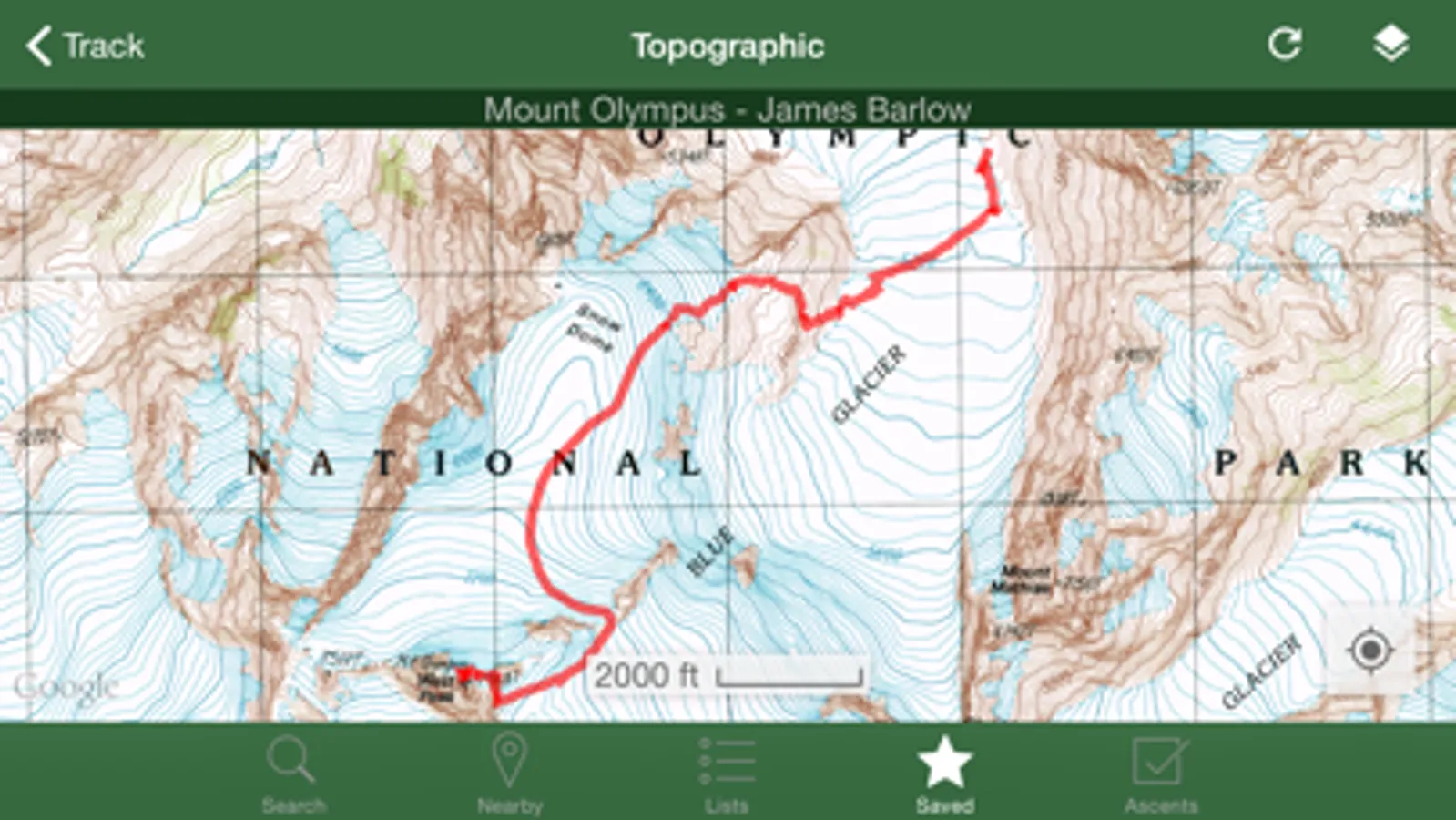
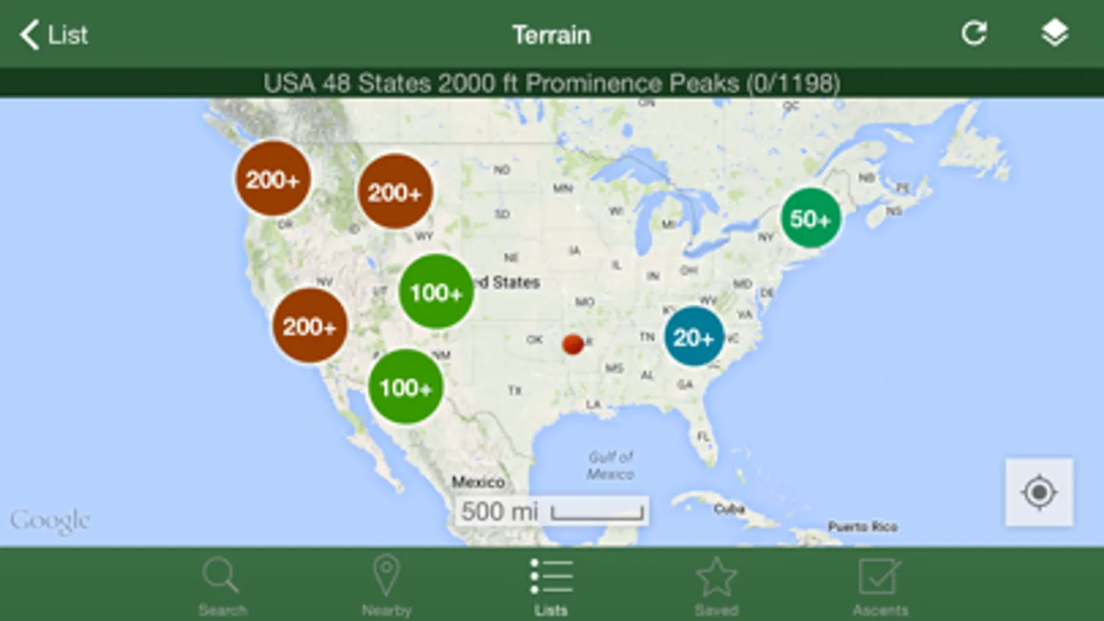
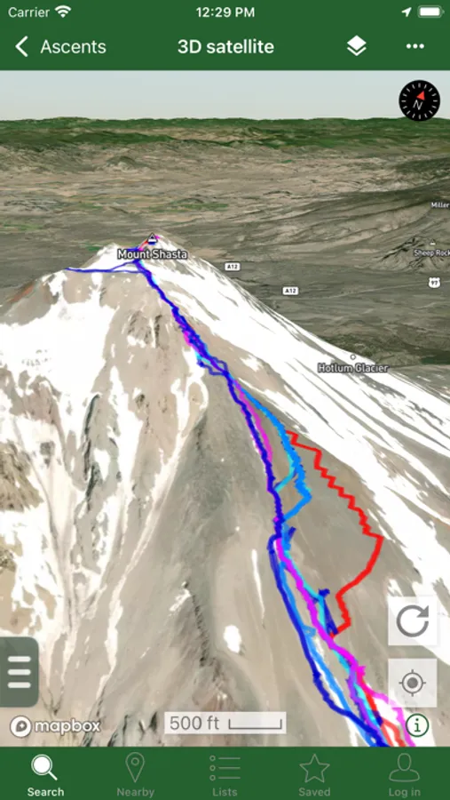
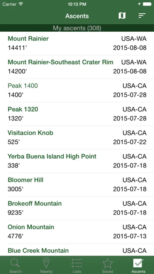
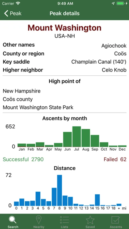
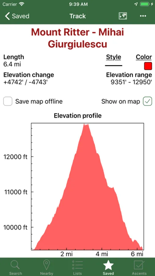
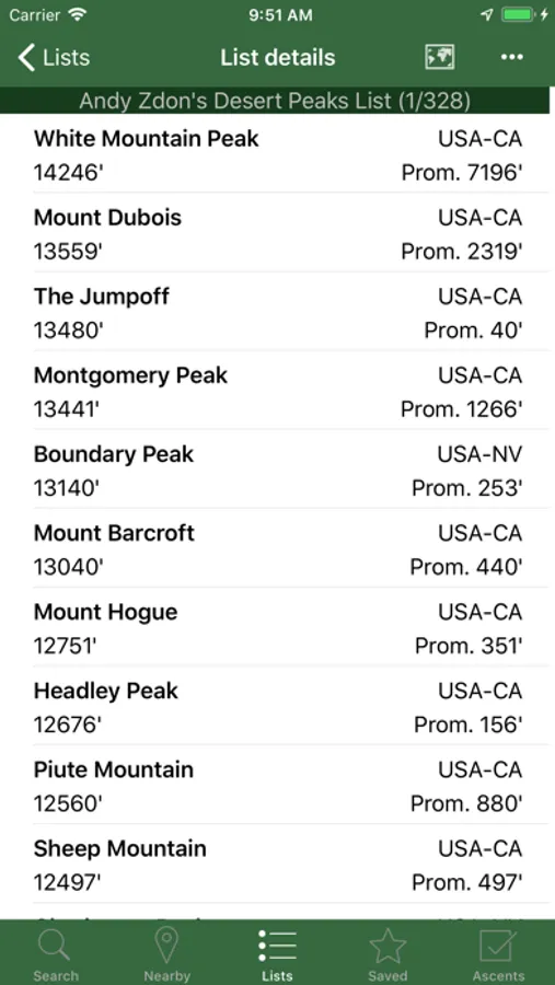
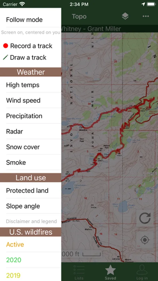
Peakbagger Screenshots
Tap to Rate:
Reviews for Peakbagger
EmilyWanerka
Helpful App but not intuitive
The app is useful for tracking ascents and serves its basic purpose well; however, its design leaves much to be desired. The layout feels cluttered and visually unappealing, making it less enjoyable to use. The layout isn’t intuitive, and it’s missing key metrics, such as total time, that would make it far more functional and comprehensive. In general the interface could be updated
GMgirl
Update..
I just added this app to see how it works and if I would be interested. Its not for me however it will not let me delete my account. Once you sign up and give your personal info you will not be able to delete and there isn't a contact that works. It will only allow to hide your info....UPDATE... They had a problem with their server all is good. They deleted my account no problem.