AppRecs review analysis
AppRecs rating 3.6. Trustworthiness 83 out of 100. Review manipulation risk 23 out of 100. Based on a review sample analyzed.
★★★☆☆
3.6
AppRecs Rating
Ratings breakdown
5 star
46%
4 star
15%
3 star
8%
2 star
10%
1 star
21%
What to know
✓
Low review manipulation risk
23% review manipulation risk
✓
Credible reviews
83% trustworthiness score from analyzed reviews
✓
Good user ratings
62% positive sampled reviews
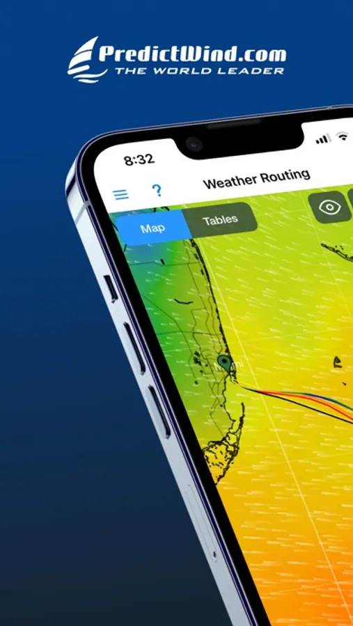
About PredictWind Offshore Weather
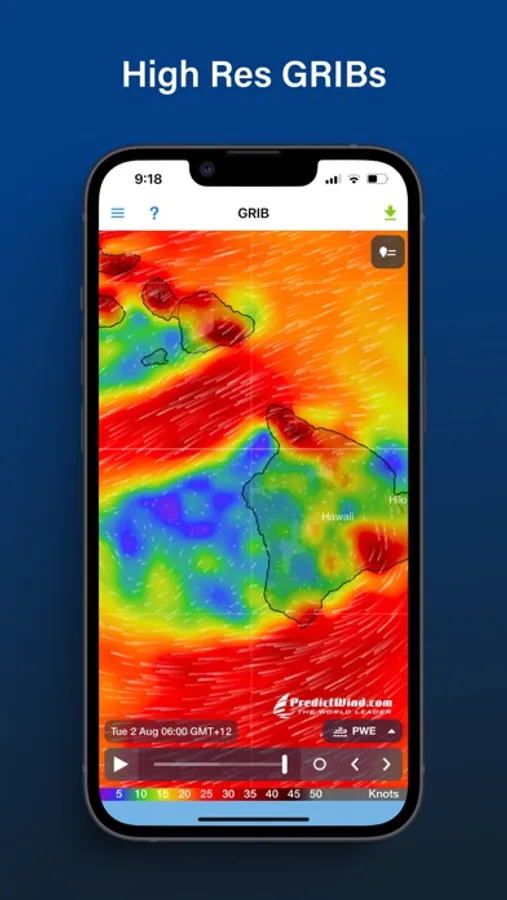
Quickly download and view GRIB files, weather routes, GMDSS maps and text forecasts, AIS data and satellite imagery.
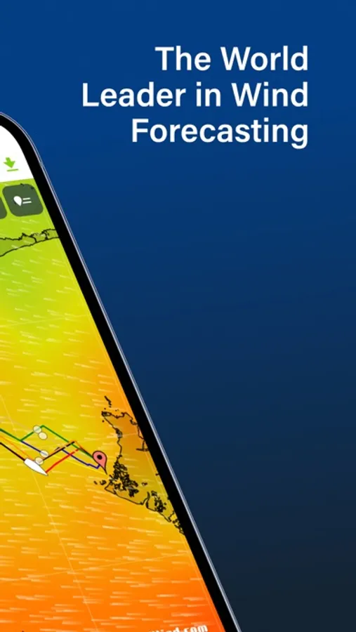
Access all the world’s top ranking forecast models for reliable and accurate weather data, including ECMWF, SPIRE, UKMO, GFS and more. Our very own PWG & PWE models offer incredible accuracy and a record-breaking 1km resolution.
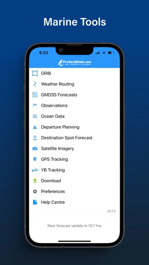
In addition to forecasts, the Offshore App also provides a suite of powerful marine tools to save you time and keep you safe at sea.
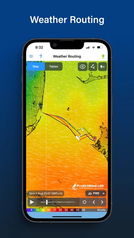
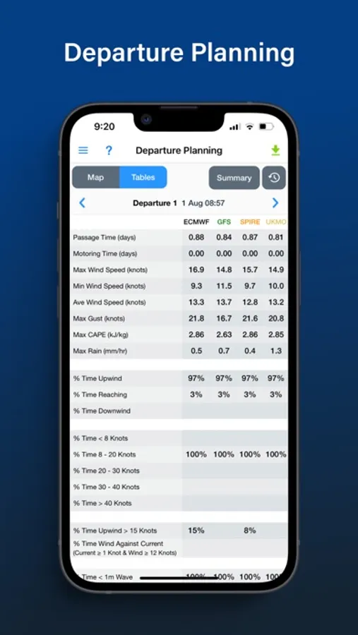
Weather Routing and Departure Planning is calculated in the PredictWind cloud at the highest resolution. The finished route is then sent back to your boat in an incredibly small file size which is ideal for low bandwidth satellite and SSB connections.
The Offshore App works with Wi-Fi, mobile networks, and most satellite connections using an Iridium GO!, Globalstar or Optimizer device.
ADDITIONAL FEATURES
GRIB file viewer: High resolution forecasts maps with animated streamlines, wind barbs or arrows.
Tables: The ultimate dashboard for detailed analysis.
Graphs: Compare multiple parameters at the same time.
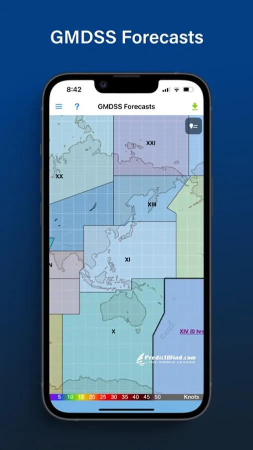
GMDSS Forecasts: View either in the traditional text format or on a map.
Destination Spot Forecast: Know exactly what the weather is doing at your destination.
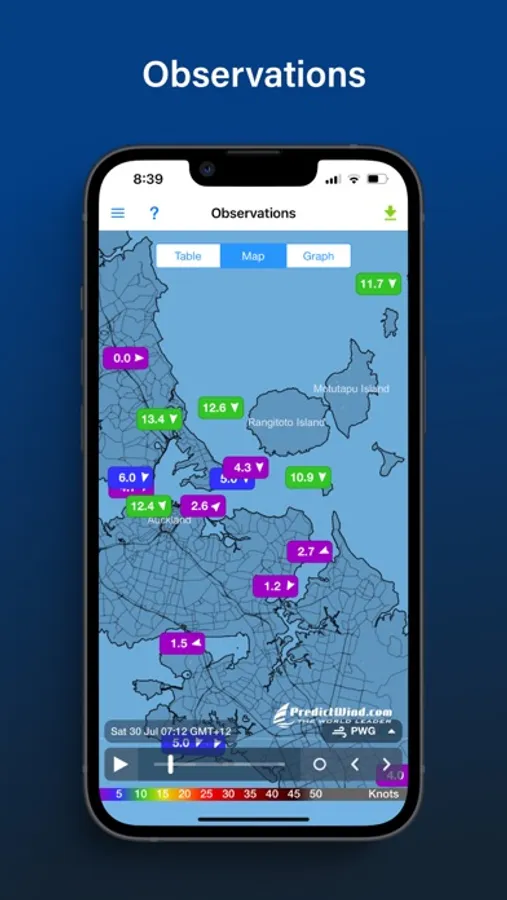
Live Observations: Know what’s happening right now out on the water.
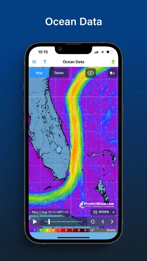
Ocean Data: See what’s happening under the waves with ocean and tidal currents, and sea temperature.
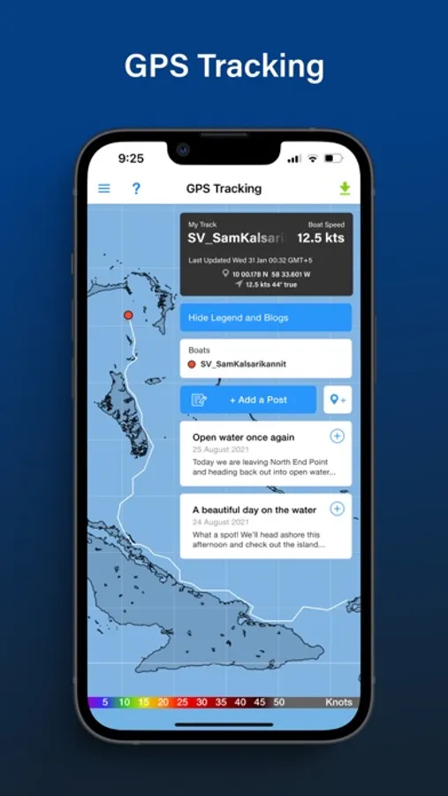
GPS Tracking: Get a free customised GPS tracking page for your blog or website.
AIS Data: View over 280,000 vessels worldwide on the AIS network.
PredictWind Offshore Weather Screenshots
Tap to Rate:
Reviews for PredictWind Offshore Weather
RobertKWFL
Not worthy of PredictWind
PrefictWind’s service, at its core, is great, but their apps are not. (Why do we need separate apps for current, rain, and offshore use anyway???) The offshore app is the worst of them all. It’s only needed for those who are offshore without Starlink. PredictWind apparently thinks, not entirely unreasonably, that adoption of satellite broadband is becoming so widespread that an app for Iridium users just isn’t needed. They seem to have given up on improving this clunky, buggy, incredibly user-unfriendly app. Beware though: if you’re still relying on iridium offshore, even as a backup, you’ll need this app and you’ll be disappointed. Biggest gripe: If you need to make manual additions to your GPS tracking page for any reason, the only way to do it is with this app. The process is painful and buggy.
TG797879074
Company dedicated to failure
PredictWind keeps making promises but they cause more problems than they can fix. Even their support bot is broken so I couldn’t get past entering my email address. The warning messages are completely covered up by the date on iPhone so the app is useless. Just like everything else they have done, broken by design and unlikely to be fixed anytime soon.