About SmartDirt
SmartDirt uses your AGTEK takeoff to display the geo-referenced 3D model, data lines, and plansheets on your iPhone or iPad.
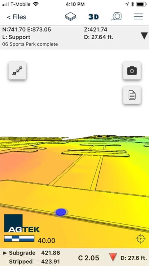
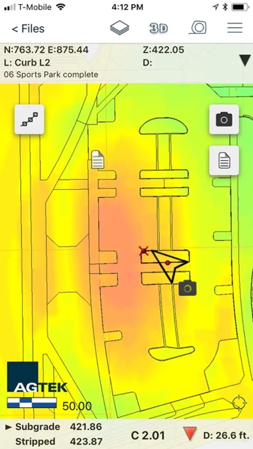
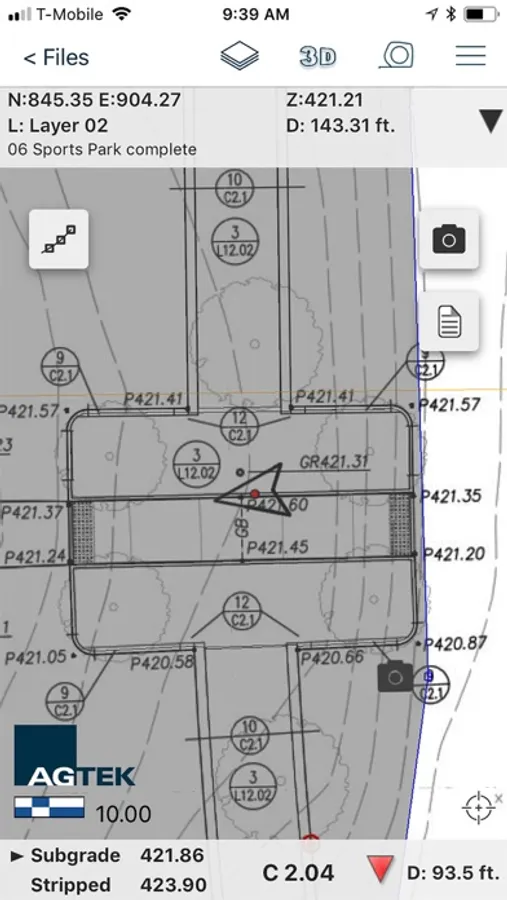
Show Cut-Fill as you walk on the interactive grid map or switch to the plans as needed.
Select points to see elevations, coordinates, station & offset, point labels and approximate distance from your location.
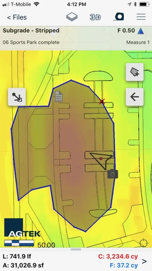
Measure slope or distance with a tap or estimate earthwork quantities with the measure tool.
Take pictures, create notes, or create tracks that can be read by Sitework 4D or Google Earth.
Show Cut-Fill as you walk on the interactive grid map or switch to the plans as needed.
Select points to see elevations, coordinates, station & offset, point labels and approximate distance from your location.
Measure slope or distance with a tap or estimate earthwork quantities with the measure tool.
Take pictures, create notes, or create tracks that can be read by Sitework 4D or Google Earth.
SmartDirt Screenshots
Tap to Rate: