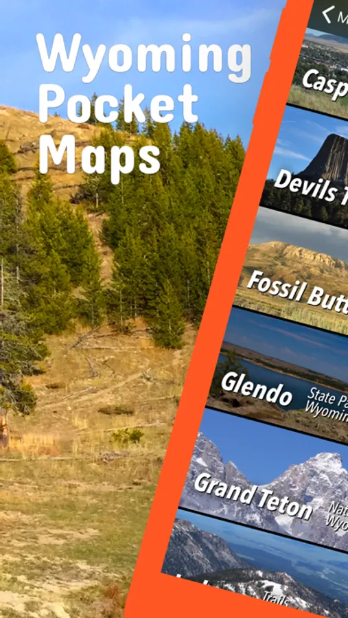
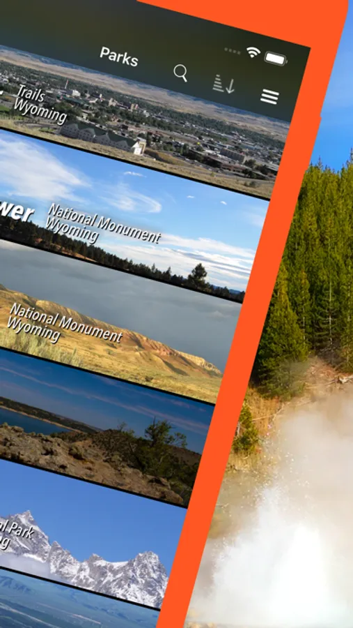
In this Wyoming Pocket Maps app, you can download and view detailed maps, guides, and trails for outdoor planning. Includes offline map sections, park information, weather updates, and sharing options.
AppRecs review analysis
AppRecs rating 4.7. Trustworthiness 65 out of 100. Review manipulation risk 20 out of 100. Based on a review sample analyzed.
★★★★☆
4.7
AppRecs Rating
Ratings breakdown
5 star
79%
4 star
13%
3 star
5%
2 star
0%
1 star
3%
What to know
✓
Low review manipulation risk
20% review manipulation risk
✓
High user satisfaction
79% of sampled ratings are 5 stars
✓
Authentic reviews
Natural distribution, no red flags
About Wyoming Pocket Maps
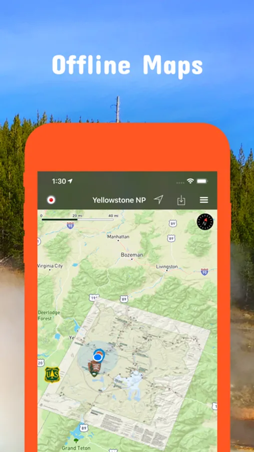
Be prepared! Plan your next trip to one of the great Wyoming parks. Download maps and guides before you venture into the Wi-Fi free wilderness.
Discover
- 70+ national parks, state parks, monuments, forests
- 140+ neatly folded maps by the National Park Service, Bureau of Land Management, United States Forest Services, and other agencies.
- Motor Vehicle Use Maps (MVUM), Motor Vehicle Travel Maps (MVTM) and visitor maps for national forests.
- 1,600+ campgrounds and campsites
- 2,600+ trails and trailheads
- 36.000+ points of interests
Plan
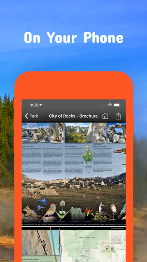
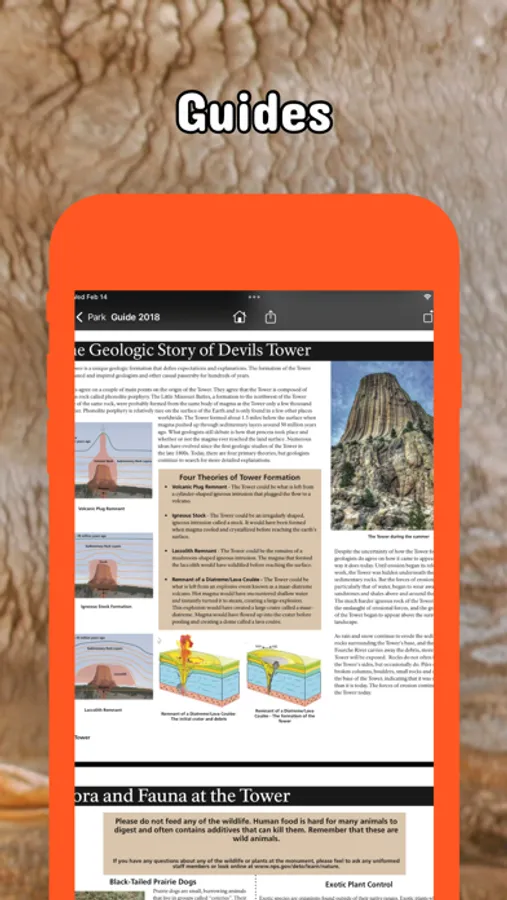
- Download maps, park brochures, and newspapers. These downloads are ready when you are offline and off the grid in the great outdoors.
- Download arbitrary map sections as offline packs.
- Photo galleries, panorama views.
- Share links to parks and maps with friends
Have fun
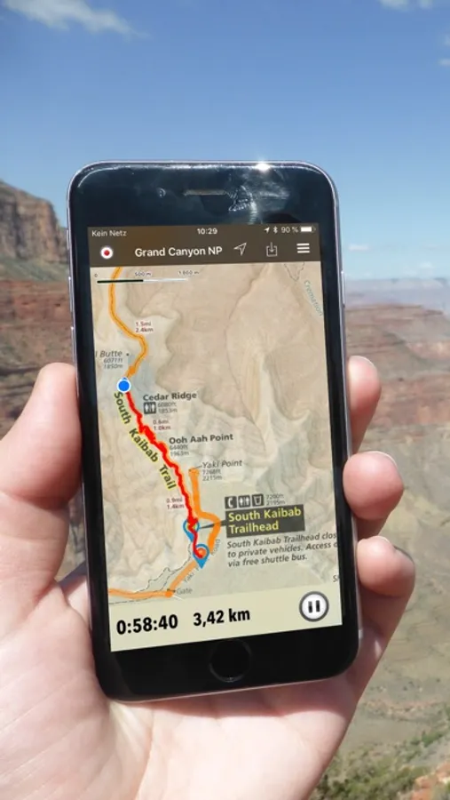
- GPS and GPX support: record your hikes, import GPX routes, tracks and waypoints for your hiking trails.
- Detailed national park information: alerts, news, visitor centers, campgrounds, driving directions, weather.
- Open your favorite maps app to get a route to the selected park.
- Current weather conditions, easy access to multi-day forecasts, sunrise and sunset times.
- Push notifications for park alerts, park news, weather warnings
So download maps and guides for:
Amsden Creek
Bear River
Beartooth
Bighorn
Bighorn Canyon
Black Hills
Boysen
Bridger-Teton
Bud Love
Buffalo Bill
Camp Creek
Casper Mountain
Chain Lakes
Cody
Continental Divide
Cottonwood Draw
Devils Tower
Fort Laramie
Fossil Butte
Glendo
Grand Teton
Guersey
Hawk Springs
Hot Springs
Jackson
John D Rockefeller Jr
Keyhole
Laramie Peak
Medicine Bow
Ocean Lake
Pinedale
Pole Mountain
Red Rim-Grizzly
Renner
Seminoe
Shoshone
Sierra Madre Mountains
Sinks Canyos
Snowy Range
Soda Lake
Thunder Basin
Wyoming Range
Yellowstone
There are additional useful information and brochures for many Wyoming state parks.
Discover
- 70+ national parks, state parks, monuments, forests
- 140+ neatly folded maps by the National Park Service, Bureau of Land Management, United States Forest Services, and other agencies.
- Motor Vehicle Use Maps (MVUM), Motor Vehicle Travel Maps (MVTM) and visitor maps for national forests.
- 1,600+ campgrounds and campsites
- 2,600+ trails and trailheads
- 36.000+ points of interests
Plan
- Download maps, park brochures, and newspapers. These downloads are ready when you are offline and off the grid in the great outdoors.
- Download arbitrary map sections as offline packs.
- Photo galleries, panorama views.
- Share links to parks and maps with friends
Have fun
- GPS and GPX support: record your hikes, import GPX routes, tracks and waypoints for your hiking trails.
- Detailed national park information: alerts, news, visitor centers, campgrounds, driving directions, weather.
- Open your favorite maps app to get a route to the selected park.
- Current weather conditions, easy access to multi-day forecasts, sunrise and sunset times.
- Push notifications for park alerts, park news, weather warnings
So download maps and guides for:
Amsden Creek
Bear River
Beartooth
Bighorn
Bighorn Canyon
Black Hills
Boysen
Bridger-Teton
Bud Love
Buffalo Bill
Camp Creek
Casper Mountain
Chain Lakes
Cody
Continental Divide
Cottonwood Draw
Devils Tower
Fort Laramie
Fossil Butte
Glendo
Grand Teton
Guersey
Hawk Springs
Hot Springs
Jackson
John D Rockefeller Jr
Keyhole
Laramie Peak
Medicine Bow
Ocean Lake
Pinedale
Pole Mountain
Red Rim-Grizzly
Renner
Seminoe
Shoshone
Sierra Madre Mountains
Sinks Canyos
Snowy Range
Soda Lake
Thunder Basin
Wyoming Range
Yellowstone
There are additional useful information and brochures for many Wyoming state parks.
Wyoming Pocket Maps Screenshots

Tap to Rate:
Reviews for Wyoming Pocket Maps
Cinfo
Documentation
Can’t find any information on using the tracks or offline packs option. No documentation or method to contact author.