In this GPS altimeter app, you can track elevation, atmospheric pressure, and use compass and maps. Includes weather updates, SOS, flashlight, and location marking features.
AppRecs review analysis
AppRecs rating 4.0. Trustworthiness 76 out of 100. Review manipulation risk 24 out of 100. Based on a review sample analyzed.
★★★★☆
4.0
AppRecs Rating
Ratings breakdown
5 star
79%
4 star
13%
3 star
4%
2 star
1%
1 star
3%
What to know
✓
Low review manipulation risk
24% review manipulation risk
⚠
Ad complaints
Many low ratings mention excessive ads
⚠
Pricing complaints
Many low ratings mention paywalls or pricing
About My Altitude: GPS Altimeter
Download now the best Altimeter app for Hikers, Trekkers, and GlobeTrotters.
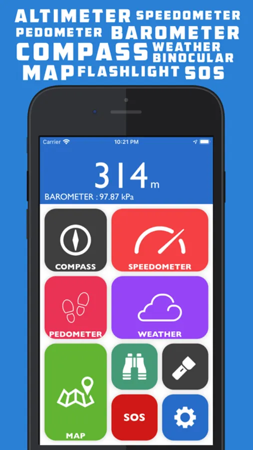
Altimeter GPS is a multipurpose app equipped with features like an altimeter, barometer, compass over your current satellite location, weather updates, pedometer, and speedometer. Use maps and binoculars for scouting and flashlight, SOS for exigencies.
Features Include :
ALTIMETER and BAROMETER: Get to know the latest elevation/altitude and atmospheric pressure around you using Altimeter and Barometer.
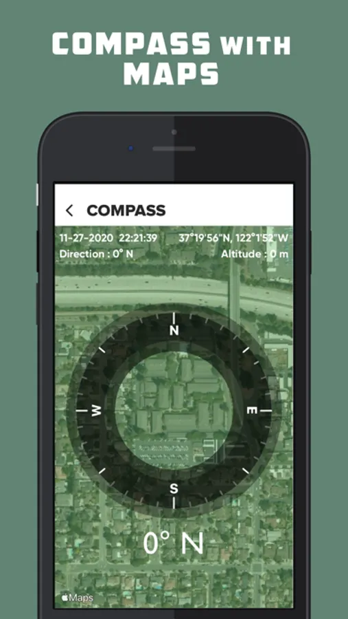
COMPASS: Compass above your satellite position always pointing according to real-time direction.
SPEEDOMETER: Speedometer to get real-time speed readings along with real-time direction and location address.
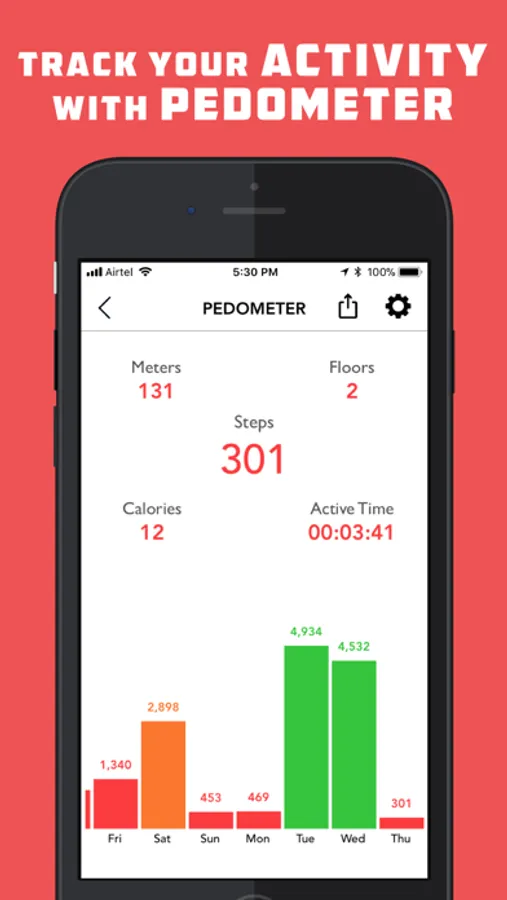
PEDOMETER / STEP COUNTER: Pedometer provides you the data about the steps taken and distance traveled in a specific time period along with Floors traversed.
WEATHER: Weather provides you the real-time weather updates based on your location. Get Current Temperature, Humidity, Sunrise/Sunset Time, Min/Max Temperature and Wind Speed.
WEATHER FORECAST: Weather Forecast provided for two weeks.
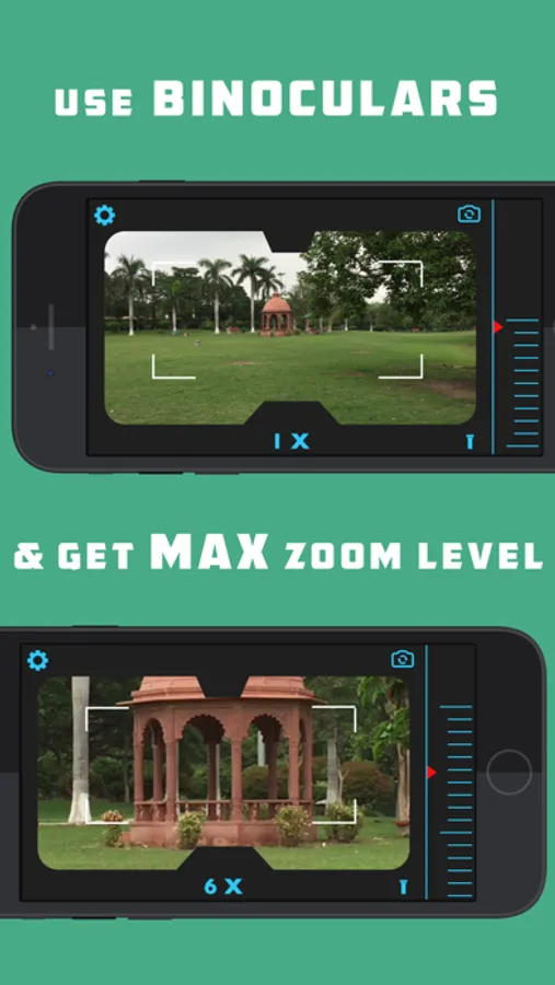
BINOCULAR: Super digital binocular app with HIGH-QUALITY ZOOM up to Maximum Zoom Level.
FLASHLIGHT: Bright, optimized and reliable flashlight. The easiest to use and useful flashlight.
SOS: In problem? Message your dear ones with real-time Coordinates using SOS function.
MAP: Track your position in maps with Standard/Hybrid/Satellite maps in Altimeter GPS.
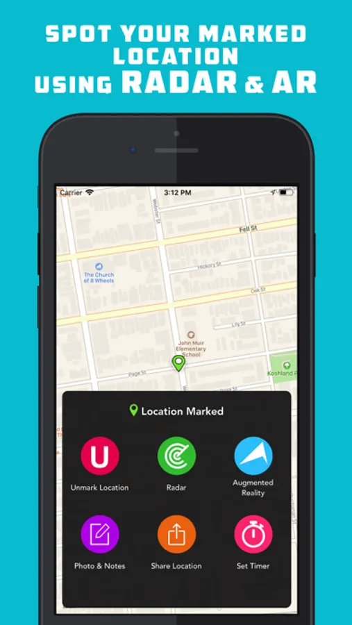
MARK LOCATION: Save a location and track back to that location using RADAR, AUGMENTED REALITY and MAP DIRECTIONS.
RADAR: Locate your marked location using RADAR
AUGMENTED REALITY: Real-Time Directional ARROW point towards the direction of your marked location.
PHOTO AND NOTES: Take a picture along with written notes of your marked location and save it. So you can find your marked location even more easily.
MARKED LOCATION TIMER: Set timer alert and get push notification after the timeout.
SHAKE TO SAVE: Manually mark your location by shaking up your iPhone/iPod in Altimeter GPS.
GET COORDINATES: Now you can copy your current coordinates and your marked coordinates using Get Coordinates section in “MAP SETTINGS”.
VOICE INSTRUCTIONS: Get voice instructions when you: Mark/Unmark your location.
Altimeter is Bootstrapped with features for urban as well as backwood areas
Altimeter GPS is an essential app for outdoor activity enthusiast like Hiking, Trekking, Mountain Biking, Skiing, Rock Climbing as well as the urbane on a day-to-day basis.
Altimeter GPS is a multipurpose app equipped with features like an altimeter, barometer, compass over your current satellite location, weather updates, pedometer, and speedometer. Use maps and binoculars for scouting and flashlight, SOS for exigencies.
Features Include :
ALTIMETER and BAROMETER: Get to know the latest elevation/altitude and atmospheric pressure around you using Altimeter and Barometer.
COMPASS: Compass above your satellite position always pointing according to real-time direction.
SPEEDOMETER: Speedometer to get real-time speed readings along with real-time direction and location address.
PEDOMETER / STEP COUNTER: Pedometer provides you the data about the steps taken and distance traveled in a specific time period along with Floors traversed.
WEATHER: Weather provides you the real-time weather updates based on your location. Get Current Temperature, Humidity, Sunrise/Sunset Time, Min/Max Temperature and Wind Speed.
WEATHER FORECAST: Weather Forecast provided for two weeks.
BINOCULAR: Super digital binocular app with HIGH-QUALITY ZOOM up to Maximum Zoom Level.
FLASHLIGHT: Bright, optimized and reliable flashlight. The easiest to use and useful flashlight.
SOS: In problem? Message your dear ones with real-time Coordinates using SOS function.
MAP: Track your position in maps with Standard/Hybrid/Satellite maps in Altimeter GPS.
MARK LOCATION: Save a location and track back to that location using RADAR, AUGMENTED REALITY and MAP DIRECTIONS.
RADAR: Locate your marked location using RADAR
AUGMENTED REALITY: Real-Time Directional ARROW point towards the direction of your marked location.
PHOTO AND NOTES: Take a picture along with written notes of your marked location and save it. So you can find your marked location even more easily.
MARKED LOCATION TIMER: Set timer alert and get push notification after the timeout.
SHAKE TO SAVE: Manually mark your location by shaking up your iPhone/iPod in Altimeter GPS.
GET COORDINATES: Now you can copy your current coordinates and your marked coordinates using Get Coordinates section in “MAP SETTINGS”.
VOICE INSTRUCTIONS: Get voice instructions when you: Mark/Unmark your location.
Altimeter is Bootstrapped with features for urban as well as backwood areas
Altimeter GPS is an essential app for outdoor activity enthusiast like Hiking, Trekking, Mountain Biking, Skiing, Rock Climbing as well as the urbane on a day-to-day basis.
My Altitude: GPS Altimeter Screenshots
Tap to Rate:
Reviews for My Altitude: GPS Altimeter
PipiLongstalking
Buttons just go to ads for other apps
Disappointed to find an app called Altimeter does not provide altitudes.
MGAbn
Useful!
It’s great to know the altitude especially where you may have oxygen concerns. People with breathing and heart issues feel it even at 4-5000 feet so it’s great to monitor the level of exercise.