AppRecs review analysis
AppRecs rating 4.5. Trustworthiness 65 out of 100. Review manipulation risk 30 out of 100. Based on a review sample analyzed.
★★★★☆
4.5
AppRecs Rating
Ratings breakdown
5 star
100%
4 star
0%
3 star
0%
2 star
0%
1 star
0%
What to know
✓
High user satisfaction
100% of sampled ratings are 5 stars
About Terra
The application is composed of the following interactive sections:
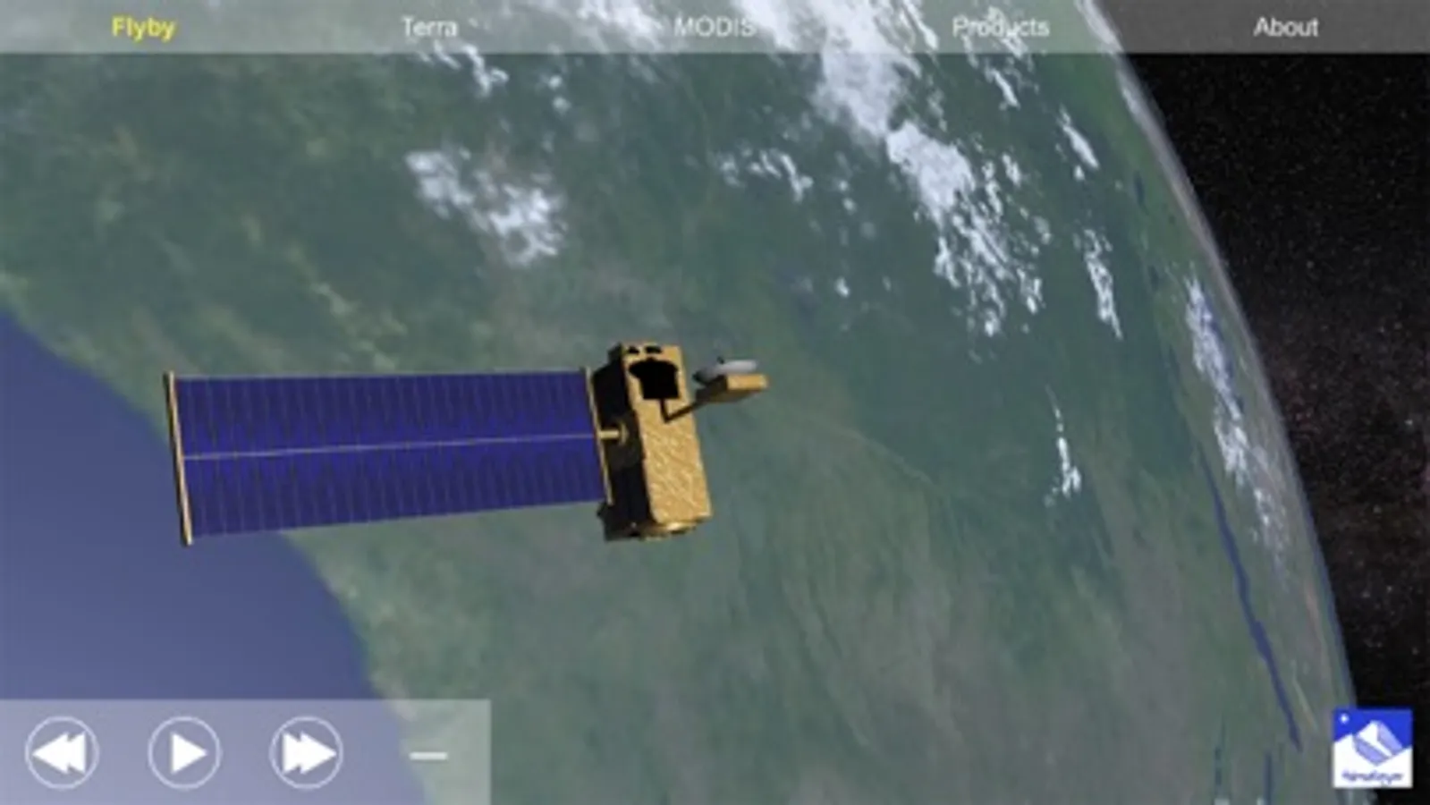
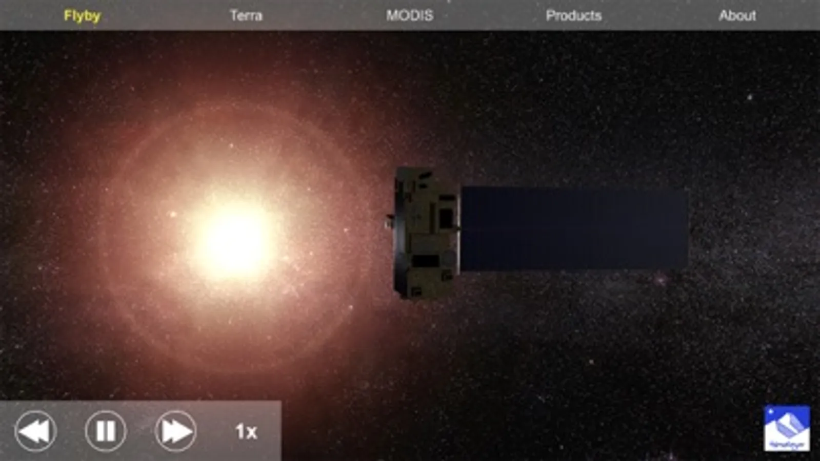
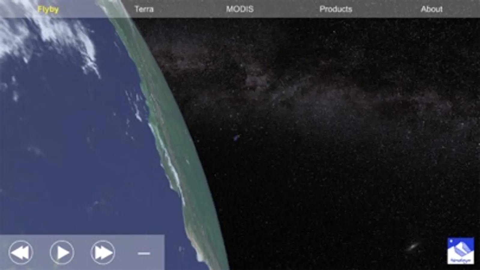
* Flyby: Simulation of the overpass of the satellite. Time, distance and size proportions are completely real. The scene does not show the real position of the satellite. Actually, it will appear in a different and random part of the globe every time the scene is loaded.
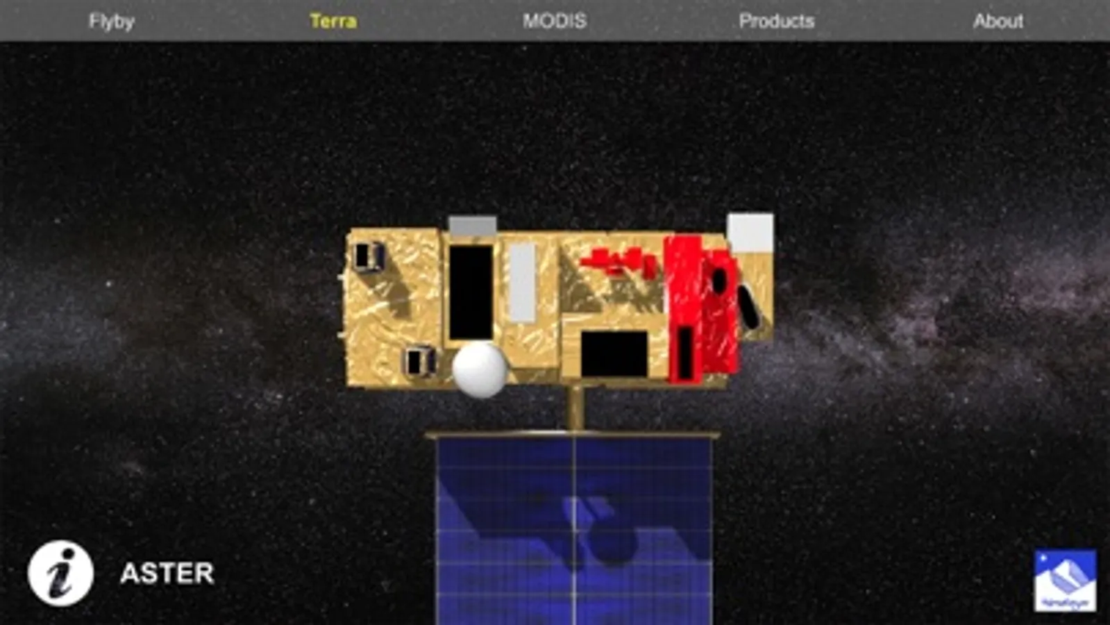
* Terra: 3D visualization of the satellite, where each instrument can be selected to get complete information about it.
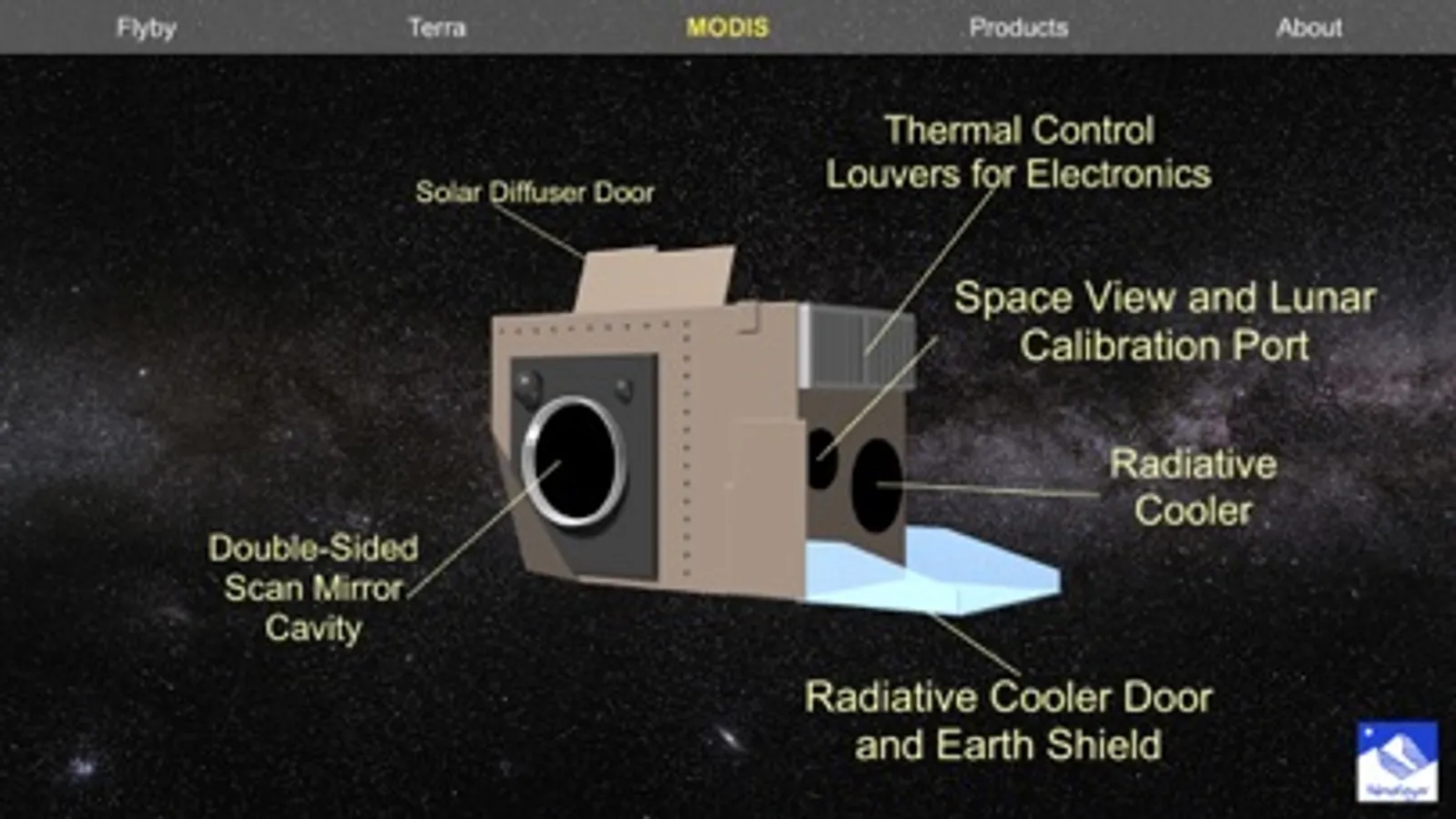
* MODIS: Simple 3D visualization of the Terra MODIS instrument, where every component has been identified.
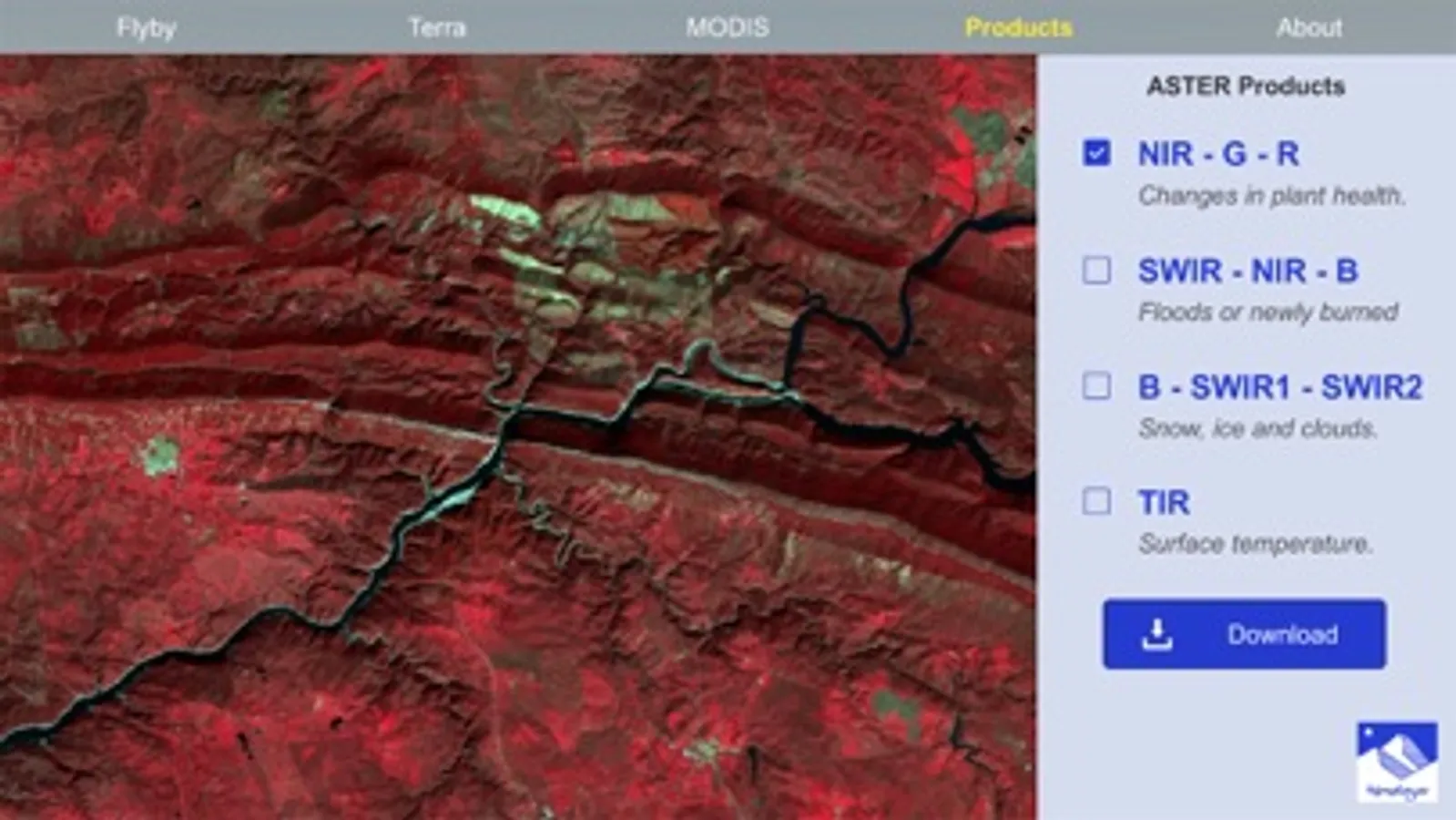
* Products: Visualization of processed data acquired by the Terra ASTER instrument. The area belongs to Monfragüe National Park (Spain), and it can be observed using different band combinations, which allow to highlight certain characteristics. The scene also presents a simulation of an user login procedure to download the original satellite products.
NOTE: This is NOT an official NASA application. All the information has been collected from official publications.
CREDITS: The original Terra mission is currently being developed by NASA. This institution owns the rights over the official and original design of the satellite, payload and data product types. The 3D adaptation of the satellite has been performed using official NASA sources and belongs to Himalaya Computing. The Milky Way background was generated by ESO.
Terra Screenshots
Tap to Rate:
Reviews for Terra
GeoBeast14
Great Educational Satellite and Remote Sensing App!
This app shows a Live Location Simulation(I think) of the Terra Satellite Mission(NASA). It allows you to Visualize the 3D Satellite, a 3D Earth Model, and the Milky Way Simulation. It gives you the Ability to Learn about the Satellite and it’s Key Components through an Interactive Model. It Explains the Model Components, such as Sensors and Cameras, and How They Relate to Remote Sensing. It even allows you to Download the Swath/Imagery Tile that the Satellite Simulation is Falling Towards, with Aster False Color Composites! Brilliant!🛰️🌎🌌