AppRecs review analysis
AppRecs rating 4.5. Trustworthiness 65 out of 100. Review manipulation risk 29 out of 100. Based on a review sample analyzed.
★★★★☆
4.5
AppRecs Rating
Ratings breakdown
5 star
100%
4 star
0%
3 star
0%
2 star
0%
1 star
0%
What to know
✓
Low review manipulation risk
29% review manipulation risk
✓
High user satisfaction
100% of sampled ratings are 5 stars
About Nautical Calculator Pro
Nautical Calculator Pro is the most complete application that solves the navigation calculations
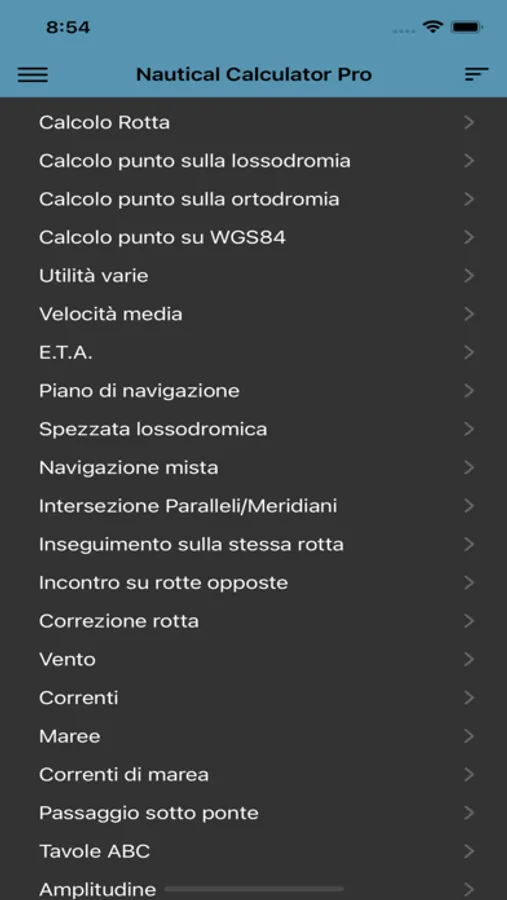
The main features are :
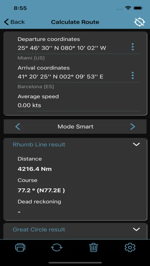
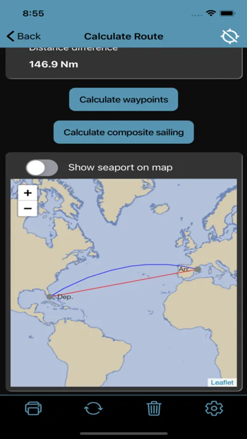
- Calculate Route (solves 2nd navigation problem)
- Calculate point on Rhumb Line (solves 1st navigation problem)
- Calculate point on Great Circle (solves 1st navigation problem)
- Calculate point on WGS84 (solves 1st navigation problem)
- Calculate Average speed
- E.T.A. calculation
- Route plan, for manual waypoints planning
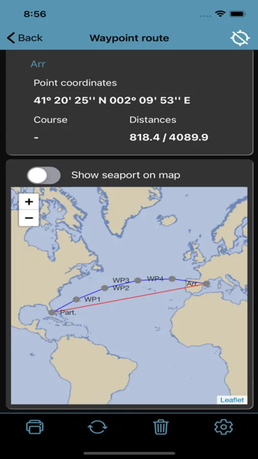
- Waypoint route
- Compisite sailing with parallel limit
- Rhumb Line Parallel/Meridian intersection
- Follow on same Rhumb Line route
- Opposite course rendez vous
- Route correction
- Calculate Amplitude at sunset and sunrise and magnetic compass deviation
- Compass detections
- Solves Drift problem
- Solves Tides problem
- Solves Tidal current problem
- Wind calculation with Beaufort classification
- ABC Tables (azimuth, initial course, right ascension with unknow star)
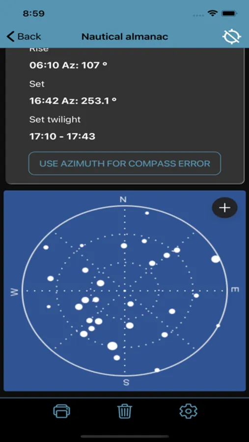
- Nautical almanac
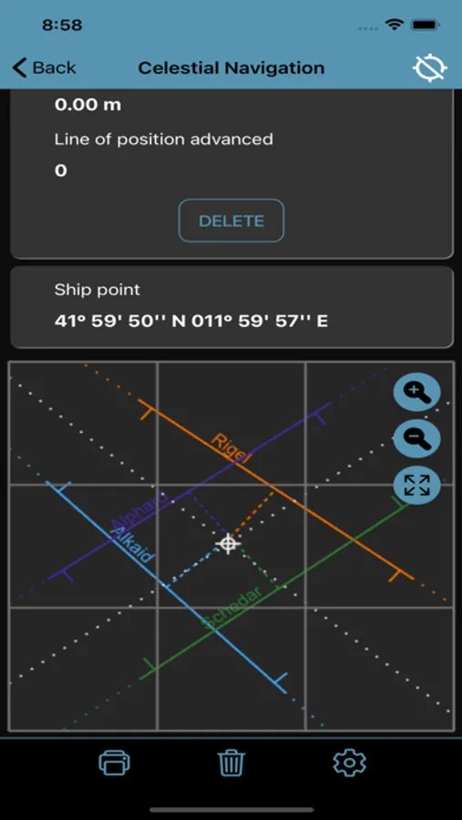
- Celestial Navigation with position line
- Meridian transit
- Celestial observation
- Coastal navigation
- Wheel Over
- Draft survey
- Converter
- Anchorage
- Interpolation
In routes feature there is a world map: it isn't a nautical chart and is not for use as a saling chart, but as a simple general means of showing the courses through the water on earth, this map isn't for navigational purposes.
No need connection for show the map; the map will be downloaded only one time.
The map, for size limit, will be show for scale over 60-70 Nm.
follow on facebook
https://www.facebook.com/NauticalCalculator
The main features are :
- Calculate Route (solves 2nd navigation problem)
- Calculate point on Rhumb Line (solves 1st navigation problem)
- Calculate point on Great Circle (solves 1st navigation problem)
- Calculate point on WGS84 (solves 1st navigation problem)
- Calculate Average speed
- E.T.A. calculation
- Route plan, for manual waypoints planning
- Waypoint route
- Compisite sailing with parallel limit
- Rhumb Line Parallel/Meridian intersection
- Follow on same Rhumb Line route
- Opposite course rendez vous
- Route correction
- Calculate Amplitude at sunset and sunrise and magnetic compass deviation
- Compass detections
- Solves Drift problem
- Solves Tides problem
- Solves Tidal current problem
- Wind calculation with Beaufort classification
- ABC Tables (azimuth, initial course, right ascension with unknow star)
- Nautical almanac
- Celestial Navigation with position line
- Meridian transit
- Celestial observation
- Coastal navigation
- Wheel Over
- Draft survey
- Converter
- Anchorage
- Interpolation
In routes feature there is a world map: it isn't a nautical chart and is not for use as a saling chart, but as a simple general means of showing the courses through the water on earth, this map isn't for navigational purposes.
No need connection for show the map; the map will be downloaded only one time.
The map, for size limit, will be show for scale over 60-70 Nm.
follow on facebook
https://www.facebook.com/NauticalCalculator
Nautical Calculator Pro Screenshots
Tap to Rate:
Reviews for Nautical Calculator Pro
Mariner12345678
Works well
I haven’t used all of the functions, but so far it works well for doing azimuths/aplitudes, star fixes, sun lines, and getting true wind direction. For the price it has been worth it for me.