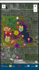
Como Park is one of the most visited destinations in Minnesota, and for good reason! Located in northwest Saint Paul in Ramsey County, Como Park was established in 1884 and has a rich history as an peaceful escape from the bustle of the metropolitan area. This app will help you to explore and discover all of the primary destinations and secret, hidden gems around Como Park! It is designed to be used offline and is compatible with location services using GPS.
Included in the app hundreds of point features and amenities from all corners of the park, many of them complete with photographs. These features include food vendors, restrooms, statues, artistic spots, distinct tree species, the Como Woodland Outdoor Classroom, vistas, bridges, crosswalks, and more! All roads, pathways, and sidewalks throughout the park are individually marked and labeled and color-coded.
The park is divided into 5 main sections - Como Lake & Pavillion, Como Zoo & Conservatory, Como Picnic Grounds, Como Golf Course, and McMurray Sports Fields. For the true explorer, there is even a detailed polygon layer that divides the 5 main sections of the park into more than 200 distinct areas to ensure that you discover absolutely everything the park has to offer.
This app comes bundled with three completely offline base layers including a street map, aerial photography, and a night map. A topographic map is also available using an internet connection.
For most featured destinations, there is a description of the location and a quick-link that allows you to easily find where you want to go on the map. Coupling this with the bundled data and GPS location services means that you will never again be confused or lost while wandering the wooded paths of the park!
This app will never contain any advertisements or in-app purchases. It was made with care by a small cartography business right here in Saint Paul, MN. By purchasing the app, you are supporting our mission and ensuring that we can continue to make great navigational apps in the future. If you see any mistakes or bugs in the app, please use the included feedback form to report these issues. Thank you for your support!
Show More
