AppRecs review analysis
AppRecs rating 3.3. Trustworthiness 65 out of 100. Review manipulation risk 29 out of 100. Based on a review sample analyzed.
★★★☆☆
3.3
AppRecs Rating
Ratings breakdown
5 star
17%
4 star
50%
3 star
0%
2 star
17%
1 star
17%
What to know
✓
Low review manipulation risk
29% review manipulation risk
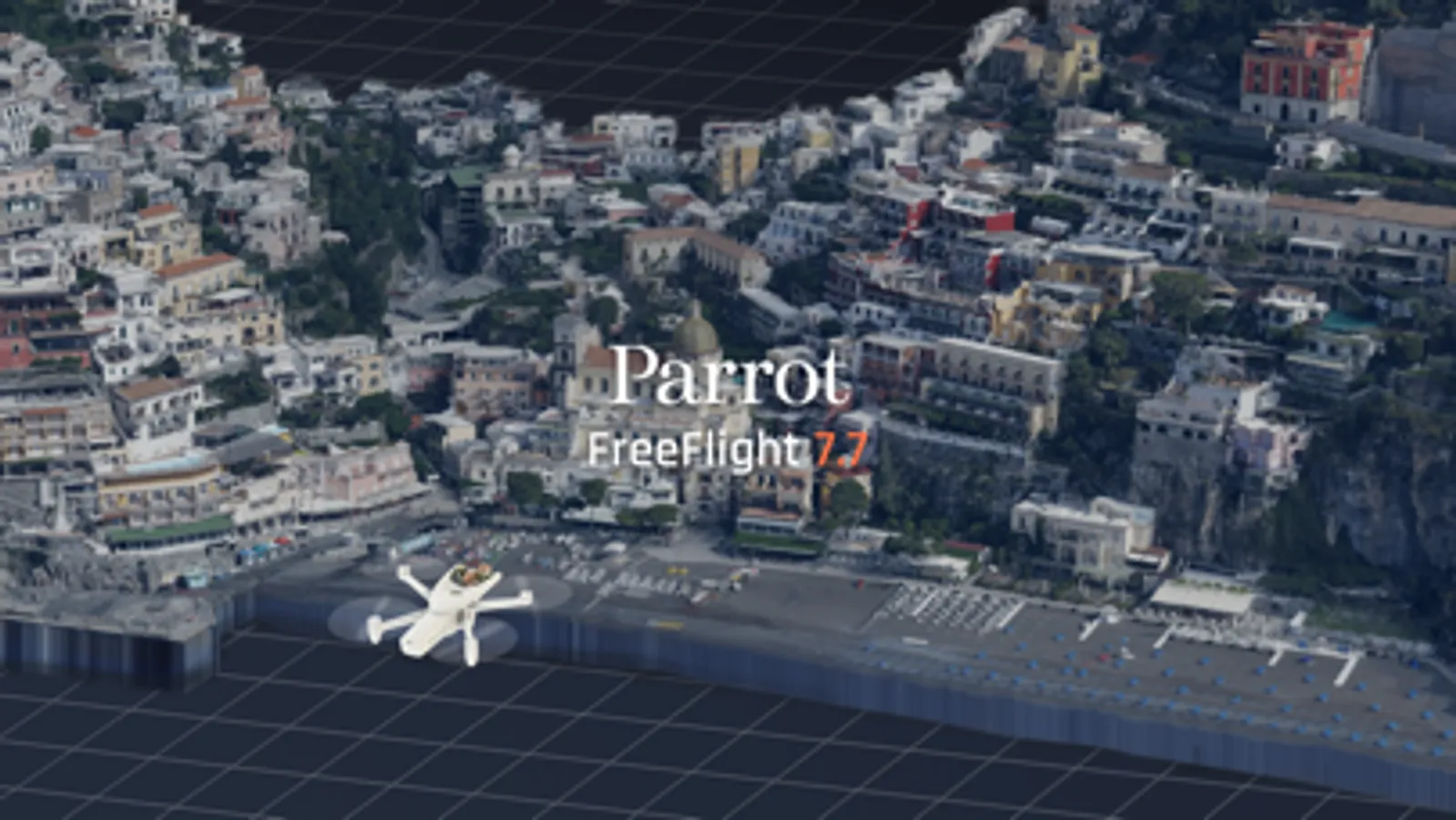
About FreeFlight 7
FreeFlight 7 is the Parrot piloting App specifically designed for the ANAFI Ai.
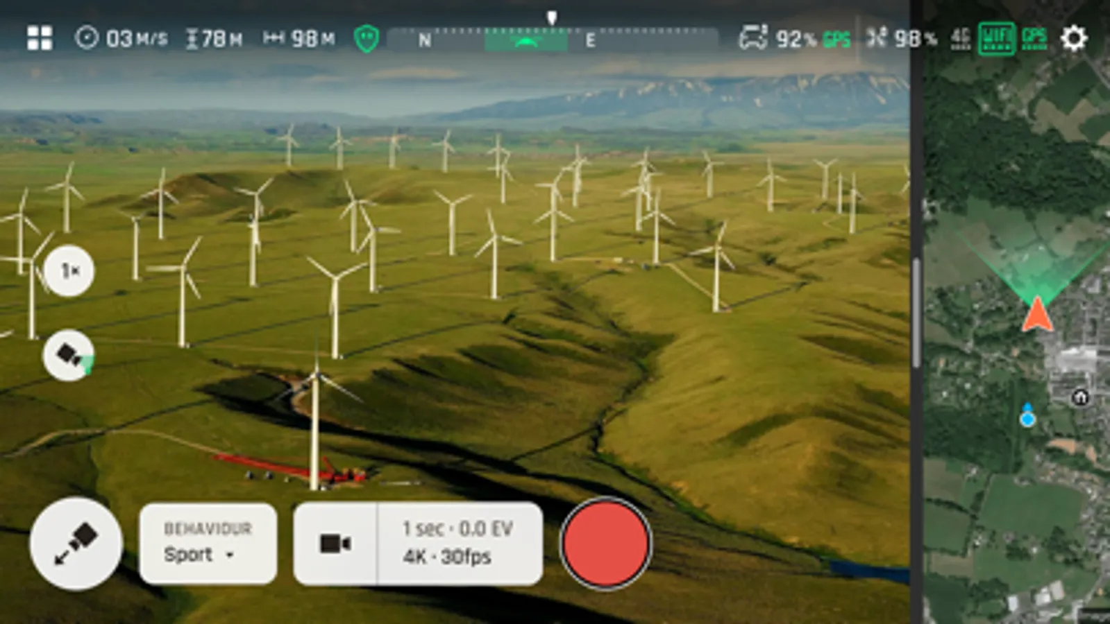
The App makes complex drone missions simpler and quicker.
Inspection, construction, infrastructure, energy, utilities, public safety, surveying, agriculture and defense professionals will benefit from advanced features:
- Inspecting buildings with strong 4G connectivity in built-up urban missions.
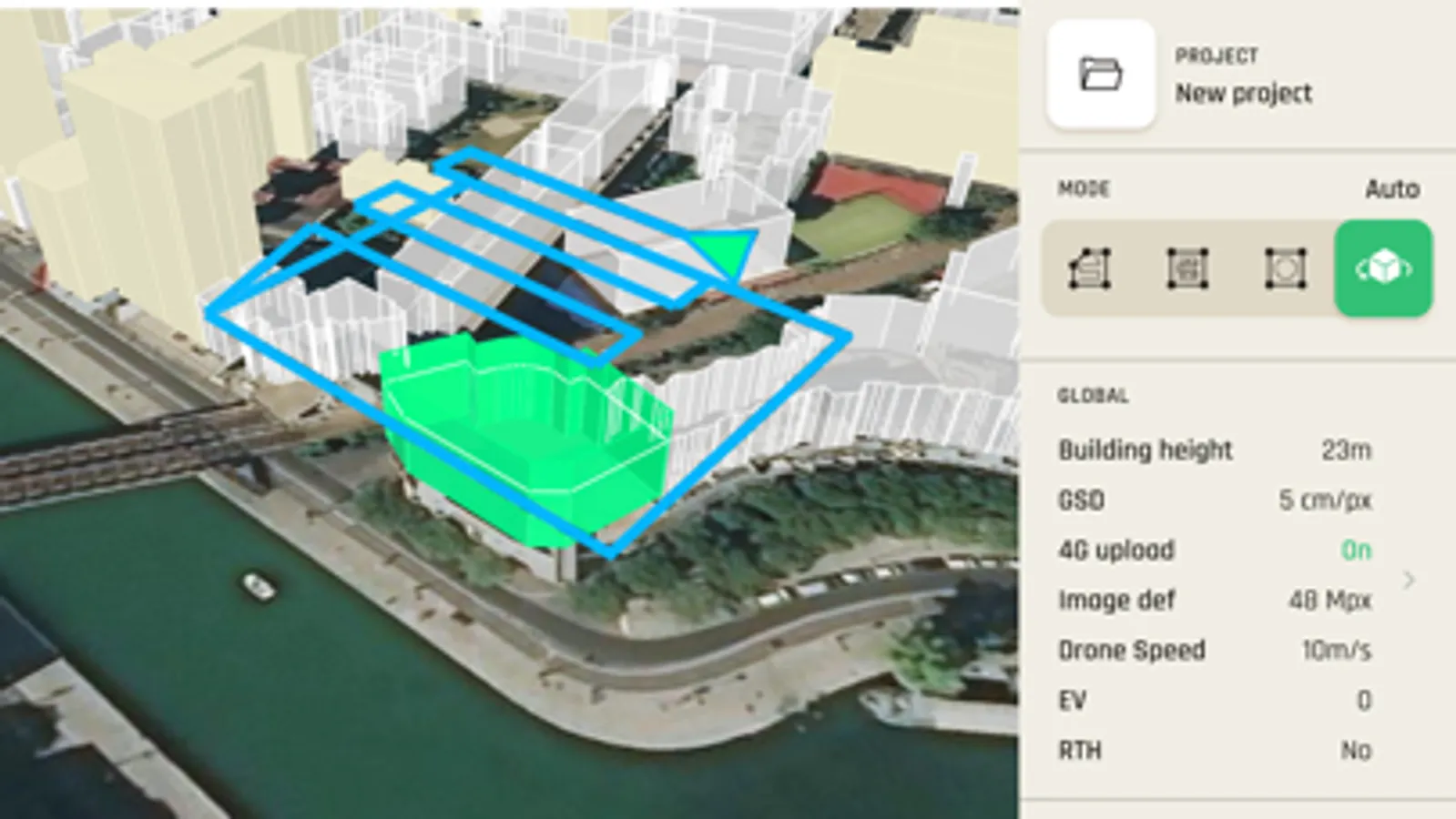
- Generating 3D models of buildings just by clicking on its land register
- Creating standard mapping missions: Grid, Double Grid and Orbit.
- Manually mapping infrastructures in 48 MP at 1fps with the GPS Lapse
- Creating precise flight plans in complex environments thanks to a unique obstacle avoidance system.
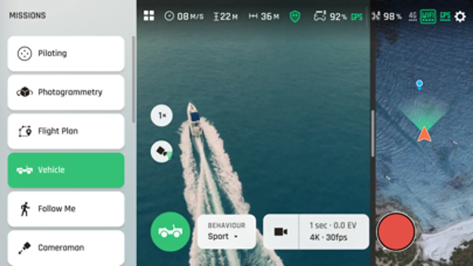
- Flying the drone automatically above a vehicle as a watchtower.
- Using private mode to keep sensitive data safe.
FreeFlight 7 is natively connected to PIX4Dcloud.
Courtesy of Parrot and PIX4D, new users can enjoy 3 photogrammetry models to familiarize themselves with 3D mapping.
For more information on ANAFI Ai, visit: https://www.parrot.com/en/drones/anafi-ai
The App makes complex drone missions simpler and quicker.
Inspection, construction, infrastructure, energy, utilities, public safety, surveying, agriculture and defense professionals will benefit from advanced features:
- Inspecting buildings with strong 4G connectivity in built-up urban missions.
- Generating 3D models of buildings just by clicking on its land register
- Creating standard mapping missions: Grid, Double Grid and Orbit.
- Manually mapping infrastructures in 48 MP at 1fps with the GPS Lapse
- Creating precise flight plans in complex environments thanks to a unique obstacle avoidance system.
- Flying the drone automatically above a vehicle as a watchtower.
- Using private mode to keep sensitive data safe.
FreeFlight 7 is natively connected to PIX4Dcloud.
Courtesy of Parrot and PIX4D, new users can enjoy 3 photogrammetry models to familiarize themselves with 3D mapping.
For more information on ANAFI Ai, visit: https://www.parrot.com/en/drones/anafi-ai
FreeFlight 7 Screenshots
Tap to Rate:
Reviews for FreeFlight 7
AnafiAI_owner
Good App, Improved, but missing gridlines for HUD!!!
Lots of improvements, but why are there still no gridlines and crosshairs of any kind for this pro inspection/mapping sUAS? Please update the app with gridlines and crosshairs options for the HUD, Parrot, why are they missing?