About EarthTrail
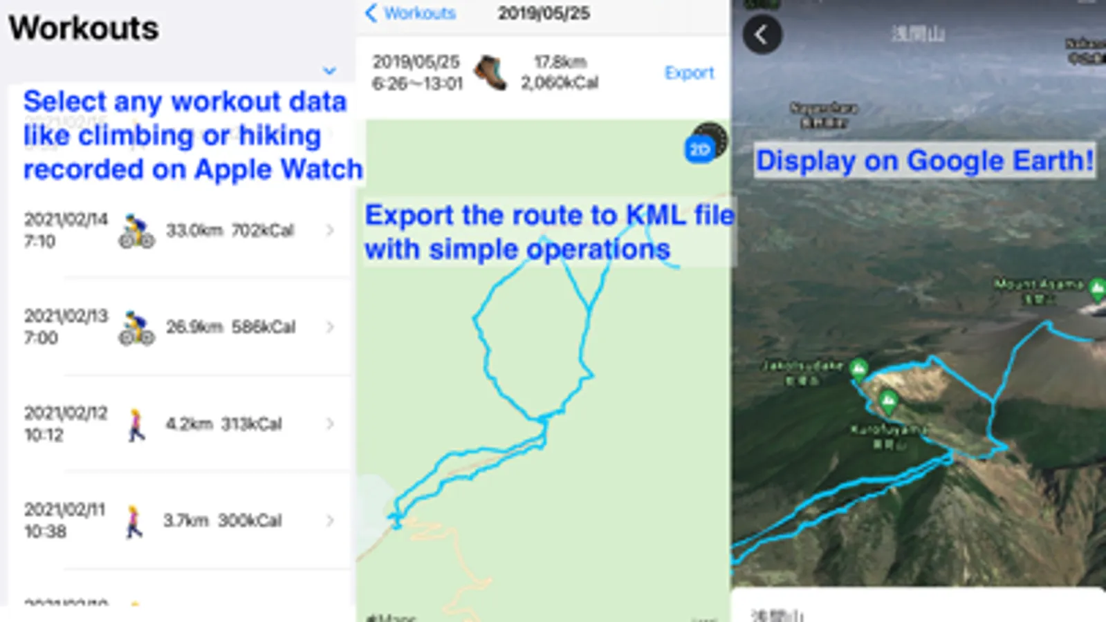
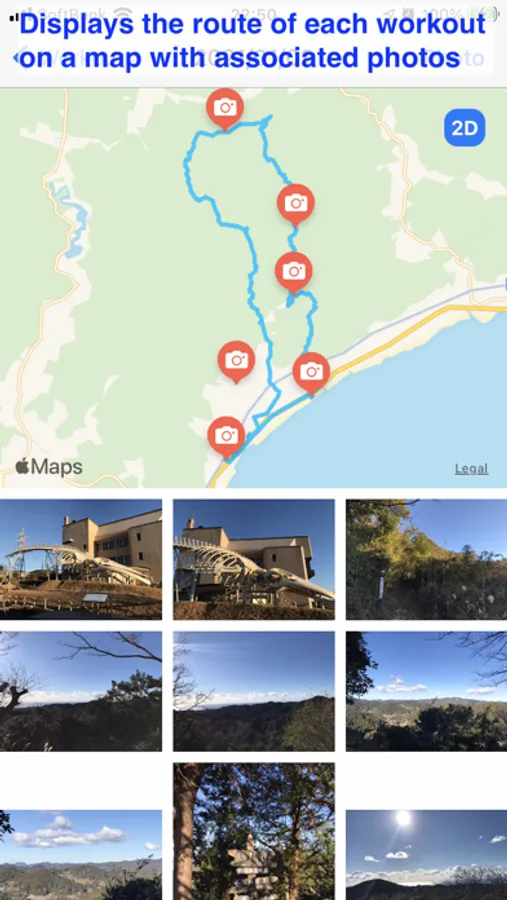
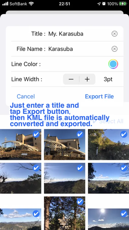
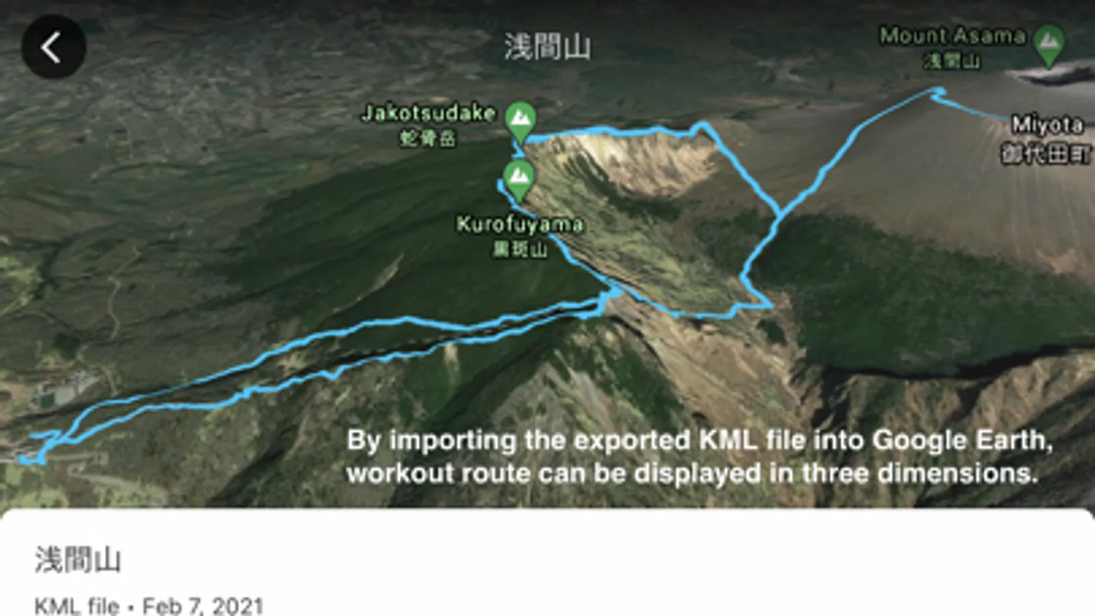
EarthTrail loads workout and route data recorded on iPhone using an Apple Watch or other device during exercise via Health/Fitness data and exports them as a KML file. The workout related photos will be able to exported as well. The exported KML file can be imported and displayed on Google Earth, allowing you to view your climbing route on 3D terrain. Google Earth for Mac can also display exported photos on 3D map.
EarthTrail Screenshots
Tap to Rate: