AppRecs review analysis
AppRecs rating 4.4. Trustworthiness 72 out of 100. Review manipulation risk 25 out of 100. Based on a review sample analyzed.
★★★★☆
4.4
AppRecs Rating
Ratings breakdown
5 star
86%
4 star
0%
3 star
0%
2 star
7%
1 star
7%
What to know
✓
Low review manipulation risk
25% review manipulation risk
✓
Credible reviews
72% trustworthiness score from analyzed reviews
✓
High user satisfaction
86% of sampled ratings are 5 stars
About rivers.run
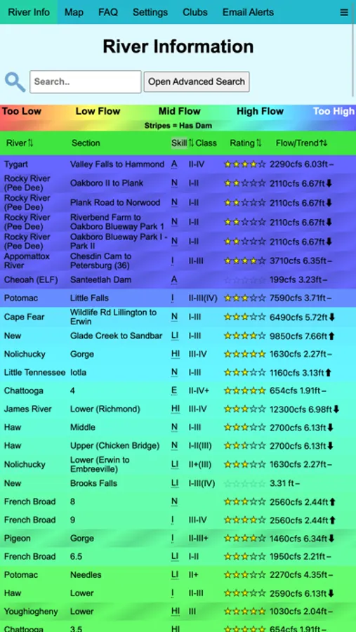
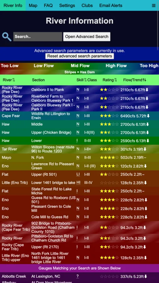
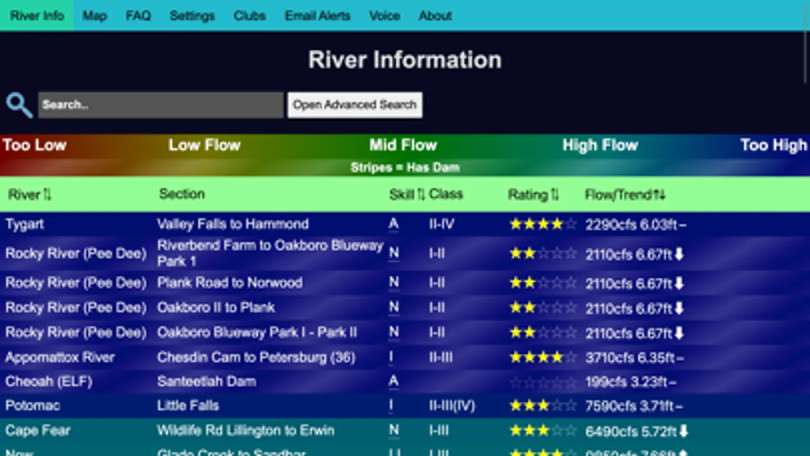
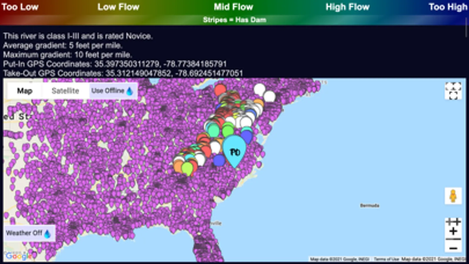
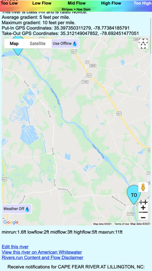
You can use GPS coordinates to find rivers near you, and search rivers by water levels, skill, name, and rating, as well as user provided tags and dam releases, helping you find whitewater (or flatwater) rivers that you want to paddle.
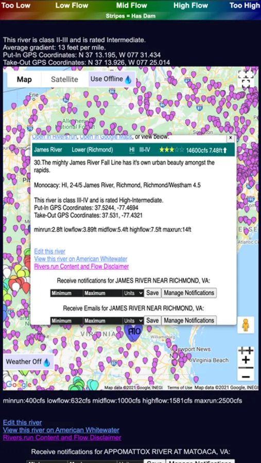
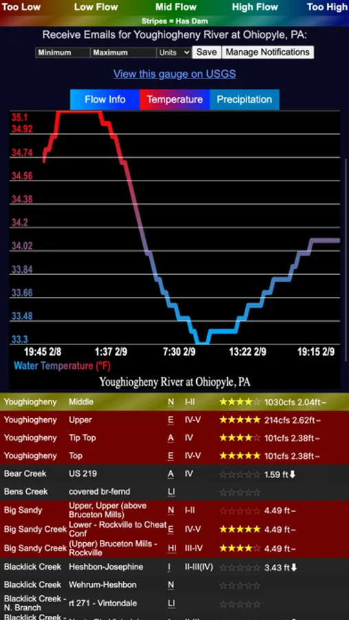
You can also use rivers.run maps to find rivers in an area, and to assist with navigation. Clicking on any point shows all the information rivers.run has about the river - flow, temperature, and other information. If you're interested in weather, you can also enable the weather view to get a good idea of where rain is currently falling.
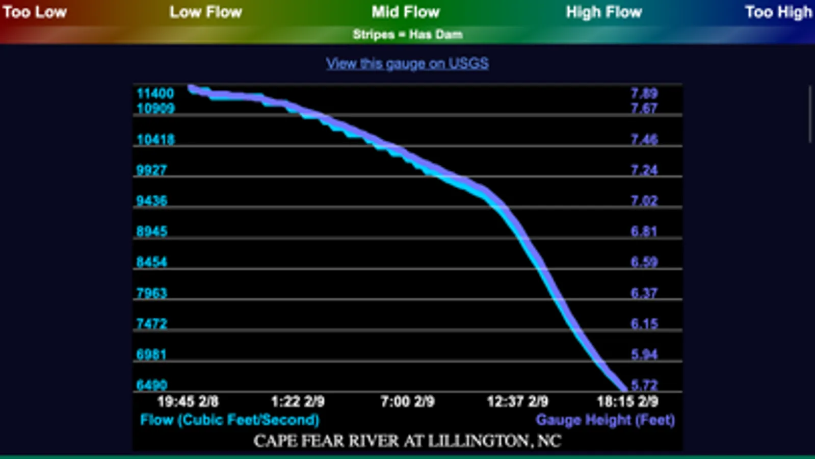
River flow levels are currently sourced from USGS (United States Geological Survey), NWS (National Weather Service), and the Meterological Service of Canada. Additional sources for gauges are planned for the future.
Information on rivers.run is crowdsourced - so if your favorite river is not available, is missing information on runnable levels, or has other issues, you can help improve it. Just go to the FAQ page in app to find directions on how to get started. If you need any assistance, you can send an email to support@rivers.run.
NOTE: Rivers.run does work offline, however needs to connect at least once in order to download river information. Attempting to use rivers.run offline before it has downloaded information may result in a launch screen freeze.
rivers.run Screenshots
Tap to Rate:
Reviews for rivers.run
KMasonS
Sadly - now seems dead Excellent FISHING (esp trout) app: convenient USGS stream info at the ready
Update: sadly, now seems dead. I hope it will be revived. This free app is the simplest, cleanest and quickest way to check USGS stream data: flow, temperature, precipitation, whatever the stream gauges collect. The interface isn’t the most intuitive, but after a few minutes use it’s a snap. Excellent. I hope the developer will allow higher resolution maps for offline usage, as modern devices have plenty of storage to accommodate that data.
None one one onenone
Great info, hard to update
Love the information provided but haven’t been able to get refreshed data in about 2 days.