AppRecs review analysis
AppRecs rating 1.5. Trustworthiness 45 out of 100. Review manipulation risk 52 out of 100. Based on a review sample analyzed.
★☆☆☆☆
1.5
AppRecs Rating
Ratings breakdown
5 star
50%
4 star
0%
3 star
0%
2 star
0%
1 star
50%
What to know
⚠
Questionable review patterns
52% review manipulation risk - some review patterns appear unusual
⚠
Mixed user feedback
Average 1.5★ rating suggests room for improvement
About GPS Waypoints Lite
GPS Waypoints Lite is a surveying application for iOS devices that enables smartphones' users to collect, classify and export Points and Paths to become map creators. This multi-purpose solution, with an easy-to-use interface, is adequate for professional activities (earth sciences surveying, infrastructure monitoring, forest, agriculture, etc...) and personal activities (outdoor and tourism).
The GPS Wpts Lite includes the following features:
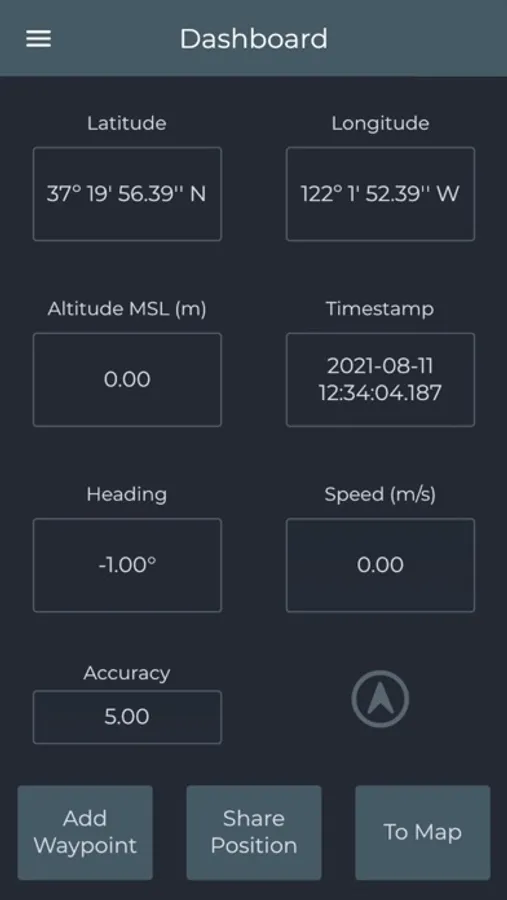
- View current position with accuracy and navigation information;
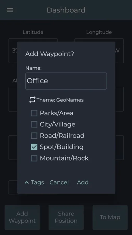
- Create Points and Paths with accuracy information and custom Tags classification;
- Get directions and distances from current position to existing Points using the magnetic or gps compass;
- Import Points from CSV, KML, GPX and Geojson files using geographic coordinates (Lat, Long in wgs84);
- Export Points to CSV, KML, GPX and Geojson files by saving data locally or sharing with other applications (e.g. Mail, iCloud/Google Drive);
- Create Paths manually and automatically for producing tracks, routes or polygons;
- Create and use survey's Themes with custom Tags for classifying Points and Paths;
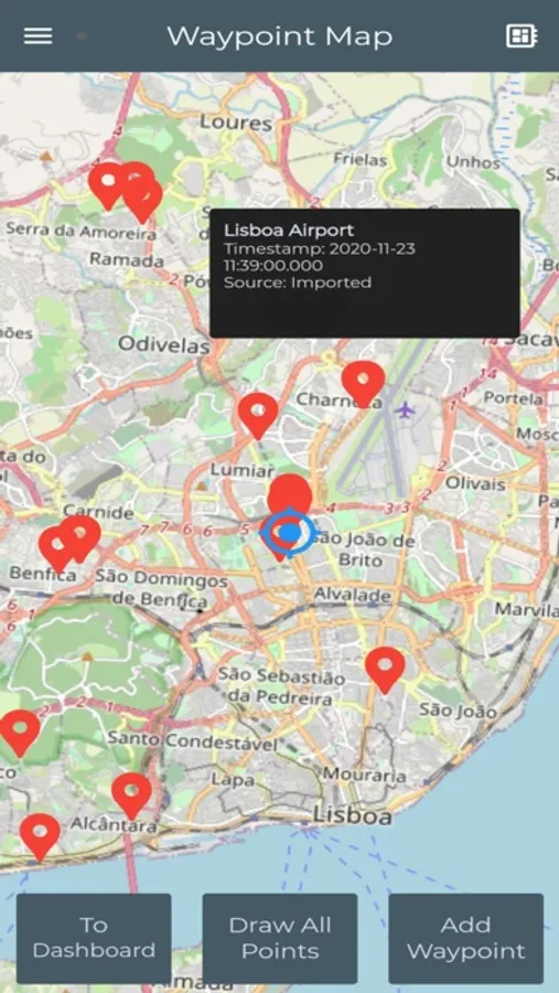
- View Geodata (Points and Paths) and measure distances on Maps;
- Satellite image processing requests (Premium);
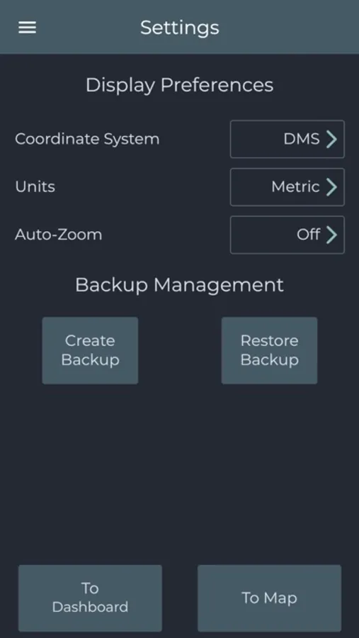
- Backup and restore your data.
The regular version has advertising and is restricted in number of exports, while Premium is unlimited in exports and has advanced features.
The GPS Wpts Lite includes the following features:
- View current position with accuracy and navigation information;
- Create Points and Paths with accuracy information and custom Tags classification;
- Get directions and distances from current position to existing Points using the magnetic or gps compass;
- Import Points from CSV, KML, GPX and Geojson files using geographic coordinates (Lat, Long in wgs84);
- Export Points to CSV, KML, GPX and Geojson files by saving data locally or sharing with other applications (e.g. Mail, iCloud/Google Drive);
- Create Paths manually and automatically for producing tracks, routes or polygons;
- Create and use survey's Themes with custom Tags for classifying Points and Paths;
- View Geodata (Points and Paths) and measure distances on Maps;
- Satellite image processing requests (Premium);
- Backup and restore your data.
The regular version has advertising and is restricted in number of exports, while Premium is unlimited in exports and has advanced features.
GPS Waypoints Lite Screenshots
Tap to Rate:
Reviews for GPS Waypoints Lite
ggvnjcvnv
Lacks accuracy.
I paid $12 for it. It messes up the timestamps. It does not record the time accurately.
Jessu$boy88
222227
Pablo Cruz$$$$