AppRecs review analysis
AppRecs rating 4.5. Trustworthiness 65 out of 100. Review manipulation risk 22 out of 100. Based on a review sample analyzed.
★★★★☆
4.5
AppRecs Rating
Ratings breakdown
5 star
100%
4 star
0%
3 star
0%
2 star
0%
1 star
0%
What to know
✓
Low review manipulation risk
22% review manipulation risk
✓
High user satisfaction
100% of sampled ratings are 5 stars
About AngelNav
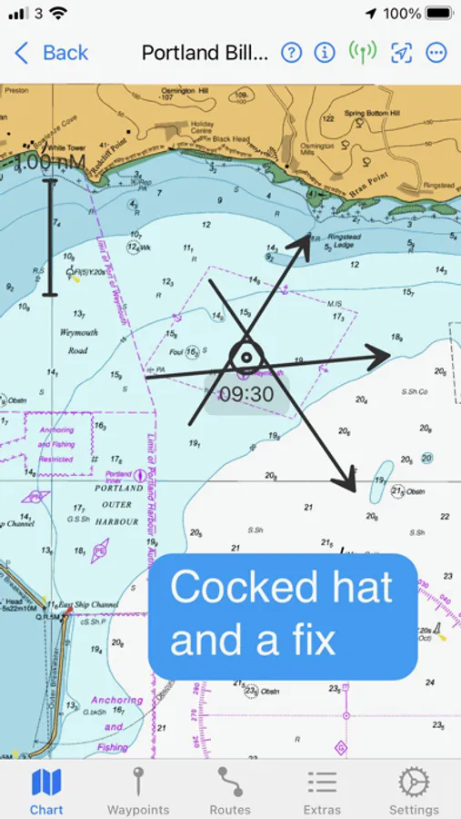
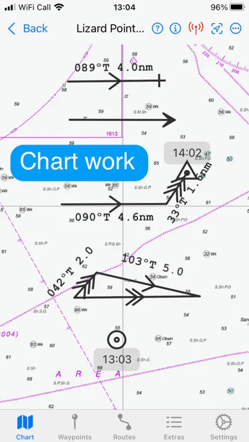
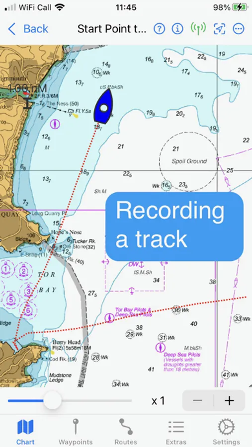
The capacity to generate classical chart work is vitally important in the event of a GPS failure, but hitherto has required pencil, plotters, and paper charts. AngelNav allows traditional techniques to be carried out using an iPad or iPhone screen instead of a paper chart. An estimated position can be plotted, position lines drawn from sighted bearings and fixes recorded. Course-to-steer diagrams are readily constructed.
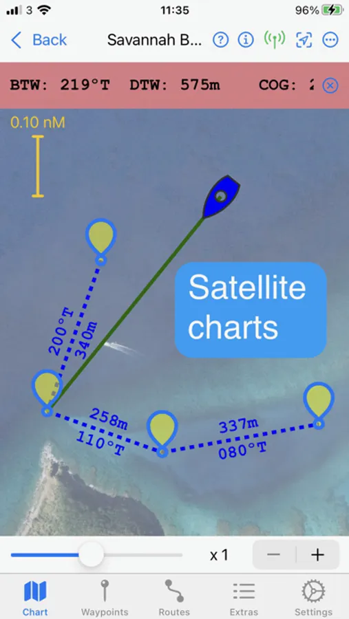
AngelNav can read most types of raster chart including the UKHO subscription charts, as well as KAP/BSB files and GeoTIFF files. It can easily create georeferenced satellite charts for offline use.
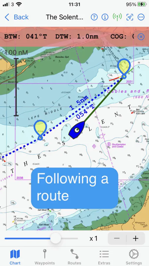
AngelNav can take GNSS navigation data from a variety of sources, including the device's stand-alone GPS, the boat's NMEA over WiFi, and SignalK. It will also display AIS information if available.
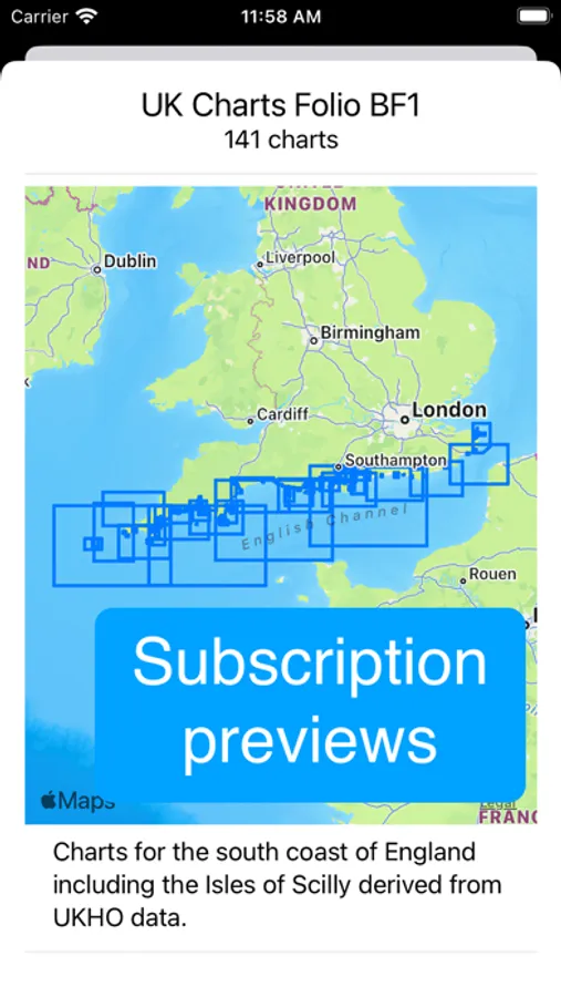
Annual subscriptions are available as in-app purchases for UKHO, SHOM, and Imray charts covering the whole of the UK, France, Spain, the Mediterranean and the Caribbean. These are divided into folios so that you can subscribe only to the charts that you need.
The app is free to use in its basic form, with additional functions and charts available as in-app purchases. This allows a user to fully evaluate the app without charge, and then to purchase the features and charts required.
Free features:
Chart plotter (Demo chart included)
Traditional navigation techniques
Waypoints and Routes
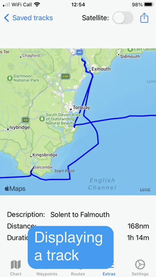
Track recording and display
Reads navigational data
Simulation mode
Paid for features (in-app purchases):
Open KAP/BSB files
Open GeoTIFF files
Open Satellite charts
Display AIS targets (if AIS information is available)
Tidal information for the British Isles
Subscription Charts:
Charts derived from UKHO data covering the coastal waters of the British isles, the Atlantic coast of Spain and Portugal including the Atlantic islands.
SHOM charts of the coasts of France
Imray charts of of the Mediterranean, Caribbean, and others
Key features:
Brand new app written from the ground up
Carry out traditional navigation techniques on screen
Free to download to for evaluation, with in-app purchases to add only the features required
Frequent updates of subscription charts including handling of notice to mariners
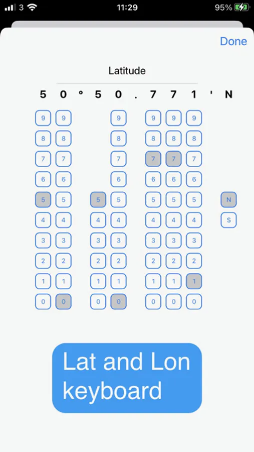
Custom keyboard for entry of waypoint latitude and longitude
Open KPA/BSB and GeoTIFF files (in-app purchase required)
Create Satellite charts for off line use (in-app purchase required)
Display AIS targets on the chart (in-app purchase required)
NOTE: The continued use of GPS running in the background can dramatically decrease battery life
AngelNav Screenshots
Tap to Rate:
Reviews for AngelNav
JH Blake
Above the Rest!
Sailors are faced with a myriad of options with weather, navigation, and general boating apps. AngelNav stands out as the only app for sailors that respects and balances their love of technology, and more importantly- their adherence and practice of traditional navigation techniques. Raster charts, satellite imagery, and optimal utilization of Apple’s ecosystem make up this amazing application. Extensive chart portfolios, and well thought out tools round out a well minded UI that respects good seamanship in our digital age. Enjoy this app, and get out there knowing you have a powerful tool at hand.