AppRecs review analysis
AppRecs rating 3.7. Trustworthiness 45 out of 100. Review manipulation risk 20 out of 100. Based on a review sample analyzed.
★★★☆☆
3.7
AppRecs Rating
Ratings breakdown
5 star
0%
4 star
0%
3 star
0%
2 star
0%
1 star
100%
About 3D地球-satellite and 3D terrain
3D Earth is a global satellite mapping software that integrates terrain, contour lines, geographic measurements, markers, altitude, compass, and more. Here, you can view real-time high-definition satellite images of any place in the world at any time. We also provide high-definition 3D terrain maps, contour lines, and geographic measurement services.
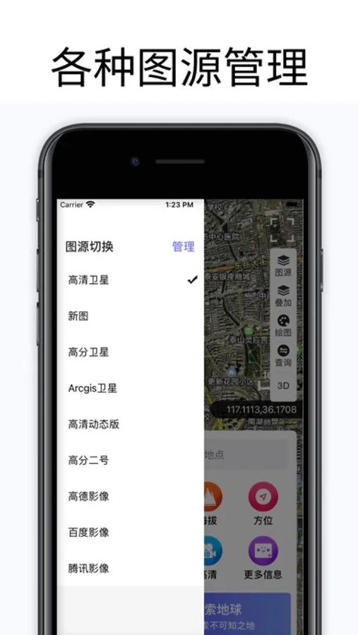
The software integrates Google Maps, Google Satellite Maps, ArcGIS Maps, Bing Maps, Bing Maps, Amap, Baidu Maps, Tencent Maps openlayer、 Sky map mapbox、 Historical imagery and first-line satellite imagery maps from 2014 to present
Our advantages
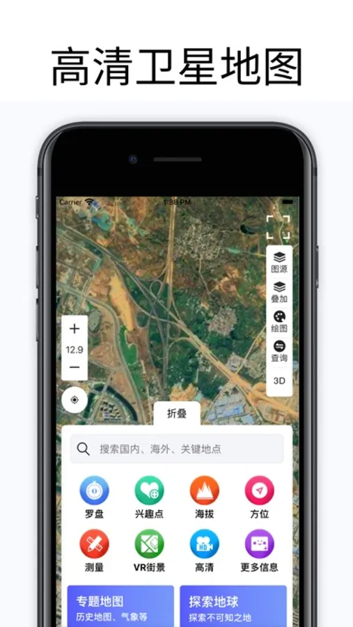
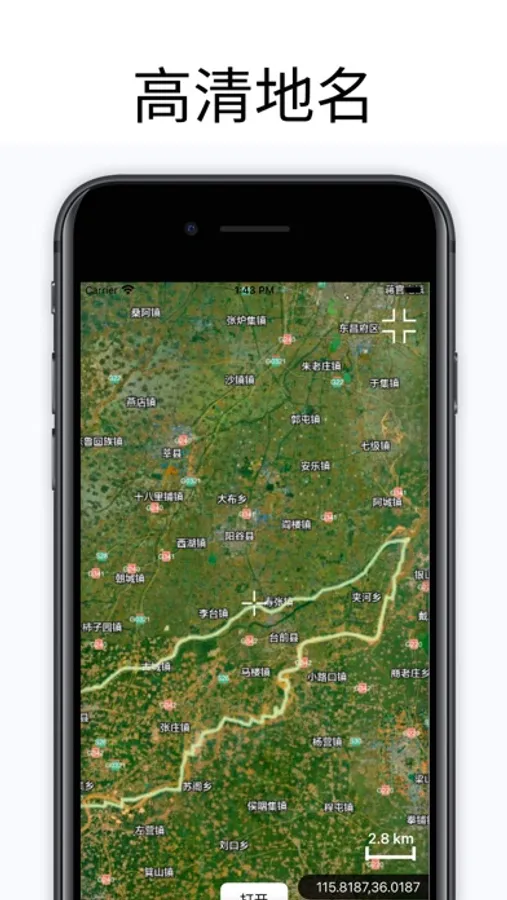
1. Can view high-definition satellite images of any location worldwide
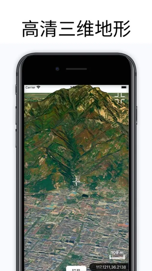
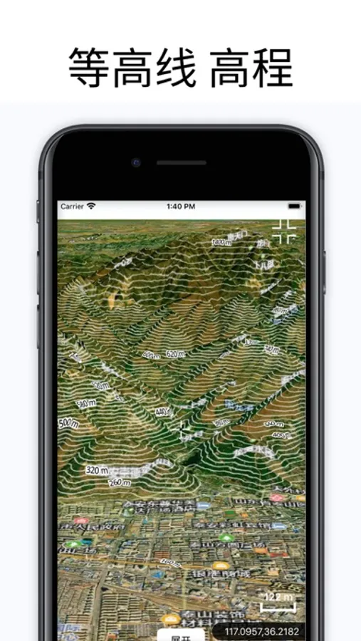
2. Can view the real 3D terrain of any location around the world, a great assistant for outdoor travel
3. Enjoy global street views without leaving the house
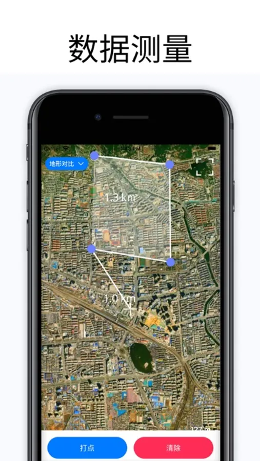
4. Geographic measurement services, specially equipped for relevant professionals, such as measuring distance, measuring area, etc., no need to go to the site anymore
5. Search service, we have a powerful search system that can search anywhere you want to view.
6. Real time altitude measurement
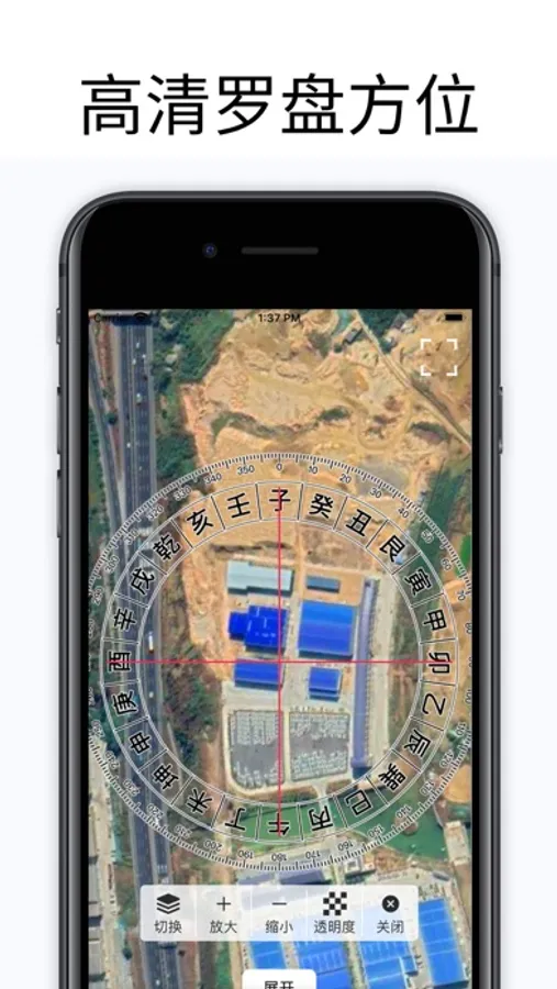
7. Compass positioning
8. Orientation correction
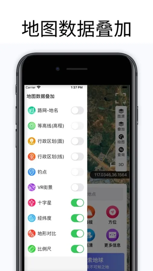
9. Contour lines
10. Drawing
11. Global Search
12. Layer switching
13. Image source management
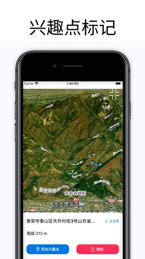
14. Fishing Outdoor Fishing Spot Service
15. New Street View Service
16. Geographic exploration
17. Historical map
18. Historical image map
3D Earth Members:
-After subscribing, you can use all the features of the product
-Subscription fees are charged on a weekly/monthly/annual basis according to different plans
-Payment will be deducted from your iTunes account upon confirmation of purchase
-The subscription will automatically renew unless auto renewal is turned off at least 24 hours before the end of the current period
-Your account will be charged according to your renewal plan within 24 hours before the end of the current period. You can manage or disable automatic renewal in your Apple ID account settings at any time after purchase.
Privacy Policy: https://mobiletoolsapp.github.io/3dearthprivacy.html
User Agreement: https://mobiletoolsapp.github.io/3dearthservice.html
The software integrates Google Maps, Google Satellite Maps, ArcGIS Maps, Bing Maps, Bing Maps, Amap, Baidu Maps, Tencent Maps openlayer、 Sky map mapbox、 Historical imagery and first-line satellite imagery maps from 2014 to present
Our advantages
1. Can view high-definition satellite images of any location worldwide
2. Can view the real 3D terrain of any location around the world, a great assistant for outdoor travel
3. Enjoy global street views without leaving the house
4. Geographic measurement services, specially equipped for relevant professionals, such as measuring distance, measuring area, etc., no need to go to the site anymore
5. Search service, we have a powerful search system that can search anywhere you want to view.
6. Real time altitude measurement
7. Compass positioning
8. Orientation correction
9. Contour lines
10. Drawing
11. Global Search
12. Layer switching
13. Image source management
14. Fishing Outdoor Fishing Spot Service
15. New Street View Service
16. Geographic exploration
17. Historical map
18. Historical image map
3D Earth Members:
-After subscribing, you can use all the features of the product
-Subscription fees are charged on a weekly/monthly/annual basis according to different plans
-Payment will be deducted from your iTunes account upon confirmation of purchase
-The subscription will automatically renew unless auto renewal is turned off at least 24 hours before the end of the current period
-Your account will be charged according to your renewal plan within 24 hours before the end of the current period. You can manage or disable automatic renewal in your Apple ID account settings at any time after purchase.
Privacy Policy: https://mobiletoolsapp.github.io/3dearthprivacy.html
User Agreement: https://mobiletoolsapp.github.io/3dearthservice.html
3D地球-satellite and 3D terrain Screenshots
Tap to Rate:
Reviews for 3D地球-satellite and 3D terrain
Alex-哥
打不升
交了钱后打不开好久了