AppRecs review analysis
AppRecs rating 3.0. Trustworthiness 45 out of 100. Review manipulation risk 28 out of 100. Based on a review sample analyzed.
★★★☆☆
3.0
AppRecs Rating
Ratings breakdown
5 star
0%
4 star
0%
3 star
100%
2 star
0%
1 star
0%
About Measure Map GPS Field
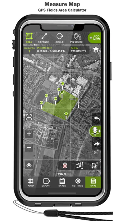
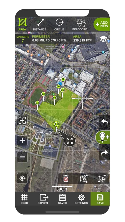
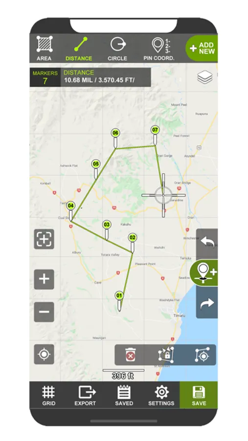
Tactical pro tool for measuring areas on the map. Place your points on the map and then calculate area between all point, calculate total Area of ant Route.
Measure any distance, route, or area you want, over Maps
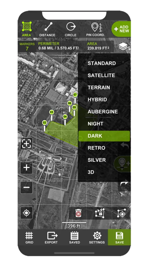
STANDARD SATELLITE TERRAIN HYBRID AUBERGINE NIGHT DARK
For accurate measurement, it is possible to connect an external GNSS or RTK antenna via bluetooth.
-Measure distance
-Measure Area
-Circle View
-Map compass
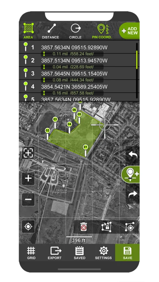
>Support UTM & MGRS coordinates
Coordinate types:
- Dec Degs (DD.dddddd°)
- Dec Degs Micro (DD.dddddd "N, S, E, W")
- Dec Mins (DDMM.mmmm)
- Deg Min Secs (DD°MM'SS.sss")
- Dec Mins Secs (DDMMSS.sss")
- UTM (Universal Transverse Mercator)
- MGRS (Military Grid Reference System)
> Measurement units;
-Foot & mile (ft.mi)
-Foot,Mile & Acre (ft,mi,ac)
-Foot (ft)
-Metric (m,km)
-Yard (yd)
-Nautical Mile (nmi)
Measure any distance, route, or area you want, over Maps
STANDARD SATELLITE TERRAIN HYBRID AUBERGINE NIGHT DARK
For accurate measurement, it is possible to connect an external GNSS or RTK antenna via bluetooth.
-Measure distance
-Measure Area
-Circle View
-Map compass
>Support UTM & MGRS coordinates
Coordinate types:
- Dec Degs (DD.dddddd°)
- Dec Degs Micro (DD.dddddd "N, S, E, W")
- Dec Mins (DDMM.mmmm)
- Deg Min Secs (DD°MM'SS.sss")
- Dec Mins Secs (DDMMSS.sss")
- UTM (Universal Transverse Mercator)
- MGRS (Military Grid Reference System)
> Measurement units;
-Foot & mile (ft.mi)
-Foot,Mile & Acre (ft,mi,ac)
-Foot (ft)
-Metric (m,km)
-Yard (yd)
-Nautical Mile (nmi)
Measure Map GPS Field Screenshots
Tap to Rate:
Reviews for Measure Map GPS Field
Unter123
Searching
Really wish I could type in an address or location that’d be super helpful.