In this navigation app, you can discover paddling routes, check river conditions, and plan trips with real-time data. Includes maps of rivers, access points, and weather forecasts.
AppRecs review analysis
AppRecs rating 4.0. Trustworthiness 81 out of 100. Review manipulation risk 24 out of 100. Based on a review sample analyzed.
★★★★☆
4.0
AppRecs Rating
Ratings breakdown
5 star
71%
4 star
10%
3 star
5%
2 star
4%
1 star
10%
What to know
✓
Low review manipulation risk
24% review manipulation risk
✓
Credible reviews
81% trustworthiness score from analyzed reviews
⚠
Pricing complaints
Many low ratings mention paywalls or pricing
About Paddle Ways - Lets Go Paddling
PaddleWays is your all-in-one paddling guide, built for kayakers, rafters, canoeists, and paddleboarders of all experience levels. Whether you’re chasing whitewater or looking for calm, scenic lakes, PaddleWays helps you find where to go, when to go, and what to expect once you’re there.
Free Basic PaddleWays Account
Everyone deserves access to the water. With a free Basic PaddleWays account, you get nationwide access to mapped rivers, lakes, boat ramps, public access points, and thousands of paddling-specific points of interest. PaddleWays+ unlocks additional features for trip planning, navigation, and safety.
Explore Paddling Routes Across the Country
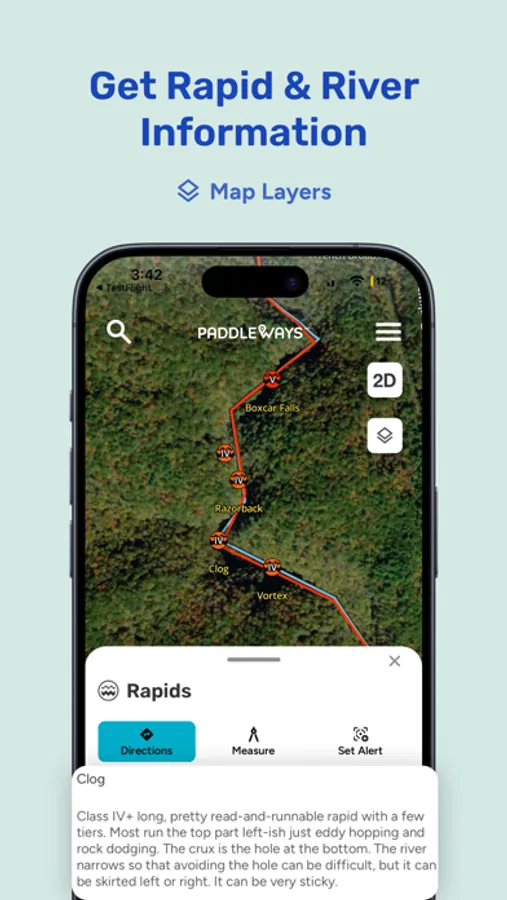
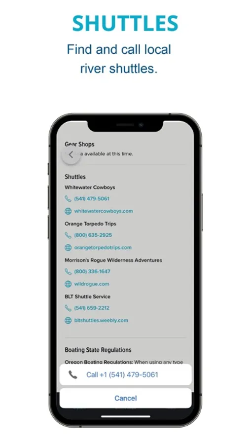
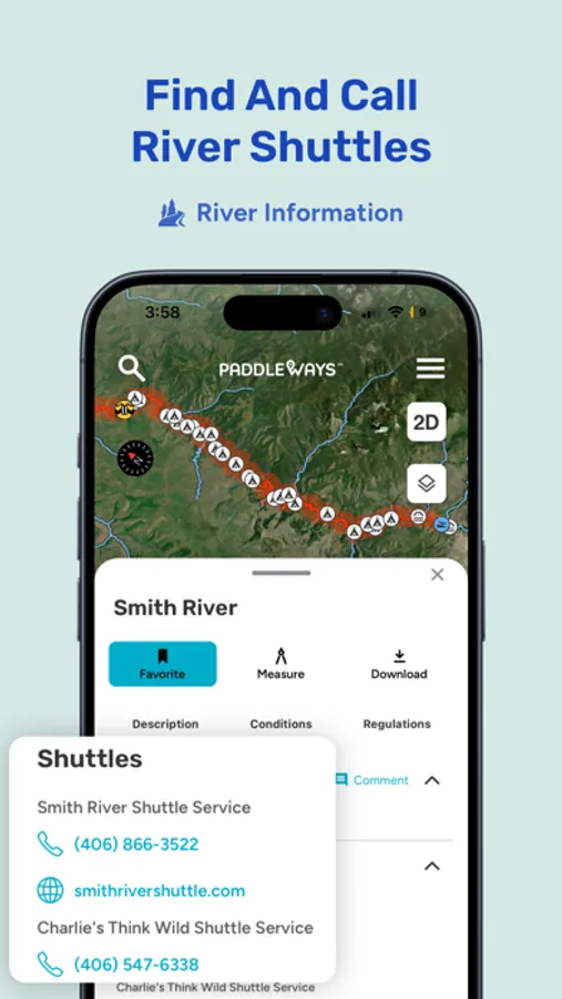
Discover thousands of mapped paddling routes, from quiet flatwater to technical whitewater runs. Find public launch points, shuttles, campsites, and detailed river descriptions all in one place.
Plan With Confidence
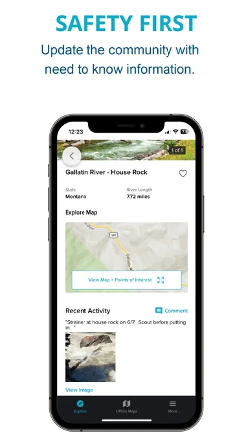
Check real-time streamflows, 10-day weather forecasts, and river conditions before you head out. Use the My Waters dashboard to save your favorite rivers and see at a glance when they’re in shape for paddling.
Plan Like a Pro
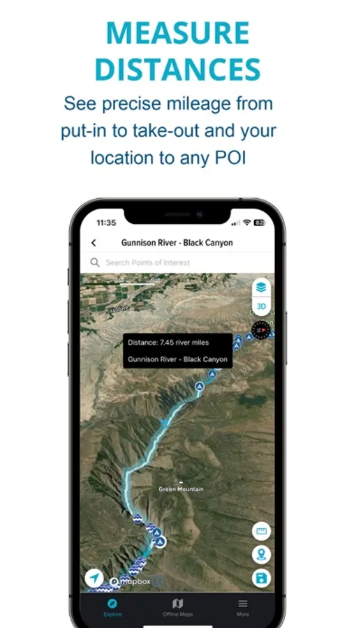
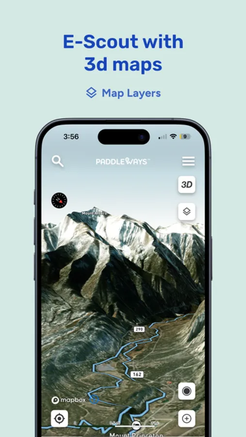
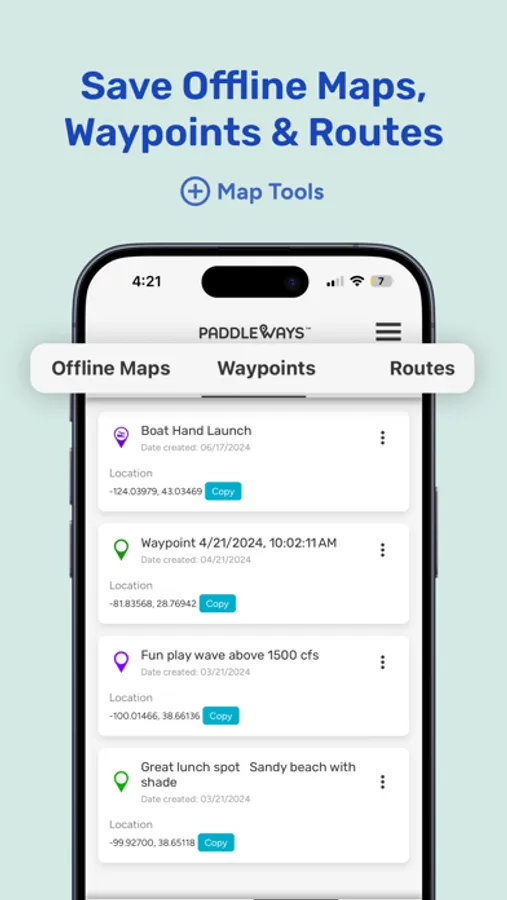
Measure float distances, find takeouts and campsites, and preview key POIs like access points and boat ramps using Street View when available. Add your own waypoints and save past trips to make planning future outings easier.
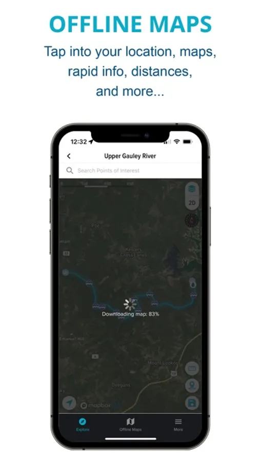
Stay Prepared, Even Offline
Use cell coverage maps to see where you’ll have service. Download maps in advance to navigate without signal. Whether you're off-grid or close to town, you’ll have the tools you need.
Built for Paddlers. Backed by NRS.
PaddleWays is supported by NRS and powered by technology from onWater. We’re committed to access, safety, and stewardship. Every PaddleWays+ subscription helps fund conservation and paddling access efforts.
PaddleWays+ Unlocks Even More
Upgrade to access premium tools:
My Waters dashboard with unlimited saved rivers
Offline maps and cell coverage overlays
10-day weather forecasts by location
Advanced weather layers including wind, radar, and pressure
Lake depth maps (select states)
Private land ownership info
Download PaddleWays and turn your phone into a trusted paddling guide.
Terms of Use: https://paddleways.com/terms-and-conditions
Paddle Ways - Lets Go Paddling Screenshots


Tap to Rate:
Reviews for Paddle Ways - Lets Go Paddling
HippieLongStockings
Not that useful
I'm unsure what I just paid for. The maps don't have waypoints. They really only give me mileage for a section. The map is not helpful for navigating waterways and absolutely useless for rapids. It doesn't even list rapids on the maps. Only sometimes it will give current flow rates. Most times I've needed information it just list conditions not available. May want to save your money. Wish there were better apps for river running.
Bev53
App keeps freezing.
I got the premium plan and now have buyers remorse. The app keeps freezing up and I can’t even explore the app to understand its functionality. I’ve deleted and reinstalled it. No joy! Also, it suggests there’s information about rivers, but what if you paddle lakes too? I had to exit the app and just google water temperature, wind and weather conditions for a lake I plan to paddle today because I couldn’t get it from the app. Useless!