In this mapping app, you can view detailed topographical maps and mark waypoints. Includes offline map access, coordinate display, and distance measurement features.
AppRecs review analysis
AppRecs rating 4.5. Trustworthiness 80 out of 100. Review manipulation risk 25 out of 100. Based on a review sample analyzed.
★★★★☆
4.5
AppRecs Rating
Ratings breakdown
5 star
72%
4 star
9%
3 star
6%
2 star
6%
1 star
8%
What to know
✓
Low review manipulation risk
25% review manipulation risk
✓
Credible reviews
80% trustworthiness score from analyzed reviews
✓
High user satisfaction
81% of sampled ratings are 4+ stars (4.3★ average)
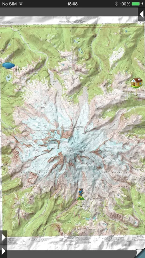
About Topo Maps
- iPad owners, please see the app "Topo Maps for iPad".
* Users write:
" I've bought all the topo map apps and I like this the best "
" Scans are gorgeous ... the interface is exceptionally clean "
" Downloading maps is easy and fast ... Map displays beautifully and zooms flawlessly "
* Includes Canada (at 1:50,000), the contiguous US (at 1:24,000), Alaska (at 1:24,000 and 1:63,360), Hawaii, Puerto Rico and the U.S. Virgin Islands.
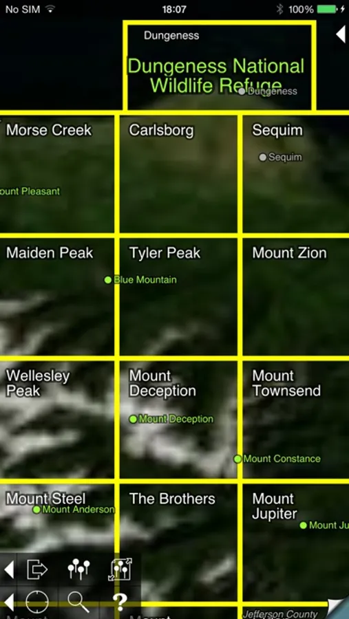
* Locate the maps you need on the satellite view. To install a map, touch for about half a second. Touch again to view it.
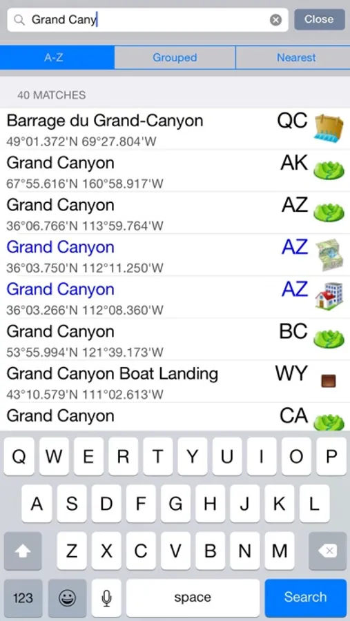
* Search by name for over a million towns, peaks, lakes, parks and other features.
* No network connection is needed once the maps have been installed.
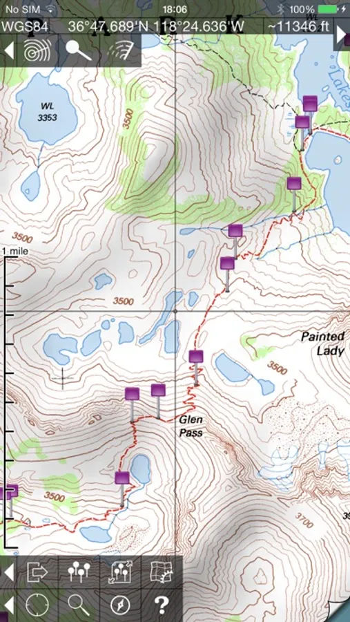
* Mark waypoints, and import and export waypoint files in GPX, KML and CSV formats.
* Touch the "current location" button to see where you are, and the compass button to align the map with the ground.
* See coordinates in NAD27 or WGS84 degrees, degrees minutes and seconds, UTM, or MGRS formats.
* Measure distances (miles, feet and km) and bearings (true and magnetic).
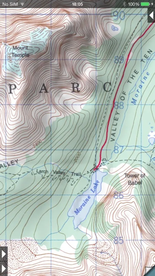
The Maps: This app uses high-quality scans of the traditional USGS and NRCan topographic maps which have been the definitive resource for hikers and other backcountry users for many years. You can make the terrain stand out with hill shading, using simulated sunlight from the direction of your choice. In the U.S., this app does not use the new "US Topo" maps because they do not show hiking trails and lack other details: please see the web site for more details.
Downloading: US maps are around 8 MB in size and download in a few seconds on a typical home broadband connection. Canadian maps are larger. Both cellular data and WiFi can be used, though WiFi is likely to be more reliable in most cases.
- Do please visit https://topomapsapp.com/ for complete instructions, so that you don't miss any features.
We have many ideas for additional features to add to future versions of this app; if you have ideas or other questions or comments, contact details can be found on the website, https://topomapsapp.com/. The website also has more screenshots and other information.
Topo Maps Screenshots
Tap to Rate:
Reviews for Topo Maps
hoodrat91910
Issue w/ Downloading Maps is Fixed!
OCTOBER 2025: The issue with being unable to download new maps to my device has been fixed. when trying to download new maps, I would get an error message saying the map wasn’t available for download or something like that. I sent an email to the app developer last night, and six hours later he had responded and said the problem was fixed. And it really was! After all these years, this is still the best topographic map app out there for use in conjunction with hiking and exploring.
Schralp7
This is an excellent product
I'm a land surveyor and this app comes in extremely useful. The quads are pretty well registered and the contours are quite accurate. The biggest downside is that many of the usgs quads are not current.