In this flight planning app, you can create routes, view weather overlays, and file flight plans easily. Includes route optimization tools, weather layers, and navigation charts.
AppRecs review analysis
AppRecs rating 4.4. Trustworthiness 74 out of 100. Review manipulation risk 27 out of 100. Based on a review sample analyzed.
★★★★☆
4.4
AppRecs Rating
Ratings breakdown
5 star
76%
4 star
8%
3 star
5%
2 star
3%
1 star
7%
What to know
✓
Low review manipulation risk
27% review manipulation risk
✓
Credible reviews
74% trustworthiness score from analyzed reviews
⚠
Pricing complaints
Many low ratings mention paywalls or pricing
About ForeFlight Mobile EFB
ForeFlight is the leading flight app for VFR and IFR pilots everywhere, making flight planning and flying easier, safer, and more enjoyable.
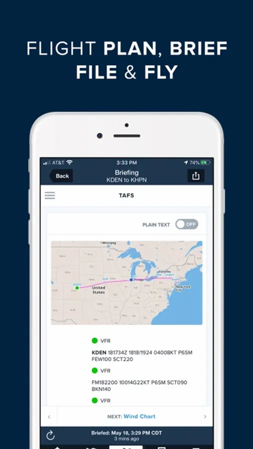
FLIGHT PLANNING, BRIEFING, & FILING
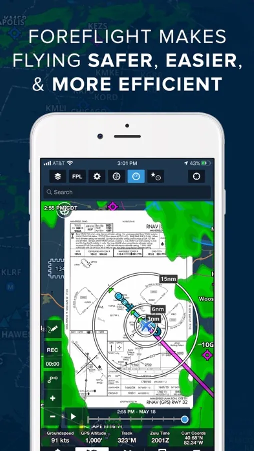
Plan flights with Touch Planning on the Map or full-featured form-based Flights view. Tap out a route in seconds and quickly see if flights will be affected by weather or TFRs. Helpful Route, Altitude, and Procedure Advisors make planning easy and accurate. Generate a graphical preflight briefing and file your flight plan directly from the app. Print a professional-grade Navlog for inflight reference.
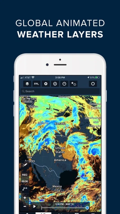
WEATHER
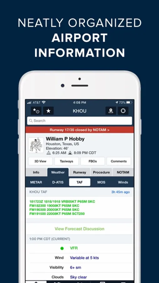
Interactive weather layers include animated radar, global satellite and winds aloft, global icing, turbulence, and surface analysis, graphical AIR/SIGMETs, flight category, visibility, and more. View decoded METARs, TAFs, and MOS forecasts. Thoughtfully organized Imagery view puts a full range of forecast tools at your fingertips.
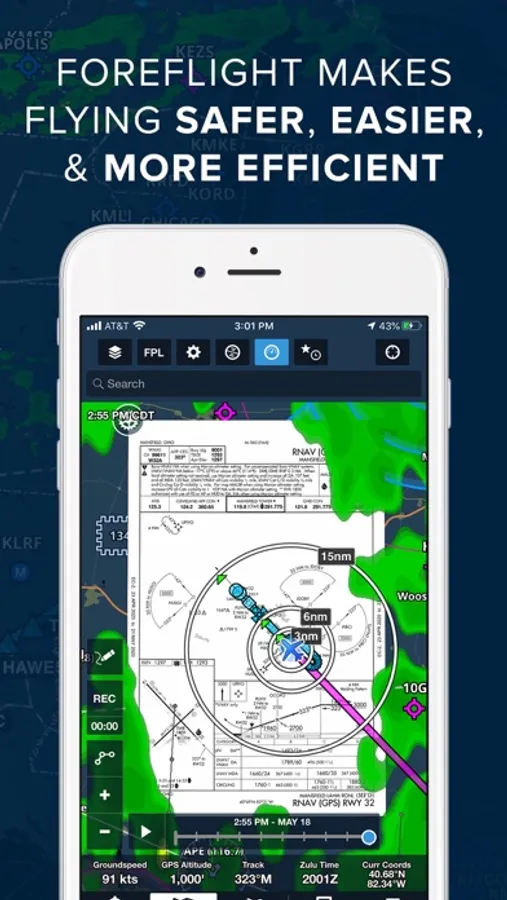
PLATES, CHARTS, & MAPS
Both VFR and IFR operations are covered with all of the essentials required for planning and navigation: data-driven Aeronautical Maps, VFR Sectionals, High/Low Enroute charts, SIDs, STARs, approach and taxi charts, and terrain, satellite, and street map views.
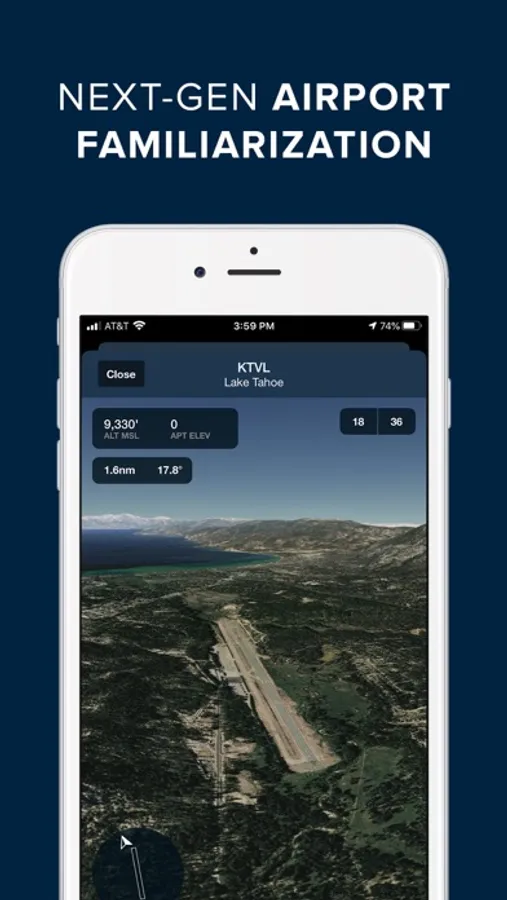
GEO-REFERENCED APPROACHES & TAXI CHARTS
Plates and taxi charts enable the real time display of your GPS location on the chart. They can also be overlaid on the Maps view along with weather and hazards for the ultimate situational awareness.
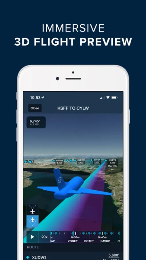
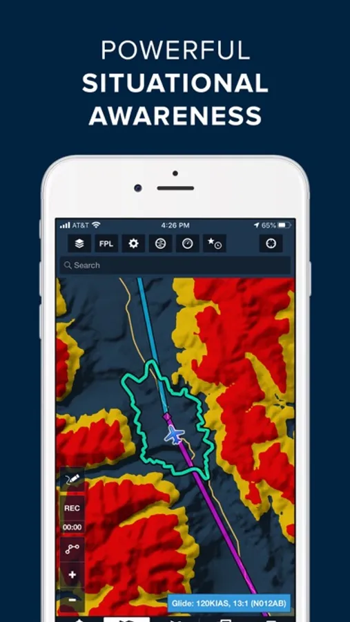
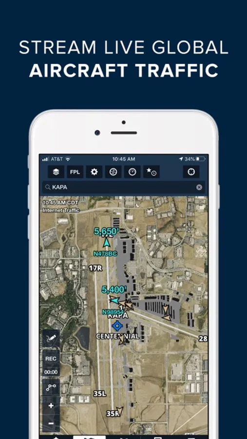
GLOBAL HAZARD AWARENESS TECHNOLOGY
Plan and fly with more confidence in all conditions and terrain. Top-down-view Hazard Advisor map layer, Terrain Profile View, and 3D Synthetic Vision seamlessly integrate into the map display to depict a clear picture of terrain and obstacle hazards anywhere in the world. When paired with an AHRS source, Synthetic Vision provides a backup attitude display.
LOGBOOK
Logbook makes it easy to log and share flights, track hours, review currency, record certificates and ratings, receive electronic instructor endorsements, and create experience reports. Your data is automatically synced across all your devices and protected in secure cloud storage.
ADDITIONAL FEATURES INCLUDE:
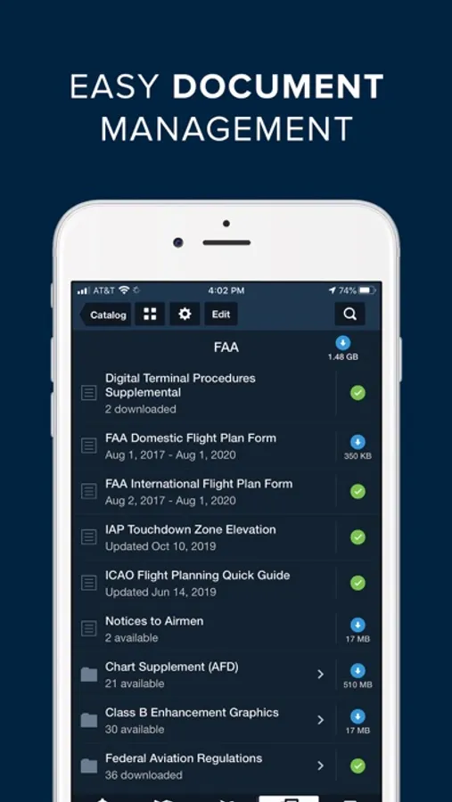
Built-in documents catalog with FAR/AIM, charts supplements, and more
Airport, FBO, and fuel price information for thousands of locations
Dynamic data-driven Aeronautical Maps
Weight & Balance
Glide Advisor
Automatic chart and data data updates
Chart color inversion for better night flying experience
Access to web planner
ForeFlight Mobile EFB Screenshots
Tap to Rate:
Reviews for ForeFlight Mobile EFB
Shefliesairplanes
Not what it used to be
I never imagined that I would write this review. As a power user of ForeFlight for years, I am saddened to say that it’s not what it used to be. I used to open the app and it just worked - wonderfully, as advertised. Now, I open the app - it lags. I sometimes have to wait 10-20 seconds before it unfreezes and I can move between tabs. Previously, ForeFlight Support would immediately respond and have a solution to an issue. Now, the responses are not as quick and they are unable to help me with the latency issue. “Reinstall” is what I am encouraged to do. I loved ForeFlight. I can’t see spending this kind of money if it doesn’t work well.
Evilandy138469204727201634
Document viewer
The update changed the document viewer so that you see 2 pages on the screen in landscape mode. It's horrible.