In this outdoor mapping app, you can navigate with detailed topographic and marine charts and record your routes. Includes offline maps, GPS tracking, route planning, and shareable GPX files.
AppRecs review analysis
AppRecs rating 4.2. Trustworthiness 82 out of 100. Review manipulation risk 23 out of 100. Based on a review sample analyzed.
★★★★☆
4.2
AppRecs Rating
Ratings breakdown
5 star
73%
4 star
19%
3 star
0%
2 star
0%
1 star
8%
What to know
✓
Low review manipulation risk
23% review manipulation risk
✓
Credible reviews
82% trustworthiness score from analyzed reviews
⚠
Pricing complaints
Many low ratings mention paywalls or pricing
About Memory-Map
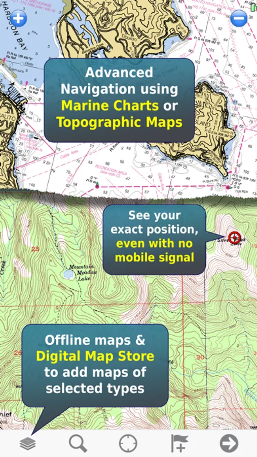
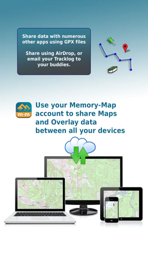
The app can be used standalone, but the maps and overlay data may also be used on your home PC or Mac for planning, and for printing maps on paper. Then upload everything to your phone or tablet and enjoy navigating outdoors with high quality maps.
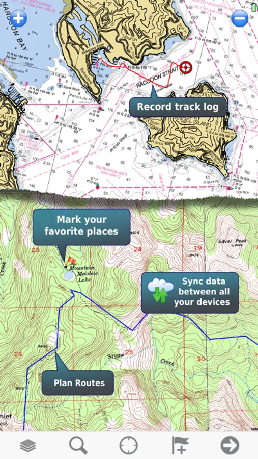
When you get home you can transfer your tracklog and points of interest back onto your computer, to see where you actually went, analyze your speed and elevation profile, and so on.
Whether you are fishing, paddling, backpacking, mountain biking or sailing, enjoy your time in the wilderness with Memory-Map. We have been developing mobile navigation apps since year 2000, and our products are trusted by mountain rescue teams, police and coast guard stations around the world.
Features:
+ Fast scrolling and zooming
+ Import and export GPX files
+ Screen lock to prevent accidental screen touches while recording a track
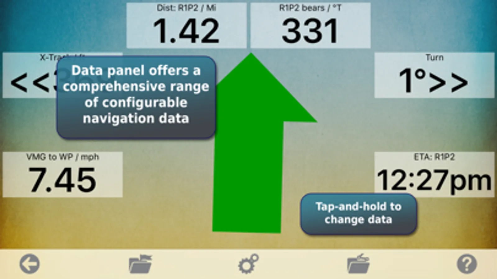
+ Shows speed and direction of travel, even while walking slowly
+ Support for GPS and Compass sensors, where available.
+ Placename index, works offline
+ Moving map, lock GPS position and automatically scroll the map
+ Records tracklogs with app running in the background
+ Create and edit marks, which may be linked to a web URL
+ Plan routes, measure distance and bearings
+ Routes snap to roads or trails, optimized for walking, cycling, or driving
+ Shows Altitude
+ Lat/Long, UTM, British National Grid and MGRS coordinate systems
+ Share position marks or tracklogs with other apps using GPX files
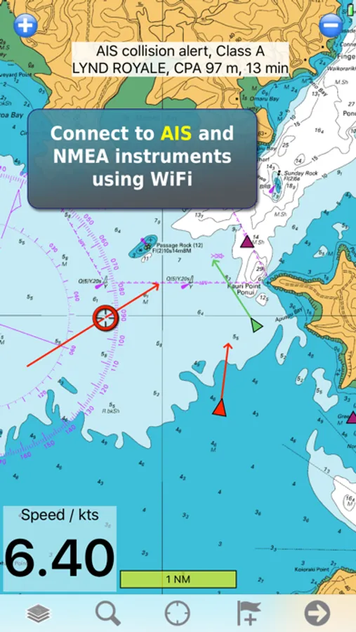
+ Connect to NMEA instruments and AIS via a WiFi gateway
+ AIS collision alarms, Anchor alarms and proximity alarms use notifications.
Battery Use Disclaimer: "Continued use of GPS running in the background can dramatically decrease battery life."
Memory-Map Screenshots
Tap to Rate:
Reviews for Memory-Map
Loranw
Good, reliable app
I use this for deer hunting. I have my deer stands marked and the trails around the property. I use it extensively for navigating through the woods. I rely on it.
Drausst
just navigate
Memory maps does just what you want it to do. It does not try to get you to join social groups for competitive hiking. I can get topo maps and nautical charts, and when I am crossing a bridge, I can switch to nautical and see the water depth! You can set waypoints before a hike and save recorded tracks.